Grade I listed buildings in Leicestershire
There are over 9,000 Grade I listed buildings in England. This page is a list of these buildings in the county of Leicestershire, by district.

Leicestershire shown within England
Blaby
| Name | Location | Type | Completed [note 1] | Date designated | Grid ref.[note 2] Geo-coordinates |
Entry number [note 3] | Image |
|---|---|---|---|---|---|---|---|
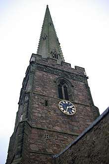
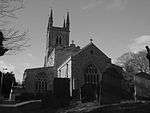
| Church of All Saints | Blaby | Parish Church | Late 13th century to early 14th century | 7 October 1957 | SP5703097857 52°34′32″N 1°09′36″W |
1074757 | 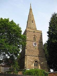 Church of All Saints |
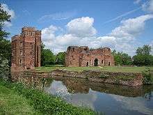
| Kirby Muxloe Castle | Kirby Muxloe, Blaby | Castle | Begun 1480 | 23 February 1987 | SK5237904619 52°38′12″N 1°13′39″W |
1177213 | |
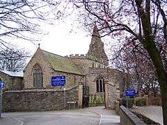
| Church of St Peter | Whetstone, Leicestershire | Parish Church | 13th century | 12 May 1997 | SP5576797526 52°34′22″N 1°10′43″W |
1245457 |  Church of St Peter |
Charnwood
| Name | Location | Type | Completed [note 1] | Date designated | Grid ref.[note 2] Geo-coordinates |
Entry number [note 3] | Image |
|---|---|---|---|---|---|---|---|
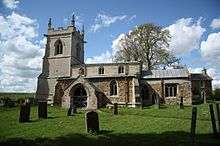
| Church of St Mary | Barkby, Charnwood | Parish Church | Late 13th century | 1 June 1966 | SK6367409856 52°40′58″N 1°03′34″W |
1074500 | |
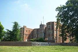
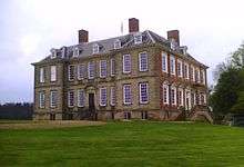
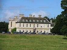
| Prestwold Hall | Prestwold, Charnwood | Country House | Mid 18th century | 9 July 1951 | SK5791921470 52°47′16″N 1°08′33″W |
1074562 | |
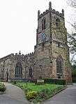
| Church of St Mary | Queniborough, Charnwood | Parish Church | Late Saxon or early Norman | 1 June 1966 | SK6508012068 52°42′09″N 1°02′18″W |
1074484 | |
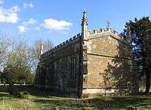
| Church of St Bartholomew and Farnham Chapel |
Quorndon, Charnwood | Church | C12-C14 | 1 June 1966 | SK5611716589 52°44′38″N 1°10′13″W |
1278876 | 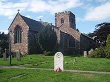 Church of St Bartholomew and Farnham Chapel |
| Rothley Court Hotel and the Chapel |
Rothley, Charnwood | Country House | Dissolution of the Monasteries | 9 July 1951 | SK5767912300 52°42′19″N 1°08′52″W |
1278606 | .jpg) Rothley Court Hotel and the Chapel |
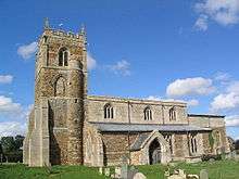
| Church of St Botolph | Shepshed, Charnwood | Parish Church | 13th century | 18 January 1950 | SK4810419693 52°46′22″N 1°17′18″W |
1236177 | |
| The Mountsorrel Cross c250 Metres South East of Church |
Swithland, Charnwood | Cross | Medieval | 1 June 1966 | SK5565612606 52°42′30″N 1°10′40″W |
1177957 | 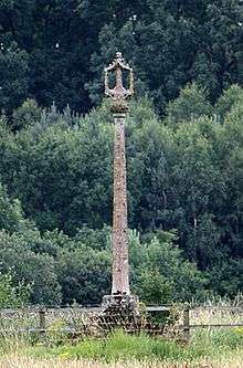 The Mountsorrel Cross c250 Metres South East of Church |
| Church of Saints Peter and Paul | Syston, Charnwood | Parish Church | 13th century | 1 June 1966 | SK6262411859 52°42′03″N 1°04′29″W |
1074467 | 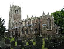 Church of Saints Peter and Paul |
| Ulverscroft Priory Ruins and Priory Farmhouse |
Ulverscroft, Charnwood | Farmhouse | 18th century | 1 June 1966 | SK5012312710 52°42′35″N 1°15′34″W |
1295073 |  |
| Church of St Mary | Wymeswold, Charnwood | Parish Church | Medieval | 1 June 1966 | SK6031723473 52°48′20″N 1°06′24″W |
1074543 | 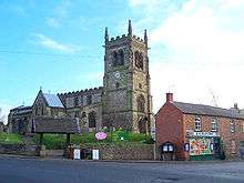 Church of St Mary |
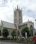
| Church of All Saints | Loughborough, Charnwood | Church | 14th century | 15 March 1965 | SK5381019942 52°46′28″N 1°12′14″W |
1320400 | |
| Garendon Park, the Triumphal Arch |
Loughborough, Charnwood | Triumphal Arch | 1730s | 15 March 1965 | SK4949919075 52°46′01″N 1°16′04″W |
1361136 |  |


City of Leicester
| Name | Location | Type | Completed [note 1] | Date designated | Grid ref.[note 2] Geo-coordinates |
Entry number [note 3] | Image |
|---|---|---|---|---|---|---|---|
| Leicester Abbey Ruins | Abbey Park, City of Leicester | Abbey | Founded 1143 | 5 January 1950 | SK5846806007 52°38′55″N 1°08′14″W |
1074051 | 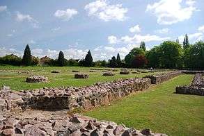 Leicester Abbey Ruins |
| Abbot Penny's Wall | City of Leicester | Walls, turrets and gates | c1500 | 14 March 1975 | SK5851306115 52°38′59″N 1°08′12″W |
1361406 | 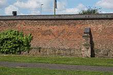 Abbot Penny's Wall |
| Assembly Rooms Basement Area Railings to Assembly Rooms (county Rooms) |
City of Leicester | Assembly Rooms | 1792 | 5 January 1950 | SK5869904350 52°38′01″N 1°08′03″W |
1184114 | 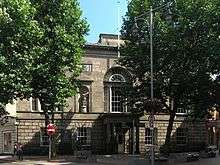 |
| Church of St Margaret | City of Leicester | Church | Anglo Saxon | 5 January 1950 | SK5854205087 52°38′25″N 1°08′11″W |
1074072 | |
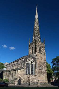
| Church of St Mary de Castro, Leicester | City of Leicester | Church | Early 13th century | 5 January 1950 | SK5828504188 52°37′56″N 1°08′25″W |
1074070 | |
| Church of St Nicholas | City of Leicester | Church | c880 AD | 5 January 1950 | SK5823804501 52°38′07″N 1°08′27″W |
1361046 | 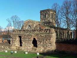 Church of St Nicholas |
| County Court (including Remains of Leicester Castle) |
City of Leicester | Castle | 11th century or 12th century | 5 January 1950 | SK5822204190 52°37′56″N 1°08′28″W |
1200622 | 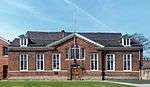 County Court (including Remains of Leicester Castle) |
| Former Church of All Saints | City of Leicester | Parish Church | 12th century | 5 January 1950 | SK5827404840 52°38′17″N 1°08′25″W |
1074012 |  Former Church of All Saints |
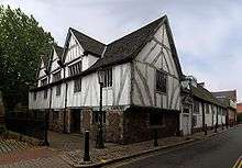
| Guildhall | City of Leicester | Courtyard | Founded 1347 | 5 January 1950 | SK5844404453 52°38′05″N 1°08′16″W |
1361405 | |
| Jewry Wall | City of Leicester | Wall | Roman | 5 January 1950 | SK5822404489 52°38′06″N 1°08′28″W |
1074773 | |
| Magazine Gateway Regimental Museum |
City of Leicester | Castle | Medieval | 5 January 1950 | SK5844604120 52°37′54″N 1°08′16″W |
1184902 | 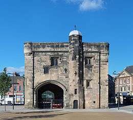 Magazine Gateway Regimental Museum |
| Remains of Cavendish House | City of Leicester | House | c. 1600 | 5 January 1950 | SK5840806078 52°38′57″N 1°08′17″W |
1074052 | 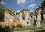 Remains of Cavendish House |
| Turret Gateway | City of Leicester | Castle | circa 1422-3 | 5 January 1950 | SK5831204122 52°37′54″N 1°08′24″W |
1074069 | 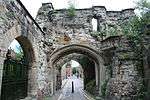 Turret Gateway |
| War Memorial | Victoria Park, Leicester | Arch | 1925 | 23 February 1955 | SK5956503212 52°37′24″N 1°07′17″W |
1074786 |
.jpg)

Harborough
| Name | Location | Type | Completed [note 1] | Date designated | Grid ref.[note 2] Geo-coordinates |
Entry number [note 3] | Image |
|---|---|---|---|---|---|---|---|
| Church of St Peter | Claybrooke Parva, Harborough | Parish Church | 12th century | 11 January 1955 | SP4961487913 52°29′13″N 1°16′15″W |
1209153 | 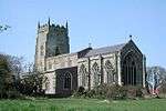 Church of St Peter |
| Church of St Peter and St Paul | Great Bowden, Harborough | Parish Church | C13-14 | 25 July 1952 | SP7463688876 52°29′34″N 0°54′08″W |
1061277 | 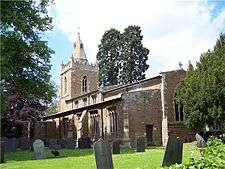 Church of St Peter and St Paul |
| Church of St Michael and All Angels | Hallaton, Harborough | Church | C12-C13 | 7 December 1966 | SP7865596531 52°33′39″N 0°50′28″W |
1360624 | 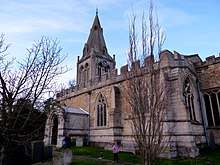 Church of St Michael and All Angels |
| Quenby Hall | Hungarton, Harborough | Country House | c1615-1630 | 19 October 1951 | SK7018606393 52°39′03″N 0°57′50″W |
1295060 | |
| Old House and Garden Walls | Kibworth Harcourt, Harborough | House | 1678 | 7 December 1966 | SP6820994550 52°32′40″N 0°59′44″W |
1188029 | |
| Church of St John the Baptist | King's Norton, Harborough | Church | 1757-1775 | 29 December 1966 | SK6890500494 52°35′52″N 0°59′03″W |
1360627 |  Church of St John the Baptist |
| Fortrey Tomb at Churchyard of St John the Baptist |
King's Norton, Harborough | Obelisk | Mid 18th century | 21 December 1984 | SK6892000488 52°35′52″N 0°59′02″W |
1360628 | .jpg) Fortrey Tomb at Churchyard of St John the Baptist |
| Church of All Saints | Lubenham, Harborough | Parish Church | Late 12th century | 7 December 1966 | SP7052487072 52°28′37″N 0°57′47″W |
1061473 | 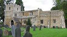 Church of All Saints |
| Church of St Mary | Lutterworth, Harborough | Church | 19th century | 11 January 1955 | SP5424584453 52°27′19″N 1°12′11″W |
1211040 | |
| Church of St Mary | Nevill Holt, Harborough | Church | C13-C15 | 7 December 1966 | SP8164393692 52°32′06″N 0°47′52″W |
1188359 | 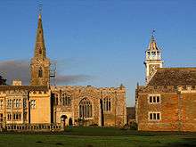 Church of St Mary |
| Nevill Holt Hall Preparatory School |
Nevill Holt, Harborough | Country House | C16-C18 | 21 July 1951 | SP8162193677 52°32′05″N 0°47′53″W |
1188367 | 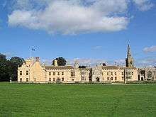 Nevill Holt Hall Preparatory School |
| Noseley Chapel | Noseley, Harborough | Chapel | c. 1220 | 29 December 1966 | SP7376298492 52°34′45″N 0°54′46″W |
1360652 | 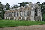 Noseley Chapel |
| Church of St Andrew | Owston, Harborough | Church | c1161 | 29 December 1966 | SK7744607964 52°39′50″N 0°51′23″W |
1074871 | |
| Church of All Saints | Peatling Magna, Harborough | Parish Church | 13th century | 11 January 1955 | SP5948292462 52°31′36″N 1°07′29″W |
1061529 | 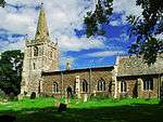 Church of All Saints |
| Church of All Saints | Scraptoft, Harborough | Church | C13-C15 | 29 December 1966 | SK6476105577 52°38′39″N 1°02′40″W |
1188364 | 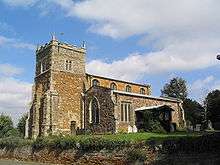 Church of All Saints |
| Church of St Peter | Stockerston, Harborough | Church | C13-C15 | 7 December 1966 | SP8337897500 52°34′08″N 0°46′17″W |
1360696 | 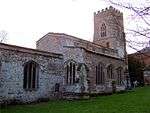 Church of St Peter |
| Church of All Saints | Theddingworth, Harborough | Parish Church | 12th century | 7 December 1966 | SP6678085739 52°27′56″N 1°01′06″W |
1188196 |  Church of All Saints |
| Church of St Peter | Tilton on the Hill, Harborough | Parish Church | 12th century TO 15th century | 29 December 1966 | SK7434405655 52°38′37″N 0°54′10″W |
1074839 | 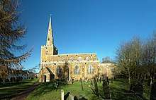 Church of St Peter |
| Stanford Hall | Westrill and Starmore, Harborough | Country House | 1697 | 11 January 1955 | SP5874079309 52°24′31″N 1°08′17″W |
1188550 | |
| Withcote Chapel | Withcote, Harborough | Chapel | 15th century | 29 December 1966 | SK7957705793 52°38′39″N 0°49′31″W |
1074845 | |
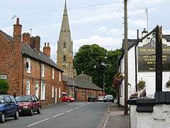
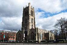
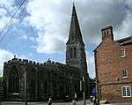
| Church of St Dionysius | Market Harborough | Church | Early 14th century | 25 June 1952 | SP7335587285 52°28′43″N 0°55′17″W |
1074439 | |
| Old Grammar School | Market Harborough | Market Hall | 1614 | 25 July 1952 | SP7336587259 52°28′42″N 0°55′16″W |
1361201 |


Hinckley and Bosworth
| Name | Location | Type | Completed [note 1] | Date designated | Grid ref.[note 2] Geo-coordinates |
Entry number [note 3] | Image |
|---|---|---|---|---|---|---|---|
| Church of St Peter | Thornton, Bagworth & Thornton, Hinckley and Bosworth | Parish Church | C13-C16 | 7 November 1966 | SK4683107667 52°39′53″N 1°18′32″W |
1074115 | 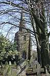 Church of St Peter |
| Church of St Mary | Barwell, Hinckley and Bosworth | Parish Church | c1300-1500 | 8 March 1963 | SP4438096502 52°33′52″N 1°20′48″W |
1074229 | 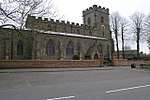 Church of St Mary |
| Newbold Verdon Hall | Newbold Verdon, Hinckley and Bosworth | Country House | c. 1700 | 22 October 1952 | SK4421703817 52°37′49″N 1°20′53″W |
1074089 | |
| Church of St Mary Magdelene | Peckleton, Hinckley and Bosworth | Parish Church | Early/Mid 14th century | 7 November 1966 | SK4701900837 52°36′12″N 1°18′26″W |
1074235 | 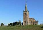 Church of St Mary Magdelene |
| Church of St Margaret | Stoke Golding, Hinckley and Bosworth | Parish Church | Early 13th century | 8 March 1963 | SP3977697265 52°34′18″N 1°24′52″W |
1074214 | 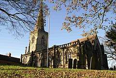 Church of St Margaret |
| Church of St Edith | Orton on the Hill, Twycross, Hinckley and Bosworth | Parish Church | Later alterations | 7 November 1966 | SK3042303931 52°37′56″N 1°33′07″W |
1188352 | 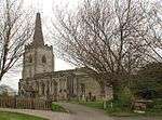 Church of St Edith |
| Church of St James | Twycross, Hinckley and Bosworth | Parish Church | Early 14th century | 7 November 1966 | SK3387104906 52°38′27″N 1°30′03″W |
1074217 | 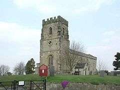 Church of St James |
| Church of St Peter | Witherley, Hinckley and Bosworth | Parish Church | Early 14th century | 7 November 1966 | SP3251697339 52°34′22″N 1°31′18″W |
1188486 | 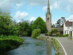 Church of St Peter |
Melton
| Name | Location | Type | Completed [note 1] | Date designated | Grid ref.[note 2] Geo-coordinates |
Entry number [note 3] | Image |
|---|---|---|---|---|---|---|---|
| Church of All Saints | Asfordby, Melton | Parish Church | 14th century | 1 January 1968 | SK7081218939 52°45′48″N 0°57′07″W |
1360866 | 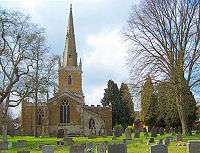 Church of All Saints |
| Belvoir Castle | Belvoir, Melton | Castle | Norman | 14 July 1953 | SK8200133719 52°53′41″N 0°46′57″W |
1360870 | |
| Church of St Mary | Bottesford, Leicestershire | Parish Church | 13th century | 1 January 1968 | SK8073339126 52°56′36″N 0°48′00″W |
1075095 | 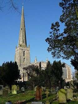 Church of St Mary |
| Church of St John the Baptist | Buckminster, Melton | Parish Church | 13th century | 1 January 1968 | SK8790723078 52°47′53″N 0°41′51″W |
1061281 | 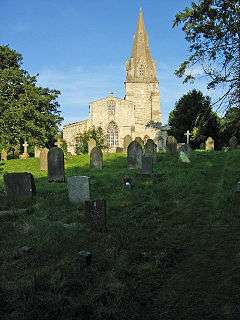 Church of St John the Baptist |
| Church of St James | Burton Lazars, Burton and Dalby, Melton | Parish Church | Late 12th century | 1 January 1968 | SK7676316941 52°44′41″N 0°51′52″W |
1360836 | 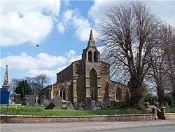 Church of St James |
| Church of St Denys | Eaton, Leicestershire | Parish Church | 13th century | 1 January 1968 | SK7982029079 52°51′12″N 0°48′58″W |
1075022 |  Church of St Denys |
| Church of St Denys | Goadby Marwood, Eaton, Melton | Parish Church | 13th century | 1 January 1968 | SK7793226379 52°49′46″N 0°50′41″W |
1360902 |  Church of St Denys |
| Church of St Mary | Freeby, Melton | Parish Church | Early 14th century | 1 January 1968 | SK8038420122 52°46′22″N 0°48′36″W |
1360855 | 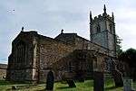 Church of St Mary |
| Church of St Mary Magdalene | Stapleford Park, Freeby, Melton | Church | 1699 | 1 January 1968 | SK8117218203 52°45′19″N 0°47′55″W |
1176947 | |
| Stapleford Hall with Adjoining Service Wings and Orangery |
Stapleford Park, Freeby, Melton | House | 1986 | 4 July 1953 | SK8137518060 52°45′15″N 0°47′45″W |
1360859 | |
| Church of St Thomas of Canterbury | Frisby on the Wreake, Melton | Parish Church | 12th century | 1 January 1968 | SK6958117801 52°45′12″N 0°58′14″W |
1360878 | 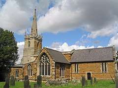 Church of St Thomas of Canterbury |
| Church of St Luke | Gaddesby, Melton | Parish Church | 12th century | 1 January 1968 | SK6897513051 52°42′39″N 0°58′50″W |
1307542 | 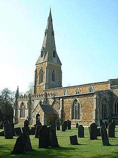 Church of St Luke |
| Church of St Mary | Ashby Folville, Gaddesby, Melton | Parish Church | Late 13th century | 1 January 1968 | SK7067811988 52°42′03″N 0°57′20″W |
1061267 |  Church of St Mary |
| Church of St Andrew | Coston, Garthorpe, Melton | Parish Church | 11th century | 1 January 1968 | SK8480322186 52°47′26″N 0°44′38″W |
1061273 | 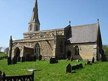 Church of St Andrew |
| Church of St Mary | Garthorpe, Leicestershire | Parish Church | Early 13th century | 1 January 1968 | SK8316020931 52°46′46″N 0°46′07″W |
1307476 | |
| Church of All Saints | Hoby, Hoby with Rotherby, Melton | Church | 13th century | 1 January 1968 | SK6691617348 52°44′59″N 1°00′36″W |
1075004 | 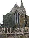 Church of All Saints |
| Church of St Peter | Kirby Bellars, Melton | Parish Church | 13th century | 1 January 1968 | SK7178918239 52°45′25″N 0°56′16″W |
1261717 | 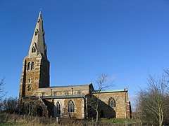 Church of St Peter |
| Church of St John the Baptist | Cold Overton, Knossington and Cold Overton, Melton | Parish Church | 13th century | 1 January 1968 | SK8102410152 52°40′59″N 0°48′10″W |
1075150 | 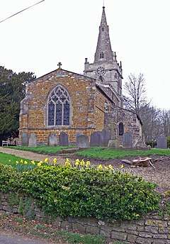 Church of St John the Baptist |
| Cold Overton Hall and adjoining Garden Walls |
Cold Overton, Knossington and Cold Overton, Melton | Country House | c. 1664 | 14 July 1953 | SK8098810088 52°40′57″N 0°48′12″W |
1075147 | 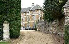 Cold Overton Hall and adjoining Garden Walls |
| Church of All Saints | Somerby, Leicestershire | Parish Church | 12th century | 1 January 1968 | SK7794710492 52°41′11″N 0°50′54″W |
1177777 | 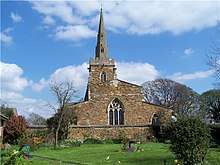 Church of All Saints |
| Church of All Saints | Pickwell, Somerby, Melton | Parish Church | 13th century | 1 January 1968 | SK7857211379 52°41′40″N 0°50′20″W |
1360851 | 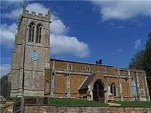 Church of All Saints |
| Church of St Andrew | Twyford, Twyford and Thorpe, Melton | Parish Church | 12th century | 1 January 1968 | SK7299210094 52°41′01″N 0°55′18″W |
1307264 | 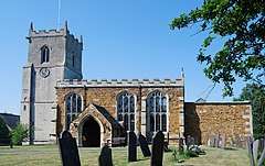 Church of St Andrew |
| Church of St Mary Magdalene | Waltham on the Wolds and Thorpe Arnold, Melton | Parish Church | Norman | 1 January 1968 | SK8025425049 52°49′01″N 0°48′38″W |
1188847 | 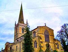 Church of St Mary Magdalene |
| Church of St Michael | Edmondthorpe, Wymondham, Melton | Parish Church | 13th century | 1 January 1968 | SK8581417556 52°44′56″N 0°43′48″W |
1075128 | |
| Church of St Peter | Wymondham, Melton | Parish Church | 13th century | 1 January 1968 | SK8515718653 52°45′32″N 0°44′22″W |
1177844 | 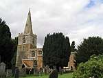 Church of St Peter |
| Parish Church of St Mary | Melton Mowbray | Parish Church | Norman | 24 October 1950 | SK7527619030 52°45′49″N 0°53′09″W |
1235286 |


North West Leicestershire
| Name | Location | Type | Completed [note 1] | Date designated | Grid ref.[note 2] Geo-coordinates |
Entry number [note 3] | Image |
|---|---|---|---|---|---|---|---|
| The Sir John Moore Church of England Primary School |
Appleby Magna, North West Leicestershire | Wall | 1697 | 16 December 1952 | SK3137209146 52°40′45″N 1°32′15″W |
1177850 | |
| Castle Ruins (including 2 Isolated Towers at South East and South West Angles of Outer Wall) |
Ashby-de-la-Zouch, North West Leicestershire | Castle | Late 15th century | 8 May 1950 | SK3612716674 52°44′47″N 1°27′59″W |
1073591 | 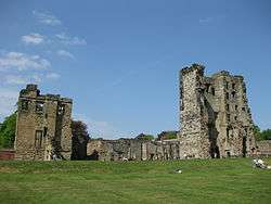 |
| Parish Church of St Helen | Ashby-de-la-Zouch, North West Leicestershire | Parish Church | 14th-century origins | 8 May 1950 | SK3608816767 52°44′50″N 1°28′01″W |
1188344 | |
| Church of St Mary and St Hardulph | Breedon on the Hill, North West Leicestershire | Cross | C9 or 10th century | 7 December 1962 | SK4057723348 52°48′22″N 1°23′58″W |
1361364 | |
| Church of St Nicholas | Lockington, Lockington-Hemington, North West Leicestershire | Parish Church | c. 1200 | 7 December 1962 | SK4680127931 52°50′49″N 1°18′24″W |
1074178 | 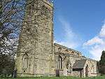 Church of St Nicholas |
| Staunton Harold Church / Chapel of the Holy Trinity |
Staunton Harold, North West Leicestershire | Chapel | 1653-1665 | 24 November 1965 | SK3799120873 52°47′03″N 1°26′17″W |
1074386 | 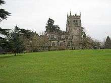 Staunton Harold Church / Chapel of the Holy Trinity |
| Staunton Harold Hall | Staunton Harold, North West Leicestershire | Country House | c. 1700 | 1 March 1950 | SK3794220908 52°47′04″N 1°26′20″W |
1177552 |


Oadby and Wigston
| Name | Location | Type | Completed [note 1] | Date designated | Grid ref.[note 2] Geo-coordinates |
Entry number [note 3] | Image |
|---|---|---|---|---|---|---|---|
| Church of All Saints | Moat Street, Wigston, Oadby and Wigston | Parish Church | Early 14th century | 1 October 1953 | SP6040998648 52°34′56″N 1°06′36″W |
1177393 | 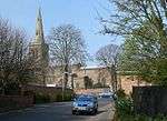 Church of All Saints |
References
Notes
- The date given is the date used by Historic England as significant for the initial building or that of an important part in the structure's description.
- Sometimes known as OSGB36, the grid reference is based on the British national grid reference system used by the Ordnance Survey.
- The "List Entry Number" is a unique number assigned to each listed building and scheduled monument by Historic England.
External links
![]()
This article is issued from Wikipedia. The text is licensed under Creative Commons - Attribution - Sharealike. Additional terms may apply for the media files.