Grade II* listed buildings in South Yorkshire
There are over 20,000 Grade II* listed buildings in England. This list includes those in South Yorkshire.
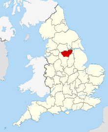
South Yorkshire shown in England
Barnsley
| Name | Location | Type | Completed [note 1] | Date designated | Grid ref.[note 2] Geo-coordinates |
Entry number [note 3] | Image |
|---|---|---|---|---|---|---|---|
| Grimethorpe Hall | Brierley, Barnsley (district) | House | c. 1670 | 18 April 1985 | SE4103609639 53°34′54″N 1°22′54″W |
1151202 | .jpg) Grimethorpe Hall |
| Cannon Hall | Cawthorne, Barnsley | Country House | Late 17th century | 25 February 1952 | SE2721708332 53°34′15″N 1°35′26″W |
1151805 | |
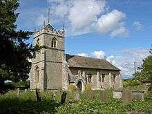
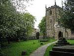
| Church of All Saints | Cawthorne, Barnsley | Church | 13th century | 18 March 1968 | SE2850307960 53°34′03″N 1°34′16″W |
1191523 | 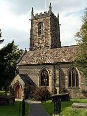 Church of All Saints |
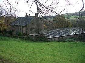
| Wool Greaves Farmhouse | Cawthorne, Barnsley | Farmhouse | 1672 | 18 March 1968 | SE2674806133 53°33′04″N 1°35′52″W |
1192159 |  |
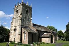
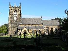
| Church of St Michael and All Angels and adjoining Stone Wall to West Side of Churchyard | Great Houghton, Barnsley | Church | 19th century | 18 April 1985 | SE4304106536 53°33′13″N 1°21′06″W |
1151170 | .jpg) Church of St Michael and All Angels and adjoining Stone Wall to West Side of Churchyard |
| Barn at Ingfield Farm immediately West of Ings Cottage | Ingbirchworth, Gunthwaite and Ingbirchworth, Barnsley | Cruck Barn | 16th century | 18 March 1968 | SE2233405641 53°32′49″N 1°39′52″W |
1151108 | |
| Stable Range about 30m west of Gunthwaite Hall Barn | Gunthwaite, Gunthwaite and Ingbirchworth, Barnsley | Stable | 1699 | 25 February 1952 | SE2372806558 53°33′18″N 1°38′36″W |
1151107 | |
| Bullhouse Hall including the cottage to left (rear) | Millhouse, Penistone, Barnsley | House | 1655 | 27 April 1988 | SE2112202712 53°31′14″N 1°40′58″W |
1151820 | |
| Cat Hill Farmhouse | Penistone, Barnsley | Farmhouse | 1634 | 23 June 1965 | SE2477605226 53°32′35″N 1°37′39″W |
1191706 | |
| Summerhouse about 20 Metres north-east of No 1, Bullhouse | Millhouse, Penistone, Barnsley | Summerhouse | 1686 | 27 April 1988 | SE2115802758 53°31′16″N 1°40′56″W |
1151824 | |
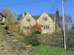
| Knabbe's Hall | Silkstone Common, Silkstone, Barnsley | Farmhouse | Third-quarter of 17th century | 25 February 1952 | SE2883903821 53°31′49″N 1°33′59″W |
1314749 | |
| Conservatory and linking Bridge at North West corner of Wentworth Castle | Wentworth Castle, Stainborough, Barnsley | Country House | 1840s | 25 February 1952 | SE3194203162 53°31′27″N 1°31′11″W |
1191675 | 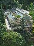 Conservatory and linking Bridge at North West corner of Wentworth Castle |
| Duke of Argyll's Monument | Wentworth Castle, Stainborough, Barnsley | Column | 1744 | 18 March 1968 | SE3224502420 53°31′03″N 1°30′55″W |
1151064 | 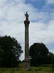 Duke of Argyll's Monument |
| Gun Room | Wentworth Castle, Stainborough, Barnsley | Bath House | Late 18th century | 25 February 1952 | SE3194403224 53°31′29″N 1°31′11″W |
1151066 | |
| Pillared Barn about 20m to south of Steeple Lodge | Wentworth Castle, Stainborough, Barnsley | Hay Barn | c. 1775 | 5 November 1973 | SE3186103465 53°31′37″N 1°31′15″W |
1315049 | |
| Rotunda Temple | Wentworth Castle, Stainborough, Barnsley | Garden Temple | 1746 | 18 March 1968 | SE3278602722 53°31′13″N 1°30′25″W |
1191615 | 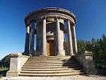 Rotunda Temple |
| Stainborough Castle | Wentworth Castle, Stainborough, Barnsley | Folly | 1728-30 | 18 March 1968 | SE3158003047 53°31′23″N 1°31′30″W |
1151069 | 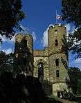 Stainborough Castle |
| Statue of the First Earl of Strafford situated at North End of East Front of Wentworth Castle | Wentworth Castle, Stainborough, Barnsley | Statue | 1744 | 4 December 1986 | SE3199003220 53°31′29″N 1°31′08″W |
1191709 | |
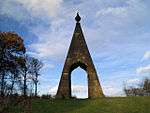
| Queen Anne's Obelisk | Wentworth Castle, Stainborough, Barnsley | Monument | 1734 | 11 November 1966 | SE3318702917 53°31′19″N 1°30′03″W |
1192441 | .jpg) Queen Anne's Obelisk |
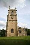
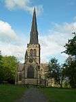
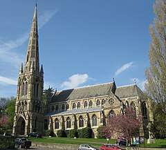
| Church of St Peter | Tankersley, Barnsley | Church | 1901 | 25 April 1969 | SK3495099586 53°29′31″N 1°28′29″W |
1286900 | 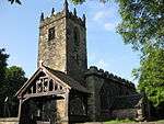 Church of St Peter |
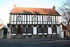
| Huthwaite Hall | Thurgoland, Barnsley | House | 1748 | 27 April 1988 | SE2836900454 53°30′00″N 1°34′26″W |
1286726 | 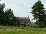 Huthwaite Hall |
| Wortley Hall with attached South-front Terrace and Steps including attached Retaining Wall and Steps to Wing set back on left | Wortley, Barnsley | Country House | 1742-46 | 25 April 1969 | SK3124199495 53°29′28″N 1°31′50″W |
1192585 | 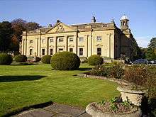 Wortley Hall with attached South-front Terrace and Steps including attached Retaining Wall and Steps to Wing set back on left |
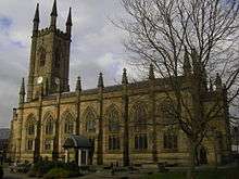
| Church of St Mary | Barnsley, Barnsley | Church | c. 1400 | 13 January 1986 | SE3435606656 53°33′19″N 1°28′58″W |
1315008 |  Church of St Mary |
| Church of St Peter Including Attached Wall and Gateway to South West | Barnsley, Barnsley | Gate | 1893-1910 | 13 January 1986 | SE3510405883 53°32′54″N 1°28′18″W |
1314984 | |
| Darley Cliffe Hall including attached Front Garden Wall and Dwellings known as Tudor House and Dower Cottage | Barnsley | House | 17th century | 11 November 1966 | SE3554704510 53°32′10″N 1°27′54″W |
1151042 | |
| Houndhill | Barnsley | House | 1606 | 11 November 1966 | SE3372604141 53°31′58″N 1°29′34″W |
1151039 | |
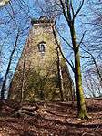
| Locke Park Tower | Barnsley, Barnsley | Tower | 1875-1877 | 13 July 1976 | SE3425005092 53°32′29″N 1°29′05″W |
1315014 |  Locke Park Tower |
| Swaithe House | Swaithe, Barnsley | Farmhouse | 17th century | 11 November 1966 | SE3723004098 53°31′56″N 1°26′23″W |
1286701 | |
| Worsbrough Corn Mill | Barnsley | Corn Mill | Early 17th century | 11 November 1966 | SE3494503326 53°31′32″N 1°28′28″W |
1151044 |  Worsbrough Corn Mill |
.jpg)
Doncaster
| Name | Location | Type | Completed [note 1] | Date designated | Grid ref.[note 2] Geo-coordinates |
Entry number [note 3] | Image |
|---|---|---|---|---|---|---|---|
| Church of St John | Adwick upon Dearne, Doncaster (district) | Church | 12th century | 5 June 1968 | SE4702401495 53°30′29″N 1°17′33″W |
1151670 | .jpg) Church of St John |
| Church of St Helena | Austerfield, Doncaster | Church | 11th century | 5 June 1968 | SK6616694691 53°26′41″N 1°00′19″W |
1151575 | 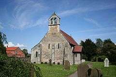 Church of St Helena |
| Barnburgh Hall Dovecote | Barnburgh, Doncaster | Dovecote | Late C16-Early 17th century | 5 June 1968 | SE4867703332 53°31′28″N 1°16′02″W |
1314757 | 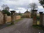 Barnburgh Hall Dovecote |
| Church of St Oswald | Kirk Sandall, Barnby Dun with Kirk Sandall, Doncaster | Church | 12th century | 5 June 1968 | SE6092808130 53°33′59″N 1°04′54″W |
1286919 | 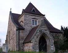 Church of St Oswald |
| Bawtry Hall | Bawtry, Doncaster | House | 1785 | 11 January 1988 | SK6506692876 53°25′43″N 1°01′20″W |
1151550 | |
| Church of St James | Braithwell, Doncaster | Sundial | 1828 | 5 June 1968 | SK5299294697 53°26′47″N 1°12′13″W |
1286514 | 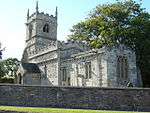 Church of St James |
| Church of St Michael and All Angels | Brodsworth, Doncaster | Church | 11th century | 5 June 1968 | SE5067307230 53°33′33″N 1°14′11″W |
1191555 | .jpg) Church of St Michael and All Angels |
| St Anne's Rest Home | Burghwallis, Doncaster | House | Early 16th century | 23 March 1988 | SE5362011988 53°36′06″N 1°11′28″W |
1192073 | |
| Cantley Hall and Outbuildings | Cantley, Doncaster | Country House | 1785 | 5 June 1968 | SE6249102139 53°30′44″N 1°03′33″W |
1191866 | .jpg) Cantley Hall and Outbuildings |
| Church of All Saints | Clayton with Frickley, Doncaster | Church | 12th century | 5 June 1968 | SE4684907882 53°33′56″N 1°17′39″W |
1151647 | 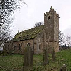 Church of All Saints |
| Hickleton Hall with attached Quadrant Walls and Walls extended to enclose Entrance Front Garden with associated Gate Piers and Statues | Hickleton, Doncaster | Country House | 1745-1748 | 27 May 1953 | SE4822605154 53°32′27″N 1°16′26″W |
1286810 | 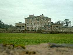 Hickleton Hall with attached Quadrant Walls and Walls extended to enclose Entrance Front Garden with associated Gate Piers and Statues |
| Stable to Hickleton Hall including the Stable Cottage and attached Walls and Gatepiers | Hickleton Hall, Hickleton, Doncaster | House | Post Mid 18th century | 11 April 1986 | SE4820805244 53°32′30″N 1°16′26″W |
1151659 | |
| The Brewhouse | Hickleton Hall, Hickleton, Doncaster | Brewhouse | Mid 18th century | 11 April 1986 | SE4820305212 53°32′29″N 1°16′27″W |
1286781 | |
| Church of St James | High Melton, Doncaster | Church | 12th century | 5 June 1968 | SE5091701811 53°30′38″N 1°14′01″W |
1192208 | |
| Hooton Pagnell Hall including Archway Flat. Nos 1 and 2, Hall Cottages, Ground Floor Flat, First Floor Flat and Pump End | Hooton Pagnell Hall, Hooton Pagnell, Doncaster | House | 18th century | 27 May 1953 | SE4856907874 53°33′55″N 1°16′05″W |
1192355 | .jpg) Hooton Pagnell Hall including Archway Flat. Nos 1 and 2, Hall Cottages, Ground Floor Flat, First Floor Flat and Pump End |
| Church of St Mary | Kirk Bramwith, Doncaster | Church | 12th century | 29 September 1987 | SE6199611722 53°35′54″N 1°03′53″W |
1286522 | 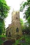 Church of St Mary |
| Church of St Katharine | Loversall, Doncaster | Church | c. 1300 | 5 June 1968 | SK5761398733 53°28′56″N 1°08′00″W |
1193085 | 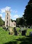 Church of St Katharine |
| Tomb Chest about 3m to South of South Chapel to Church of St Katharine | Loversall, Doncaster | Chest Tomb | Early 14th century | 26 November 1987 | SK5761898718 53°28′55″N 1°08′00″W |
1314861 | 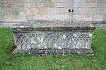 Tomb Chest about 3m to South of South Chapel to Church of St Katharine |
| Owston Hall, Flats 1 to 5 and including the Old Hall | Owston Village, Owston, Doncaster | Apartment | 1988 | 5 June 1968 | SE5500111090 53°35′37″N 1°10′14″W |
1286676 | 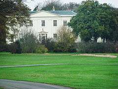 Owston Hall, Flats 1 to 5 and including the Old Hall |
| Church of St Michael | Rossington, Doncaster | Church | 12th century | 5 June 1968 | SK6250898396 53°28′43″N 1°03′35″W |
1151519 | 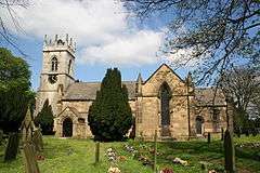 Church of St Michael |
| Church of St Winifred | Stainton, Doncaster | Church | 12th century | 5 June 1968 | SK5552093633 53°26′12″N 1°09′57″W |
1286289 | 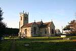 Church of St Winifred |
| Remains of Chapel at Manor House Farm | Thorpe in Balne, Doncaster | Chapel | 12th century | 5 June 1968 | SE5990511084 53°35′35″N 1°05′47″W |
1286641 | |
| Lindrick House | Tickhill, Doncaster | House | Early 18th century | 22 January 1981 | SK5904792660 53°25′39″N 1°06′46″W |
1191433 | 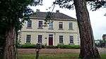 Lindrick House |
| St Leonard's Hospital | Tickhill, Doncaster | House | 1470 | 27 December 1962 | SK5924693374 53°26′02″N 1°06′35″W |
1191574 | |
| The Friary and Friary Close | Tickhill, Doncaster | House | 1983 | 27 December 1962 | SK5860492755 53°25′42″N 1°07′10″W |
1286862 | |
| Tickhill Castle House | Tickhill, Doncaster | House | 17th century | 22 January 1981 | SK5929392902 53°25′46″N 1°06′33″W |
1151747 |  Tickhill Castle House |
| East Lodge and attached Forecourt Wall | Wadworth, Doncaster | Gate Lodge | c. 1750 | 5 June 1968 | SK5672797193 53°28′06″N 1°08′49″W |
1193428 | |
| West Lodge and attached Forecourt Wall | Wadworth, Doncaster | Gate Lodge | c. 1750 | 5 June 1968 | SK5669297190 53°28′06″N 1°08′51″W |
1151506 | |
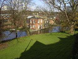
| Warmsworth Hall | Warmsworth, Doncaster | House | 1668 | 5 June 1968 | SE5471400608 53°29′58″N 1°10′36″W |
1193489 | 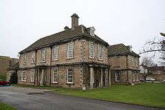 Warmsworth Hall |
| Christ Church | Doncaster | Church | 1827-9 | 12 June 1950 | SE5797703309 53°31′24″N 1°07′37″W |
1286309 | 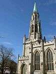 Christ Church |
| Church of St Laurence | Adwick-le-Street, Doncaster | Church | 12th century | 19 October 1962 | SE5409808601 53°34′16″N 1°11′04″W |
1151473 | 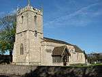 Church of St Laurence |
| Church of St Wilfrid | Cantley, Doncaster | Tower | 15th century | 5 September 1988 | SE6185001439 53°30′22″N 1°04′08″W |
1151446 | |
| The Market Hall, Corn Exchange and Fish Market | Doncaster | Corn Exchange | 1870-3 | 12 June 1950 | SE5759303444 53°31′28″N 1°07′58″W |
1192688 | 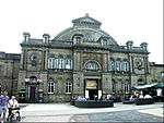 The Market Hall, Corn Exchange and Fish Market |
.jpg)
Rotherham
| Name | Location | Type | Completed [note 1] | Date designated | Grid ref.[note 2] Geo-coordinates |
Entry number [note 3] | Image |
|---|---|---|---|---|---|---|---|
| Aughton Court | Aston, Aston cum Aughton, Rotherham (district) | Country House | c. 1772 | 29 March 1968 | SK4690485181 53°21′41″N 1°17′48″W |
1314660 | |
| Hellaby Hall | Bramley, Rotherham | House | c. 1690 | 1 April 1987 | SK5057692271 53°25′29″N 1°14′25″W |
1192650 | 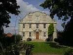 Hellaby Hall |
| Hoober Stand | Brampton Bierlow, Rotherham | Tower | 1747-9 | 29 April 1952 | SK4074798545 53°28′55″N 1°23′15″W |
1132812 | |
| Needle's Eye | Brampton Bierlow, Rotherham | Carriageway | Mid-Late 18th century | 29 March 1968 | SK3962298821 53°29′05″N 1°24′16″W |
1314588 | |
| Rainborough Lodges and Gates | Brampton Bierlow, Rotherham | Gate Lodge | 1798-1804 | 29 March 1968 | SE4075700616 53°30′02″N 1°23′13″W |
1314591 | 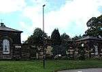 Rainborough Lodges and Gates |
| Dinnington Hall | Dinnington St. John's, Rotherham | House | Early to mid 18th century | 29 July 1966 | SK5248885686 53°21′56″N 1°12′46″W |
1314652 | |
| 4, Walseker Lane | Woodall, Harthill with Woodall, Rotherham | Farmhouse | Late Medieval | 15 October 1986 | SK4828780763 53°19′18″N 1°16′36″W |
1132671 | |
| Church of St John the Baptist | Hooton Roberts, Rotherham | Church | 12th century | 29 March 1968 | SK4840397066 53°28′05″N 1°16′20″W |
1286668 | 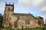 Church of St John the Baptist |
| Slade Hooton Hall | Slade Hooton, Laughton-en-le-Morthen, Rotherham | Country House | 1698 | 29 March 1968 | SK5242089240 53°23′51″N 1°12′47″W |
1151845 | .jpg) Slade Hooton Hall |
| Stable and Remains of attached Barn immediately to South West of Slade Hooton Hall | Slade Hooton, Laughton-en-le-Morthen, Rotherham | Barn | 1705 | 29 March 1968 | SK5240889217 53°23′50″N 1°12′48″W |
1193434 | |
| Wall enclosing Front Garden to Slade Hooton Hall including attached Gatepiers and Gateway | Slade Hooton, Laughton-en-le-Morthen, Rotherham | Gate | c. 1700 | 29 March 1968 | SK5239789267 53°23′52″N 1°12′48″W |
1151846 | |
| Church of St Peter | Letwell, Rotherham | Church | 15th century | 29 July 1966 | SK5594787052 53°22′39″N 1°09′38″W |
1132679 | |
| Langold Farmhouse | Letwell, Rotherham | Farmhouse | Mid C18, pre 1768 | 29 May 1966 | SK5703886529 53°22′21″N 1°08′39″W |
1132672 | |
| Old Stable and Coachhouse Buildings at Langold | Letwell, Rotherham | House | 1986 | 29 May 1966 | SK5703986529 53°22′21″N 1°08′39″W |
1314640 | |
| Church of Saint Bartholomew | Maltby, Rotherham | Church | 11th century | 13 November 1959 | SK5276791883 53°25′16″N 1°12′27″W |
1314662 | 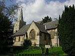 Church of Saint Bartholomew |
| Malpas Hill Gateway | Sandbeck Park, Maltby, Rotherham | Gate | c. 1760 | 13 November 1959 | SK5885990280 53°24′22″N 1°06′58″W |
1314689 | 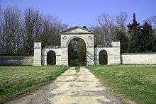 Malpas Hill Gateway |
| Sandbeck Park Stables | Sandbeck Park, Maltby, Rotherham | House | c. 1760 | 13 November 1959 | SK5683690337 53°24′24″N 1°08′47″W |
1151900 | |
| Church of St James | Ravenfield, Rotherham | Church | 18th century | 29 March 1968 | SK4858795452 53°27′13″N 1°16′11″W |
1151867 | 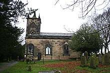 Church of St James |
| Gatehouse to Thorpe Salvin Hall | Thorpe Salvin, Rotherham | Gatehouse | Mid-late 16th century | 29 July 1966 | SK5212681243 53°19′32″N 1°13′08″W |
1314668 | 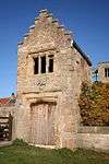 Gatehouse to Thorpe Salvin Hall |
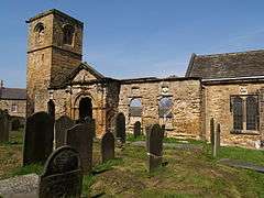
| Ruins of Thorpe Salvin Hall | Thorpe Salvin, Rotherham | Country House | Mid to late C16, pre 1582 | 29 July 1966 | SK5213981266 53°19′33″N 1°13′07″W |
1286372 | 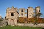 Ruins of Thorpe Salvin Hall |
| Church of St Leonard | Thrybergh, Rotherham | Church | 11th century | 29 March 1968 | SK4668795489 53°27′15″N 1°17′54″W |
1132783 | 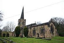 Church of St Leonard |
| Thurcroft Hall | Brookhouse, Thurcroft, Rotherham | Country House | 1699 | 29 March 1968 | SK5095889213 53°23′50″N 1°14′06″W |
1314692 | 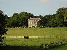 Thurcroft Hall |
| Church of St Peter and St Paul | Todwick, Rotherham | Church | 11th century | 29 July 1986 | SK4974684126 53°21′06″N 1°15′15″W |
1151903 | 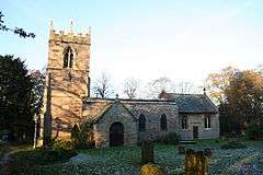 Church of St Peter and St Paul |
| Church of St John the Baptist | Wales, Rotherham | Church | Early 12th century | 29 May 1966 | SK4775782683 53°20′20″N 1°17′03″W |
1286360 | 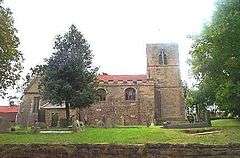 Church of St John the Baptist |
| Camellia House | Wentworth Woodhouse, Wentworth, Rotherham | Camellia House | Mid 18th century | 29 March 1968 | SK3909697685 53°28′28″N 1°24′45″W |
1286162 | |
| Church of the Holy Trinity | Wentworth, Rotherham | Church | 1872-76 | 29 March 1968 | SK3838798141 53°28′43″N 1°25′23″W |
1192788 | |
| Doric Temple | Wentworth Park, Wentworth, Rotherham | Park | c. 1745 | 29 April 1952 | SK3993097174 53°28′11″N 1°24′00″W |
1193160 | |
| Gateway with attached Plinth Wall and Ironwork Screen forming South Side of South Court at Wentworth Woodhouse | Wentworth Woodhouse, Wentworth, Rotherham | Gate | c. 1630 | 21 August 1985 | SK3957797633 53°28′26″N 1°24′19″W |
1193422 |  Gateway with attached Plinth Wall and Ironwork Screen forming South Side of South Court at Wentworth Woodhouse |
| Holy Trinity Wentworth (old) Church | Wentworth, Rotherham | Church | C14-C15 | 29 March 1968 | SK3838198283 53°28′48″N 1°25′23″W |
1314580 | |
| Ionic Temple at West End of South Terrace | Wentworth Woodhouse, Wentworth, Rotherham | Temple | Possibly as early as 1735 | 21 August 1985 | SK3912497554 53°28′24″N 1°24′43″W |
1132730 | .jpg) Ionic Temple at West End of South Terrace |
| Church of St Mary Magdalene | Whiston, Rotherham | Church | 12th century | 29 March 1968 | SK4510590025 53°24′18″N 1°19′23″W |
1192880 | 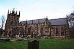 Church of St Mary Magdalene |
| Morthen Hall | Whiston, Rotherham | Country House | Early 18th century | 29 March 1968 | SK4788689476 53°24′00″N 1°16′53″W |
1192970 | .jpg) Morthen Hall |
| Whiston Hall Barn | Whiston, Rotherham | Barn | 16th century | 19 February 1986 | SK4473490053 53°24′19″N 1°19′43″W |
1132687 | |
| Clifton House | Rotherham | House | 1783 | 19 October 1951 | SK4348892734 53°25′47″N 1°20′49″W |
1286766 | 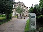 Clifton House |
| Keppel's Column | Thorpe Common, Rotherham | Column | 1773-80 | 19 February 1986 | SK3894194731 53°26′52″N 1°24′55″W |
1314632 | |
| Moorgate Hall and attached Outbuilding | Rotherham | House | 17th century | 19 October 1951 | SK4313192071 53°25′25″N 1°21′09″W |
1132715 | |
| Rockingham Kiln | Rotherham | Pottery Kiln | Early 19th century | 11 December 1953 | SK4405498814 53°29′03″N 1°20′15″W |
1314614 | 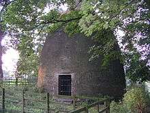 Rockingham Kiln |
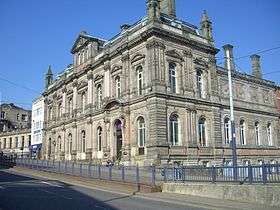
| St Marys Rectory | Rotherham | Vicarage | 1752 | 8 October 1962 | SK4363495926 53°27′30″N 1°20′40″W |
1314613 | |
| 25 and 27 High Street | Rotherham | Inn | 15th century | 23 November 1973 | SK4287792796 53°25′49″N 1°21′22″W |
1132712 | 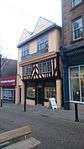 25 and 27 High Street |

Sheffield
| Name | Location | Type | Completed [note 1] | Date designated | Grid ref.[note 2] Geo-coordinates |
Entry number [note 3] | Image |
|---|---|---|---|---|---|---|---|
| Church of St James | Midhopestones, Bradfield, Sheffield | Church | Medieval | 25 April 1969 | SK2350099538 53°29′31″N 1°38′50″W |
1132872 | 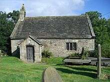 Church of St James |
| Fair House Farmhouse | Low Bradfield, Bradfield, Sheffield | Farmhouse | Late 17th century | 8 August 1985 | SK2602491841 53°25′22″N 1°36′36″W |
1132863 | |
| Loxley United Reformed Church | Loxley, Bradfield, Sheffield | Congregational Chapel | 1787 | 8 August 1985 | SK3029890164 53°24′27″N 1°32′45″W |
1314565 | 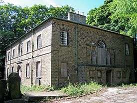 Loxley United Reformed Church |
| Onesacre Hall | Oughtibridge, Bradfield, Sheffield | House | 1630-1640 | 25 April 1969 | SK2973193436 53°26′13″N 1°33′14″W |
1191806 | |
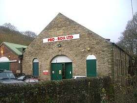
| Rolling Mill | Little Matlock, Bradfield, Sheffield | Rolling Mill | 1882 | 24 June 1976 | SK3095189419 53°24′02″N 1°32′09″W |
1132839 | |
| The Old Hall & the Priory | Ecclesfield, Sheffield | House | 1736 | 25 February 1952 | SK3525494262 53°26′38″N 1°28′15″W |
1314582 | |
| Whitley Hall Hotel | Ecclesfield, Sheffield | House | 16th century | 25 April 1969 | SK3450694887 53°26′59″N 1°28′55″W |
1192829 | 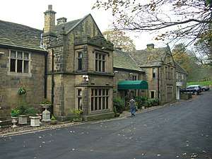 Whitley Hall Hotel |
| Beauchief Hall and Adjoining Steps Forecourt Walls and Gates | Beauchief, Sheffield | Country House | 1671 | 1 May 1952 | SK3289681522 53°19′47″N 1°30′27″W |
1246567 |  Beauchief Hall and Adjoining Steps Forecourt Walls and Gates |
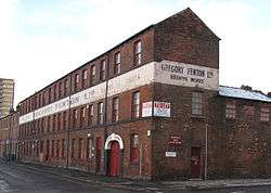
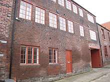
| Beehive Works | Sheffield | Cutlery Works | Late 1850s-c1890 | 13 June 1988 | SK3473586663 53°22′32″N 1°28′46″W |
1271239 | |
| Bishops' House | Meersbrook, Sheffield | Farmhouse | c. 1500 | 1 May 1952 | SK3535683957 53°21′05″N 1°28′13″W |
1271162 | 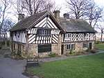 Bishops' House |
| Broom Hall | Broomhall, Sheffield | House | 16th century | 1 May 1952 | SK3368186525 53°22′28″N 1°29′43″W |
1271100 | |
| Butchers Wheel | Sheffield | Cutlery Works | c. 1835 | 13 June 1988 | SK3550186867 53°22′39″N 1°28′04″W |
1246467 | |
| Carbrook Hall Public House | Carbrook, Sheffield | House | c. 1620 | 1 May 1952 | SK3888390012 53°24′20″N 1°25′00″W |
1246476 | 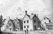 Carbrook Hall Public House |
| Cathedral Church of St Marie | Sheffield | Parish Hall | 1846-1850 | 28 June 1973 | SK3547487293 53°22′53″N 1°28′05″W |
1271205 | |
| Central Glasshouse on North West Side of Botanical Gardens | Broomhill, Sheffield | Colonnade | c. 1935 | 1 May 1952 | SK3343986312 53°22′21″N 1°29′56″W |
1247258 | 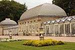 Central Glasshouse on North West Side of Botanical Gardens |
| Church of St James the Great | Norton, Sheffield | Parish Church | 11th century | 1 May 1952 | SK3587982166 53°20′07″N 1°27′46″W |
1271180 | |
| Church of St John | Ranmoor, Sheffield | Parish Church | 1879 | 28 June 1973 | SK3195286280 53°22′21″N 1°31′16″W |
1271043 | |
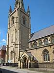
| Church of St Mary | Sheffield | Church | 1826-1830 | 28 June 1973 | SK3524886306 53°22′21″N 1°28′18″W |
1246817 | |
| Church of St Mary the Virgin | Beighton, Sheffield | Parish Church | 12th century | 28 June 1973 | SK4427283353 53°20′43″N 1°20′11″W |
1270442 | |
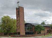
| Church of St Paul | Parson Cross, Sheffield | Church | 1958-1959 | 25 September 1998 | SK3535693063 53°25′59″N 1°28′09″W |
1376605 | |
| Church of St Thomas a Becket and Remains of Beauchief Abbey Church | Beauchief, Sheffield | Abbey | c1175-1536 | 1 May 1952 | SK3334381923 53°19′59″N 1°30′03″W |
1271291 | |
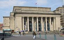
| City Hall | Sheffield | Public Hall | 1920-34 | 16 January 1981 | SK3518987236 53°22′51″N 1°28′21″W |
1246548 | |
| Crucible Steel Shop in South Corner of Sandersons Kaysers Darnall Works | Darnall, Sheffield | Crucible Steel Works | 1871 | 21 May 1987 | SK3847288374 53°23′27″N 1°25′23″W |
1247446 |  Crucible Steel Shop in South Corner of Sandersons Kaysers Darnall Works |
| Cruicible Steel Shops on South East Side of Sanderson Kaysers Darnall Works | Darnall, Sheffield | Crucible Steel Works | 1872 | 21 May 1987 | SK3849688385 53°23′27″N 1°25′21″W |
1247369 |  Cruicible Steel Shops on South East Side of Sanderson Kaysers Darnall Works |
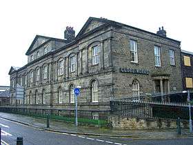
| Cutlers Hall | Sheffield | Banqueting House | 1832 | 28 June 1973 | SK3537687402 53°22′56″N 1°28′11″W |
1247108 | 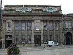 Cutlers Hall |
| East Range at Cornish Place Works | Kelham Island, Sheffield | Petrol Pump | c. 1924 | 28 June 1973 | SK3491588291 53°23′25″N 1°28′35″W |
1270962 | 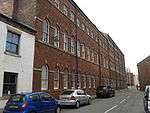 East Range at Cornish Place Works |
| Endcliffe Hall with Screen Wall to North West and Terrace Wall and Steps to South and West | Endcliffe, Sheffield | House | c. 1860 | 28 June 1973 | SK3248886230 53°22′19″N 1°30′47″W |
1254807 |  Endcliffe Hall with Screen Wall to North West and Terrace Wall and Steps to South and West |
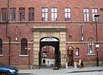
| Entrance Gateway to Green Lane Works | Kelham Island, Sheffield | Gate | 1860 | 1 May 1952 | SK3502588192 53°23′22″N 1°28′29″W |
1255044 | 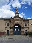 Entrance Gateway to Green Lane Works |
| Former Counting House and Workmens' Cottages at Abbeydale Works Museum | Abbeydale, Sheffield | Workers Cottage | 1786-93 | 1 May 1952 | SK3257481999 53°20′02″N 1°30′44″W |
1271385 | 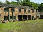 Former Counting House and Workmens' Cottages at Abbeydale Works Museum |
| Former Stables and Coach House at Number 3 Mount Pleasant Community Centre | Sharrow, Sheffield | Stable | c. 1770 | 1 May 1952 | SK3485485720 53°22′02″N 1°28′40″W |
1270903 | 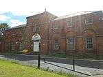 Former Stables and Coach House at Number 3 Mount Pleasant Community Centre |
| Gateway and Adjoining Walls at Garden Entrance to Oakes Park | Norton, Sheffield | Gate | Early 18th century | 28 June 1973 | SK3654182076 53°20′04″N 1°27′10″W |
1271161 | |
| Gateway to General Cemetery with Screen and Flanking Walls | Sharrow, Sheffield | Gate | 1836 | 8 September 1970 | SK3422285835 53°22′06″N 1°29′14″W |
1247054 | 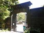 Gateway to General Cemetery with Screen and Flanking Walls |
| Globe Works | Kelham Island, Sheffield | Managers House | 1825 | 14 May 1970 | SK3481488238 53°23′23″N 1°28′41″W |
1271128 | |
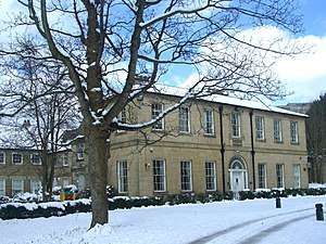
| Heritage House | Upperthorpe, Sheffield | Hospital | 1793-97 | 8 September 1970 | SK3449288247 53°23′24″N 1°28′58″W |
1270452 | |
| King Edward VII Upper School | Broomhill, Sheffield | School | 1995 | 28 June 1973 | SK3364486714 53°22′34″N 1°29′45″W |
1254957 | |
| Leah's Yard | Sheffield | Courtyard | Mid 19th century | 31 May 1983 | SK3519587112 53°22′47″N 1°28′21″W |
1247012 | |
| Left Hand Glasshouse on North West Side of Botanical Gardens | Broomhill, Sheffield | Glasshouse | 1837-38 | 1 May 1952 | SK3341986280 53°22′20″N 1°29′57″W |
1247278 |  Left Hand Glasshouse on North West Side of Botanical Gardens |
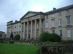
| Library and Arts Tower, University of Sheffield | Sheffield | Faculty Building | 1962-1965 | 30 March 1993 | SK3416987437 53°22′58″N 1°29′16″W |
1247655 | 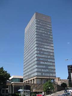 Library and Arts Tower, University of Sheffield |
| Lyceum Theatre | Sheffield | Theatre | 1897 | 15 November 1972 | SK3557487201 53°22′50″N 1°28′00″W |
1270876 | 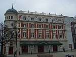 Lyceum Theatre |
| Main Gateway and Lodges to General Cemetery | Sharrow, Sheffield | Gate | 1836 | 8 September 1970 | SK3401185928 53°22′09″N 1°29′25″W |
1247071 | 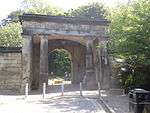 Main Gateway and Lodges to General Cemetery |
| Managers House and Adjoining Stable on East Side of Abbeydale Works Museum | Abbeydale, Sheffield | Managers House | 1838 | 28 June 1973 | SK3236681439 53°19′44″N 1°30′56″W |
1246449 | |
| Mappin Art Gallery | Weston Park, Sheffield | Park | 1887 | 28 June 1973 | SK3388587354 53°22′55″N 1°29′31″W |
1254483 | 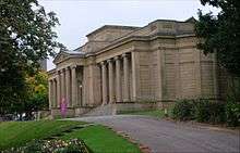 Mappin Art Gallery |
| Mount Pleasant Community Centre | Sheffield | House | c. 1770 | 1 May 1952 | SK3488285706 53°22′01″N 1°28′38″W |
1270937 | 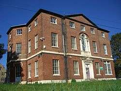 Mount Pleasant Community Centre |
| Norton Hall Hospital with Colonnade and Orangery | Sheffield | Country House | Late 18th century | 28 June 1973 | SK3580982175 53°20′07″N 1°27′49″W |
1246798 | 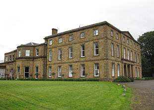 Norton Hall Hospital with Colonnade and Orangery |
| Oaks Park and Adjoining Terrace Wall and Steps | Norton, Sheffield | Kitchen | Early 19th century | 28 June 1973 | SK3662282067 53°20′03″N 1°27′05″W |
1246843 | 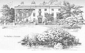 Oaks Park and Adjoining Terrace Wall and Steps |
| Old Chapel at General Cemetery | Sharrow, Sheffield | Cemetery Chapel | c. 1836 | 8 September 1970 | SK3413485879 53°22′07″N 1°29′18″W |
1247073 | 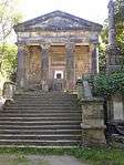 Old Chapel at General Cemetery |
| Old Queens Head Public House | Sheffield | House | Mid 19th century | 1 May 1952 | SK3581387254 53°22′51″N 1°27′47″W |
1247088 | 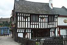 Old Queens Head Public House |
| Park Hill | Park Hill, Sheffield | Flats | 1957-1960 | 22 December 1998 | SK3606487093 53°22′46″N 1°27′34″W |
1246881 | |
| Portland Works | Highfield, Sheffield | Cutlery Works | Late 1870s | 12 December 1995 | SK3508686027 53°22′12″N 1°28′27″W |
1271036 | |
| Right Hand Glasshouse on North West Side of Botanical Gardens | Broomhill, Sheffield | Glasshouse | 1837-38 | 1 May 1952 | SK3346486348 53°22′23″N 1°29′55″W |
1270952 | 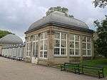 Right Hand Glasshouse on North West Side of Botanical Gardens |
| Sharrow Mills | Sharrow, Sheffield | Managers House | Mid 18th century | 28 June 1973 | SK3386185857 53°22′07″N 1°29′33″W |
1247589 | |
| Sheffield United Gas Light Company Offices | Sheffield | Office | 1875 | 28 June 1973 | SK3582487518 53°23′00″N 1°27′46″W |
1270948 | |
| Shepherd Wheel and Attached Dam Goit and Weir | Whiteley Woods, Sheffield | Dam | c. 1780 | 28 June 1973 | SK3173485396 53°21′52″N 1°31′29″W |
1255068 |  Shepherd Wheel and Attached Dam Goit and Weir |
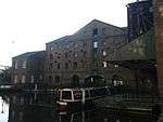
| Terminal Warehouse | Victoria Quays, Sheffield | Canal Warehouse | c. 1819 | 18 August 1971 | SK3598087660 53°23′04″N 1°27′38″W |
1247016 | |
| The Mount | Broomhill, Sheffield | House | c. 1970 | 28 June 1973 | SK3343786777 53°22′36″N 1°29′56″W |
1254959 | |
| The Old Bank House and Attached Railings | Sheffield | House | 1728 | 1 May 1952 | SK3545887574 53°23′02″N 1°28′06″W |
1255072 | 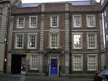 The Old Bank House and Attached Railings |
| Turret House 150 Metres West of Manor House Ruins | Manor Park, Sheffield | Pavilion | c. 1574 | 1 May 1952 | SK3749086481 53°22′26″N 1°26′17″W |
1271283 |  Turret House 150 Metres West of Manor House Ruins |
| West Range at Cornish Place Works | Kelham Island, Sheffield | Courtyard | Late 19th century | 28 June 1973 | SK3487188326 53°23′26″N 1°28′38″W |
1270928 | 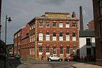 West Range at Cornish Place Works |
| Wicker Arch and Adjoining Viaduct and Buildings | Wicker, Sheffield | Workshop | 1995 | 28 June 1973 | SK3594488075 53°23′18″N 1°27′40″W |
1270747 | 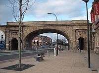 Wicker Arch and Adjoining Viaduct and Buildings |
| Workshop Ranges and Crucible Furnace Attached to Number 35 | Netherthorpe, Sheffield | House | c. 1840 | 13 June 1988 | SK3465887744 53°23′07″N 1°28′49″W |
1270867 | |
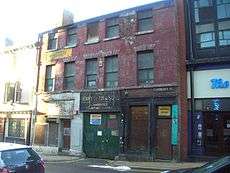
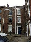
| 1 to 15 Paradise Square | Sheffield | House | 1787 | 1 May 1952 | SK3530787556 53°23′01″N 1°28′14″W |
1246807 | _Sheffield_-_geograph.org.uk_-_1473087.jpg) 1 to 15 Paradise Square |
| 4 to 12 Paradise Square | Sheffield | House | c. 1771 | 1 May 1952 | SK3535787590 53°23′02″N 1°28′12″W |
1271131 | 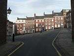 4 to 12 Paradise Square |
| 14 to 22 Paradise Square | Sheffield | House | MID C20 | 1 May 1952 | SK3534187602 53°23′03″N 1°28′13″W |
1246808 | 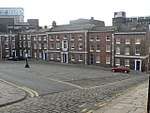 14 to 22 Paradise Square |
| 17 and 19 Paradise Square | Sheffield | House | Late 18th century | 1 May 1952 | SK3529787565 53°23′02″N 1°28′15″W |
1271132 | |
| 24 Paradise Square | Sheffield | House | c. 1771 | 1 May 1952 | SK3530087595 53°23′03″N 1°28′15″W |
1246809 | |
| War Memorial | Sheffield | War memorial | 1925 | 28 June 1973 | SK3520687182 |
1271299 |


.jpg)
Notes
- The date given is the date used by Historic England as significant for the initial building or that of an important part in the structure's description.
- Sometimes known as OSGB36, the grid reference is based on the British national grid reference system used by the Ordnance Survey.
- The "List Entry Number" is a unique number assigned to each listed building and scheduled monument by Historic England.
External links
![]()
This article is issued from Wikipedia. The text is licensed under Creative Commons - Attribution - Sharealike. Additional terms may apply for the media files.