Grade II* listed buildings in Nottinghamshire
There are over 20,000 Grade II* listed buildings in England. This page is a list of these buildings in the county of Nottinghamshire, by district.
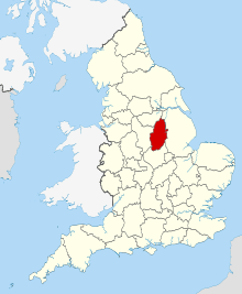
Nottinghamshire shown within England
Ashfield
| Name | Location | Type | Completed [note 1] | Date designated | Grid ref.[note 2] Geo-coordinates |
Entry number [note 3] | Image |
|---|---|---|---|---|---|---|---|
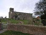
| Church of All Saints | Annesley | Statue | 1832 | 12 October 1988 | SK5109953620 53°04′39″N 1°14′19″W |
1275939 | |
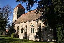
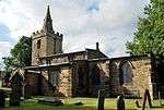
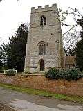
| Church of St Helen | Selston | Tower | Late 14th century | 13 October 1966 | SK4583453308 53°04′30″N 1°19′02″W |
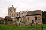
1275170 | 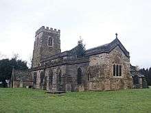 Church of St Helen |
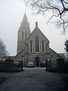
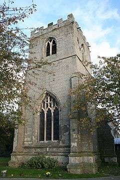
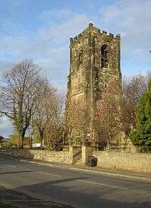
| Church of St Mary Magdalene | Hucknall | Tower | 1925 | 12 October 1988 | SK5334649381 53°02′21″N 1°12′21″W |
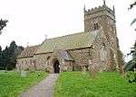
1217611 | 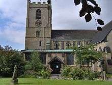 Church of St Mary Magdalene |
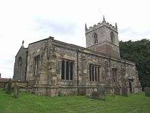
| Church of St Mary Magdalene | Sutton-in-Ashfield | Tower | c. 1395 | 4 June 1980 | SK4894058959 53°07′32″N 1°16′12″W |
1221773 | 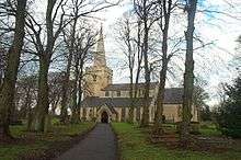 Church of St Mary Magdalene |
Bassetlaw
| Name | Location | Type | Completed [note 1] | Date designated | Grid ref.[note 2] Geo-coordinates |
Entry number [note 3] | Image |
|---|---|---|---|---|---|---|---|
| Barn and Attached Range of Farm Buildings at Manor Farm | Askham | Dovecote | 19th century | 14 November 1985 | SK7399274937 53°15′59″N 0°53′32″W |
1370116 |  |
| Church of St Nicholas | Askham | Parish Church | 12th century | 1 February 1967 | SK7397375000 53°16′01″N 0°53′33″W |
1045707 | 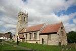 Church of St Nicholas |
| Ranby Hall | Babworth | House | 19th century | 1 February 1967 | SK6547583042 53°20′25″N 1°01′05″W |
1045110 | |
| Church of All Saints | Beckingham | Parish Church | 13th century | 1 February 1967 | SK7790090293 53°24′13″N 0°49′47″W |
1045129 | 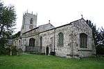 Church of All Saints |
| St Giles Church, Carburton | Carburton | Sundial | 18th century | 30 November 1966 | SK6111173286 53°15′11″N 1°05′08″W |
1370105 | |
| Clumber Bridge (that Part in Worksop Rural District) | Clumber Park, Carburton | Road Bridge | c. 1770 | 30 November 1966 | SK6210973827 53°15′28″N 1°04′14″W |
1045732 | 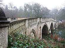 Clumber Bridge (that Part in Worksop Rural District) |
| Drayton Gate | Clumber Park, Carburton | Gate Pier | Late 18th century | 13 February 1967 | SK6490974468 53°15′48″N 1°01′42″W |
1045058 | 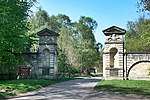 Drayton Gate |
| Greek Garden Temple | Clumber Park, Carburton | Garden Temple | c. 1765 | 13 February 1967 | SK6297874535 53°15′51″N 1°03′26″W |
1156511 | 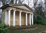 Greek Garden Temple |
| Roman Garden Temple | Clumber Park, Carburton | Garden Temple | c. 1765 | 13 February 1967 | SK6281674762 53°15′58″N 1°03′35″W |
1156484 | |
| The Grotto | Clumber Park, Carburton | Grotto | c. 1765 | 30 September 1977 | SK6214473938 53°15′32″N 1°04′12″W |
1045034 | 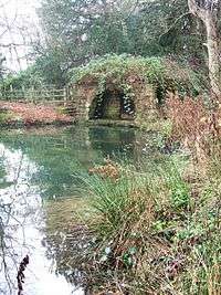 The Grotto |
| Church of St Giles | Darlton | Parish Church | c. 1200 | 1 February 1967 | SK7787673674 53°15′16″N 0°50′03″W |
1212465 | |
| Gate Piers and Flanking Walls to Normanton Gate | Elkesley | Gate Pier | c. 1700 | 30 September 1977 | SK6485574644 53°15′53″N 1°01′45″W |
1156026 | |
| West Bridge over River Poulter | Elkesley | Road Bridge | 1789 | 1 February 1967 | SK6485175745 53°16′29″N 1°01′44″W |
1223918 | |
| Church of Holy Trinity and Boundary Wall | Everton | Gate | 20th century | 1 February 1967 | SK6913691334 53°24′51″N 0°57′41″W |
1156568 | 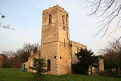 Church of Holy Trinity and Boundary Wall |
| Church of St Peter and St Paul | Gringley-on-the-Hill | Parish Church | 13th century | 1 February 1967 | SK7359890666 53°24′28″N 0°53′40″W |
1370395 | |
| Church of St James (ruin) | Haughton | Church | Early 12th century | 28 February 1952 | SK6911172986 53°14′58″N 0°57′56″W |
1267085 | 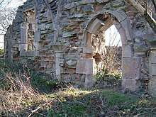 Church of St James (ruin) |
| North Engine House, Walkway and Cut Waters | Misterton | Engine House | Early 19th century | 23 November 1984 | SK7784895131 53°26′50″N 0°49′46″W |
1156775 | .jpg) North Engine House, Walkway and Cut Waters |
| South Engine House and Boundary Wall | Misterton | Engine House | 1828 | 23 November 1984 | SK7783895118 53°26′50″N 0°49′46″W |
1370383 | .jpg) South Engine House and Boundary Wall |
| Church of St Matthew | Normanton on Trent | Parish Church | 13th century | 1 February 1967 | SK7907069009 53°12′44″N 0°49′03″W |
1233792 | |
| North Leverton Windmill | North Leverton with Habblesthorpe | Tower Mill | 1813 | 28 February 1952 | SK7750782022 53°19′46″N 0°50′16″W |
1234469 |  North Leverton Windmill |
| Church of St Peter and St Paul | North Wheatley | Parish Church | 13th century | 1 February 1967 | SK7621085868 53°21′51″N 0°51′22″W |
1234572 | |
| The Old Hall and adjoining Old Hall Farm House | North Wheatley | Farmhouse | 20th century | 28 February 1952 | SK7619485749 53°21′47″N 0°51′23″W |
1275959 | |
| Church of St Leonard | Ragnall | Parish Church | Restored 1864-7 | 1 February 1967 | SK8020773674 53°15′14″N 0°47′57″W |
1233804 | 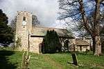 Church of St Leonard |
| Church of St Wilfrid | Scrooby | Parish Church | Early 15th century | 1 February 1967 | SK6522090754 53°24′34″N 1°01′13″W |
1239733 | |
| East Stable at Shireoaks Hall | Shireoaks | Dwelling | Early 18th century | 13 February 1967 | SK5521780631 53°19′11″N 1°10′21″W |
1045054 | |
| Shireoaks Hall | Shireoaks | Country House | c. 1600 | 13 February 1967 | SK5524380596 53°19′10″N 1°10′20″W |
1370408 | |
| West Stable and Attached Outbuildings at Shireoaks Hall | Shireoaks | Stable | Early 18th century | 13 February 1967 | SK5523280648 53°19′12″N 1°10′20″W |
1045055 | |
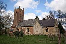
| Church of All Saints | South Leverton | Parish Church | 12th century | 1 February 1967 | SK7833981106 53°19′16″N 0°49′31″W |
1275880 | 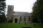 Church of All Saints |
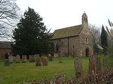
| Church of St Peter | Stokeham | Parish Church | 13th century | 1 February 1967 | SK7823876916 53°17′00″N 0°49′41″W |
1233882 | 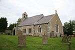 Church of St Peter |
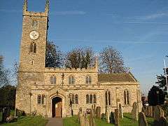
| Church of St Peter and St Paul | Sturton le Steeple | Parish Church | 12th century | 1 February 1967 | SK7879983871 53°20′45″N 0°49′04″W |
1275773 | 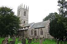 Church of St Peter and St Paul |
| Arch | Serlby Park, Styrrup with Oldcotes | Arch | Early 18th century | 12 April 1985 | SK6337089855 53°24′06″N 1°02′54″W |
1224495 | .jpg) Arch |
| The Old Grammar School, Number 4, and Attached Wall, Gate and Steps | Tuxford | House | 1952 | 28 February 1952 | SK7371871033 53°13′52″N 0°53′50″W |
1224333 | _Tuxford%2C_Nottinghamshire_-_geograph.org.uk_-_167767.jpg) The Old Grammar School, Number 4, and Attached Wall, Gate and Steps |
| Pair of Lodges Flanking North Drive | Welbeck Abbey, Welbeck | Lodge | Mid 18th century | 12 April 1985 | SK5603474328 53°15′47″N 1°09′41″W |
1266532 | |
| Pair of Lodges Flanking the Entrance to Glass Court Drive, Tunnel Entrance and Wall | Welbeck | Wall | 19th century | 12 April 1985 | SK5627174353 53°15′48″N 1°09′28″W |
1224510 | |
| Pair of Lodges Flanking the South Drive | Welbeck Abbey, Welbeck | Lodge | Mid 18th century | 12 April 1985 | SK5617474161 53°15′41″N 1°09′34″W |
1224870 | |
| Church of St Paul | West Drayton | Parish Church | 12th century | 1 February 1967 | SK7111474747 53°15′54″N 0°56′07″W |
1224416 |  Church of St Paul |
| Church of St Mary the Virgin with Boundary Walls and Gates | West Stockwith | Gate | 18th century | 1 February 1967 | SK7902794740 53°26′37″N 0°48′42″W |
1045087 | .jpg) Church of St Mary the Virgin with Boundary Walls and Gates |
| Sloswicke's Hospital | Retford | Almshouse | 1657 | 5 November 1976 | SK7059781352 53°19′28″N 0°56′30″W |
1302341 | |
| Amcott House | Retford | House | Mid 18th century | 14 September 1949 | SK7073881112 53°19′20″N 0°56′22″W |
1178702 | |
| Castle Farm with Attached Farmyard Wall and Outbuildings | Worksop | Farmhouse | 1758 | 13 February 1967 | SK5761177065 53°17′15″N 1°08′14″W |
1045026 | |
| Church of St Michael the Archangel | West Retford | Church | 14th century | 14 September 1949 | SK7023481313 53°19′27″N 0°56′49″W |
1370357 | 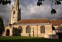 Church of St Michael the Archangel |
| Clumber Bridge and Cascade (that Part in the Former Worksop M.b) | Clumber Park | Bridge | 1763 | 13 February 1967 | SK6013976241 53°16′47″N 1°05′58″W |
1156520 | Clumber Bridge and Cascade (that Part in the Former Worksop M.b) |
| Depository at Canal Wharf | Worksop | Canal | 19th century | 10 April 1975 | SK5859879242 53°18′25″N 1°07′19″W |
1045059 | |
| Gateford Hall | Gateford | House | Mid 17th century | 13 February 1967 | SK5695581550 53°19′40″N 1°08′47″W |
1370401 | |
| Osberton Hall | Retford | Country House | 18th century | 13 February 1967 | SK6270279893 53°18′44″N 1°03′37″W |
1156774 | .jpg) Osberton Hall |
| Parish Church of All Hallows | Ordsall | Lych Gate | 18th or early 19th century | 14 September 1949 | SK7043579719 53°18′35″N 0°56′40″W |
1045228 | 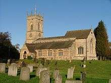 Parish Church of All Hallows |
| Parish Church of St Swithun | Retford | Parish Church | 15th century | 14 September 1949 | SK7064681324 53°19′27″N 0°56′27″W |
1370346 | |
| The Old Ship Inn | Worksop | Timber Framed House | Late 16th century | 13 February 1967 | SK5841678608 53°18′04″N 1°07′30″W |
1045065 | |
| 25 Grove Street | Retford | House | Late 18th century | 14 September 1949 | SK7065581175 53°19′22″N 0°56′27″W |
1302355 | |

Broxtowe
| Name | Location | Type | Completed [note 1] | Date designated | Grid ref.[note 2] Geo-coordinates |
Entry number [note 3] | Image |
|---|---|---|---|---|---|---|---|
| Bennerley Viaduct (north East End) | Awsworth | Railway Viaduct | 1877 | 21 November 1974 | SK4727743844 52°59′23″N 1°17′50″W |
1247946 |  Bennerley Viaduct (north East End) |
| Church of St Catherine | Cossall | Parish Church | 13th century | 13 October 1966 | SK4839042289 52°58′33″N 1°16′51″W |
1247982 | |
| Willoughby Almshouses and Adjoining Boundary Wall | Cossall | Gate | 1685 | 14 May 1952 | SK4831942308 52°58′33″N 1°16′55″W |
1247951 | 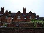 Willoughby Almshouses and Adjoining Boundary Wall |
| Beauvale House Service Wing and Stables and Garden Wall | Moorgreen, Greasley | Country House | 1871-73 | 27 June 1986 | SK4855249161 53°02′15″N 1°16′39″W |
1278051 | |
| Church of St Patrick | Nuthall | Parish Church | 13th century | 13 October 1966 | SK5147544473 52°59′42″N 1°14′04″W |
1248182 | |
| Gothic Summerhouse at Number 9 the Yews | Nuthall | Summerhouse | 1759 | 13 October 1966 | SK5151044343 52°59′38″N 1°14′03″W |
1248177 | |
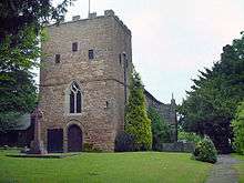
| Church of St Helen | Stapleford | Tower | 13th century | 18 October 1949 | SK4885637362 52°55′53″N 1°16′29″W |
1248029 | 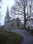 Church of St Helen |
| Church of St Helen | Trowell | Parish Church | 13th century | 13 October 1966 | SK4837039743 52°57′10″N 1°16′53″W |
1278008 | |
| The Manor House and Adjoining Terrace | Bramcote | House | 20th century | 18 October 1949 | SK5095837343 52°55′52″N 1°14′36″W |
1263875 | |
| 35 Hallams Lane | Beeston | Coal Shed | 1936-1937 | 14 April 1987 | SK5151835915 52°55′05″N 1°14′07″W |
1263872 | |
City of Nottingham
| Name | Location | Type | Completed [note 1] | Date designated | Grid ref.[note 2] Geo-coordinates |
Entry number [note 3] | Image |
|---|---|---|---|---|---|---|---|
| Adams Building and Attached Railings | Lace Market | Workshop | 1995 | 12 July 1972 | SK5762639840 52°57′10″N 1°08′37″W |
1270430 |  Adams Building and Attached Railings |
| Albert Ball Memorial Homes | Lenton | Almshouses | 1922 | 30 November 1995 | SK5531339114 52°56′48″N 1°10′42″W |
1246781 | |
| Arkwright Building, Nottingham Trent University | Nottingham | Public Library | 1877-81 | 12 July 1972 | SK5703840324 52°57′26″N 1°09′09″W |
1255017 |  Arkwright Building, Nottingham Trent University |
| Boots D90 West Headquarters Building | Nottingham | Courtyard | 1966-1968 | 28 August 1996 | SK5497436919 52°55′37″N 1°11′01″W |
1268303 | |
| Bromley House | Nottingham | Town House | 1752 | 11 August 1952 | SK5704439910 52°57′13″N 1°09′09″W |
1246247 | |
| Camellia House 100 Metres South West of Wollaton Hall | Wollaton Park | Camellia House | 1823 | 12 July 1972 | SK5321339139 52°56′49″N 1°12′34″W |
1255271 | 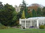 Camellia House 100 Metres South West of Wollaton Hall |
| Cathedral Church of St Barnabas and Attached Boundary Wall | Nottingham | Boundary Wall | 1841-44 | 11 August 1952 | SK5672040028 52°57′17″N 1°09′26″W |
1247533 | 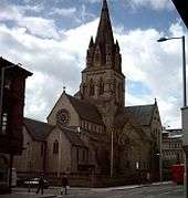 Cathedral Church of St Barnabas and Attached Boundary Wall |
| Church of Holy Trinity | Lenton | Parish Church | 1842 | 30 November 1995 | SK5545539310 52°56′54″N 1°10′34″W |
1247151 | |
| Church of St Andrew and Boundary Wall | Nottingham | Gate | 1869-71 | 12 July 1972 | SK5703441190 52°57′54″N 1°09′08″W |
1058983 |  Church of St Andrew and Boundary Wall |
| Church of St Leodegarius and Attached Grave Enclosure | Basford | Tower | Rebuilt 1859-61 | 29 April 1964 | SK5529742774 52°58′46″N 1°10′40″W |
1271037 | 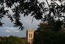 Church of St Leodegarius and Attached Grave Enclosure |
| Church of St Leonard and Attached Boundary Wall | Wollaton | Parish Church | c. 1200 | 11 August 1952 | SK5249239790 52°57′11″N 1°13′13″W |
1255283 | 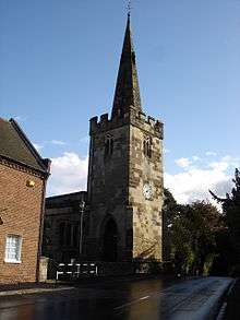 Church of St Leonard and Attached Boundary Wall |
| Church of St Martin | Bilborough | Tower | c. 1450 | 29 April 1964 | SK5202041811 52°58′16″N 1°13′37″W |
1255110 | 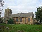 Church of St Martin |
| Church of St Nicholas | Nottingham | Tower | 1906 | 11 August 1952 | SK5714539565 52°57′02″N 1°09′03″W |
1270639 | 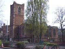 Church of St Nicholas |
| Church of St Wilfrid | Wilford | Tower | Late 15th century | 29 April 1964 | SK5663337797 52°56′05″N 1°09′32″W |
1271049 | |
| Colwick Hall | Colwick | Country House | Early 18th century | 11 August 1952 | SK6017639027 52°56′43″N 1°06′21″W |
1254981 | |
| Council House, Exchange Buildings and Adjoining Shops and Bank | Old Market Square | Council House | 1924-29 | 4 February 1988 | SK5730939900 52°57′12″N 1°08′54″W |
1270582 |  Council House, Exchange Buildings and Adjoining Shops and Bank |
| Doric Temple and Attached Bridge 200 Metres South-east of Wollaton Hall | Wollaton Park | Bridge | Early 19th century | 10 August 1989 | SK5337539174 52°56′50″N 1°12′26″W |
1270389 | .jpg) Doric Temple and Attached Bridge 200 Metres South-east of Wollaton Hall |
| Elite Building | Nottingham | Shop | 1921 | 12 July 1972 | SK5722240058 52°57′17″N 1°08′59″W |
1254539 | .jpg) Elite Building |
| Enfield House and attached Area Wall | Nottingham | Town House | Mid 18th century | 11 August 1952 | SK5737039675 52°57′05″N 1°08′51″W |
1270637 | |
| Former Police Station adjoining Shire Hall | Lace Market, Nottingham | Gate | 1905 | 12 July 1972 | SK5756239612 52°57′03″N 1°08′41″W |
1247636 | .jpg) Former Police Station adjoining Shire Hall |
| Gate and Railings to Forecourt of Number 24 and 26 Low Pavement | Nottingham | Gate | c. 1733 | 12 July 1972 | SK5739739679 52°57′05″N 1°08′50″W |
1270638 | |
| Habitat and Rj's Homeshop | Nottingham | Merchants House | c. 1720 | 11 May 1988 | SK5706339951 52°57′14″N 1°09′07″W |
1254555 | .jpg) Habitat and Rj's Homeshop |
| Lenton Lodge (former Gateway to Wollaton Park) and attached Bollards | Nottingham | Gate Lodge | 1823-25 | 11 August 1952 | SK5483839187 52°56′50″N 1°11′07″W |
1270829 |  Lenton Lodge (former Gateway to Wollaton Park) and attached Bollards |
| Lenton War Memorial | Lenton | War memorial | 1823-25 | 30 November 1995 | SK5529039094 52°56′47″N 1°10′43″W |
1246782 | 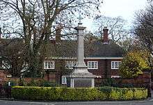 Lenton War Memorial |
| Midland Railway Station | Nottingham | Footbridge | 1904 | 12 July 1972 | SK5744539204 52°56′50″N 1°08′48″W |
1271301 | 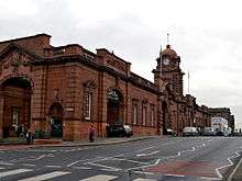 Midland Railway Station |
| Newdigate House and Attached Railings and Boundary Wall | Nottingham | House | c. 1675 | 11 August 1952 | SK5705939600 52°57′03″N 1°09′08″W |
1271185 | 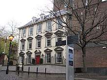 Newdigate House and Attached Railings and Boundary Wall |
| Newton Building at Nottingham Trent University | Nottingham | Polytechnic | 1956-1958 | 24 April 1998 | SK5706340228 52°57′23″N 1°09′07″W |
1323704 | _-_geograph.org.uk_-_656572.jpg) Newton Building at Nottingham Trent University |
| Nottingham Playhouse | Nottingham | Theatre | 1961-3 | 14 July 1994 | SK5679639939 52°57′14″N 1°09′22″W |
1255252 | |
| People's Hall | Nottingham | House | 1750 | 12 July 1972 | SK5766540002 52°57′15″N 1°08′35″W |
1254499 |  People's Hall |
| Railings and Gate to Forecourt at Willoughby House | Nottingham | Gate | c. 1743 | 12 July 1972 | SK5737939681 52°57′05″N 1°08′51″W |
1254748 | |
| Sheriff House | Nottingham | Town House | 1768 | 11 August 1952 | SK5692639748 52°57′08″N 1°09′15″W |
1270499 | |
| Shire Hall and Adjoining County Gaol | Lace Market | Gate | 1770-72 | 24 October 1988 | SK5759239606 52°57′03″N 1°08′39″W |
1254517 | 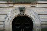 Shire Hall and Adjoining County Gaol |
| Willoughby House | Nottingham | Town House | c. 1738 | 11 August 1952 | SK5738139665 52°57′05″N 1°08′51″W |
1254559 | |
| 24 and 26 Low Pavement | Nottingham | Town House | c. 1733 | 11 August 1952 | SK5739739671 52°57′05″N 1°08′50″W |
1254560 | |
| 19 Castle Gate | Nottingham | Town House | 1775 | 11 August 1952 | SK5720439648 52°57′04″N 1°09′00″W |
1246653 | |
| 56 Village Road | Clifton | Aisled House | 14th century | 14 April 1954 | SK5446434997 52°54′35″N 1°11′30″W |
1255237 | |


Gedling
| Name | Location | Type | Completed [note 1] | Date designated | Grid ref.[note 2] Geo-coordinates |
Entry number [note 3] | Image |
|---|---|---|---|---|---|---|---|
| Bestwood Lodge Hotel and Terrace Wall | Bestwood Park, Bestwood St. Albans | Country House | 1862 | 13 December 1972 | SK5695246506 53°00′46″N 1°09′09″W |
1227444 | 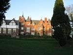 Bestwood Lodge Hotel and Terrace Wall |
| Bestwood Pumping Station | Bestwood St. Albans | Coal Shed | 1871-1874 | 5 September 1972 | SK5792848246 53°01′42″N 1°08′16″W |
1265233 | |
| Emmanuel Church | Bestwood St. Albans | Parish Church | 1868 | 27 April 1987 | SK5663046423 53°00′44″N 1°09′27″W |
1235441 | 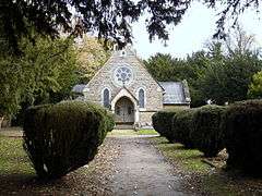 Emmanuel Church |
| Winding House and Headstocks at Bestwood Colliery | Bestwood St. Albans | Colliery | Late 19th century | 27 April 1987 | SK5563947460 53°01′18″N 1°10′19″W |
1235186 | 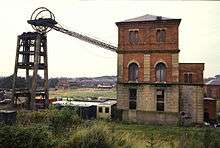 Winding House and Headstocks at Bestwood Colliery |
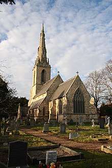
| Church of St Wilfrid | Calverton | Tower | 1763 | 13 October 1966 | SK6174049184 53°02′11″N 1°04′51″W |
1235903 | |
| Brewhouse, Crewyard and Mill Barn at Hall Farmhouse | Linby | Brewhouse | Late 18th century | 27 April 1987 | SK5338051135 53°03′17″N 1°12′18″W |
1265319 | |
| Church of St Michael | Linby | Tower | 13th century | 13 October 1966 | SK5345350892 53°03′09″N 1°12′14″W |
1265318 | 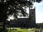 Church of St Michael |
| Boatswain's Monument 30m north-east of Newstead Abbey | Newstead Park, Newstead | Commemorative Monument | 1808 | 13 October 1966 | SK5423053785 53°04′43″N 1°11′31″W |
1264302 | .jpg) Boatswain's Monument 30m north-east of Newstead Abbey |
| The Cannon Fort and adjoining Dock | Newstead Park, Newstead | Dock | c. 1750 | 13 October 1966 | SK5376053823 53°04′44″N 1°11′56″W |
1264406 | |
| Engine House, Boiler House and Workshop at Papplewick Pumping Station | Ravenshead | Boiler House | 1881 | 18 October 1971 | SK5827452136 53°03′48″N 1°07′55″W |
1265301 | 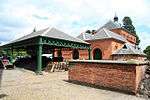 Engine House, Boiler House and Workshop at Papplewick Pumping Station |
| Church of St Swithun | Woodborough | Tower | 13th century | 13 October 1966 | SK6315147711 53°01′23″N 1°03′36″W |
1264188 | |
| Woodborough Hall | Woodborough | House | circa 1660 | 15 July 1985 | SK6251447760 53°01′25″N 1°04′10″W |
1227555 | |
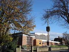
| Church of the Good Shepherd | Arnold | Roman Catholic Church | 1962-1964 | 25 September 1998 | SK5805844326 52°59′35″N 1°08′11″W |
1376603 | |
| Church of St Mary | Arnold | Tower | 14th century | 24 January 1950 | SK5868446146 53°00′34″N 1°07′37″W |
1235987 |  Church of St Mary |
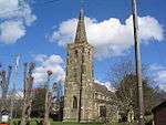
| Church of St Paul | Daybrook | Parish Church | 1892-96 | 27 April 1987 | SK5796645158 53°00′02″N 1°08′16″W |
1236096 | .jpg) Church of St Paul |
Mansfield
| Name | Location | Type | Completed [note 1] | Date designated | Grid ref.[note 2] Geo-coordinates |
Entry number [note 3] | Image |
|---|---|---|---|---|---|---|---|
| Warsop Parish Centre | Warsop | Farmhouse | 15th century | 28 August 1962 | SK5674468837 53°12′49″N 1°09′06″W |
1251896 | .jpg) Warsop Parish Centre |
| Cavendish Monument and attached Railings | Mansfield | Commemorative Monument | 1849 | 17 March 1978 | SK5384161092 53°08′39″N 1°11′47″W |
1207176 | 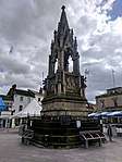 Cavendish Monument and attached Railings |
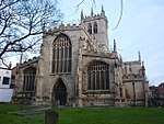
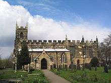
| Church of St Edmund | Mansfield Woodhouse | Parish Church | 1304 | 28 January 1957 | SK5401763212 53°09′48″N 1°11′37″W |
1251828 | 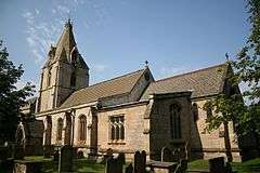 Church of St Edmund |
| Church of St Mark and attached Boundary Wall | Mansfield | Parish Church | 1897 | 21 March 1994 | SK5377060448 53°08′19″N 1°11′52″W |
1214953 | 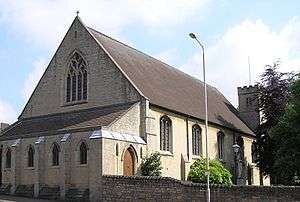 Church of St Mark and attached Boundary Wall |
| Innisdoon and attached Garden Wall and Gate Piers | Mansfield | Arts and Crafts house and coach house | 1904-05 | 7 October 1977 | SK5361461615 53°08′56″N 1°11′59″W |
1214391 | .jpg) Innisdoon and attached Garden Wall and Gate Piers |
| St Peter's House | Mansfield | House | Late 17th century | 19 December 1955 | SK5406961059 53°08′38″N 1°11′35″W |
1213928 | 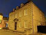 St Peter's House |
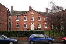
| The Old Meeting House | Mansfield | Unitarian Chapel | 1702 | 19 December 1955 | SK5360461143 53°08′41″N 1°12′00″W |
1207181 | _(geograph_2877618).jpg) The Old Meeting House |
| The Old Town Hall and attached Piers and Railings | Mansfield | Civic building (1835-1836)[1] | 1836 | 17 March 1978 | SK5382461046 53°08′38″N 1°11′48″W |
1207179 | .jpg) The Old Town Hall and attached Piers and Railings |
| The Priory | Mansfield Woodhouse | House | 20th century | 28 January 1957 | SK5376163204 53°09′48″N 1°11′50″W |
1251852 | .jpg) The Priory |
| Waverley House | Mansfield | House | 1754 | 19 December 1955 | SK5369861217 53°08′43″N 1°11′55″W |
1288092 | .jpg) Waverley House |
Newark and Sherwood
| Name | Location | Type | Completed [note 1] | Date designated | Grid ref.[note 2] Geo-coordinates |
Entry number [note 3] | Image |
|---|---|---|---|---|---|---|---|
| Averham Park House | Averham | House | 20th century | 11 August 1961 | SK7435056417 53°05′59″N 0°53′28″W |
1046003 | |
| The Old House | Bleasby | House | 17th century | 11 August 1961 | SK7194949442 53°02′15″N 0°55′42″W |
1045572 | |
| Church of St Mary of the Purification | Blidworth | Tower | 15th century | 11 August 1961 | SK5856655631 53°05′41″N 1°07′37″W |
1045529 | .jpg) Church of St Mary of the Purification |
| Carlton Hall | Carlton-on-Trent | Country House | 1765 | 7 August 1952 | SK7992264026 53°10′03″N 0°48′21″W |
1046012 | 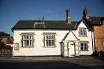 Carlton Hall |
| Church of St Mary | Carlton-on-Trent | Church | 12th century | 11 August 1961 | SK7994963938 53°10′00″N 0°48′20″W |
1178592 | |
| Church of All Saints | Coddington | Parish Church | 13th century | 16 January 1967 | SK8349254493 53°04′52″N 0°45′18″W |
1157230 | 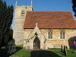 Church of All Saints |
| Thatch Cottage and Boundary Wall | Collingham | House | Late 16th century | 17 October 1984 | SK8289461317 53°08′33″N 0°45′44″W |
1369947 | |
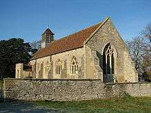
| Church of St Michael | Cotham | Parish Church | 12th century | 16 January 1967 | SK7942447616 53°01′12″N 0°49′03″W |
1178419 | |
| Church of St Andrew | Eakring | Church | 19th century | 11 August 1961 | SK6753662169 53°09′09″N 0°59′30″W |
1370132 | 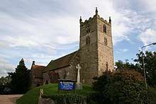 Church of St Andrew |
| Church of St Oswald | East Stoke | Church | 13th century | 16 January 1967 | SK7479450061 53°02′33″N 0°53′09″W |
1045578 | |
| Church of St Giles | Edingley | Church | 19th century | 11 August 1961 | SK6650855862 53°05′45″N 1°00′30″W |
1193510 | |
| Church of All Saints | Elston | Church | 13th century | 16 January 1967 | SK7588247982 53°01′26″N 0°52′12″W |
1370154 | |
| Elston Towers | Elston | Country House | 1872 | 8 May 1980 | SK7471548386 53°01′39″N 0°53′15″W |
1370153 | 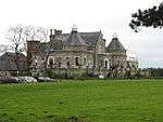 Elston Towers |
| Church of St Denis | Morton | Parish Church | 1756 | 11 August 1961 | SK7270051357 53°03′16″N 0°55′01″W |
1302376 | |
| Halloughton Manor Farm House | Halloughton | Farmhouse | 13th century | 7 August 1952 | SK6885451765 53°03′31″N 0°58′27″W |
1178664 | |
| Church of St Nicholas | Hockerton | Parish Church | 12th century | 11 August 1961 | SK7159656445 53°06′01″N 0°55′56″W |
1045486 | |
| Gazebo and Garden Wall at Kelham Hall | Kelham | Summerhouse | 1844-46 | 19 September 1985 | SK7751355543 53°05′29″N 0°50′38″W |
1045983 | .jpg) Gazebo and Garden Wall at Kelham Hall |
| Church of St Swithun | Kirklington | Tower | 17th century | 11 August 1961 | SK6791957607 53°06′41″N 0°59′13″W |
1045490 | |
| Church of Holy Trinity | Kirton | Parish Church | 13th century | 11 August 1961 | SK6912069379 53°13′01″N 0°57′59″W |
1156898 | .JPG) Church of Holy Trinity |
| Old Hall Farm House | Kneesall | Farmhouse | 19th century | 11 August 1966 | SK7025564241 53°10′14″N 0°57′02″W |
1156929 | |
| Langford Hall | Langford | Country House | 1780-90 | 16 January 1967 | SK8233757444 53°06′28″N 0°46′17″W |
1046033 |  Langford Hall |
| Langford Old Hall | Langford | Farmhouse | Early 19th century | 25 February 1952 | SK8205858865 53°07′14″N 0°46′31″W |
1369987 | |
| Moorhouse Chapel | Laxton | Chapel | 1860 | 25 July 1980 | SK7530266780 53°11′34″N 0°52′28″W |
1045631 | 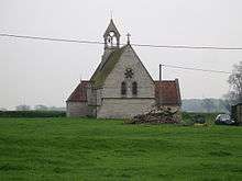 Moorhouse Chapel |
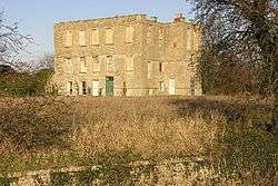
| The Old Hall | Lowdham | House | Early 17th century | 7 August 1952 | SK6649746744 53°00′50″N 1°00′37″W |
1045495 | |
| Club Room and Stables at Rear of Ossington Hotel | Newark-on-Trent | Club | 1882 | 19 May 1971 | SK7974654134 53°04′43″N 0°48′40″W |
1196076 | |
| Concrete Footbridge across River Trent | Newark-on-Trent | Footbridge | 1915 | 23 October 1989 | SK8014355107 53°05′14″N 0°48′17″W |
1297721 | |
| Former Magnus School and adjoining Headmaster's House and English School | Newark-on-Trent | Teachers House | 1817 | 29 September 1950 | SK8004253903 53°04′35″N 0°48′24″W |
1288060 | 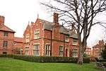 Former Magnus School and adjoining Headmaster's House and English School |
| Former White Hart Hotel | Newark-on-Trent | Inn | c. 1430 | 29 September 1950 | SK7989753840 53°04′33″N 0°48′32″W |
1196426 | .jpg) Former White Hart Hotel |
| Kiln Warehouse | Newark-on-Trent | Kiln | 1857 | 7 August 1989 | SK7975554359 53°04′50″N 0°48′39″W |
1196290 | |
| Martin Forster House | Newark-on-Trent | Vicarage | c. 1730 | 29 September 1950 | SK8002353886 53°04′34″N 0°48′25″W |
1196098 | .jpg) Martin Forster House |
| Ossington Hotel and adjoining Garden Walls and Summerhouse | Newark-on-Trent | Garden Wall | 1882 | 19 May 1971 | SK7972354108 53°04′42″N 0°48′41″W |
1287626 | 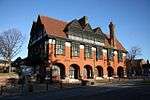 Ossington Hotel and adjoining Garden Walls and Summerhouse |
| Shalem House 1-4, The Friary | Newark-on-Trent | Apartment | 1992 | 29 September 1950 | SK8019454040 53°04′39″N 0°48′16″W |
1215654 | |
| 40 & 41 Market Place | Newark-on-Trent | Coaching Inn | 1721 | 29 September 1950 | SK7987153848 53°04′33″N 0°48′33″W |
1297637 | |
| 1, 3, & 5 Bridge Street and 27 & 28 Market Place | Newark-on-Trent | House | c. 1730 | 29 September 1950 | SK7994253880 53°04′34″N 0°48′29″W |
1297635 | |
| 43 Market Place | Newark-on-Trent | Coaching Inn | Early 18th century | 29 September 1950 | SK7985353846 53°04′33″N 0°48′34″W |
1278230 | |
| Church of St George | North Clifton | Parish Church | 13th century | 16 January 1967 | SK8185971259 53°13′55″N 0°46′30″W |
1046053 | 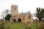 Church of St George |
| Ollerton Hall | Ollerton | Country House | c. 1700 | 7 August 1952 | SK6547167543 53°12′03″N 1°01′17″W |
1045598 | |
| Sundial 50m east of Church of Holy Rood | Ossington | Sundial | Early 17th century | 19 September 1985 | SK7594665171 53°10′42″N 0°51′54″W |
1301995 | .jpg) Sundial 50m east of Church of Holy Rood |
| Church of St John | Perlethorpe cum Budby | Parish Church | 1876 | 11 August 1961 | SK6454970956 53°13′54″N 1°02′04″W |
1045471 | .jpg) Church of St John |
| Sundial 150m south of Thoresby Hall | Thoresby Park, Perlethorpe cum Budby | Sundial | Mid 18th century | 11 August 1961 | SK6384671071 53°13′58″N 1°02′42″W |
1157251 | |
| Orangery, Fountain and Garden Wall at Rufford Abbey | Rufford | Bath House/Orangery | 1729 | 10 July 1975 | SK6458964700 53°10′32″N 1°02′06″W |
1370165 | .jpg) Orangery, Fountain and Garden Wall at Rufford Abbey |
| The Gables | South Muskham | Farmhouse | c. 1600 | 21 November 1974 | SK7791757095 53°06′19″N 0°50′15″W |
1369972 | |
| Winthorpe Bridge carrying Bypass over River Trent | South Muskham | Road Bridge | 1964 | 29 May 1998 | SK8052856733 53°06′06″N 0°47′55″W |
1323680 | .jpg) Winthorpe Bridge carrying Bypass over River Trent |
| Cranfield House and adjoining Garden Walls | Southwell | Clergy House | 1709 | 7 August 1952 | SK7025253896 53°04′40″N 0°57′10″W |
1046145 | 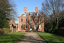 Cranfield House and adjoining Garden Walls |
| Gateway and Flanking Walls at Minster Churchyard | Southwell | Gate | Mid 14th century | 11 August 1961 | SK7004653837 53°04′38″N 0°57′21″W |
1288504 | |
| Norwood Park and the West Wing | Norwood Park, Southwell | Country House | cica 1763 | 7 August 1952 | SK6871754683 53°05′06″N 0°58′32″W |
1370212 | .jpg) Norwood Park and the West Wing |
| Saracen's Head Hotel | Southwell | Assembly Rooms | 1805 | 7 August 1952 | SK7006553921 53°04′41″N 0°57′20″W |
1369925 | 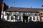 Saracen's Head Hotel |
| The Residence and Vicars Court and Adjoining Boundary Walls | Southwell | Clergy House | 1689 | 7 August 1952 | SK7027953787 53°04′36″N 0°57′09″W |
1211749 |  The Residence and Vicars Court and Adjoining Boundary Walls |
| Church of St Mary | Staunton | Parish Church | 14th century | 16 January 1967 | SK8052643274 52°58′51″N 0°48′08″W |
1045995 | .JPG) Church of St Mary |
| Staunton Hall and Service Wing | Staunton | Country House | 16th century | 15 October 1984 | SK8056743213 52°58′49″N 0°48′05″W |
1302335 |  Staunton Hall and Service Wing |
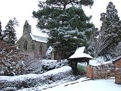
| Church of St Helen | Thorney | Parish Church | 1850 | 16 January 1967 | SK8592472843 53°14′44″N 0°42′50″W |
1302452 | |
| Thurgarton Priory | Thurgarton | House | 13th century | 7 August 1952 | SK6917549165 53°02′07″N 0°58′11″W |
1045528 | .jpg) Thurgarton Priory |
| Greet House | Upton | Workhouse | 1824 | 8 May 2000 | SK7115254284 53°04′52″N 0°56′21″W |
1045931 |  Greet House |
| Upton Hall | Upton | Country House | 17th century | 7 August 1952 | SK7348054406 53°04′55″N 0°54′16″W |
1179760 | |
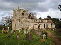
| Church of St Edmund | Walesby | Parish Church | 12th century | 11 August 1961 | SK6850170754 53°13′46″N 0°58′31″W |
1178711 | |
| Church of St Swithin | Wellow | Parish Church | 12th century | 11 August 1961 | SK6707466100 53°11′16″N 0°59′52″W |
1370185 | |
| Winthorpe Hall | Winthorpe | Country House | c. 1760 | 16 January 1967 | SK8121856578 53°06′01″N 0°47′18″W |
1178886 |  Winthorpe Hall |


Rushcliffe
| Name | Location | Type | Completed [note 1] | Date designated | Grid ref.[note 2] Geo-coordinates |
Entry number [note 3] | Image |
|---|---|---|---|---|---|---|---|
| Ivy Cottage and Adjoining Walls | Bunny | House | c. 1700 | 13 October 1966 | SK5820829539 52°51′37″N 1°08′13″W |
1277626 | |
| Old School Incorporating Schoolhouse and Almshouses | Bunny | Apartment | 1986 | 14 May 1952 | SK5833329613 52°51′39″N 1°08′06″W |
1249034 | 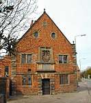 Old School Incorporating Schoolhouse and Almshouses |
| The Manor House | Costock | House | 1952 | 14 May 1952 | SK5738626402 52°49′56″N 1°08′59″W |
1260272 | |
| Church of St Mary and All Saints | Hawsworth | Tower | 13th century | 1 December 1965 | SK7528343457 52°58′59″N 0°52′48″W |
1243797 | 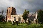 Church of St Mary and All Saints |
| Wall and Gazebo at Holme Pierrepont Hall | Holme Pierrpont | Gate | Early 17th century | 13 November 1986 | SK6269339317 52°56′51″N 1°04′06″W |
1249200 | |
| Church of St Luke | Kinoulton | Church | 1793 | 1 December 1965 | SK6765030721 52°52′11″N 0°59′47″W |
1264839 | .jpg) Church of St Luke |
| Langar House | Langar cum Barnstone | Country House | Early 18th century | 12 February 1952 | SK7225934714 52°54′18″N 0°55′38″W |
1235998 | |
| Church of St Margaret | Owthorpe | Church | Pre-1705 | 1 December 1965 | SK6723433439 52°53′39″N 1°00′07″W |
1236253 | 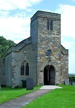 Church of St Margaret |
| Church of St Peter and St Paul | Shelford | Cross | 10th century | 1 December 1965 | SK6617142359 52°58′28″N 1°00′58″W |
1250021 | 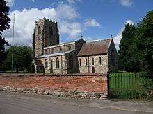 Church of St Peter and St Paul |
| Shelford Manor House and Attached Wall and Pier | Shelford, Shelford and Newton | House | c. 1580 | 28 November 1972 | SK6723343433 52°59′03″N 1°00′00″W |
1039570 | |
| Stanford Hall | Stanford on Soar | Country House | Early 18th century | 14 May 1952 | SK5588423867 52°48′34″N 1°10′21″W |
1260097 |  Stanford Hall |
| Church of St Anne | Sutton Bonington | Parish Church | 13th century | 13 October 1966 | SK5074425044 52°49′14″N 1°14′54″W |
1242374 | |
| Church of St Michael | Sutton Bonington | Parish Church | 13th century | 13 October 1966 | SK5042825428 52°49′27″N 1°15′11″W |
1242372 | |
| The Hall | Sutton Bonington | Country House | Early 18th century | 13 October 1966 | SK5046825299 52°49′22″N 1°15′09″W |
1242389 | 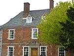 The Hall |
| Church of All Saints | Thrumpton | Parish Church | 13th century | 13 October 1966 | SK5097431162 52°52′32″N 1°14′39″W |
1242423 | 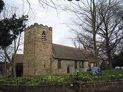 Church of All Saints |
| Church of St Helen | West Leake | Parish Church | 12th century | 13 October 1966 | SK5274826428 52°49′58″N 1°13′07″W |
1242473 | .jpg) Church of St Helen |
| Church of St John of Beverley | Whatton-in-the-Vale | Parish Church | 11th century | 1 December 1965 | SK7450139674 52°56′57″N 0°53′33″W |
1243823 |  Church of St John of Beverley |
| Church of St Peter and St Paul | Widmerpool | Parish Church | 14th century | 1 December 1965 | SK6287428206 52°50′52″N 1°04′04″W |
1242476 | |
| Wiverton Hall Including Service Range to Rear Left | Wiverton Hall | Country House | 1814 | 12 February 1952 | SK7133536343 52°55′11″N 0°56′26″W |
1264494 | 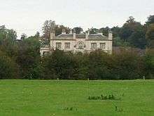 Wiverton Hall Including Service Range to Rear Left |
| Church of the Holy Rood | Edwalton | Parish Church | 12th century | 13 December 1949 | SK5985035002 52°54′33″N 1°06′41″W |
1302765 | 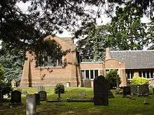 Church of the Holy Rood |
| Test Match Hotel | West Bridgford | Public House | 1938 | 4 May 2000 | SK5889837182 52°55′44″N 1°07′31″W |
1380283 | |
See also
Category:Grade II* listed buildings in Nottinghamshire
Notes
- The date given is the date used by Historic England as significant for the initial building or that of an important part in the structure's description.
- Sometimes known as OSGB36, the grid reference is based on the British national grid reference system used by the Ordnance Survey.
- The "List Entry Number" is a unique number assigned to each listed building and scheduled monument by Historic England.
References
- 1835 The foundation stone of the Mansfield Town Hall was laid by Mr. John Coke. 1836 The Town Hall was opened for the first time. ourmansfieldandarea.org (Mansfield District Council Museum), Retrieved 13 February 2020
External links
![]()
This article is issued from Wikipedia. The text is licensed under Creative Commons - Attribution - Sharealike. Additional terms may apply for the media files.