Grade II* listed buildings in Herefordshire (M–Z)
There are over 20,000 Grade II* listed buildings in England. This article comprises a list of these buildings in the county of Herefordshire.
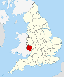
Herefordshire shown in England
List
| Name | Location | Type | Completed [note 1] | Date designated | Grid ref.[note 2] Geo-coordinates |
Entry number [note 3] | Image |
|---|---|---|---|---|---|---|---|
| 41a Bridge Street | Hereford, County of Herefordshire | Box Frame House | Late 14th century | 23 December 1987 | SO5079339758 52°03′14″N 2°43′09″W |
1205588 |  |
| 60 St Owen Street | Hereford | House | 13th century | 22 October 1973 | SO5137139758 52°03′15″N 2°42′38″W |
1196876 | |
| 29, 30 and 30a Castle Street | Hereford | House | Early 18th century | 10 June 1952 | SO5116639740 52°03′14″N 2°42′49″W |
1205955 |  29, 30 and 30a Castle Street |
| 31 Castle Street | Hereford | House | Mid 18th century | 10 June 1952 | SO5115039747 52°03′14″N 2°42′50″W |
1205978 | |
| 20 Church Street | Hereford | House | 18th century | 10 June 1952 | SO5101139882 52°03′19″N 2°42′57″W |
1206265 | |
| 10 and 11 Castle Street | Hereford | House | Early 19th century | 10 June 1952 | SO5124039744 52°03′14″N 2°42′45″W |
1205907 | |
| 1a St Owen Street | Hereford | House | Early 19th century | 22 October 1973 | SO5121139966 52°03′21″N 2°42′47″W |
1207400 | |
| 48 and 49 Broad Street | Hereford | House | Early 19th century | 10 June 1952 | SO5088039962 52°03′21″N 2°43′04″W |
1280611 | |
| 9 Castle Street | Hereford | House | Early 19th century | 10 June 1952 | SO5122939747 52°03′14″N 2°42′46″W |
1297429 | |
| 5 and 7 Widemarsh Street | Hereford | House | 19th century | 10 June 1952 | SO5095840067 52°03′24″N 2°43′00″W |
1196893 | |
| 1 and 1a Widemarsh Street | Hereford | House | 1973 | 22 October 1973 | SO5095940050 52°03′24″N 2°43′00″W |
1297391 | |
| 3 Castle Hill | Hereford | House | 17th century | 22 October 1973 | SO5113639699 52°03′13″N 2°42′50″W |
1196801 | |
| 1 Bell Square | Weobley | House | 1987 | 20 February 1953 | SO4013651694 52°09′37″N 2°52′36″W |
1081927 | .jpg) 1 Bell Square |
| 1 The Southend | Ledbury | Timber Framed House | c. 1600 | 18 September 1953 | SO7111537565 52°02′09″N 2°25′21″W |
1301682 | .jpg) 1 The Southend |
| 2 The Southend | Ledbury | Timber Framed House | c. 1600 | 18 September 1953 | SO7111737560 52°02′08″N 2°25′21″W |
1082844 | 2 The Southend |
| 2 New Street | Ledbury | Timber Framed House | c. 1600 | 18 September 1953 | SO7111037561 52°02′08″N 2°25′21″W |
1082831 |  2 New Street |
| 4 New Street | Ledbury | Timber Framed House | c. 1600 | 18 September 1953 | SO7110537560 52°02′08″N 2°25′21″W |
1349411 | |
| 30 The Homend | Ledbury | House | 18th century | 18 September 1953 | SO7101737823 52°02′17″N 2°25′26″W |
1349388 | |
| Magistrates' House and Nos 1, 2 and 3 Magistrates' Court | Ledbury | Timber Framed House | Early 18th century | 18 September 1953 | SO7118537736 52°02′14″N 2°25′17″W |
1082904 |  Magistrates' House and Nos 1, 2 and 3 Magistrates' Court |
| Mahollam Cottages | Mahollam, Kington Rural | House | 15th century | 19 August 1953 | SO2702654355 52°10′57″N 3°04′07″W |
1301272 | |
| 47 New Street | Ross-on-Wye | Prison | 1820-30 | 22 October 1952 | SO5987324247 51°54′55″N 2°35′05″W |
1349286 | .jpg) 47 New Street |
| Man of Ross House | Ross-on-Wye | House | 1689 | 22 October 1952 | SO5991924109 51°54′51″N 2°35′03″W |
1098674 |  Man of Ross House |
| Market House | Ross-on-Wye | House | 1660-1674 | 22 October 1952 | SO5991924130 51°54′51″N 2°35′03″W |
1098680 |  Market House |
| Marlbrook House and attached Outbuilding | Weobley | House | 16th century | 20 February 1953 | SO4020551500 52°09′31″N 2°52′32″W |
1301256 | .jpg) Marlbrook House and attached Outbuilding |
| Michaelchurch Court, Steps and Terrace Walls to Entrance Front | Michaelchurch Escley | House | Early 17th century | 29 September 1952 | SO3084634397 52°00′13″N 3°00′32″W |
1224391 | |
| Minaret, Boundary Walls and Gate Piers to North of Hope End Hotel | Hope End, near Colwall | Gate Pier | 1810-20 | 15 May 1975 | SO7227841227 52°04′07″N 2°24′21″W |
1082143 | |
| Monnington Court | Monnington on Wye, Brobury with Monnington on Wye | House | 14th century | 20 February 1953 | SO3730543356 52°05′06″N 2°54′59″W |
1157849 |  Monnington Court |
| Mordiford Bridge (that part on Mordiford) | Mordiford | Road Bridge | 14th century | 26 January 1967 | SO5699337454 52°02′02″N 2°37′42″W |
1099818 |  Mordiford Bridge (that part on Mordiford) |
| Moreton Bridge (that part in Moreton CP) | Moreton on Lugg | Road Bridge | 16th century or 17th century | 20 October 1952 | SO5128545889 52°06′33″N 2°42′46″W |
1099255 |  Moreton Bridge (that part in Moreton CP) |
| Moreton Bridge (that part in Marden CP) | Marden | Road Bridge | 16th century or 17th century | 26 January 1967 | SO5129245893 52°06′33″N 2°42′45″W |
1178835 | Moreton Bridge (that part in Marden CP) |
| Nelson Column | Hereford | Column | c. 1809 | 10 June 1952 | SO5125139576 52°03′09″N 2°42′44″W |
1297466 |  Nelson Column |
| New Court | Lugwardine | Country House | 18th century | 11 October 1985 | SO5422141180 52°04′02″N 2°40′09″W |
1099834 | |
| New House | Goodrich | Farmhouse | 1953 | 18 May 1953 | SO5633519528 51°52′21″N 2°38′08″W |
1099457 | |
| Northern half of Weobley Stores (4 Portland St) | Weobley | House | 17th century | 20 February 1953 | SO4025751579 52°09′33″N 2°52′29″W |
1301241 | .jpg) Northern half of Weobley Stores (4 Portland St) |
| Nun Upton | Nun Upton, Brimfield | House | Late 17th century | 11 June 1959 | SO5419466580 52°17′44″N 2°40′23″W |
1081859 | |
| Obelisk at NGR SO 7523 | Eastnor Park, Eastnor | Obelisk | 1812 | 10 January 1986 | SO7523237827 52°02′18″N 2°21′45″W |
1266786 |  Obelisk at NGR SO 7523 |
| Old Court | Bredwardine | Farmhouse | 2nd half 14th century | 29 September 1952 | SO3352144772 52°05′50″N 2°58′19″W |
1099520 | .jpg) Old Court |
| Old Court | Longtown | Farmhouse | 14th century | 14 March 1986 | SO3375630272 51°58′01″N 2°57′56″W |
1342121 | |
| Old Court Hotel | Whitchurch | Manor House | 16th century | 18 May 1963 | SO5525417423 51°51′13″N 2°39′04″W |
1225292 | |
| Old Sufton | Mordiford | Country House | 16th century | 20 October 1952 | SO5754138388 52°02′32″N 2°37′14″W |
1301840 | |
| Old Talbot Inn | Ledbury | Hotel | c. 1596 | 18 September 1953 | SO7106437549 52°02′08″N 2°25′24″W |
1082833 |  Old Talbot Inn |
| Orleton Manor | Orleton | Cross Passage House | late 16th century to early 17th century | 11 June 1959 | SO4908366964 52°17′54″N 2°44′53″W |
1081810 | |
| Outbuilding about 30m east of Marstow Court | Marstow | House | 15th century | 26 March 1987 | SO5532319201 51°52′11″N 2°39′01″W |
1214715 | |
| Palace Chambers | Hereford | House | 1952 | 10 June 1952 | SO5089339790 52°03′16″N 2°43′03″W |
1052295 | |
| Parish Church (dedication unknown) | Moreton Jeffries | Parish Church | 12th century | 9 June 1967 | SO6031148487 52°08′00″N 2°34′53″W |
1082237 | |
| Parish Hall (old Boys School) | Cradley | Parish Hall | 1952 | 9 April 1952 | SO7365447105 52°07′18″N 2°23′10″W |
1082300 |  Parish Hall (old Boys School) |
| Park Farmhouse | Colwall | Farmhouse | C16-C17 | 18 November 1952 | SO7384142372 52°04′45″N 2°22′59″W |
1178575 |  Park Farmhouse |
| Peg's Farmhouse | Wellington Heath | Farmhouse | 14th century | 18 November 1952 | SO7029341140 52°04′04″N 2°26′05″W |
1224884 | |
| Pembridge Post Office and Stores | Pembridge | House | 14th century | 16 June 1987 | SO3901358084 52°13′03″N 2°53′39″W |
1081730 | |
| Penrhos Court | Penrhos, Lyonshall | Farmhouse | Late 13th century or early 14th century | 18 December 1974 | SO3169956083 52°11′55″N 3°00′03″W |
1081753 |  Penrhos Court |
| Perrycroft | Colwall | House | 1893-5 | 18 February 1970 | SO7653641803 52°04′27″N 2°20′38″W |
1178660 | |
| Phillips House | Much Marcle | House | 1703 | 18 November 1952 | SO6584632750 51°59′32″N 2°29′56″W |
1099029 |  Phillips House |
| Pontrilas Court | Pontrilas, Kentchurch | House | Mid- and Late 17th century | 20 May 1987 | SO3957327496 51°56′34″N 2°52′50″W |
1099622 | |
| Poston House | Vowchurch | House | 1984 | 12 November 1984 | SO3598537924 52°02′10″N 2°56′05″W |
1225155 |  Poston House |
| Preaching Cross in Grounds of Coningsby Hospital | Hereford | Preaching Cross | 14th century | 10 June 1952 | SO5115240419 52°03′36″N 2°42′50″W |
1279469 |  Preaching Cross in Grounds of Coningsby Hospital |
| Priory House | Clifford | Farmhouse | 17th century | 29 September 1952 | SO2543244670 52°05′43″N 3°05′24″W |
1167739 | |
| Putley Parish Church | Putley | Parish Church | 12th century | 4 December 1985 | SO6460737606 52°02′09″N 2°31′03″W |
1099008 |  Putley Parish Church |
| Red Lion Hotel (Lal Bagh Restaurant) | Weobley | House | 17th century | 20 February 1953 | SO4020951731 52°09′38″N 2°52′32″W |
1349832 |  Red Lion Hotel (Lal Bagh Restaurant) |
| Remains of Blackfriars Priory | Hereford | Dominican Friary | c. 1276 | 10 June 1952 | SO5119040419 52°03′36″N 2°42′48″W |
1293327 |  Remains of Blackfriars Priory |
| Remains of Chapel North West of Lower Brockhampton Farmhouse | Brockhampton | Chapel | 12th century | 9 June 1967 | SO6872056031 52°12′06″N 2°27′33″W |
1082377 |  Remains of Chapel North West of Lower Brockhampton Farmhouse |
| Roman Catholic Church of St James | Bartestree | Chapel | c. 1400 | 11 October 1985 | SO5684540595 52°03′43″N 2°37′51″W |
1099878 | |
| Rotherwas Chapel | Rotherwas, Dinedor | Roman Catholic Chapel | Earlier | 26 January 1967 | SO5361638333 52°02′29″N 2°40′40″W |
1180032 |  Rotherwas Chapel |
| Rudhall Almshouses | Ross-on-Wye | Almshouse | 14th century | 22 October 1952 | SO5987124099 51°54′50″N 2°35′05″W |
1098698 |  Rudhall Almshouses |
| Ruins of Church of St Mary | Avenbury | Church | Norman | 12 April 1973 | SO6615553153 52°10′32″N 2°29′47″W |
1349633 | %2C_Avenbury_(geograph_2042326).jpg) Ruins of Church of St Mary |
| Ruxton Court | Llangarron | Farmhouse | 1963 | 18 May 1963 | SO5409019471 51°52′19″N 2°40′06″W |
1099426 |  Ruxton Court |
| Serendipity | Ross-on-Wye | House | 17th century | 22 October 1952 | SO5989224143 51°54′52″N 2°35′04″W |
1179457 |  Serendipity |
| Shell House | Ledbury | House | Early 18th century | 18 September 1953 | SO7100837848 52°02′18″N 2°25′27″W |
1179949 | |
| Shelwick Court | Shelwick, Holmer & Shelwick | Farmhouse | 15th century | 13 October 1980 | SO5272743023 52°05′01″N 2°41′29″W |
1099293 | 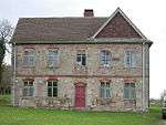 Shelwick Court |
| Shire Hall | Hereford | Shire Hall | c1815-17 | 10 June 1952 | SO5124139996 52°03′22″N 2°42′45″W |
1297425 | |
| Snodhill Castle | Snodhill, Peterchurch | Bailey | 12th century | 17 January 1949 | SO3224040354 52°03′27″N 2°59′23″W |
1172756 | .jpg) Snodhill Castle |
| Snodhill Court Farmhouse | Snodhill, Peterchurch | Farmhouse | Early 17th century | 17 January 1949 | SO3192440342 52°03′26″N 2°59′39″W |
1099450 | |
| St Katherine's Chapel, Hall and Stable | Ledbury | Hall House | 1330-40 | 18 September 1953 | SO7107737646 52°02′11″N 2°25′23″W |
1179854 | .jpg) St Katherine's Chapel, Hall and Stable |
| St Owen's Chambers and attached Railings | Hereford | House | Early 18th century | 10 June 1952 | SO5124939862 52°03′18″N 2°42′45″W |
1196871 |  St Owen's Chambers and attached Railings |
| Stables 15m north-east of Langstone Court | Llangarron | Stable | c. 1700 | 18 May 1953 | SO5345222043 51°53′42″N 2°40′40″W |
1099444 | |
| Staick House | Eardisland | House | Late 16th century | 20 February 1953 | SO4204358743 52°13′26″N 2°51′00″W |
1081908 |  Staick House |
| Street House | Weston under Penyard | House | Early 18th century | 18 May 1953 | SO6321323596 51°54′35″N 2°32′10″W |
1099642 | |
| Sufton Court | Mordiford | Country House | c. 1790 | 11 October 1985 | SO5730537941 52°02′18″N 2°37′26″W |
1179699 |  Sufton Court |
| Summerhouse, Gate, Boundary Walls about 60m south-west of Perrycroft with associated Walls | Colwall | Gate | c1893-1914 | 19 September 1984 | SO7648141809 52°04′27″N 2°20′40″W |
1349715 | |
| Swan House and School View | Pembridge | House | Late 16th century or early 17th century | 25 March 1987 | SO3893358139 52°13′05″N 2°53′43″W |
1301065 | |
| Swanstone Court and attached Outbuildings and Hop Kiln | Knapton Green, Dilwyn | House | 17th century | 20 February 1953 | SO4415453001 52°10′21″N 2°49′05″W |
1349817 | |
| The Bay Horse Inn | Bromyard, Bromyard and Winslow | Timber Framed House | Early 17th century | 25 October 1951 | SO6541754651 52°11′20″N 2°30′26″W |
1349643 | 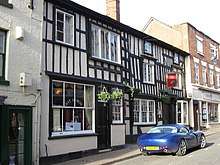 The Bay Horse Inn |
| The Church Cottage | Colwall | House | late C16-early 17th century | 19 September 1984 | SO7393442303 52°04′42″N 2°22′54″W |
1302409 | |
| The Church House | Ledbury | Timber Framed House | c. 1600 | 18 September 1953 | SO7119637721 52°02′14″N 2°25′17″W |
1301821 |  The Church House |
| The Dairy Farmhouse and attached Barn | Weobley | Farmhouse | 15th century | 20 February 1953 | SO4001651810 52°09′41″N 2°52′42″W |
1166641 |  The Dairy Farmhouse and attached Barn |
| The Feathers Hotel | Ledbury | House | Early 17th century | 18 September 1953 | SO7109837622 52°02′10″N 2°25′22″W |
1301759 |  The Feathers Hotel |
| The Forbury | Leominster | House | Mid 18th century | 24 July 1954 | SO4973059176 52°13′43″N 2°44′15″W |
1255417 | .jpg) The Forbury |
| The Gables | Weobley | House | 17th century | 20 February 1953 | SO4026451670 52°09′36″N 2°52′29″W |
1081893 | .jpg) The Gables |
| The Green | Winslow, Bromyard and Winslow | House | 18th century | 12 April 1973 | SO6243754314 52°11′09″N 2°33′03″W |
1275549 | |
| The Hall | Brampton Bryan | House | 17th century with earlier origins | 11 June 1959 | SO3699772589 52°20′52″N 2°55′35″W |
1349754 | |
| The Market Hall | Pembridge | Market Hall | Later | 16 October 1967 | SO3902558101 52°13′04″N 2°53′38″W |
1081729 |  The Market Hall |
| The Marsh | Eyton | House | 14th century | 11 June 1959 | SO4748961382 52°14′53″N 2°46′14″W |
1166720 | |
| The Master's House of St Katherines Hospital (Malvern Hills District Council Office) | Ledbury | House | Added/Altered each Century | 5 November 1976 | SO7104437658 52°02′12″N 2°25′25″W |
1301731 | |
| The Old Corner House | Weobley | House | 1987 | 20 February 1953 | SO4021851712 52°09′38″N 2°52′31″W |
1166418 |  The Old Corner House |
| The Old Grammar School | Ledbury | Teachers House/Museum | Late 15th century | 18 September 1953 | SO7117137729 52°02′14″N 2°25′18″W |
1301848 |  The Old Grammar School |
| The Old Grammar School | Weobley | House | Mid 19th century | 20 February 1953 | SO4037151530 52°09′32″N 2°52′23″W |
1081901 | |
| The Old Manor | Weobley | Base Cruck House | 14th century | 20 February 1953 | SO4014851699 52°09′37″N 2°52′35″W |
1349868 |  The Old Manor |
| The Pound Farmhouse | Kington Rural | Farmhouse | Late 19th century | 19 August 1953 | SO2894254175 52°10′52″N 3°02′26″W |
1166590 | |
| The Rodd | Rodd, Nash and Little Brampton | Country House | 1629 | 19 August 1953 | SO3222762607 52°15′27″N 2°59′40″W |
1081457 | .jpg) The Rodd |
| The Steppes | Ledbury | Timber Framed House | c. 1600 | 18 September 1953 | SO7103937564 52°02′09″N 2°25′25″W |
1082838 | .jpg) The Steppes |
| The Throne | Weobley | Farmhouse | 16th century | 20 February 1953 | SO4038051566 52°09′33″N 2°52′23″W |
1081899 | .jpg) The Throne |
| The Town Council Offices | Ledbury | House | c. 1600 | 18 September 1953 | SO7112637731 52°02′14″N 2°25′20″W |
1082903 |  The Town Council Offices |
| The Vauld Farmhouse | The Vauld, Marden | Farmhouse | 16th century | 20 October 1952 | SO5319249486 52°08′30″N 2°41′07″W |
1179095 |  The Vauld Farmhouse |
| Thinghill Grange | Withington | Farmhouse | 14th century | 26 January 1967 | SO5513145267 52°06′14″N 2°39′23″W |
1348998 | |
| Tower Hill House | Bromyard, Bromyard and Winslow | Timber Framed House | 1630 | 25 October 1951 | SO6547954455 52°11′14″N 2°30′23″W |
1349646 | .jpg) Tower Hill House |
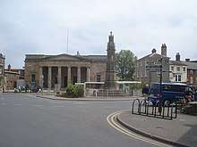
| Town Hall | Hereford | Town Hall | c. 1904 | 22 October 1973 | SO5119639918 52°03′20″N 2°42′47″W |
1279640 |  Town Hall |
| Tudor House Antiques | Ledbury | Timber Framed House | 17th century | 18 September 1953 | SO7099237882 52°02′19″N 2°25′28″W |
1082864 | |
| Ty Mawr | Longtown | Farmhouse | 14th century | 29 September 1952 | SO3217226626 51°56′02″N 2°59′17″W |
1342122 | |
| Unicorn House | Weobley | House | Mid 19th century | 20 February 1953 | SO4031851572 52°09′33″N 2°52′26″W |
1349837 | .jpg) Unicorn House |
| Upper Court | Clifford | Farmhouse | Mid 16th century | 29 September 1952 | SO2441745400 52°06′06″N 3°06′18″W |
1099497 | |
| Upper House Farmhouse | Eardisley | Farmhouse | 15th century | 19 August 1953 | SO3104849714 52°08′29″N 3°00′32″W |
1157429 | |
| Upper Limebrook Farmhouse | Limebrook, Wigmore | Farmhouse | 15th century | 11 June 1959 | SO3749566567 52°17′37″N 2°55′04″W |
1081743 | |
| Upper Wyhall | Walford | House | 16th century | 18 May 1953 | SO5968920745 51°53′02″N 2°35′13″W |
1167566 | |
| Upton Court | Little Hereford | Farmhouse | late 16th century or early 17th century | 11 June 1959 | SO5513766027 52°17′26″N 2°39′33″W |
1167003 | |
| Upton Court | Upton Bishop | Farmhouse | 14th century | 18 May 1953 | SO6578428155 51°57′03″N 2°29′57″W |
1166877 | |
| Urishay Castle Chapel | Peterchurch | Private Chapel | Early 12th century | 17 January 1949 | SO3229637611 52°01′58″N 2°59′18″W |
1099487 | |
| Walsopthorne Farmhouse | Ashperton | Farmhouse | c. 1600 | 26 March 1986 | SO6502942320 52°04′41″N 2°30′42″W |
1302708 |  Walsopthorne Farmhouse |
| Walter Scott Charity School | Ross-on-Wye | Gate Pier | 1717 | 22 October 1952 | SO6005424030 51°54′48″N 2°34′56″W |
1098685 |  Walter Scott Charity School |
| Weston Hall | Weston under Penyard | House | c. 1600 | 18 May 1953 | SO6264323679 51°54′37″N 2°32′40″W |
1099643 |  Weston Hall |
| Wharton Court | Wharton, Leominster | House | 1603 | 24 July 1954 | SO5111855862 52°11′56″N 2°43′00″W |
1255348 |  Wharton Court |
| Whitbourne Hall | Meadow Green, Whitbourne | Country House | 1860-2 | 9 April 1952 | SO7042456768 52°12′30″N 2°26′03″W |
1275628 | |
| White Cross | Hereford | Cross | c. 1370 | 10 June 1952 | SO4931140664 52°03′43″N 2°44′27″W |
1196892 |  White Cross |
| White House and Attached Service Wing to Rear | St Margarets | House | Early 19th century | 29 September 1952 | SO3494335639 52°00′55″N 2°56′58″W |
1266559 | |
| White House Farmhouse | St Devereux | Farmhouse | 15th century | 26 January 1967 | SO4532232165 51°59′07″N 2°47′51″W |
1099587 | |
| Willersley Court | Willersley, Willersley and Winforton | Farmhouse | Early 16th century | 19 August 1953 | SO3117847429 52°07′15″N 3°00′24″W |
1157569 | .jpg) Willersley Court |
| Woodhouse Farmhouse | Staplow, Ledbury | Farmhouse | 14th century | 18 November 1952 | SO6899541212 52°04′06″N 2°27′13″W |
1224740 | |
| Wooding Farmhouse | Thornbury | House | C16/17 | 9 April 1952 | SO6174059618 52°14′00″N 2°33′42″W |
1275938 | |
| Worcester Lodge to Brockhampton Park | Brockhampton Park, Brockhampton | Estate Cottage | 18th century | 9 June 1967 | SO6883354560 52°11′18″N 2°27′26″W |
1176667 | |

.jpg)


References
- The date given is the date used by Historic England as significant for the initial building or that of an important part in the structure's description.
- Sometimes known as OSGB36, the grid reference is based on the British national grid reference system used by the Ordnance Survey.
- The "List Entry Number" is a unique number assigned to each listed building and scheduled monument by Historic England.
External links
![]()
This article is issued from Wikipedia. The text is licensed under Creative Commons - Attribution - Sharealike. Additional terms may apply for the media files.