Gouhenans
Gouhenans is a commune in the Haute-Saône department in the region of Bourgogne-Franche-Comté in eastern France.
Gouhenans | |
|---|---|
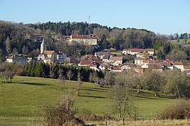 A general view of Gouhenans | |
 Coat of arms | |
Location of Gouhenans 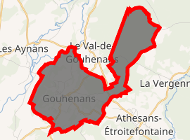
| |
 Gouhenans  Gouhenans | |
| Coordinates: 47°36′28″N 6°28′12″E | |
| Country | France |
| Region | Bourgogne-Franche-Comté |
| Department | Haute-Saône |
| Arrondissement | Lure |
| Canton | Villersexel |
| Area 1 | 8.45 km2 (3.26 sq mi) |
| Population (2017-01-01)[1] | 388 |
| • Density | 46/km2 (120/sq mi) |
| Time zone | UTC+01:00 (CET) |
| • Summer (DST) | UTC+02:00 (CEST) |
| INSEE/Postal code | 70271 /70110 |
| Elevation | 277–381 m (909–1,250 ft) |
| 1 French Land Register data, which excludes lakes, ponds, glaciers > 1 km2 (0.386 sq mi or 247 acres) and river estuaries. | |
Coale mines are operating in the village between 1828 and 1916.[2]
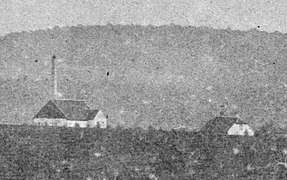 Mine-schaft 4.
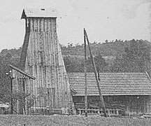 Mine-schaft 13.
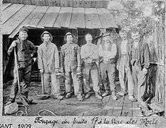 Mine-schaft 17.
Salt mines are operating in the village between 1831 and 1945. A chemical factory (1844-1955) and a glass factory (1903-1912) are added to the complex.
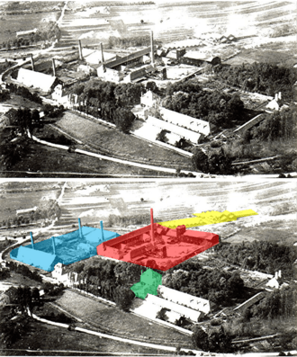
Aerial view of Gouhenans factories.
Salina |
Chemical factory |
Glass factory |
Administrative offices |
References
- INSEE (in English)
- "Populations légales 2017". INSEE. Retrieved 6 January 2020.
- Pierre Semonin, Le gîte houiller de Villafans, 1993
| Wikimedia Commons has media related to Gouhenans. |
| Authority control |
|
|---|
This article is issued from Wikipedia. The text is licensed under Creative Commons - Attribution - Sharealike. Additional terms may apply for the media files.