Gorda, California
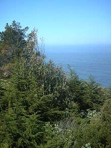
Gorda is an unincorporated community in Monterey County, California.[1] It is located 3 miles (4.8 km) south of Cape San Martin,[2] at an elevation of 148 feet (45 m).[1] It is one of the three small settlements of filling stations, restaurants, and motels located along State Route 1 on the Big Sur coast. The ZIP Code is 93920, but mail must be addressed to Big Sur,[3] and the community is inside area code 805.
Gorda | |
|---|---|
.jpg) Gorda, California. | |
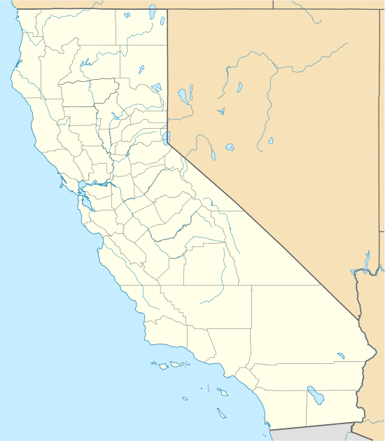 Gorda Location in California | |
| Coordinates: 35°52′35″N 121°26′46″W | |
| Country | United States |
| State | California |
| County | Monterey County |
| Elevation | 148 ft (45 m) |
| ZIP code | 93920 |
| Area code | 805 |
| GNIS feature ID | 271364 |
History
The fresh springs in Gorda were used by Native American tribes. The first settlement by Westerners was in 1878, when a stagecoach stop was built in Gorda. The settlement expanded with the Gold Rush of the 1880s.[4] The town is now the location of the Gorda Springs Ocean Side Resort.
Gorda is derived from the Spanish word for "fat" or "well-fed".[5]
A post office operated at Gorda from 1893 to 1923, moving in 1910.[2]
In 1979, the town attracted national attention after most of its public land was purchased by Kidco Limited Ventures, a corporation owned by four children all minors from Ramona, California, who were heirs of the family that owned the Cessna Aircraft company. [6] After funding the company, $500,000 was invested as a tax shelter to purchase the town's land. At the time, Dickie Cessna was 14 years old and the other three siblings were June (16), Bette (13) and Nene (11). [7] [8] After the Cessna children were paid for the filming rights, a dramatized version of the events was made and distributed by 20th Century. The film, Kidco, was released in 1984 as a comedy,directed by Ronald F. Maxwell and starring Scott Schwartz, Clifton James, Charles Hallahan, Maggie Blye, and Vincent Schiavelli.
In May, 2017, a massive landslide took place just south of Gorda, severing Highway 1; the world-famous coastal route for through traffic between northern and southern California was closed. This had a considerable negative economic impact for tourism between Monterey and Morro Bay. A CALTRANS study indicated that rerouting the highway around the slide was preferred over other alternatives.[9][10] Until the slide was repaired, the only route into Gorda beginning in the south was via a lengthy detour over the narrow, winding Nacimiento-Fergusson Road. Hwy SR 1 was re-opened to the south of town in July 2018.[11]
Government
At the county level, Gorda is represented on the Monterey County Board of Supervisors by Supervisor Dave Potter.[12]
In the California State Legislature, Gorda is in the 17th Senate District, represented by Democrat Bill Monning, and in the 30th Assembly District, represented by Democrat Robert Rivas.[13]
In the United States House of Representatives, Gorda is in California's 20th congressional district, represented by Democrat Jimmy Panetta[14]
Fuel prices
As of April 26, 2008, Gorda had the highest gasoline prices in the United States at $6.70 per gallon. Part of this cost goes to subsidize the 100 gallon per day Diesel generator fuel bill for the town.[15][16][17]
Geography
Under the Köppen climate classification, "dry-summer subtropical" climates are often referred to as "Mediterranean". This climate zone has an average temperature above 10 °C (50 °F) in their warmest months, and an average in the coldest between 18 to −3 °C (64 to 27 °F). Summers tend to be dry with less than one-third the rainfall of the wettest winter month, and with less than 30 mm (1 in) of precipitation in a summer month.[18]
Climate
| Climate data for Gorda, CA | |||||||||||||
|---|---|---|---|---|---|---|---|---|---|---|---|---|---|
| Month | Jan | Feb | Mar | Apr | May | Jun | Jul | Aug | Sep | Oct | Nov | Dec | Year |
| Record high °F (°C) | 81 (27) |
85 (29) |
87 (31) |
98 (37) |
96 (36) |
102 (39) |
99 (37) |
101 (38) |
100 (38) |
100 (38) |
90 (32) |
75 (24) |
102 (39) |
| Average high °F (°C) | 59.7 (15.4) |
61.5 (16.4) |
63.4 (17.4) |
68.3 (20.2) |
72.6 (22.6) |
75.9 (24.4) |
75.6 (24.2) |
77.3 (25.2) |
77.1 (25.1) |
73.2 (22.9) |
64.5 (18.1) |
59.9 (15.5) |
69.1 (20.6) |
| Average low °F (°C) | 42.9 (6.1) |
43.1 (6.2) |
43.4 (6.3) |
43.5 (6.4) |
45.8 (7.7) |
48.3 (9.1) |
50.4 (10.2) |
50.0 (10.0) |
50.3 (10.2) |
47.9 (8.8) |
44.9 (7.2) |
41.9 (5.5) |
46.0 (7.8) |
| Record low °F (°C) | 27 (−3) |
29 (−2) |
27 (−3) |
30 (−1) |
35 (2) |
37 (3) |
41 (5) |
40 (4) |
39 (4) |
36 (2) |
28 (−2) |
27 (−3) |
27 (−3) |
| Average precipitation inches (mm) | 9.10 (231) |
8.65 (220) |
6.49 (165) |
3.11 (79) |
1.09 (28) |
0.24 (6.1) |
0.03 (0.76) |
0.05 (1.3) |
0.42 (11) |
2.03 (52) |
4.85 (123) |
7.62 (194) |
43.70 (1,110) |
| Average precipitation days (≥ 0.01 in) | 10.3 | 11.2 | 10.3 | 6.5 | 3.7 | 1.1 | 0.3 | 0.4 | 1.3 | 3.5 | 7.5 | 10.3 | 66.4 |
| Source: NOAA[19] | |||||||||||||
References
- "Gorda". Geographic Names Information System. United States Geological Survey. Retrieved February 2, 2015.
- Durham, David L. (1998). California's Geographic Names: A Gazetteer of Historic and Modern Names of the State. Clovis, Calif.: Word Dancer Press. p. 901. ISBN 1-884995-14-4.
- "USPS.com® - ZIP Code™ Lookup". Archived from the original on 2010-11-23.
- "Gorda Springs Resort, Big Sur, CA - California Beaches". Beachcalifornia.com.
- Gannett, Henry (1905). The Origin of Certain Place Names in the United States. Govt. Print. Off. pp. 139.
- "Life Is Mellow in a Town Owned by Four Youths; Came Here to Be Left Alone Town Bought as Tax Shelter", The New York Times, November 6, 1980, pA16
- "A Place of Their Own", photo in Pittsburgh Press, June 6, 1979, pA-6
- Kidco Isn't Kid Stuff— Children's Company Is Big Business Now", by Cilla Brown, Los Angeles Times, April 22, 1979, pI-12
- "'Mother Of All Landslides' In Big Sur Buries Section Of California's Highway 1". Npr.org. Retrieved 12 August 2018.
- "New road planned to traverse Big Sur slide". Sfgate.com. 2 August 2017. Retrieved 12 August 2018.
- Forgione, Mary (July 18, 2018). "It's open! The last landslide closure on Highway 1 near Big Sur reopened to traffic earlier than expected". The Los Angeles Times. Retrieved July 20, 2018.
- "Monterey County Supervisorial District 5 Map (North District 5)" (PDF). County of Monterey. Archived from the original (PDF) on 1 July 2012. Retrieved 21 September 2012.
- "Statewide Database". UC Regents. Archived from the original on February 1, 2015. Retrieved February 2, 2015.
- "California's 20th Congressional District - Representatives & District Map". Civic Impulse, LLC. Retrieved September 24, 2014.
- "$5.20 a Gallon? America's Priciest Gas". ABC News. 31 March 2008. Retrieved 12 August 2018.
- "Most Stunning View in Town Is the One at the Pump", Jesse McKinley, The New York Times, March 12, 2008
- "NBCNews.com Video Player". NBC News.
- "Big Sur, California Köppen Climate Classification (Weatherbase)". Weatherbase.com.
- "NOWData - NOAA Online Weather Data". National Oceanic and Atmospheric Administration. Retrieved 2013-05-02.

Municipalities and communities of Monterey County, California, United States | ||
|---|---|---|
| Cities | 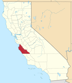 Monterey County map | |
| CDPs | ||
| Unincorporated communities |
| |
| Ghost towns |
| |
| Footnotes | ‡This populated place also has portions in an adjacent county | |