Geyssans
Geyssans is a commune in the Drôme department in southeastern France.
Geyssans | |
|---|---|
 Coat of arms | |
Location of Geyssans 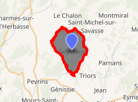
| |
 Geyssans  Geyssans | |
| Coordinates: 45°07′20″N 5°05′40″E | |
| Country | France |
| Region | Auvergne-Rhône-Alpes |
| Department | Drôme |
| Arrondissement | Valence |
| Canton | Drôme des collines |
| Intercommunality | CA Valence Romans Agglo |
| Government | |
| • Mayor (2008–2014) | Maurice Detriors |
| Area 1 | 10.90 km2 (4.21 sq mi) |
| Population (2017-01-01)[1] | 717 |
| • Density | 66/km2 (170/sq mi) |
| Time zone | UTC+01:00 (CET) |
| • Summer (DST) | UTC+02:00 (CEST) |
| INSEE/Postal code | 26140 /26750 |
| Elevation | 242–475 m (794–1,558 ft) (avg. 435 m or 1,427 ft) |
| 1 French Land Register data, which excludes lakes, ponds, glaciers > 1 km2 (0.386 sq mi or 247 acres) and river estuaries. | |
Location
It is located north of Génissieux, off the D52 which goes towards St Michel s/ Savasse, and Montmiral. The main road ends up in Reculais, a former commune now part of Arthémonay.[2]
Population
| Year | Pop. | ±% |
|---|---|---|
| 1911 | 409 | — |
| 1962 | 248 | −39.4% |
| 1968 | 261 | +5.2% |
| 1975 | 263 | +0.8% |
| 1982 | 308 | +17.1% |
| 1990 | 408 | +32.5% |
| 1999 | 468 | +14.7% |
| 2008 | 585 | +25.0% |
Sights
There is a pretty little ancient chapel to visit in Geyssans named St Ange, located on the very top of the hill. There is also a very clear view, on a good day, on the Rhone valley and the Vercors Plateau.
References
- "Populations légales 2017". INSEE. Retrieved 6 January 2020.
- Reculais on cassini.ehess.fr
| Wikimedia Commons has media related to Geyssans. |
| Authority control |
|
|---|
This article is issued from Wikipedia. The text is licensed under Creative Commons - Attribution - Sharealike. Additional terms may apply for the media files.