Condorcet, Drôme
Condorcet is a commune in the Drôme department in the Auvergne-Rhône-Alpes region in southeastern France.
Condorcet | |
|---|---|
 Coat of arms | |
Location of Condorcet 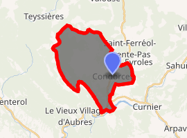
| |
 Condorcet  Condorcet | |
| Coordinates: 44°24′31″N 5°12′03″E | |
| Country | France |
| Region | Auvergne-Rhône-Alpes |
| Department | Drôme |
| Arrondissement | Nyons |
| Canton | Nyons et Baronnies |
| Intercommunality | Val d'Eygues |
| Government | |
| • Mayor (2008–2014) | Patrick Coullet |
| Area 1 | 22.44 km2 (8.66 sq mi) |
| Population (2017-01-01)[1] | 486 |
| • Density | 22/km2 (56/sq mi) |
| Time zone | UTC+01:00 (CET) |
| • Summer (DST) | UTC+02:00 (CEST) |
| INSEE/Postal code | 26103 /26110 |
| Elevation | 301–1,217 m (988–3,993 ft) (avg. 337 m or 1,106 ft) |
| 1 French Land Register data, which excludes lakes, ponds, glaciers > 1 km2 (0.386 sq mi or 247 acres) and river estuaries. | |
Geography
Condorcet is roughly 10 km (6.2 mi) north-east of the town of Nyons.
History
The history of Condorcet begins in late antiquity. An old local tradition holds that the ancient, ruined part of the village was once occupied by a forest sacred to druids. The monks of Cluny Abbey founded a priory in Condorcet in the 10th century. The counts of Die (Drôme) were the lords of Condorcet from the earliest days of feudalism.
Population
| Year | Pop. | ±% |
|---|---|---|
| 1911 | 495 | — |
| 1962 | 222 | −55.2% |
| 1968 | 224 | +0.9% |
| 1975 | 252 | +12.5% |
| 1982 | 340 | +34.9% |
| 1990 | 386 | +13.5% |
| 1999 | 447 | +15.8% |
| 2008 | 474 | +6.0% |
See also
References
- "Populations légales 2017". INSEE. Retrieved 6 January 2020.
| Wikimedia Commons has media related to Condorcet (Drôme). |
| Authority control |
|
|---|
This article is issued from Wikipedia. The text is licensed under Creative Commons - Attribution - Sharealike. Additional terms may apply for the media files.