Geography of the Marshall Islands
The Marshall Islands consist of two archipelagic island chains of 30 atolls and 1,152 islands, which form two parallel groups—the "Ratak" (sunrise) chain and the "Ralik" (sunset) chain. The Marshalls are located in the North Pacific Ocean and share maritime boundaries with Micronesia and Kiribati. Two-thirds of the nation's population lives in the capital of Majuro and the settlement of Ebeye. The outer islands are sparsely populated due to lack of employment opportunities and economic development.
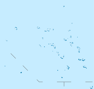 Map of the Marshall Islands | |
| Geography | |
|---|---|
| Location | Oceania |
| Coordinates | 9°00′N 168°00′E |
| Adjacent bodies of water | Pacific Ocean |
| Total islands | 1,152 |
| Area | 181.3 km2 (70.0 sq mi) |
| Coastline | 370.4 km (230.16 mi) |
| Administration | |
| Largest settlement | Majuro |
| Additional information | |
| Time zone | |
Statistics
The country is located about one-half of the way from Hawaii to Papua New Guinea. The archipelago includes the atolls of Bikini, Enewetak, Kwajalein, Majuro, Rongelap, and Utirik.
The total area of the islands is equal to the size of the City of Washington, DC. The largest atoll with a land area of 6 square miles (16 km2) is Kwajalein.[1] The terrain consists of low coral limestone and sand islands. Natural resources include coconut products, marine products, and deep seabed minerals. Current environmental issues are inadequate supplies of potable water; pollution of Majuro lagoon from household waste and discharges from fishing vessels.
Maritime claims:
territorial sea:
12 nautical miles
contiguous zone:
24 nm
exclusive economic zone:
200 nm
Elevation extremes:
lowest point:
Pacific Ocean 0 meters
highest point:
unnamed location on Likiep 10 meters (33 ft) above sea level
Land use:
arable land:
11.11%
permanent crops:
44.44%
other:
44.44% (2011)
Environment - international agreements:
party to:
Biodiversity, Climate Change, Climate Change-Kyoto Protocol, Desertification, Hazardous Wastes, Law of the Sea, Ozone Layer Protection, Ship Pollution, Wetlands, Whaling
Bikini and Enewetak are former US nuclear test sites; Kwajalein, the famous World War II battleground, is now used as a US missile test range; the island city of Ebeye is the second largest settlement in the Marshall Islands, after the capital of Majuro, and one of the most densely populated locations in the Pacific.[2]

Climate
Tropical; hot and humid with a Koeppen-Geiger classification of Af.[3] The wet season lasts from May to November and the islands border the typhoon belt. Typhoons do pose an infrequent threat from July to mid November.[3]
Due to their low elevation, the Marshall Islands are threatened by the potential effects of sea level rise.[4] According to the President of Nauru, the Marshall Islands are the most endangered nation on Earth due to flooding from climate change.[5]
A study by the University of Plymouth found that the tides move sediment to create higher elevation, which may keep the islands habitable.[6]
Extreme points

This is a list of the extreme points of the Marshall Islands, the points that are farther north, south, east or west than any other location.
- Northernmost point – Bokak Atoll (Taongi), Ratak Chain*
- Easternmost point – Knox Atoll, Ratak Chain
- Southernmost point – Ebon Atoll, Ralik Chain
- Westernmost point - Ujelang Atoll, Ralik Chain
- Note: the government of the Marshall Islands claims Wake Island, currently under US administration. If this is considered part of the Marshall Islands, then Toki Point on Peale Island, Wake Island is the northern-most point of the Marshall Islands
References
- Fuchs, Andrew. "atomicatolls | Culture & History [Cont'd]". atomicatolls. Retrieved 2019-03-26.
- "Australia - Oceania :: Marshall Islands — The World Factbook - Central Intelligence Agency". cia.gov. Retrieved 2019-03-22.
- "Climate of the World: Marshall Islands | weatheronline.co.uk". weatheronline.co.uk. Retrieved 2019-03-22.
- ClimateWire, Julia Pyper. "Storm Surges, Rising Seas Could Doom Pacific Islands This Century". Scientific American. Retrieved 2019-03-26.
- Stephen, Marcus (November 14, 2011). "A sinking feeling: why is the president of the tiny Pacific island nation of Nauru so concerned about climate change? - Free Online Library". thefreelibrary.com. Retrieved 2019-03-26.
- Taylor, Michael. "Small islands may not disappear under rising seas, researchers find". Thomson Reuters Foundation. Retrieved 29 June 2020.
![]()
Marshall Islands articles | |||||||
|---|---|---|---|---|---|---|---|
| History | |||||||
| Geography |
| ||||||
| Politics |
| ||||||
| Economy |
| ||||||
| Culture |
| ||||||
| |||||||