Geneseo, New York
Geneseo /ˌdʒɛnɪˈsiːoʊ/ is a town in Livingston County in the Finger Lakes region of New York, United States. It is at the south end of the five-county Rochester Metropolitan Area. The population of the town was 10,483 at the 2010 census.[5]
Geneseo, New York | |
|---|---|
Town | |
 The Bear Fountain sits in the center of Geneseo village's Main Street. In this picture, it is decorated with flags for Memorial Day. | |
 Geneseo  Geneseo | |
| Coordinates: 42°47′45″N 77°48′49″W | |
| Country | |
| State | |
| County | Livingston |
| Town established | 1789 |
| Government | |
| • Type | Town Council |
| • Mayor | Margaret Duff (D) |
| Area | |
| • Total | 45.14 sq mi (116.92 km2) |
| • Land | 43.94 sq mi (113.82 km2) |
| • Water | 1.20 sq mi (3.10 km2) |
| Elevation | 909 ft (277 m) |
| Population | |
| • Total | 10,483 |
| • Estimate (2016)[4] | 10,726 |
| • Density | 244.08/sq mi (94.24/km2) |
| Time zone | UTC-5 (Eastern (EST)) |
| • Summer (DST) | UTC-4 (EDT) |
| ZIP code | 14454 |
| Area code(s) | 585 |
| FIPS code | 36-051-28629 |
| GNIS feature ID | 0978991 |
| Website | www |
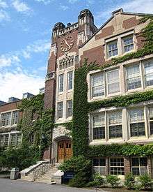
The English name "Geneseo" is an anglicization of the Iroquois name for the earlier Iroquois town there, Gen-nis-he-yo (which means "beautiful valley").[6][7] The village of Geneseo lies within the western portion of the town. The village and town are known today mainly as the home of the State University of New York at Geneseo.
History
Pre-revolution
Near Geneseo was the largest Seneca village, Chenussio, a center of power for the Iroquois Confederacy. It was also the confederacy's "bread basket", with orchards, vineyards, and fields of maize and vegetables.
During the American Revolution, the Seneca joined the British and the Tories against the colonists who were fighting for independence. The alliance's raids from the west were a major threat to the American cause, and General Washington sent the Sullivan Expedition to neutralize the Iroquois. As Sullivan's army approached Geneseo with their "scorched earth" policy, the Senecas repeatedly fell back. However, a large Seneca party ambushed one of Sullivan's scouting parties, carried them as prisoners to Geneseo and tortured them to death. When Sullivan's troops arrived and found the savagely mutilated bodies, they became enraged and destroyed anything that could support the Iroquois. No longer able to raid from Geneseo and the surrounding area, about 5,000 Seneca fled to British-held Fort Niagara, where they spent one of the coldest winters on record, with much loss of life, in camps outside the fort with only the small amount of supplies the British could spare.
Post-revolution
The town was established in 1789, before the formation of Livingston County. The settlement of Geneseo by the colonists began shortly after the arrival of James and William Wadsworth in 1790. The brothers came to the Genesee Valley from Connecticut as agents of their uncle, Colonel Jeremiah Wadsworth, to care for and sell the land he had purchased. The Wadsworths were participants in the negotiations of the Treaty of Big Tree between Robert Morris and the Senecas at the site of Geneseo in 1797.
Geneseo, as well as nearby Mount Morris, was part of the Morris Reserve that Morris held back from his sale of much of western New York to the Holland Land Company.
Geneseo was the birthplace of Eliza Emily Chappell Porter in 1807, who was a nurse, teacher, school builder, and Underground Railroad operative during the Civil War. Geneseo was also the birthplace, in 1851, of the swindler Ferdinand Ward.
The village of Geneseo became the county seat of Livingston County in 1821 and was incorporated in 1832. The State Normal School, now SUNY Geneseo, opened in 1871. A portion of the village was designated a National Historic Landmark by the United States Department of the Interior in 1991.
Present day


The valley of the Genesee River is wide and fertile, with some of the best agricultural land in New York, but it was very prone to flooding, and Geneseo suffered several bad floods until the United States Army Corps of Engineers' construction of the Mount Morris Dam upstream of the community in the 1950s.[7] Agriculture is now a large contributor to Geneseo's economy. Geneseo is also used by many as a bedroom community for jobs in Rochester, 30 miles (48 km) to the north. The village of Geneseo is governed by a mayor and four trustees.
The town can be roughly divided into three geographies: the village has a small-town atmosphere, much of Route 20A is commercialized, and the majority of the town's area is farmland. One of the main issues faced by the community today is urban sprawl. The increasing presence of big-box stores on Route 20A has been welcomed by some residents, who appreciate the convenience of nearby retailers, and discouraged by others, who oppose the suburbanization of the small town.
The Geneseo Airport (D52) is a general aviation airport west of the village, on the Wadsworth farm. It was established during July 1969, and is used for approximately 20 aircraft operations each day.[8] Since 1980, it has hosted groups restoring and operating historic military aircraft—originally the National Warplane Museum, and now the 1941 Historical Aircraft Group Museum. An airshow is held annually on the field, during the second weekend in July.
The Association for the Preservation of Geneseo (APOG) is a civic organization dedicated to preserving, improving, and restoring the places of civic, architectural, and historic interest to Geneseo and to educate members of the community to their architectural and historical heritage. Additional aims and purposes are to encourage others to contribute their knowledge, advice, and financial assistance.[9]
Sweet Briar and the Wadsworth Fort Site are listed on the National Register of Historic Places.[10]
Education
The Geneseo Central School District encompasses Geneseo and Groveland, and consists of Geneseo Central School, which graduates approximately 75 students each year.[11]
The school mascot is the Blue Devils and wear blue and white, with a gray accent color. Past accent colors included red and black.
In 1933, the school moved to its own building on School Street and in 1963 added a wing. In 1974 it moved into a new building at its present location on Avon Road.[12]
Geography
According to the United States Census Bureau, the town has an area of 45.1 square miles (116.9 km2), of which 43.9 square miles (113.8 km2) are land and 1.2 square miles (3.1 km2), or 2.65%, are water.[13]
The Genesee River defines the western town line, and Conesus Lake is on part of the eastern town line. Interstate 390 and U.S. Route 20A pass through the town, along with State Routes 39, 63, and 256.
Climate
Geneseo has a mild climate; summers typically bring temperatures between 60–80 °F (16–27 °C), while winters average 15–35 °F (−9–2 °C).
| Climate data for Geneseo, New York | |||||||||||||
|---|---|---|---|---|---|---|---|---|---|---|---|---|---|
| Month | Jan | Feb | Mar | Apr | May | Jun | Jul | Aug | Sep | Oct | Nov | Dec | Year |
| Record high °F (°C) | 67 (19) |
72 (22) |
84 (29) |
91 (33) |
92 (33) |
95 (35) |
99 (37) |
97 (36) |
94 (34) |
83 (28) |
77 (25) |
71 (22) |
99 (37) |
| Average high °F (°C) | 32 (0) |
34 (1) |
42 (6) |
55 (13) |
68 (20) |
77 (25) |
81 (27) |
79 (26) |
71 (22) |
60 (16) |
48 (9) |
37 (3) |
57 (14) |
| Daily mean °F (°C) | 24 (−4) |
26 (−3) |
34 (1) |
46 (8) |
58 (14) |
66 (19) |
71 (22) |
69 (21) |
62 (17) |
51 (11) |
40 (4) |
30 (−1) |
47.2 (8.4) |
| Average low °F (°C) | 16 (−9) |
16 (−9) |
24 (−4) |
34 (1) |
45 (7) |
55 (13) |
59 (15) |
57 (14) |
50 (10) |
39 (4) |
32 (0) |
22 (−6) |
37 (3) |
| Record low °F (°C) | −24 (−31) |
−13 (−25) |
−9 (−23) |
11 (−12) |
29 (−2) |
35 (2) |
45 (7) |
37 (3) |
28 (−2) |
21 (−6) |
11 (−12) |
−7 (−22) |
−24 (−31) |
| Average precipitation inches (mm) | 1.57 (40) |
1.42 (36) |
2.20 (56) |
2.48 (63) |
3.00 (76) |
3.75 (95) |
3.78 (96) |
3.18 (81) |
3.20 (81) |
2.56 (65) |
2.45 (62) |
1.93 (49) |
31.52 (801) |
| Source: The Weather Channel[14] | |||||||||||||
Communities
The town includes a number of hamlets on the western shore of Conesus Lake. From north to south along NY 256 (West Lake Road), they are:[15]

- Sleggs Landing
- Eagle Point
- Sacketts Harbor
- Wadsworth Cove
- Long Point
- Long Point Cove
- Cottonwood Cove
All of the listed hamlets are part of the larger Conesus Lake census-designated place.
Demographics
| Historical population | |||
|---|---|---|---|
| Census | Pop. | %± | |
| 1820 | 1,598 | — | |
| 1830 | 2,675 | 67.4% | |
| 1840 | 2,892 | 8.1% | |
| 1850 | 2,958 | 2.3% | |
| 1860 | 3,002 | 1.5% | |
| 1870 | 3,032 | 1.0% | |
| 1880 | 3,340 | 10.2% | |
| 1890 | 3,534 | 5.8% | |
| 1900 | 3,613 | 2.2% | |
| 1910 | 3,188 | −11.8% | |
| 1920 | 3,007 | −5.7% | |
| 1930 | 3,135 | 4.3% | |
| 1940 | 3,133 | −0.1% | |
| 1950 | 3,782 | 20.7% | |
| 1960 | 4,337 | 14.7% | |
| 1970 | 7,278 | 67.8% | |
| 1980 | 8,673 | 19.2% | |
| 1990 | 9,178 | 5.8% | |
| 2000 | 9,654 | 5.2% | |
| 2010 | 10,483 | 8.6% | |
| Est. 2016 | 10,726 | [4] | 2.3% |
| U.S. Decennial Census[16] | |||
As of the census[3] of 2000, there were 9,654 people, 2,523 households, and 1,303 families residing in the town. The population density was 219.6 people per square mile (84.8/km²). There were 2,698 housing units at an average density of 23.7 persons/km² (61.4 persons/sq mi). The town's racial makeup was 93.91% White, 1.48% African American, 0.11% Native American, 2.61% Asian, 0.04% Pacific Islander, 0.69% from other races, and 1.15% from two or more races. Hispanic or Latino of any race were 2.19% of the population.
There were 2,523 households out of which 23.5% had children under the age of 18 living with them, 41.3% were married couples living together, 8.3% had a female householder with no husband present, and 48.4% were non-families. 26.0% of all households were made up of individuals and 9.6% had someone living alone who was 65 years of age or older. The average household size was 2.53 and the average family size was 2.92.
11.9% of the town's population was under age of 18, 51.3% was from age 18 to 24, 15.2% was from age 25 to 44, 13.2% was from age 45 to 64, and 8.5% were age 65 or older. The median age was 22 years. For every 100 females, there were 72.3 males. For every 100 females age 18 and over, there were 68.4 males.
The town's median household income was $40,660, and the median family income was $62,206. Males had a median income of $42,218 versus $25,969 for females. The town's per capita income was $15,303. About 8.7% of families and 29.8% of the population were below the poverty line, including 12.2% of those under the age of 18 and 5.5% ages 65 or older.
References
- "Mayor Margaret Duff". The Village of Geneseo Board of Trustees. The Village of Geneseo. Archived from the original on August 23, 2007. Retrieved 2007-10-10.
- "2016 U.S. Gazetteer Files". United States Census Bureau. Retrieved July 5, 2017.
- "U.S. Census website". United States Census Bureau. Retrieved January 31, 2008.
- "Population and Housing Unit Estimates". Retrieved June 9, 2017.
- "Total Population: 2010 Census DEC Summary File 1 (P1), Geneseo town, New York". data.census.gov. U.S. Census Bureau. Retrieved June 2, 2020.
- Gannett, Henry (1905). The Origin of Certain Place Names in the United States. Govt. Print. Off. pp. 135–136.
- Cook, William R.; Daniel J. Schultz (2004). Around Geneseo. Arcadia Publishing. ISBN 0-7385-3496-X.
- "Geneseo Airport". Airports. AirNav.com. July 5, 2007. Retrieved August 17, 2007.
- "Association for the Preservation of Geneseo". Association for the Preservation of Geneseo. Retrieved August 17, 2007.
- "National Register Information System". National Register of Historic Places. National Park Service. March 13, 2009.
- "About Us". Geneseo Central School District. Archived from the original on September 27, 2007. Retrieved August 17, 2007.
- Jen-o-see 1933, '63 & 1974–75, yearbooks of the school
- "U.S. Gazetteer Files: 2019: Places: New York". U.S. Census Bureau Geography Division. Retrieved June 2, 2020.
- "Monthly Averages for Geneseo, NY". The Weather Channel. Retrieved April 18, 2012.
- "Town of Geneseo Map". Livingston County Planning Department. July 2003. Archived from the original (JPEG) on April 18, 2007. Retrieved December 19, 2007.
- "Census of Population and Housing". Census.gov. Retrieved June 4, 2015.
External links
| Wikimedia Commons has media related to Geneseo, New York. |
- Town and Village of Geneseo official website
- Wadsworth Library
- Geneseo Central School District
- Association for the Preservation of Geneseo
- Genesee Valley Conservancy
- State University of New York, College at Geneseo
- 1941 Historical Aircraft Group Museum
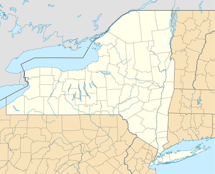
Municipalities and communities of Livingston County, New York, United States | ||
|---|---|---|
| Towns |  Map of New York highlighting Livingston County | |
| Villages | ||
| CDPs | ||
| Other hamlet | ||
| Authority control |
|
|---|