Fultonville, New York
Fultonville is a village in Montgomery County, New York, United States. The village is named after Robert Fulton, inventor of the steamboat.[3]
Fultonville, New York | |
|---|---|
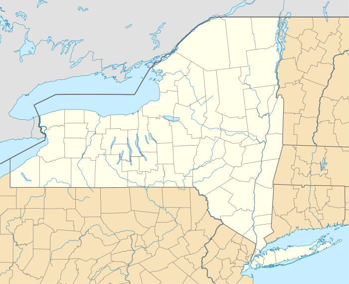 Fultonville, New York Location within the state of New York | |
| Coordinates: 42°56′48″N 74°22′10″W | |
| Country | United States |
| State | New York |
| County | Montgomery |
| Government | |
| • Mayor | Linda Petterson-Law |
| • Treasurer | Tina Sweet |
| • Street and Water Superintendent | Ronald Kasza |
| • Clerk | Vickie Romano |
| Area | |
| • Total | 0.52 sq mi (1.35 km2) |
| • Land | 0.48 sq mi (1.24 km2) |
| • Water | 0.04 sq mi (0.11 km2) |
| Elevation | 289 ft (88 m) |
| Population (2010) | |
| • Total | 784 |
| • Estimate (2019)[2] | 783 |
| • Density | 1,641.51/sq mi (633.73/km2) |
| Time zone | UTC-5 (Eastern (EST)) |
| • Summer (DST) | UTC-4 (EDT) |
| ZIP codes | 12016, 12072 |
| Area code(s) | 518 Exchange: 853 |
| FIPS code | 36-27859 |
| GNIS feature ID | 0950807 |
| Website | Village website |
Fultonville Historic District | |
| NRHP reference No. | 100004242 |
|---|---|
| Designated HD | August 8, 2019 |
The Fultonville Village is on the south bank of the Mohawk River in the Town of Glen. It is west of Amsterdam, NY, and is often referred to as South Fonda.
In 2019 the developed area of the village was listed on the National Register of Historic Places as the Fultonville Historic District in recognition of its well-preserved architecture from its original settlement, the era around the development of the Erie Canal, and afterwards.[4]
History
 Starin Mausoleum in Fultonville Cemetery - 1907-1915
The area was located near to the site of the Mohawk village of Andagaron during the middle of the seventeenth century, which was located about a mile to the west.[5]

The first white settlement on the site was made around 1750 by John Evart Van Epps, and was called "Van Epps Swamp" due to the swampland by the river. During the American Revolution, the homes that were located here were burned.[6]

The village was founded around 1824 in anticipation of the opening of the Erie Canal, and the West Shore Railroad ran through Fultonville, and had a station there as of 1889. The West Shore was later absorbed into the New York Central system. Fultonville was incorporated as a village on August 9, 1848.
Original Trustees
- Howland Fish - President
- Andrew J Yates
- William B Wemple
- Thomas R Horton
- Delancey D Starin
Mayors
- John Synder [1951-1957]
- George Wadsworth [1987-1995]
- Daniel Szabo [1995-2000] [Resigned]
- Robert Headwell [2000-2016]
- George Donaldson (Interim) [2017]
- Ryan B. Weitz [2017] [Resigned after one month] [7]
- Linda Petterson-Law [Appointed May 2017, elected 2018]
2016 presidential election
- Hillary Clinton (D)-144 27.61%
- Donald Trump (R)-352 66.88%
- Johnson (L)-18 3.42%
- Jill Stein (G)-11 2.09%
At the time of incorporation, the village's population numbered 630. In 1875, the population had increased to 1220.
Attractions
Poplar Mist boat tours
With operations commencing in 1993, the Poplar Hotel/Restaurant offered a two and a half hour boat trip down the Mohawk River on a 102-passenger boat from mid-May through mid-October.
Cobblestone Hall and Free Library

Cobblestone Hall and Free Library was built sometime before 1868 when the house belonged to C. B. Freeman. Freeman was the proprietor of Fultonville Steam Mills. He lived at this residence until at least 1878 when F. W. Beers published a history of Montgomery and Fulton Counties. By 1905, a large wooden addition had been made to the rear of the building which was then called "Cobblestone Free Hall and Library." The building still stands, minus the addition, and is a private residence.
Geography
Fultonville is located at 42°56′48″N 74°22′10″W (42.946764, -74.369395).[8]
According to the United States Census Bureau, the village covers a total area of 0.5 square miles (1.3 km2), of which 0.5 square miles (1.3 km2) of it is land and 0.04 square miles (0.10 km2) is water.
The village is on the south bank of the Mohawk River with the Village of Fonda on the opposite shore, linked by a bridge carrying NY-30A. The Mohawk River is part of the Erie Canal at this location.
The New York State Thruway (Interstate 90) passes through the community. New York State Route 5S (Maple Avenue), parallels the Thruway and intersects New York State Route 30A (Main Street) in Fultonville.
Demographics
| Historical population | |||
|---|---|---|---|
| Census | Pop. | %± | |
| 1870 | 1,117 | — | |
| 1880 | 881 | −21.1% | |
| 1890 | 1,122 | 27.4% | |
| 1900 | 977 | −12.9% | |
| 1910 | 812 | −16.9% | |
| 1920 | 869 | 7.0% | |
| 1930 | 831 | −4.4% | |
| 1940 | 806 | −3.0% | |
| 1950 | 840 | 4.2% | |
| 1960 | 815 | −3.0% | |
| 1970 | 812 | −0.4% | |
| 1980 | 777 | −4.3% | |
| 1990 | 748 | −3.7% | |
| 2000 | 710 | −5.1% | |
| 2010 | 784 | 10.4% | |
| Est. 2019 | 783 | [2] | −0.1% |
| U.S. Decennial Census[9] | |||
As of the census[10] of 2000, 710 people, 279 households, and 191 families resided in the village. The population density was 1,590.0 people per square mile (571.1/km²). The 309 housing units create an average density of 642.8 per square mile (248.6/km²). The racial makeup of the village was 99.00% White, 1.00% Latino. 99.52% spoke English 0.36% spoke German and 0.12% spoke Polish
33.0% of households had children under age 18 living with them. 44.4% were married couples living together. 17.6% had a female householder with no husband present. 31.2% were non-families. 25.8% of all households were made up of single individuals and 11.8% had someone living alone aged 65+. The average household size was 2.50 and the average family size was 2.96.
27.7% were under age 18, 9.4% from 18 to 24, 26.9% from 25 to 44, 21.4% from 45 to 64, and 14.5% who were 65+. The median age was 35. For every 100 females, the village hosted 87.3 males. For every 100 females age 18 and over, there were 88.6 males.
The median household income was $32,361, and the median family income was $34,167. Males had a median income of $30,500 versus $20,909 for females. The per capita income for the village was $15,283. About 3.4% of families and 6.9% of the population were below the poverty line, including 3.3% of those under age 18 and 4.5% of those age 65 or over.
Education
Fultonville area residents attend the Fonda-Fultonville Central School District, located in Fonda, New York.
Religion
 Reformed Church - 1907-1915
 Methodist Church - 1907-1915
 Calvary Baptist Church - 1907-1915
- Fultonville Reformed Church
- Fonda-Fultonville United Methodist Church [Torn down after fire March 14th, 2017]
- Calvary Baptist Church [No Longer in Use]
Cemeteries
- Maple Avenue Cemetery - Est. 1874
- Old Fultonville Cemetery
References
- "2019 U.S. Gazetteer Files". United States Census Bureau. Retrieved July 27, 2020.
- "Population and Housing Unit Estimates". United States Census Bureau. May 24, 2020. Retrieved May 27, 2020.
- Zurlo, Sam (15 April 1996). "Area place names reflect local history and personalities". The Daily Gazette. pp. B5. Retrieved 23 April 2015.
- "Weekly List 20190809". U.S. National Park Service. August 8, 2019. Retrieved August 17, 2019.
- Greene (ed.), Nelson (1925). History of the Mohawk Valley: Gateway to the West 1614-1925. Chicago: S. J. Clarke Publishing Company. Retrieved Nov 29, 2018.CS1 maint: extra text: authors list (link)
- "John E. Van Eps House". rooteweb.com. Retrieved Nov 29, 2018.
- Frisch, Morgan (3 May 2017). "Weitz, Dimezzas resign from positions in Fultonville". The Recorder. Retrieved 9 July 2018.
- "US Gazetteer files: 2010, 2000, and 1990". United States Census Bureau. 2011-02-12. Retrieved 2011-04-23.
- "Census of Population and Housing". Census.gov. Retrieved June 4, 2015.
- "U.S. Census website". United States Census Bureau. Retrieved 2008-01-31.
External links
- Official website
- Area history for Fultonville
- "APHNYS: Newest/Youngest and Senior Members". 2011-06-09. Archived from the original on 2011-06-09. Retrieved 2020-03-24.
- "Spectrum News | Rochester". spectrumlocalnews.com. Retrieved 2020-03-24.
- "Village of Fultonville historian youngest in state | The Daily Gazette". dailygazette.com. Retrieved 2020-03-24.
- "News, Sports, Jobs - Leader Herald". Retrieved 2020-03-24.
Municipalities and communities of Montgomery County, New York, United States | ||
|---|---|---|
| City |  | |
| Towns | ||
| Villages | ||
| CDP | ||
| Hamlets | ||
| Footnotes | ‡This populated place also has portions in an adjacent county or counties | |
| Topics |  | |
|---|---|---|
| Lists by county |
| |
| Lists by city | ||
| Other lists | ||
| ||
| Authority control |
|
|---|