Franklin County, Illinois
Franklin County is a county located in the U.S. state of Illinois. According to the 2010 census, it has a population of 39,561.[1] Its county seat is Benton.[2] It is located in the southern portion of Illinois known locally as "Little Egypt".
Franklin County | |
|---|---|
 Franklin County Courthouse in Benton | |
 Location within the U.S. state of Illinois | |
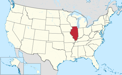 Illinois's location within the U.S. | |
| Coordinates: 37°59′N 88°55′W | |
| Country | |
| State | |
| Founded | January 2, 1818 |
| Named for | Benjamin Franklin |
| Seat | Benton |
| Largest city | West Frankfort |
| Area | |
| • Total | 431 sq mi (1,120 km2) |
| • Land | 409 sq mi (1,060 km2) |
| • Water | 23 sq mi (60 km2) 5.2% |
| Population (2010) | |
| • Total | 39,561 |
| • Estimate (2018) | 38,701 |
| • Density | 92/sq mi (35/km2) |
| Time zone | UTC−6 (Central) |
| • Summer (DST) | UTC−5 (CDT) |
| Congressional district | 12th |
| Website | www |
History
Franklin County was established on January 2, 1818 and formed from parts of Gallatin and White counties. It was named for Benjamin Franklin.[3]
 Franklin County at the time of its formation in 1818
 The creation of Williamson County in 1839 reduced Franklin to its current borders.
Coal mining
Coal was mined in Franklin County as early as 1889, at the King Coal Mine, located at Township 5 South, Range 3 East.[4]
The high levels of gas found in Franklin County's coal deposits have resulted in mining disasters and explosions over the years.[5] Between 1905 and 1968, there were eleven mine disasters.[6] In 1905, the Zeigler No. 1 mine, located in Zeigler, had an explosion that killed about fifty people.[7] In 1917, an explosion in Old Ben Mine No. 11, located in Christopher, killed 17.[8] The worst explosion occurred in 1951, in the Orient No. 2 Mine in West Frankfort, in which 119 people died.[9]
The West Frankfort quadrangle of Franklin County is home to 17 coal mines, according to a 2004 report.[5]
Geography
According to the U.S. Census Bureau, the county has a total area of 431 square miles (1,120 km2), of which 409 square miles (1,060 km2) is land and 23 square miles (60 km2) (5.2%) is water.[10] Wayne Fitzgerrell State Recreation Area is located in this county.
Climate and weather
| Benton, Illinois | ||||||||||||||||||||||||||||||||||||||||||||||||||||||||||||
|---|---|---|---|---|---|---|---|---|---|---|---|---|---|---|---|---|---|---|---|---|---|---|---|---|---|---|---|---|---|---|---|---|---|---|---|---|---|---|---|---|---|---|---|---|---|---|---|---|---|---|---|---|---|---|---|---|---|---|---|---|
| Climate chart (explanation) | ||||||||||||||||||||||||||||||||||||||||||||||||||||||||||||
| ||||||||||||||||||||||||||||||||||||||||||||||||||||||||||||
| ||||||||||||||||||||||||||||||||||||||||||||||||||||||||||||
In recent years, average temperatures in the county seat of Benton have ranged from a low of 21 °F (−6 °C) in January to a high of 90 °F (32 °C) in July, although a record low of −22 °F (−30 °C) was recorded in January 1977 and a record high of 104 °F (40 °C) was recorded in August 2007. Average monthly precipitation ranged from 2.87 inches (73 mm) in February to 4.59 inches (117 mm) in May.[11]
In 1912, a tornado destroyed facilities at the Possum Ridge Mine.[5][12]
On March 18, 1925, Franklin County was among five southern Illinois counties effected by the infamous Tri State Tornado. The storm cut across the southern edge of the county, hitting West Frankfort and destroying most of the northern side of town, causing significant damage to the town's mining facilities. Farther to the east, the village of Parrish was also struck, and was never rebuilt. The storm killed 192 people in Franklin County, injuring hundreds more and leaving scores of people homeless.
Adjacent counties
- Jefferson County (north)
- Hamilton County (east)
- Saline County (southeast)
- Williamson County (south)
- Jackson County (southwest)
- Perry County (west)
Demographics
| Historical population | |||
|---|---|---|---|
| Census | Pop. | %± | |
| 1820 | 1,763 | — | |
| 1830 | 4,083 | 131.6% | |
| 1840 | 3,682 | −9.8% | |
| 1850 | 5,681 | 54.3% | |
| 1860 | 9,393 | 65.3% | |
| 1870 | 12,652 | 34.7% | |
| 1880 | 16,129 | 27.5% | |
| 1890 | 17,138 | 6.3% | |
| 1900 | 19,675 | 14.8% | |
| 1910 | 25,943 | 31.9% | |
| 1920 | 57,293 | 120.8% | |
| 1930 | 59,442 | 3.8% | |
| 1940 | 53,137 | −10.6% | |
| 1950 | 48,685 | −8.4% | |
| 1960 | 39,281 | −19.3% | |
| 1970 | 38,329 | −2.4% | |
| 1980 | 43,201 | 12.7% | |
| 1990 | 40,319 | −6.7% | |
| 2000 | 39,018 | −3.2% | |
| 2010 | 39,561 | 1.4% | |
| Est. 2018 | 38,701 | [13] | −2.2% |
| U.S. Decennial Census[14] 1790-1960[15] 1900-1990[16] 1990-2000[17] 2010-2013[1] | |||
As of the 2010 United States Census, there were 39,561 people, 16,617 households, and 10,912 families residing in the county.[18] The population density was 96.8 inhabitants per square mile (37.4/km2). There were 18,525 housing units at an average density of 45.3 per square mile (17.5/km2).[10] The racial makeup of the county was 97.7% white, 0.3% Asian, 0.3% American Indian, 0.3% black or African American, 0.3% from other races, and 1.1% from two or more races. Those of Hispanic or Latino origin made up 1.2% of the population.[18] In terms of ancestry, 21.8% were German, 18.7% were Irish, 15.9% were English, 9.4% were American, and 5.7% were Italian.[19]
Of the 16,617 households, 30.0% had children under the age of 18 living with them, 48.8% were married couples living together, 11.6% had a female householder with no husband present, 34.3% were non-families, and 30.0% of all households were made up of individuals. The average household size was 2.35 and the average family size was 2.88. The median age was 41.8 years.[18]
The median income for a household in the county was $34,381 and the median income for a family was $43,170. Males had a median income of $39,122 versus $28,950 for females. The per capita income for the county was $18,504. About 14.5% of families and 19.8% of the population were below the poverty line, including 30.5% of those under age 18 and 9.9% of those age 65 or over.[20]
Communities
Villages
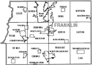
Census-designated place
Education
Regional
- Franklin, Johnson, Massac, and Williamson County Regional Office of Education #21 [21]
Primary and secondary
- Christopher Unit School District #99 [22]
- Sesser Unit School District [23]
- Benton School District #47 [24]
- Frankfort Community Unit School District #168 [25]
- Zeigler-Royalton Community Unit School District #188 [26]
- Thompsonville Community Unit School District #174 [27]
- Ewing-Northern Community Unit School District #115 [28]
Higher education
- John A. Logan College Extension Center - West Frankfort
Specialized
- Franklin & Jefferson County Special Education Cooperative [29]
Politics
Until the 2000s, Franklin County, owing to its strong Southern leanings and opposition to the “Yankee” Civil War was Democratic-leaning. It voted for Republican Presidential nominees only in landslide GOP victories, and even Walter Mondale when he came within 3,819 votes of losing all fifty states in 1984 was able to carry Franklin County by 1,011 votes. However, since the turn of the century opposition to the Democratic Party's liberal views on social issues has produced a powerful swing towards the Republican Party.[30] In 2016, Hillary Clinton did fifteen percent worse than any previous Democratic candidate, receiving only 25 percent of the county's ballots.
| Year | Republican | Democratic | Third parties |
|---|---|---|---|
| 2016 | 70.1% 13,116 | 25.3% 4,727 | 4.6% 868 |
| 2012 | 57.3% 10,267 | 40.5% 7,254 | 2.2% 393 |
| 2008 | 50.3% 9,404 | 47.5% 8,880 | 2.3% 430 |
| 2004 | 53.7% 10,388 | 45.6% 8,816 | 0.8% 148 |
| 2000 | 44.2% 8,490 | 53.1% 10,201 | 2.7% 521 |
| 1996 | 30.8% 5,354 | 56.5% 9,814 | 12.6% 2,190 |
| 1992 | 25.6% 5,504 | 59.3% 12,744 | 15.1% 3,233 |
| 1988 | 40.9% 7,677 | 58.7% 11,023 | 0.4% 83 |
| 1984 | 47.4% 9,656 | 52.4% 10,667 | 0.3% 54 |
| 1980 | 49.0% 9,731 | 47.5% 9,425 | 3.5% 700 |
| 1976 | 36.5% 7,420 | 63.1% 12,818 | 0.4% 86 |
| 1972 | 54.0% 10,121 | 45.6% 8,545 | 0.3% 63 |
| 1968 | 42.9% 9,036 | 47.9% 10,095 | 9.2% 1,943 |
| 1964 | 35.9% 7,620 | 64.1% 13,581 | |
| 1960 | 51.0% 11,861 | 48.9% 11,368 | 0.2% 37 |
| 1956 | 51.0% 11,761 | 49.0% 11,308 | |
| 1952 | 49.3% 11,723 | 50.4% 11,981 | 0.3% 62 |
| 1948 | 43.9% 9,407 | 54.8% 11,750 | 1.3% 287 |
| 1944 | 49.0% 11,377 | 50.2% 11,663 | 0.8% 173 |
| 1940 | 45.1% 12,936 | 54.2% 15,523 | 0.7% 201 |
| 1936 | 40.2% 10,708 | 57.3% 15,254 | 2.5% 663 |
| 1932 | 32.5% 7,560 | 63.4% 14,754 | 4.2% 976 |
| 1928 | 45.8% 9,900 | 52.6% 11,369 | 1.6% 353 |
| 1924 | 39.6% 6,779 | 33.8% 5,791 | 26.6% 4,551 |
| 1920 | 51.1% 7,608 | 32.9% 4,894 | 16.0% 2,384 |
| 1916 | 46.4% 6,371 | 46.8% 6,419 | 6.8% 934 |
| 1912 | 36.1% 2,098 | 41.9% 2,435 | 22.0% 1,276 |
| 1908 | 48.5% 2,539 | 45.9% 2,401 | 5.6% 293 |
| 1904 | 50.0% 2,077 | 43.4% 1,801 | 6.6% 273 |
| 1900 | 48.0% 2,117 | 50.5% 2,226 | 1.5% 68 |
| 1896 | 47.4% 2,038 | 52.0% 2,233 | 0.6% 26 |
| 1892 | 44.3% 1,631 | 48.4% 1,782 | 7.4% 273 |
References
- "State & County QuickFacts". United States Census Bureau. Archived from the original on June 6, 2011. Retrieved July 5, 2014.
- "Find a County". National Association of Counties. Archived from the original on May 31, 2011. Retrieved June 7, 2011.
- Gannett, Henry (1905). The Origin of Certain Place Names in the United States. Govt. Print. Off. pp. 131.
- Hinton, Wayne. "Illinois Coal & Coal Mining, History & Genealogy - Coal Mines of Franklin County, Illinois". Wayne's World of History & Genealogy. Retrieved June 24, 2018.
- Chenowith, Cheri; Myers, Alan R (2014). "Directory of Coal Mines in Illinois, 7.5 Minute Quadrangle Series, West Frankfort Quadrangle, Franklin County" (PDF). Illinois State Geological Survey.
- United States Mine Rescue Association. "Mine Disasters in the United States - By County - Franklin County, IL". Mine Disasters in the United States. Retrieved June 25, 2018.
- United States Mine Rescue Association. "Ziegler Mine Explosion". Mine Disasters in the United States. Retrieved June 24, 2018.
- United States Mine Rescue Association. "Old Ben No. 11 Mine Explosion". Mine Disasters in the United States. Retrieved June 24, 2018.
- United States Mine Rescue Association. "Orient No. 2 Mine Explosion - West Frankfort, Illinois". Mine Disasters in the United States. Retrieved June 24, 2018.
- "Population, Housing Units, Area, and Density: 2010 - County". United States Census Bureau. Archived from the original on February 12, 2020. Retrieved July 11, 2015.
- "Monthly Averages for Benton, Illinois". The Weather Channel. Retrieved January 27, 2011.
- Hubbs, Barbara Barr. "Possum Ridge Mine History". Williamson County Illinois Historical Society. Retrieved June 24, 2018.
- "Population and Housing Unit Estimates". Retrieved November 6, 2019.
- "U.S. Decennial Census". United States Census Bureau. Retrieved July 5, 2014.
- "Historical Census Browser". University of Virginia Library. Retrieved July 5, 2014.
- "Population of Counties by Decennial Census: 1900 to 1990". United States Census Bureau. Retrieved July 5, 2014.
- "Census 2000 PHC-T-4. Ranking Tables for Counties: 1990 and 2000" (PDF). United States Census Bureau. Retrieved July 5, 2014.
- "DP-1 Profile of General Population and Housing Characteristics: 2010 Demographic Profile Data". United States Census Bureau. Archived from the original on February 13, 2020. Retrieved July 11, 2015.
- "DP02 SELECTED SOCIAL CHARACTERISTICS IN THE UNITED STATES – 2006-2010 American Community Survey 5-Year Estimates". United States Census Bureau. Archived from the original on February 13, 2020. Retrieved July 11, 2015.
- "DP03 SELECTED ECONOMIC CHARACTERISTICS – 2006-2010 American Community Survey 5-Year Estimates". United States Census Bureau. Archived from the original on February 13, 2020. Retrieved July 11, 2015.
- Franklin, Johnson, Massac, and Williamson County Regional Office of Education #21
- Christopher Unit School District #99
- Sesser Unit School District #196
- Benton School District #47
- Frankfort Community Unit School District #168
- Zeigler-Royalton Community Unit School District #188
- Thompsonville Community Unit School District #174
- Ewing-Northern Community Unit School District #115
- Franklin & Jefferson County Special Education Cooperative
- Cohn, Nate; ‘Demographic Shift: Southern Whites’ Loyalty to G.O.P. Nearing That of Blacks to Democrats’, The New York Times, April 24, 2014
- Leip, David. "Dave Leip's Atlas of U.S. Presidential Elections". uselectionatlas.org. Retrieved November 2, 2018.
- United States Census Bureau 2007 TIGER/Line Shapefiles
- United States Board on Geographic Names (GNIS)
- United States National Atlas
Places adjacent to Franklin County, Illinois | ||||||||||
|---|---|---|---|---|---|---|---|---|---|---|
| ||||||||||
Municipalities and communities of Franklin County, Illinois, United States | ||
|---|---|---|
| Cities | Map of Illinois highlighting Franklin County | |
| Villages | ||
| Townships | ||
| CDP | ||
| Other unincorporated communities | ||
| Footnotes | ‡This populated place also has portions in an adjacent county or counties | |
| Counties | 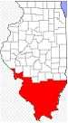 | |
|---|---|---|
| Mid-sized cities (25,000+) | ||
| Small Cities (10,000-25,000) | ||
| Small Cities (5,000-10,000) | ||
| Interstates | ||
| Airports/Military bases |
| |
| Universities | ||
| Colleges | ||
| Sports teams based in the Southern Illinois | ||
| Authority control |
|
|---|