Fowler, Michigan
Fowler is a village in Clinton County in the U.S. state of Michigan. The population was 1,208 at the 2010 census.
Fowler, Michigan | |
|---|---|
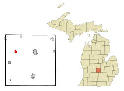 Location of Fowler, Michigan | |
| Coordinates: 43°0′8″N 84°44′25″W | |
| Country | United States |
| State | Michigan |
| County | Clinton |
| Area | |
| • Total | 1.31 sq mi (3.39 km2) |
| • Land | 1.28 sq mi (3.32 km2) |
| • Water | 0.03 sq mi (0.07 km2) |
| Elevation | 745 ft (227 m) |
| Population | |
| • Total | 1,208 |
| • Estimate (2019)[3] | 1,222 |
| • Density | 952.46/sq mi (367.84/km2) |
| Time zone | UTC-5 (Eastern (EST)) |
| • Summer (DST) | UTC-4 (EDT) |
| ZIP code | 48835 |
| Area code(s) | 989 |
| FIPS code | 26-30040[4] |
| GNIS feature ID | 0626354[5] |
History
Originally called "Dallas", Fowler was created when Robert Highman, Chief Engineer of the Detroit, Grand Haven, and Milwaukee Railroad, and E.A Wales acquired a tract of land along the railroad right-of-way in 1847. Dallas was later changed to Isabella and subsequently Fowler. The town subsequently moved to a tract of land 1/10 of a mile west of the original tract, owned by John N. Fowler[6] and in 1869 the name was changed to "Fowler". In 1885, the town incorporated as a village in Clinton County, reportedly during a high growth lumber boom.
Fowler remains a small rural community, serving the needs of the local farming community and as a satellite community to Lansing.
Geography
The village is located at approximately -84.739 Longitude and 43.002 Latitude in Dallas Township on M-21 about 10 miles (16 km) west of St. Johns and about 50 miles (80 km) east of Grand Rapids. It is about 20 miles (32 km) north of I-96 via county roads. The 48835 ZIP code centroid is located at -84.749958 longitude, 43.010137 Latitude, somewhat outside the incorporated city limits.
According to the United States Census Bureau, the village has a total area of 1.35 square miles (3.50 km2), of which 1.32 square miles (3.42 km2) is land and 0.03 square miles (0.08 km2) is water.[7]
Demographics
| Historical population | |||
|---|---|---|---|
| Census | Pop. | %± | |
| 1880 | 321 | — | |
| 1890 | 346 | 7.8% | |
| 1900 | 426 | 23.1% | |
| 1910 | 476 | 11.7% | |
| 1920 | 472 | −0.8% | |
| 1930 | 561 | 18.9% | |
| 1940 | 579 | 3.2% | |
| 1950 | 675 | 16.6% | |
| 1960 | 854 | 26.5% | |
| 1970 | 1,020 | 19.4% | |
| 1980 | 1,021 | 0.1% | |
| 1990 | 912 | −10.7% | |
| 2000 | 1,136 | 24.6% | |
| 2010 | 1,208 | 6.3% | |
| Est. 2019 | 1,222 | [3] | 1.2% |
| U.S. Decennial Census[8] | |||
2010 census
As of the census[2] of 2010, there were 1,208 people, 451 households, and 319 families living in the village. The population density was 915.2 inhabitants per square mile (353.4/km2). There were 488 housing units at an average density of 369.7 per square mile (142.7/km2). The racial makeup of the village was 98.1% White, 0.4% African American, 0.7% Asian, 0.2% from other races, and 0.6% from two or more races. Hispanic or Latino of any race were 2.5% of the population.
There were 451 households, of which 34.1% had children under the age of 18 living with them, 60.3% were married couples living together, 7.1% had a female householder with no husband present, 3.3% had a male householder with no wife present, and 29.3% were non-families. 24.2% of all households were made up of individuals, and 12.9% had someone living alone who was 65 years of age or older. The average household size was 2.68 and the average family size was 3.24.
The median age in the village was 36.1 years. 29.7% of residents were under the age of 18; 7.4% were between the ages of 18 and 24; 25.5% were from 25 to 44; 20% were from 45 to 64; and 17.3% were 65 years of age or older. The gender makeup of the village was 50.7% male and 49.3% female.
2000 census
As of the census[4] of 2000, there were 1,136 people, 428 households, and 306 families living in the village. The population density was 877.0 per square mile (337.4/km2). There were 446 housing units at an average density of 344.3 per square mile (132.5/km2). The racial makeup of the village was 100% White
There were 428 households, out of which 35.5% had children under the age of 18 living with them, 62.1% were married couples living together, 7.0% had a female householder with no husband present, and 28.3% were non-families. 23.8% of all households were made up of individuals, and 11.2% had someone living alone who was 65 years of age or older. The average household size was 2.64 and the average family size was 3.19.
In the village, the population was spread out, with 27.9% under the age of 18, 9.9% from 18 to 24, 28.9% from 25 to 44, 17.7% from 45 to 64, and 15.7% who were 65 years of age or older. The median age was 33 years. For every 100 females, there were 100.7 males. For every 100 females age 18 and over, there were 94.5 males.
The median income for a household in the village was $42,171, and the median income for a family was $56,625. Males had a median income of $40,134 versus $25,804 for females. The per capita income for the village was $18,123. About 2.7% of families and 4.0% of the population were below the poverty line, including 2.2% of those under age 18 and 6.7% of those age 65 or over.
Notable people
- Todd Simon, head coach of Southern Utah University men's basketball team
- Clem Sohn, daredevil, aviation pioneer
- Slicker Parks, baseball pitcher for University of Michigan and Detroit Tigers
References
- "2019 U.S. Gazetteer Files". United States Census Bureau. Retrieved July 25, 2020.
- "U.S. Census website". United States Census Bureau. Retrieved 2012-11-25.
- "Population and Housing Unit Estimates". United States Census Bureau. May 24, 2020. Retrieved May 27, 2020.
- "U.S. Census website". United States Census Bureau. Retrieved 2008-01-31.
- U.S. Geological Survey Geographic Names Information System: Fowler, Michigan
- Gannett, Henry (1905). The Origin of Certain Place Names in the United States. Govt. Print. Off. pp. 130.
- "US Gazetteer files 2010". United States Census Bureau. Archived from the original on 2012-07-02. Retrieved 2012-11-25.
- "Census of Population and Housing". Census.gov. Retrieved June 4, 2015.
External links
- Fowler Public School District
- U.S. Geological Survey Geographic Names Information System: Fowler, MI
Municipalities and communities of Clinton County, Michigan, United States | ||
|---|---|---|
| Cities | 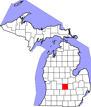 Map of Michigan highlighting Clinton County.svg | |
| Villages | ||
| Charter townships | ||
| General law townships | ||
| CDPs | ||
| Footnotes | ‡This populated place also has portions in an adjacent county or counties | |
| Authority control |
|
|---|