Flippin, Arkansas
Flippin is a city in Marion County, Arkansas, United States. The population was 1,355 at the 2010 census.
Flippin, Arkansas | |
|---|---|
.jpg) Sign in front of Flippin city hall | |
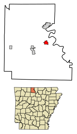 Location of Flippin in Marion County, Arkansas. | |
| Coordinates: 36°16′38″N 92°35′32″W | |
| Country | United States |
| State | Arkansas |
| County | Marion |
| Area | |
| • Total | 1.88 sq mi (4.88 km2) |
| • Land | 1.88 sq mi (4.88 km2) |
| • Water | 0.00 sq mi (0.00 km2) |
| Population (2010) | |
| • Total | 1,355 |
| • Estimate (2019)[2] | 1,322 |
| • Density | 702.07/sq mi (271.06/km2) |
| Time zone | UTC-6 (Central (CST)) |
| • Summer (DST) | UTC-5 (CDT) |
| ZIP code | 72634 |
| Area code(s) | 870 |
| FIPS code | 05-24010 |
Kelley Linck, a tourism official from Yellville, represents Marion, Searcy, Boone, and Baxter counties in the Arkansas House of Representatives. He is a Republican and a native of Flippin.
The town was named for the Thomas Flippin family and was incorporated in 1921.[3]
Geography
Flippin is located on a major non-interstate highway, US 412/62, in the Ozarks near the South Shore of Bull Shoals Lake. The town lies between the White River and the Buffalo National River.
According to the United States Census Bureau, the city has a total area of 1.8 square miles (4.7 km2), all land.
Climate
The climate in this area is characterized by hot, humid summers and generally mild to cool winters. According to the Köppen Climate Classification system, Flippin has a humid subtropical climate, abbreviated "Cfa" on climate maps.[4]
Demographics
| Historical population | |||
|---|---|---|---|
| Census | Pop. | %± | |
| 1930 | 325 | — | |
| 1940 | 332 | 2.2% | |
| 1950 | 646 | 94.6% | |
| 1960 | 433 | −33.0% | |
| 1970 | 626 | 44.6% | |
| 1980 | 1,072 | 71.2% | |
| 1990 | 1,006 | −6.2% | |
| 2000 | 1,357 | 34.9% | |
| 2010 | 1,355 | −0.1% | |
| Est. 2019 | 1,322 | [2] | −2.4% |
| U.S. Decennial Census[5] | |||
As of the census[6] of 2000, there were 1,357 people, 583 households, and 357 families residing in the city. The population density was 755.7 people per square mile (291.1/km2). There were 644 housing units at an average density of 358.7 per square mile (138.1/km2). The racial makeup of the city was 95.87% White, 0.44% Black or African American, 1.11% Native American, 0.29% Asian, 0.07% from other races, and 2.21% from two or more races. 0.81% of the population were Hispanic or Latino of any race.
There were 583 households, out of which 29.2% had children under the age of 18 living with them, 44.3% were married couples living together, 14.2% had a female householder with no husband present, and 38.6% were non-families. 33.4% of all households were made up of individuals, and 16.1% had someone living alone who was 65 years of age or older. The average household size was 2.33 and the average family size was 2.99.
In the city, the population was spread out, with 27.9% under the age of 18, 8.7% from 18 to 24, 27.6% from 25 to 44, 20.0% from 45 to 64, and 15.8% who were 65 years of age or older. The median age was 35 years. For every 100 females, there were 85.4 males. For every 100 females age 18 and over, there were 74.5 males.
Economy
Ranger Boats was founded in and continues to operate out of Flippin.
Ark-Plas, Diego's Fresh Mex, Subway, Micro Plastics, J&P Auto Sales, Wal-Mart, Flippin Public Schools, Marion County Government, Actronix, Parkview Pizza, NATCO, and Spirit Industries are top employers of Flippin citizens. Located close to the White River, tourism plays a vital role in the Flippin economy. Several resorts that feature trout fishing and lodging on the White River include: Cedarwood Lodge, Sportsman's Resort, Stetson's on the White, White Hole Resort and Wildcat Shoals Resort.
Education
Public education for elementary and secondary school students is provided by the Flippin School District and its three schools including Flippin High School.
Infrastructure
Highways
.svg.png)


.svg.png)
References
- "2019 U.S. Gazetteer Files". United States Census Bureau. Retrieved June 30, 2020.
- "Population and Housing Unit Estimates". United States Census Bureau. May 24, 2020. Retrieved May 27, 2020.
- "Flippin, Arkansas".
- Climate Summary for Flippin, Arkansas
- "Census of Population and Housing". Census.gov. Retrieved June 4, 2015.
- "U.S. Census website". United States Census Bureau. Retrieved 2008-01-31.
Municipalities and communities of Marion County, Arkansas, United States | ||
|---|---|---|
| Cities | 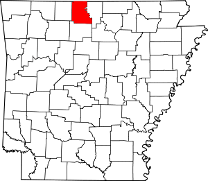 Map of Arkansas highlighting Marion County | |
| Town | ||
| Unincorporated communities | ||