Eutawville, South Carolina
Eutawville /juːˈtoʊvəl/ is a town in Orangeburg County, South Carolina, United States. Prior to 1910, Eutawville was located in the northwest portion of Saint James Goose Creek Township, Berkeley County. The population was 315 at the 2010 census.
Eutawville, South Carolina | |
|---|---|
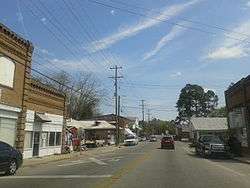 Central Eutawville in April, 2015 | |
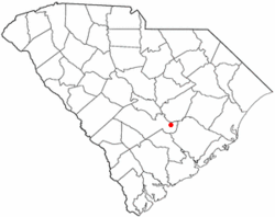 Location of Eutawville, South Carolina | |
| Coordinates: 33°24′N 80°21′W | |
| Country | United States |
| State | South Carolina |
| County | Orangeburg |
| Area | |
| • Total | 0.95 sq mi (2.47 km2) |
| • Land | 0.95 sq mi (2.47 km2) |
| • Water | 0.00 sq mi (0.00 km2) |
| Elevation | 108 ft (33 m) |
| Population (2010) | |
| • Total | 315 |
| • Estimate (2019)[2] | 290 |
| • Density | 304.62/sq mi (117.60/km2) |
| Time zone | UTC-5 (Eastern (EST)) |
| • Summer (DST) | UTC-4 (EDT) |
| ZIP code | 29048 |
| Area code(s) | 803, 839 |
| FIPS code | 45-24100[3] |
| GNIS feature ID | 1247697[4] |
| Website | www |
History
Eutawville takes its name from the Eutaw Spring.[5][6]
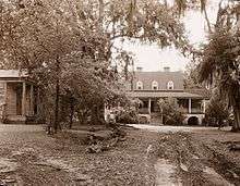
James Sinkler (died 1752) moved to America from Scotland in the early 1700s and settled near Bonneau, South Carolina. James Sinkler (1740–1800) and his wife Margaret Cantey moved to Upper St. John's Parish in 1785. William Sinkler (1787–1853), son of James and Margaret Cantey Sinkler and in turn his son, William Henry, owned Belvidere plantation in Eutawville.[7]
Eutawville was the site of the Battle of Eutaw Springs in 1781 during the American Revolutionary War. It was the last battle in the field in the southern states during the war.[8]
Eutaw Springs Battleground Park, Numertia Plantation, and St. Julien Plantation are listed on the National Register of Historic Places.[9]
Geography
Eutawville is located at 33°24′N 80°21′W (33.3938, -80.3448).[10] It sits near the Santee River.[8]
According to the United States Census Bureau, the town has a total area of 0.9 square miles (2.3 km2), all land.
Demographics
| Historical population | |||
|---|---|---|---|
| Census | Pop. | %± | |
| 1890 | 224 | — | |
| 1900 | 305 | 36.2% | |
| 1910 | 405 | 32.8% | |
| 1920 | 285 | −29.6% | |
| 1930 | 327 | 14.7% | |
| 1940 | 496 | 51.7% | |
| 1950 | 478 | −3.6% | |
| 1960 | 468 | −2.1% | |
| 1970 | 386 | −17.5% | |
| 1980 | 615 | 59.3% | |
| 1990 | 350 | −43.1% | |
| 2000 | 344 | −1.7% | |
| 2010 | 315 | −8.4% | |
| Est. 2019 | 290 | [2] | −7.9% |
| U.S. Decennial Census[11] | |||
As of the census[3] of 2000, there were 344 people, 134 households, and 92 families residing in the town. The population density was 371.7 people per square mile (142.8/km2). There were 161 housing units at an average density of 174.0 per square mile (66.8/km2). The racial makeup of the town was 65.99% White, 32.27% African American, 0.29% Native American, 0.29% from other races, and 1.16% from two or more races. Hispanic or Latino of any race were 0.58% of the population.
There were 134 households, out of which 27.6% had children under the age of 18 living with them, 47.0% were married couples living together, 18.7% had a female householder with no husband present, and 30.6% were non-families. 27.6% of all households were made up of individuals, and 11.2% had someone living alone who was 65 years of age or older. The average household size was 2.57 and the average family size was 3.11.
In the town, the population was spread out, with 26.2% under the age of 18, 8.4% from 18 to 24, 23.5% from 25 to 44, 26.7% from 45 to 64, and 15.1% who were 65 years of age or older. The median age was 40 years. For every 100 females, there were 84.9 males. For every 100 females age 18 and over, there were 91.0 males.
The median income for a household in the town was $21,136, and the median income for a family was $36,354. Males had a median income of $26,458 versus $21,750 for females. The per capita income for the town was $12,352. About 21.8% of families and 28.1% of the population were below the poverty line, including 34.0% of those under age 18 and 30.6% of those age 65 or over.
Climate
The climate in this area is characterized by relatively high temperatures and evenly distributed precipitation throughout the year. According to the Köppen Climate Classification system, Eutawville has a Humid subtropical climate, abbreviated "Cfa" on climate maps.[12]
| Climate data for Eutawville, South Carolina | |||||||||||||
|---|---|---|---|---|---|---|---|---|---|---|---|---|---|
| Month | Jan | Feb | Mar | Apr | May | Jun | Jul | Aug | Sep | Oct | Nov | Dec | Year |
| Average high °C (°F) | 15 (59) |
16 (60) |
20 (68) |
24 (75) |
28 (83) |
32 (89) |
32 (90) |
32 (90) |
30 (86) |
25 (77) |
20 (68) |
16 (60) |
24 (75) |
| Average low °C (°F) | 2 (36) |
3 (37) |
7 (44) |
11 (51) |
15 (59) |
19 (67) |
21 (70) |
21 (69) |
18 (64) |
12 (53) |
6 (42) |
2 (36) |
11 (52) |
| Average precipitation cm (inches) | 7.6 (3) |
9.4 (3.7) |
9.1 (3.6) |
7.9 (3.1) |
8.9 (3.5) |
12 (4.8) |
17 (6.5) |
15 (5.8) |
13 (5) |
6.4 (2.5) |
5.8 (2.3) |
8.4 (3.3) |
120 (47) |
| Source: Weatherbase [13] | |||||||||||||
References
- "2019 U.S. Gazetteer Files". United States Census Bureau. Retrieved July 29, 2020.
- "Population and Housing Unit Estimates". United States Census Bureau. May 24, 2020. Retrieved May 27, 2020.
- "U.S. Census website". United States Census Bureau. Retrieved 2008-01-31.
- "US Board on Geographic Names". United States Geological Survey. 2007-10-25. Retrieved 2008-01-31.
- Gannett, Henry (1905). The Origin of Certain Place Names in the United States. Govt. Print. Off. pp. 122.
- Dunkerly, Robert; Boland, Irene (2017). Eutaw Springs. Columbia: The University of South Carolina Press. pp. 27–30. ISBN 9781611177589.
- "South Caroliniana Library - University Libraries - University of South Carolina". library.sc.edu. Retrieved 31 July 2018.
- Chisholm, Hugh, ed. (1911). . Encyclopædia Britannica. 9 (11th ed.). Cambridge University Press. p. 957.
- "National Register Information System". National Register of Historic Places. National Park Service. July 9, 2010.
- "US Gazetteer files: 2010, 2000, and 1990". United States Census Bureau. 2011-02-12. Retrieved 2011-04-23.
- "Census of Population and Housing". Census.gov. Retrieved June 4, 2015.
- "Eutawville, South Carolina Köppen Climate Classification (Weatherbase)". Weatherbase. Retrieved 31 July 2018.
- "Weatherbase.com". Weatherbase. 2013. Retrieved on September 18, 2013.
External links
| Wikimedia Commons has media related to Eutawville, South Carolina. |
Municipalities and communities of Orangeburg County, South Carolina, United States | ||
|---|---|---|
| City | 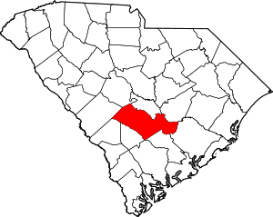 Map of South Carolina highlighting Orangeburg County | |
| Towns | ||
| CDPs | ||
| Unincorporated communities | ||