Ethelsville, Alabama
Ethelsville is a town in Pickens County, Alabama, United States. As of the 2010 census, the population of the town was 81, unchanged from 2000. The town was named after Ethel Hancock, a one time resident and staple of the community. It was incorporated in 1952.[3]
Ethelsville, Alabama | |
|---|---|
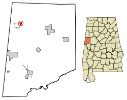 Location of Ethelsville in Pickens County, Alabama. | |
| Coordinates: 33°24′48″N 88°12′55″W | |
| Country | United States |
| State | Alabama |
| County | Pickens |
| Area | |
| • Total | 0.57 sq mi (1.47 km2) |
| • Land | 0.57 sq mi (1.47 km2) |
| • Water | 0.00 sq mi (0.00 km2) |
| Elevation | 364 ft (111 m) |
| Population (2010) | |
| • Total | 81 |
| • Estimate (2019)[2] | 73 |
| • Density | 128.75/sq mi (49.71/km2) |
| Time zone | UTC-6 (Central (CST)) |
| • Summer (DST) | UTC-5 (CDT) |
| ZIP code | 35461 |
| Area code(s) | 205, 659 |
| FIPS code | 01-24472 |
| GNIS feature ID | 0118045 |
Geography
Ethelsville is located at 33°24′49″N 88°12′56″W (33.413563, -88.215516).[4]
According to the U.S. Census Bureau, the town has a total area of 0.6 square miles (1.6 km2), all land.
Demographics
| Historical population | |||
|---|---|---|---|
| Census | Pop. | %± | |
| 1960 | 62 | — | |
| 1970 | 98 | 58.1% | |
| 1980 | 95 | −3.1% | |
| 1990 | 52 | −45.3% | |
| 2000 | 81 | 55.8% | |
| 2010 | 81 | 0.0% | |
| Est. 2019 | 73 | [2] | −9.9% |
| U.S. Decennial Census[5] | |||
As of the 2010 United States Census, there were 81 people living in the town. 74.1% were White and 25.9% were African American.
As of the census[6] of 2000, there were 81 people, 37 households, and 23 families living in the town. The population density was 143.2 people per square mile (54.9/km2). There were 43 housing units at an average density of 76.0 per square mile (29.1/km2). The racial makeup of the town was 86.42% White and 13.58% Black or African American.
There were 37 households, out of which 21.6% had children under the age of 18 living with them, 45.9% were married couples living together, 13.5% had a female householder with no husband present, and 37.8% were non-families. 29.7% of all households were made up of individuals, and 10.8% had someone living alone who was 65 years of age or older. The average household size was 2.19 and the average family size was 2.74.
In the town, the population was spread out, with 16.0% under the age of 18, 8.6% from 18 to 24, 28.4% from 25 to 44, 33.3% from 45 to 64, and 13.6% who were 65 years of age or older. The median age was 43 years. For every 100 females, there were 102.5 males. For every 100 females age 18 and over, there were 112.5 males.
The median income for a household in the town was $29,375, and the median income for a family was $43,125. Males had a median income of $24,063 versus $31,500 for females. The per capita income for the town was $15,341. There were 33.3% of families and 33.9% of the population living below the poverty line, including 22.2% of under eighteens and 28.6% of those over 64.
References
- "2019 U.S. Gazetteer Files". United States Census Bureau. Retrieved June 29, 2020.
- "Population and Housing Unit Estimates". United States Census Bureau. May 24, 2020. Retrieved May 27, 2020.
- https://news.google.com/newspapers?nid=1817&dat=19790722&id=nAgdAAAAIBAJ&sjid=BJ4EAAAAIBAJ&pg=5418,4346942&hl=en
- "US Gazetteer files: 2010, 2000, and 1990". United States Census Bureau. 2011-02-12. Retrieved 2011-04-23.
- "U.S. Decennial Census". Census.gov. Retrieved June 6, 2013.
- "U.S. Census website". United States Census Bureau. Retrieved 2008-01-31.
Municipalities and communities of Pickens County, Alabama, United States | ||
|---|---|---|
| Cities | 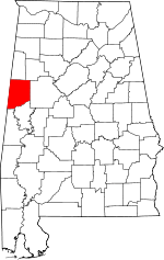 Map of Alabama highlighting Pickens County | |
| Towns | ||
| CDP | ||
| Unincorporated communities | ||