Eastford, Connecticut
Eastford is a town in Windham County, Connecticut, United States. The population was 1,618 at the 2000 census.
Eastford, Connecticut | |
|---|---|
 | |
 Seal | |
 Location in Windham County and the state of Connecticut. | |
| Coordinates: 41°53′37″N 72°05′49″W | |
| Country | United States |
| State | Connecticut |
| NECTA | Hartford |
| Region | Northeastern Connecticut |
| County | Windham |
| Incorporated | 1847 |
| Government | |
| • Type | Selectman-town meeting |
| • First selectman | Jacqueline Dubois (R) |
| • State Senator | Dan Champaigne (R-35th District) |
| • State Rep. | Pat Boyd (D-50th District) |
| Area | |
| • Total | 29.2 sq mi (75.6 km2) |
| • Land | 28.9 sq mi (74.8 km2) |
| • Water | 0.3 sq mi (0.9 km2) |
| Elevation | 653 ft (199 m) |
| Population (2005) | |
| • Total | 1,761 |
| • Density | 61/sq mi (24/km2) |
| Time zone | UTC-5 (Eastern) |
| • Summer (DST) | UTC-4 (Eastern) |
| ZIP code | 06242 |
| Area code(s) | 860 |
| FIPS code | 09-21860 |
| GNIS feature ID | 213420 |
| Major highways | |
| Website | www |
History
Eastford was formed in 1847 when it was broken off from Ashford, Connecticut. The name "Eastford" is locational, for the town is east of Ashford.[1]
Geography
According to the United States Census Bureau, the town has a total area of 29.2 square miles (76 km2), of which, 28.9 square miles (75 km2) of it is land and 0.3 square miles (0.78 km2) of it (1.20%) is water.
Principal Communities
- Phoenixville—A 1930s book describes it as "a small crossroads hamlet on Still River, which grew up around a twine mill (1831), now abandoned."[2]
- East Phoenixville
- North Ashford
On the National Register of Historic Places
- Benjamin Bosworth House — John Perry Rd. (added 1978)
- Natchaug Forest Lumber Shed — Kingsbury Rd., Natchaug State Forest (added 1986)
- Sumner-Carpenter House — 333 Old Colony Rd. (added 1991)
- Union Society of Phoenixville House — 4 Hartford Turnpike. (added 2007)
Demographics
| Historical population | |||
|---|---|---|---|
| Census | Pop. | %± | |
| 1850 | 1,127 | — | |
| 1860 | 1,005 | −10.8% | |
| 1870 | 984 | −2.1% | |
| 1880 | 855 | −13.1% | |
| 1890 | 561 | −34.4% | |
| 1900 | 523 | −6.8% | |
| 1910 | 513 | −1.9% | |
| 1920 | 496 | −3.3% | |
| 1930 | 529 | 6.7% | |
| 1940 | 496 | −6.2% | |
| 1950 | 598 | 20.6% | |
| 1960 | 746 | 24.7% | |
| 1970 | 922 | 23.6% | |
| 1980 | 1,028 | 11.5% | |
| 1990 | 1,314 | 27.8% | |
| 2000 | 1,618 | 23.1% | |
| 2010 | 1,749 | 8.1% | |
| Est. 2014 | 1,734 | [3] | −0.9% |
| U.S. Decennial Census[4] | |||
At the 2000 census there were 1,618 people, 618 households, and 451 families living in the town. The population density was 56.0 people per square mile (21.6/km2). There were 705 housing units at an average density of 24.4 per square mile (9.4/km2). The racial makeup of the town was 97.78% White, 0.43% African American, 0.19% Native American, 0.37% Asian, 0.31% from other races, and 0.93% from two or more races. Hispanic or Latino of any race were 1.36%.[5]
There were 618 households out of which 100 have children under the age of 18 living with them, 63.1% were married couples living together, 6.1% had a female householder with no husband present, and 27.0% were non-families. 21.8% of households were one person and 9.1% were one person aged 65 or older. The average household size was 2.62 and the average family size was 3.06.
The age distribution was 26.3% under the age of 18, 5.6% from 18 to 24, 29.2% from 25 to 44, 25.4% from 45 to 64, and 13.4% 65 or older. The median age was 39 years. For every 100 females, there were 103.0 males. For every 100 females age 18 and over, there were 101.0 males.
The median household income was $57,159 and the median family income was $62,031. Males had a median income of $45,000 versus $31,964 for females. The per capita income for the town was $25,364. About 4.4% of families and 6.0% of the population were below the poverty line, including 10.0% of those under age 18 and 3.7% of those age 65 or over.
| Voter Registration and Party Enrollment as of October 27, 2009[6] | |||||
|---|---|---|---|---|---|
| Party | Active Voters | Inactive Voters | Total Voters | Percentage | |
| Republican | 391 | 25 | 416 | 34.84% | |
| Democratic | 290 | 9 | 299 | 25.04% | |
| Unaffiliated | 437 | 38 | 475 | 39.78% | |
| Minor Parties | 0 | 0 | 0 | 0.0% | |
| Total | 1,121 | 73 | 1,194 | 100% | |
Education
Residents are zoned to the Eastford School District for grades Preschool through 8. The only school in the district is Eastford Elementary School. Most high schoolers attend Woodstock Academy. The town is near three alternative high schools: Ellis Vocational Technical School, Windham Technical School and Quinebaug Middle College.
Notable people
- Andrew T. Judson (1784–1853), United States federal judge and US Congressman.
- Nathaniel Lyon (1818–1861), the first Union General to be killed in the Civil War is buried here in his family plot.
Trivia
There was another Eastford in the state which was renamed East Windsor shortly after its separation from Windsor.
Eastford is the site of Frog Rock, a rest stop and roadside attraction on U.S. Route 44.[7]
References
- The Connecticut Magazine: An Illustrated Monthly. Connecticut Magazine Company. 1903. p. 332.
- Federal Writer's Project for the State of Connecticut. Connecticut; a Guide to Its Roads, Lore, and People. p. 434. Retrieved May 29, 2013.
- "Annual Estimates of the Resident Population for Incorporated Places: April 1, 2010 to July 1, 2014". Archived from the original on May 23, 2015. Retrieved June 4, 2015.
- "Census of Population and Housing". Census.gov. Retrieved June 4, 2015.
- "U.S. Census website". United States Census Bureau. Retrieved 2008-01-31.
- "Registration and Party Enrollment Statistics as of October 27, 2009" (PDF). Connecticut Secretary of State. Archived from the original (PDF) on June 17, 2010. Retrieved 2010-08-14.
- Haar, Dan (2014-08-18). "The Best Of Americana At Frog Rock Rest Stop". The Hartford Courant. Retrieved 2020-08-09.
External links
| Wikimedia Commons has media related to Eastford, Connecticut. |

Municipalities and communities of Windham County, Connecticut, United States | ||
|---|---|---|
| Towns | 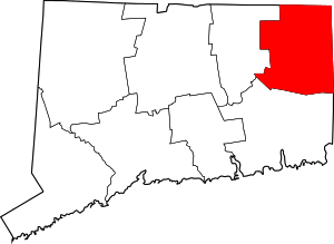 | |
| Borough | ||
| Former cities |
| |
| Other communities |
| |
| Authority control |
|
|---|