East Washington, Pennsylvania
East Washington is a borough in Washington County, Pennsylvania, United States. The population was 2,234 at the 2010 census.
East Washington | |
|---|---|
 Historic homes on South Wade Avenue | |
 Location of East Washington in Washington County, Pennsylvania. | |
 East Washington Location of East Washington in Pennsylvania | |
| Coordinates: 40°10′26″N 80°14′2″W | |
| Country | United States |
| State | Pennsylvania |
| County | Washington |
| Established | 1892 |
| Government | |
| • Mayor | Michael Gomber |
| Area | |
| • Total | 0.45 sq mi (1.16 km2) |
| • Land | 0.45 sq mi (1.16 km2) |
| • Water | 0.00 sq mi (0.00 km2) |
| Population (2010) | |
| • Total | 2,234 |
| • Estimate (2019)[2] | 1,810 |
| • Density | 4,031.18/sq mi (1,556.91/km2) |
| Time zone | UTC-4 (EST) |
| • Summer (DST) | UTC-5 (EDT) |
| Area code(s) | 724 |
| Website | www.eastwash.com |
History
The East Washington Historic District was listed on the National Register of Historic Places in 1984.[3]
Geography
East Washington is located at 40°10′26″N 80°14′2″W (40.173799, -80.233945).[4]
According to the United States Census Bureau, the borough has a total area of 0.5 square miles (1.3 km2), all of it land.
Demographics
| Historical population | |||
|---|---|---|---|
| Census | Pop. | %± | |
| 1900 | 1,051 | — | |
| 1910 | 1,300 | 23.7% | |
| 1920 | 1,561 | 20.1% | |
| 1930 | 1,859 | 19.1% | |
| 1940 | 2,106 | 13.3% | |
| 1950 | 2,304 | 9.4% | |
| 1960 | 2,483 | 7.8% | |
| 1970 | 2,198 | −11.5% | |
| 1980 | 2,241 | 2.0% | |
| 1990 | 2,126 | −5.1% | |
| 2000 | 1,930 | −9.2% | |
| 2010 | 2,234 | 15.8% | |
| Est. 2019 | 1,810 | [2] | −19.0% |
| Sources:[5][6][7] | |||
At the 2000 census there were 1,930 people, 903 households, and 492 families living in the borough. The population density was 4,225.3 people per square mile (1,620.0/km²). There were 983 housing units at an average density of 2,152.1 per square mile (825.1/km²). The racial makeup of the borough was 94.04% White, 4.25% African American, 0.21% Native American, 0.36% Asian, 0.10% Pacific Islander, 0.05% from other races, and 0.98% from two or more races. Hispanic or Latino of any race were 0.21%.[6]
There were 903 households, 23.4% had children under the age of 18 living with them, 42.9% were married couples living together, 9.1% had a female householder with no husband present, and 45.5% were non-family households. 38.2% of households were one person and 12.2% were one person aged 65 or older. The average household size was 2.14 and the average family size was 2.82.
The age distribution was 20.3% under the age of 18, 10.1% from 18 to 24, 28.9% from 25 to 44, 25.7% from 45 to 64, and 15.0% 65 or older. The median age was 40 years. For every 100 females, there were 90.7 males. For every 100 females age 18 and over, there were 84.4 males.
The median household income was $41,319 and the median family income was $65,625. Males had a median income of $47,266 versus $27,414 for females. The per capita income for the borough was $32,852. About 5.4% of families and 9.8% of the population were below the poverty line, including 8.4% of those under age 18 and none of those age 65 or over.
References
- "2019 U.S. Gazetteer Files". United States Census Bureau. Retrieved July 28, 2020.
- "Population and Housing Unit Estimates". United States Census Bureau. May 24, 2020. Retrieved May 27, 2020.
- "National Register Information System". National Register of Historic Places. National Park Service. July 9, 2010.
- "US Gazetteer files: 2010, 2000, and 1990". United States Census Bureau. 2011-02-12. Retrieved 2011-04-23.
- "Census of Population and Housing". U.S. Census Bureau. Retrieved 11 December 2013.
- "U.S. Census website". United States Census Bureau. Retrieved 2008-01-31.
- "Incorporated Places and Minor Civil Divisions Datasets: Subcounty Resident Population Estimates: April 1, 2010 to July 1, 2012". Population Estimates. U.S. Census Bureau. Archived from the original on 11 June 2013. Retrieved 11 December 2013.
External links
Pittsburgh metropolitan area | ||
|---|---|---|
| Counties | 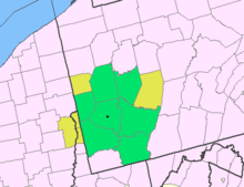 Map of the Pittsburgh Tri-State with green counties in the metropolitan area and yellow counties in the combined area | |
| Major cities | ||
| Cities and towns 15k–50k (in 2010) | ||
| Airports | ||
| Topics | ||
| ||

| Authority control |
|
|---|