Deerpark, New York
Deerpark is a town in the western part of Orange County, New York. As of the 2010 Census, the population was at 7,901. The center of population of New York is located in Cuddebackville, a hamlet in Deerpark.[3]
Deerpark | |
|---|---|
Town | |
 Location in the state of New York and the US. | |
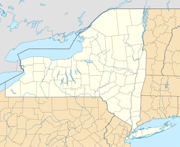 Deerpark Location in the state of New York and the US.  Deerpark Deerpark (the United States) | |
| Coordinates: 41°27′N 74°39′W | |
| Country | |
| State | New York |
| County | Orange |
| Government | |
| • Town Supervisor | Gary Spears (R, C, I) |
| Area | |
| • Total | 67.95 sq mi (175.98 km2) |
| • Land | 66.50 sq mi (172.23 km2) |
| • Water | 1.45 sq mi (3.75 km2) |
| Population (2010) | |
| • Total | 7,901 |
| • Estimate (2016)[2] | 7,741 |
| • Density | 116.41/sq mi (44.95/km2) |
| Time zone | EST |
| • Summer (DST) | EDT |
| Area code(s) | 845 |
| FIPS code | 36-071-19961 |
| Website | The Town of Deerpark Website |
History
Dutch colonists attempted to settle the town in the 17th Century. The town was organized in 1798 after Port Jervis was set apart from the territory. The town was part of the boundary dispute between New York and New Jersey, which was not settled until 1773.
The former Delaware and Hudson Canal ran through the town.
Geography
According to the United States Census Bureau, the town has a total area of 67.9 square miles (176 km2), of which, 66.4 square miles (172 km2) of it is land and 1.5 square miles (3.9 km2) of it (2.14%) is water. It is considered the second largest town in area in Orange County.
The southwest town line is the border of Pennsylvania, marked by the Delaware River. The western and northern town lines are the border of Sullivan County, New York. The Neversink River flows through the town. The city of Port Jervis is located in the southern corner of the town, and a small portion of the town borders on Montague Township, New Jersey.
US Route 209 parallels the course of the Neversink River. The Hawk's Nest scenic overlook along New York State Route 97 offers views of the Delaware River. Interstate 84 passes through the southern portion of town near the New Jersey state line.
Demographics
| Historical population | |||
|---|---|---|---|
| Census | Pop. | %± | |
| 1820 | 1,340 | — | |
| 1830 | 1,167 | −12.9% | |
| 1840 | 1,607 | 37.7% | |
| 1850 | 4,032 | 150.9% | |
| 1860 | 5,186 | 28.6% | |
| 1870 | 9,387 | 81.0% | |
| 1880 | 11,420 | 21.7% | |
| 1890 | 2,156 | −81.1% | |
| 1900 | 1,932 | −10.4% | |
| 1910 | 1,696 | −12.2% | |
| 1920 | 1,615 | −4.8% | |
| 1930 | 1,779 | 10.2% | |
| 1940 | 2,227 | 25.2% | |
| 1950 | 2,519 | 13.1% | |
| 1960 | 2,777 | 10.2% | |
| 1970 | 4,370 | 57.4% | |
| 1980 | 5,633 | 28.9% | |
| 1990 | 7,832 | 39.0% | |
| 2000 | 7,858 | 0.3% | |
| 2010 | 7,901 | 0.5% | |
| Est. 2016 | 7,741 | [2] | −2.0% |
| U.S. Decennial Census[4] | |||
As of the census[5] of 2000, there were 7,858 people, 2,906 households, and 2,115 families residing in the town. The population density was 118.3 people per square mile (45.7/km2). There were 3,332 housing units at an average density of 50.2 per square mile (19.4/km2). The racial makeup of the town was 90.52% White, 5.54% African American, 0.27% Native American, 0.57% Asian, 0.74% from other races, and 1.36% from two or more races. Hispanic or Latino of any race were 5.82% of the population.
There were 2,906 households out of which 35.7% had children under the age of 18 living with them, 58.4% were married couples living together, 9.0% had a female householder with no husband present, and 27.2% were non-families. 20.9% of all households were made up of individuals and 7.9% had someone living alone who was 65 years of age or older. The average household size was 2.70 and the average family size was 3.12.
In the town, the population was spread out with 27.5% under the age of 18, 6.3% from 18 to 24, 29.4% from 25 to 44, 25.8% from 45 to 64, and 11.0% who were 65 years of age or older. The median age was 38 years. For every 100 females, there were 100.1 males. For every 100 females age 18 and over, there were 97.5 males.
The median income for a household in the town was $45,000, and the median income for a family was $49,987. Males had a median income of $40,070 versus $25,642 for females. The per capita income for the town was $18,252. About 7.4% of families and 14.8% of the population were below the poverty line, including 10.9% of those under age 18 and 5.5% of those age 65 or over.
Communities and locations

- Cahoonzie – A hamlet in the western part of the town on NY-42.
- Cuddebackville – A hamlet at the intersection of US-209 and NY-211, located about ten miles north of Port Jervis. The community was named after Colonel William Cuddeback, the original owner of the site.[6]
- Dragon Springs – A compound of the Falun Gong movement, home to its leader Li Hongzhi and many of his followers.
- Godeffroy – A small hamlet south of Cuddebackville on US-209.
- Huguenot – A hamlet north of Port Jervis on US-209. Huguenot Schoolhouse and Neversink Valley Grange Hall No. 1530 are listed on the National Register of Historic Places.[7][8]
- Montague Valley Wildlife Management Area – A conservation area near Cahoonzie.
- Paradise – A hamlet on County Road 7 by the north town line.
- Port Orange – A hamlet north of Cuddebackville on US-209.
- Prospect Hill – A hamlet west of Cuddebackville.
- Rio – A hamlet on NY-42 near the north town line. Cottage in the Pines was listed on the National Register of Historic Places in 2015.[9]
- Roses Point – A location south of Cuddebackville on US-209.
- Sparrowbush – A hamlet west of Port Jervis on NY-42 and the Delaware River.
- Westbrookville – A hamlet north of Cuddebackville on US-209
References
- Notes
- "2016 U.S. Gazetteer Files". United States Census Bureau. Retrieved Jul 5, 2017.
- "Population and Housing Unit Estimates". Retrieved June 9, 2017.
- "State Centers" U.S. Census Bureau
- "Census of Population and Housing". Census.gov. Retrieved June 4, 2015.
- "U.S. Census website". United States Census Bureau. Retrieved 2008-01-31.
- Eager, Samuel Watkins (1846). An Outline History of Orange County: Together with Local Tradition and Short Biographical Sketches of Early Settlers, Etc. T. E. Henderson. p. 394.
- "National Register Information System". National Register of Historic Places. National Park Service. July 9, 2010.
- "National Register of Historic Places Listings". Weekly List of Actions Taken on Properties: 12/09/13 through 12/13/13. National Park Service. 2013-12-20.
- "National Register of Historic Places Listings". Weekly List of Actions Taken on Properties: 10/19/15 through 10/23/15. National Park Service. 2015-10-13.
External links
| Wikimedia Commons has media related to Deerpark, New York. |
Municipalities and communities of Orange County, New York, United States | ||
|---|---|---|
| Cities | 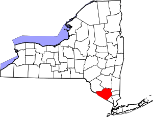 | |
| Towns | ||
| Villages | ||
| CDPs | ||
| Other hamlets |
| |
| Authority control |
|---|