Creutzwald
Creutzwald (German: Kreuzwald) is a commune in the Moselle département in Grand Est in north-eastern France.
Creutzwald | |
|---|---|
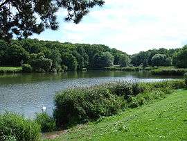 Creutzwald Lake | |
.svg.png) Coat of arms | |
Location of Creutzwald 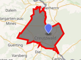
| |
 Creutzwald 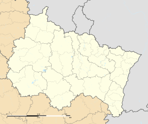 Creutzwald | |
| Coordinates: 49°12′00″N 6°41′00″E | |
| Country | France |
| Region | Grand Est |
| Department | Moselle |
| Arrondissement | Forbach-Boulay-Moselle |
| Canton | Boulay-Moselle |
| Intercommunality | Warndt |
| Government | |
| • Mayor (2007–2008) | Jean-Luc Wozniak |
| Area 1 | 26.72 km2 (10.32 sq mi) |
| Population (2017-01-01)[1] | 13,095 |
| • Density | 490/km2 (1,300/sq mi) |
| Time zone | UTC+01:00 (CET) |
| • Summer (DST) | UTC+02:00 (CEST) |
| INSEE/Postal code | 57160 /57150 |
| Elevation | 198–334 m (650–1,096 ft) (avg. 219 m or 719 ft) |
| 1 French Land Register data, which excludes lakes, ponds, glaciers > 1 km2 (0.386 sq mi or 247 acres) and river estuaries. | |
With Germany, it manages the Warndt forest.
History
The town was formed in 1810, by the merging of the three villages of La Croix, La Houve, and Wilhelmsbronn. It continued to be known as Creutzwald-la-Croix until 1961, when the name was simplified. Until that point, it had been redundant, as the German word Kreuz, and French Croix both mean "cross".
Creutzwald was the last town in France to have a working coal mine, in La Houve, which closed on 23 April 2004.
Administration
Together with the municipalities of Bisten-en-Lorraine, Guerting, Ham-sous-Varsberg and Varsberg, it forms the Communauté de communes of Warndt. Although Creutzwald is the largest town in terms of population in its Canton, the administrative centre is Bouzonville. This is due to demographic changes since the 19th century, as in 1885, there were 1698 inhabitants in Bouzonville, and only 1493 in Creutzwald.
See also
External links
| Wikimedia Commons has media related to Creutzwald. |
| Authority control |
|
|---|
- "Populations légales 2017". INSEE. Retrieved 6 January 2020.