Corinth, Arkansas
Corinth is a town in Yell County, Arkansas, United States. The population was 65 at the 2000 census. It is part of the Russellville Micropolitan Statistical Area.
Corinth, Arkansas | |
|---|---|
 Location of Corinth in Yell County, Arkansas. | |
| Coordinates: 35°3′28″N 93°25′54″W | |
| Country | United States |
| State | Arkansas |
| County | Yell |
| Area | |
| • Total | 3.15 sq mi (8.16 km2) |
| • Land | 3.09 sq mi (8.00 km2) |
| • Water | 0.06 sq mi (0.15 km2) |
| Elevation | 351 ft (107 m) |
| Population (2010) | |
| • Total | 70 |
| • Estimate (2019)[2] | 67 |
| • Density | 21.68/sq mi (8.37/km2) |
| Time zone | UTC−6 (Central (CST)) |
| • Summer (DST) | UTC−5 (CDT) |
| ZIP Code | 72824 |
| Area code(s) | 479 |
| FIPS code | 05-15310 |
| GNIS feature ID | 0071230 |
History
According to a few residences, who have lived in the community since incorporation, a group of landowners got together in thoughts of incorporating, back when the city of Belleville was a bustling town (due to the railroad that went through the town at the time). The city was wanting to acquire portions of the land that is now Corinth. The landowners, who did not want to be taxed city tax, filed to incorporate their land into what is now known as Corinth Arkansas.
Geography
Corinth is located at 35°3′28″N 93°25′54″W (35.057769, -93.431629).[3]
According to the United States Census Bureau, the town has a total area of 8.4 km2 (3.2 mi2), of which 8.1 km2 (3.1 mi2) is land and 0.3 km2 (0.1 mi2) (4.00%) is water.
Demographics
| Historical population | |||
|---|---|---|---|
| Census | Pop. | %± | |
| 1980 | 38 | — | |
| 1990 | 63 | 65.8% | |
| 2000 | 65 | 3.2% | |
| 2010 | 70 | 7.7% | |
| Est. 2019 | 67 | [2] | −4.3% |
| U.S. Decennial Census[4] 2014 Estimate[5] | |||
As of the census[6] of 2000, there were 65 people, 25 households, and 18 families residing in the town. The population density was 8.0/km2 (20.8/mi2). There were 29 housing units at an average density of 3.6/km2 (9.3/mi2). The racial makeup of the town was 96.92% White, 3.08% from other races. 24.62% of the population were Hispanic or Latino of any race.
There were 25 households, out of which 24.0% had children under the age of 18 living with them, 60.0% were married couples living together, 8.0% had a female householder with no husband present, and 28.0% were non-families. Of all households 28.0% were made up of individuals, and 12.0% had someone living alone who was 65 years of age or older. The average household size was 2.60 and the average family size was 3.22.
In the town, the population was spread out, with 21.5% under the age of 18, 12.3% from 18 to 24, 24.6% from 25 to 44, 26.2% from 45 to 64, and 15.4% who were 65 years of age or older. The median age was 36 years. For every 100 females, there were 124.1 males. For every 100 females age 18 and over, there were 131.8 males.
The median income for a household in the town was $28,125, and the median income for a family was $44,375. Males had a median income of $16,607 versus $19,167 for females. The per capita income for the town was $10,926. There were 9.1% of families and 10.6% of the population living below the poverty line, including no under eighteens and 5.9% of those over 64.
Education
Public education for early childhood, elementary and secondary school students is available from Danville School District, which leads to graduation from Danville High School.
References
- "2019 U.S. Gazetteer Files". United States Census Bureau. Retrieved June 30, 2020.
- "Population and Housing Unit Estimates". United States Census Bureau. May 24, 2020. Retrieved May 27, 2020.
- "US Gazetteer files: 2010, 2000, and 1990". United States Census Bureau. 2011-02-12. Retrieved 2011-04-23.
- "Census of Population and Housing". Census.gov. Retrieved June 4, 2015.
- "Annual Estimates of the Resident Population for Incorporated Places: April 1, 2010 to July 1, 2014". Archived from the original on May 22, 2015. Retrieved June 4, 2015.
- "U.S. Census website". United States Census Bureau. Retrieved 2008-01-31.
Municipalities and communities of Yell County, Arkansas, United States | ||
|---|---|---|
| Cities | 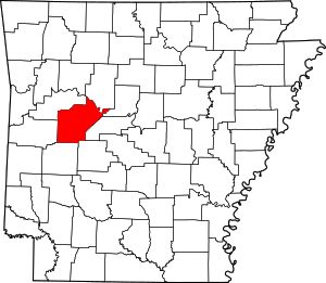 Map of Arkansas highlighting Yell County | |
| Town | ||
| Unincorporated communities | ||
| Footnotes | ‡This populated place also has portions in an adjacent county or counties | |