Claremont, North Carolina
Claremont is a city in Catawba County, North Carolina, United States. The population was 1,352 at the 2010 census.[5] It is part of the Hickory–Lenoir–Morganton Metropolitan Statistical Area.
Claremont, North Carolina | |
|---|---|
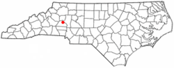 Location of Claremont, North Carolina | |
| Coordinates: 35°42′50″N 81°9′2″W | |
| Country | United States |
| State | North Carolina |
| County | Catawba |
| Area | |
| • Total | 2.98 sq mi (7.71 km2) |
| • Land | 2.98 sq mi (7.71 km2) |
| • Water | 0.00 sq mi (0.00 km2) |
| Elevation | 981 ft (299 m) |
| Population (2010) | |
| • Total | 1,352 |
| • Estimate (2019)[2] | 1,408 |
| • Density | 472.80/sq mi (182.58/km2) |
| Time zone | UTC-5 (Eastern (EST)) |
| • Summer (DST) | UTC-4 (EDT) |
| ZIP code | 28610 |
| Area code(s) | 828 |
| FIPS code | 37-12720[3] |
| GNIS feature ID | 1019681[4] |
| Website | cityofclaremont |
History
The Bunker Hill Covered Bridge and Rock Barn Farm are listed on the National Register of Historic Places.[6]
Geography
Claremont is located east of the center of Catawba County at 35°42′50″N 81°9′2″W (35.713752, -81.150661).[7] U.S. Route 70 passes through the center of town, leading west 4 miles (6 km) to Conover and east 4 miles (6 km) to Catawba. Interstate 40 passes just north of the town, with access from Exit 135. I-40 leads west 12 miles (19 km) to Hickory and east 16 miles (26 km) to Statesville.
According to the United States Census Bureau, Claremont has a total area of 2.7 square miles (7.1 km2), all land.[5]
Demographics
| Historical population | |||
|---|---|---|---|
| Census | Pop. | %± | |
| 1900 | 160 | — | |
| 1910 | 297 | 85.6% | |
| 1920 | 435 | 46.5% | |
| 1930 | 368 | −15.4% | |
| 1940 | 467 | 26.9% | |
| 1950 | 669 | 43.3% | |
| 1960 | 728 | 8.8% | |
| 1970 | 788 | 8.2% | |
| 1980 | 880 | 11.7% | |
| 1990 | 980 | 11.4% | |
| 2000 | 1,038 | 5.9% | |
| 2010 | 1,352 | 30.3% | |
| Est. 2019 | 1,408 | [2] | 4.1% |
| U.S. Decennial Census[8] | |||
As of the census[3] of 2010, there were 1,355 people, 456 households, and 300 families residing in the city. The population density was 542.0 people per square mile (159.7/km2). There were 492 housing units at an average density of 196.3 per square mile (75.7/km2). The racial makeup of the city was 95.66% White, 2.22% African American, 0.10% Native American, 0.87% Asian, 0.67% from other races, and 0.48% from two or more races. Hispanic or Latino of any race were 2.99% of the population.
There were 456 households, out of which 27.2% had children under the age of 18 living with them, 55.3% were married couples living together, 8.1% had a female householder with no husband present, and 34.0% were non-families. 28.5% of all households were made up of individuals, and 12.9% had someone living alone who was 65 years of age or older. The average household size was 2.28 and the average family size was 2.79.
In the city, the population was spread out, with 20.2% under the age of 18, 8.9% from 18 to 24, 31.6% from 25 to 44, 25.9% from 45 to 64, and 13.4% who were 65 years of age or older. The median age was 38 years. For every 100 females, there were 97.7 males. For every 100 females age 18 and over, there were 92.1 males.
The median income for a household in the city was $40,652, and the median income for a family was $49,886. Males had a median income of $30,543 versus $22,500 for females. The per capita income for the city was $21,097. About 5.3% of families and 7.0% of the population were below the poverty line, including 10.8% of those under age 18 and 15.3% of those age 65 or over.
Notable people
- Landon Huffman, competes in the NASCAR Camping World Truck Series
- Robert Huffman, former NASCAR driver
- Tricia Andreassen, Multi-Time Best Selling Author, Speaker and Media Personality
Media
- The Claremont Courier, free monthly publication
References
- "2019 U.S. Gazetteer Files". United States Census Bureau. Retrieved July 27, 2020.
- "Population and Housing Unit Estimates". United States Census Bureau. May 24, 2020. Retrieved May 27, 2020.
- "U.S. Census website". United States Census Bureau. Retrieved 2008-01-31.
- "US Board on Geographic Names". United States Geological Survey. 2007-10-25. Retrieved 2008-01-31.
- "Geographic Identifiers: 2010 Demographic Profile Data (G001): Claremont city, North Carolina". U.S. Census Bureau, American Factfinder. Archived from the original on February 12, 2020. Retrieved December 29, 2014.
- "National Register Information System". National Register of Historic Places. National Park Service. July 9, 2010.
- "US Gazetteer files: 2010, 2000, and 1990". United States Census Bureau. 2011-02-12. Retrieved 2011-04-23.
- "Census of Population and Housing". Census.gov. Retrieved June 4, 2015.
External links
Municipalities and communities of Catawba County, North Carolina, United States | ||
|---|---|---|
| Cities | 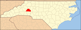 Catawba County map | |
| Towns | ||
| CDPs | ||
| Unincorporated communities |
| |
| Footnotes | ‡This populated place also has portions in an adjacent county or counties | |