Chehalis, Washington
Chehalis (/ʃəˈheɪlɪs/ (![]()
Chehalis, Washington | |
|---|---|
 | |
| Nickname(s): the Rose City | |
 Location of Chehalis, Washington | |
| Coordinates: 46°39′36″N 122°57′48″W | |
| Country | United States |
| State | Washington |
| County | Lewis |
| Area | |
| • Total | 5.88 sq mi (15.23 km2) |
| • Land | 5.81 sq mi (15.04 km2) |
| • Water | 0.07 sq mi (0.19 km2) |
| Elevation | 243 ft (74 m) |
| Population | |
| • Total | 7,259 |
| • Estimate (2019)[3] | 7,654 |
| • Density | 1,318.06/sq mi (508.88/km2) |
| Time zone | UTC-8 (Pacific (PST)) |
| • Summer (DST) | UTC-7 (PDT) |
| ZIP code | 98532 |
| Area code(s) | 360 Exchanges: 740,748 |
| FIPS code | 53-11475 |
| GNIS feature ID | 1503929[4] |
| Website | Ci.Chehalis.WA.US |
Etymology
The Native American Chehalis people described, using their language and pronunciation, a location and village in present-day Westport, Washington that translates to American English as "place of sand" or "shifting sand".[6] Early non-native explorers of the Pacific Northwest vocalized the words as "Chehalis" and proceeded to describe the original inhabitants as such.
In 1879, the town of Saundersville, Washington, named after S.S. Saunders on whose donation land claim it was founded, began to officially use the word "Chehalis" to denote its location to the Chehalis people and the Chehalis River. The translations were also fitting for the growing town due to the muddy bottomland along the Chehalis River which had long vexed stagecoach travelers on the Washington arm of the Oregon Trail between Kalama and New Market (now Tumwater).[7]
History
Chehalis began as a settlement around a warehouse beside a railroad track in 1873, when the Northern Pacific Railroad built northward from Kalama to Tacoma, and ignored Claquato, then the county seat three miles to the west[8]. After the Northern Pacific bypassed Claquato, the county seat was moved to Chehalis, leaving Claquato little more than a historical landmark. By 1874, a store was added to the warehouse, and a courthouse and several houses were constructed[9]. Chehalis was incorporated on November 23, 1883.[10]
Logging soon began in the nearby forests. Lumber workers of Scandinavian, English, and Scots-Irish descent arrived and settled in the neighboring valleys[11]. In 1940, the chief local industries were: dairying, poultry raising, fruit growing, milk condensing, fruit and vegetable packing, brick and tile manufacturing, coal mining, portable house manufacturing, and fern shipping.
Geography
According to the U.S. Census Bureau, the city has a total area of 5.55 square miles (14.37 km2), of which, 5.53 square miles (14.32 km2) is land and 0.02 square miles (0.05 km2) is water.[12]
The city straddles Interstate 5 at a point almost exactly halfway between Seattle, Washington and Portland, Oregon. The historic downtown and most of the city's amenities lie on the east side of the freeway, nestled at the base of a small range of forested hills. On the west side of the freeway are parks, farms, a few subdivisions developed in the hills to the west, and a centralized shopping district, the Twin City Town Center.[13] The Chehalis–Centralia Airport (CLS) is located immediately west of the freeway towards the northern end of the city. From numerous vantage points in the hills just west of town, one can see Mount Rainier, Mount Adams, and Mount St. Helens—weather permitting. Chehalis is a frequented stop by bicyclists while on the annual Seattle to Portland Bicycle Classic.
The Chehalis River winds its way through the valley in which the city resides, and is joined by a tributary, the Newaukum River. This confluence of waters, along with the intersections of tributaries and railroads within Chehalis, helped the city become known as "The Maple Leaf City".[14] Both the Chehalis and Newaukum rivers are prone to flooding during periods of abnormally heavy or persistent rain, and the lowlands from the freeway westward are particularly susceptible to inundation. A variety of local groups, scientists, and government have organized a partnership called "The Chehalis Basin Strategy" to propose and research a combination of plans along the Chehalis River to mitigate flooding and to restore aquatic habitat for local Chinook salmon.[15] The current proposal outlines several flood control reduction measures, including levee improvements at the local airport and a flood retention dam in Pe Ell.[16]
Climate
This region experiences warm (but not hot) and dry summers, with no average monthly temperatures above 71.6 °F. According to the Köppen Climate Classification system, Chehalis has a warm-summer Mediterranean climate, abbreviated "Csb" on climate maps.[17]
Demographics

| Historical population | |||
|---|---|---|---|
| Census | Pop. | %± | |
| 1890 | 1,309 | — | |
| 1900 | 1,775 | 35.6% | |
| 1910 | 4,507 | 153.9% | |
| 1920 | 4,558 | 1.1% | |
| 1930 | 4,907 | 7.7% | |
| 1940 | 4,857 | −1.0% | |
| 1950 | 5,639 | 16.1% | |
| 1960 | 5,199 | −7.8% | |
| 1970 | 5,727 | 10.2% | |
| 1980 | 6,100 | 6.5% | |
| 1990 | 6,527 | 7.0% | |
| 2000 | 7,057 | 8.1% | |
| 2010 | 7,259 | 2.9% | |
| Est. 2019 | 7,654 | [3] | 5.4% |
| U.S. Decennial Census[18] 2018 Estimate[19] | |||
2010 census
As of the census[2] of 2010, there were 7,259 people, 2,868 households, and 1,655 families residing in the city. The population density was 1,312.7 inhabitants per square mile (506.8/km2). There were 3,131 housing units at an average density of 566.2 per square mile (218.6/km2). The racial makeup of the city was 87.0% White, 1.7% African American, 1.3% Native American, 1.3% Asian, 0.2% Pacific Islander, 5.7% from other races, and 2.8% from two or more races. Hispanic or Latino of any race were 11.6% of the population.
There were 2,868 households, of which 31.1% had children under the age of 18 living with them, 36.9% were married couples living together, 14.9% had a female householder with no husband present, 6.0% had a male householder with no wife present, and 42.3% were non-families. 35.3% of all households were made up of individuals, and 16.8% had someone living alone who was 65 years of age or older. The average household size was 2.36 and the average family size was 3.02.
The median age in the city was 33.5 years. 24.5% of residents were under the age of 18; 12.5% were between the ages of 18 and 24; 25.9% were from 25 to 44; 22.6% were from 45 to 64; and 14.4% were 65 years of age or older. The gender makeup of the city was 50.2% male and 49.8% female.
2000 census
As of the census of 2000, there were 7,057 people, 2,671 households, and 1,696 families residing in the city. The population density was 1,259.0 people per square mile (485.7/km2). There were 2,871 housing units at an average density of 512.2 per square mile (197.6/km2). The racial makeup of the city was 89.56% White, 1.35% African American, 1.46% Native American, 1.20% Asian, 0.24% Pacific Islander, 3.95% from other races, and 2.24% from two or more races. Hispanic or Latino of any race were 7.91% of the population. 18.4% were of German, 11.0% English, 11.0% American and 8.4% Irish ancestry.
There were 2,671 households, out of which 33.2% had children under the age of 18 living with them, 43.8% were married couples living together, 14.4% had a female householder with no husband present, and 36.5% were non-families. 30.4% of all households were made up of individuals, and 15.1% had someone living alone who was 65 years of age or older. The average household size was 2.46 and the average family size was 3.06.
In the city, the population was spread out, with 29.2% under the age of 18, 11.4% from 18 to 24, 26.6% from 25 to 44, 18.9% from 45 to 64, and 14.0% who were 65 years of age or older. The median age was 32 years. For every 100 females, there were 102.0 males. For every 100 females age 18 and over, there were 94.0 males.
The median income for a household in the city was $33,482, and the median income for a family was $41,387. Males had a median income of $32,289 versus $24,414 for females. The per capita income for the city was $15,944. About 16.0% of families and 19.8% of the population were below the poverty line, including 27.6% of those under age 18 and 8.9% of those age 65 or over.
Government
Chehalis is served by a democratically elected city council of 7 members. This council selects an acting mayor from within its ranks. As of March, 2020, the current mayor is Dennis Dawes, a 26-year veteran of the Chehalis police force.[20]
The city is located in District 2 of Lewis County and as of June, 2020, represented by County Commissioner Bobby Jackson.[21]
Politics
Chehalis is recognized as being majority Republican and conservative, although slightly less so than Lewis County as a whole. The results for the 2016 U.S. Presidential Election for all Chehalis voting districts were as follows[22]:
- Donald J. Trump (Republican) - 1,458 (53.92%)
- Hillary Rodham Clinton (Democrat) - 1,011 (37.39%)
- Gary Johnson (Libertarian) - 164 (6.07%)
- Jill Stein (Green) - 51 (1.89%)
- Darrell Castle (Constitution) - 9 (0.33%)
- Other candidates - 11 (0.41%)
Sister city
Chehalis is a sister city with Inasa, Shizuoka in Japan, now merged into the city of Hamamatsu, which continues the relationship.[23]
Historic buildings and sites


- Vernetta Smith Chehalis Timberland Library - The library is named in honor of the mother of former Chehalis resident, Orin Smith, the new library's chief donor. This library was completed in 2008 after the original Chehalis Library and Chehalis City Hall was torn down in September, 2007. Originally part of the Carnegie library movement, the first library was built in 1910 and survived a major 1949 earthquake.[24]
- Lewis County Historical Museum - The building, built and opened in 1912, was originally known as the Northern Pacific Railway Depot. The Lewis County Historical Society and Museum currently occupies the site, celebrating the storied history of Lewis County, Washington. The society "mobilized to save the depot" beginning in 1972 after the city was informed that the building would be torn down. Renovation began in 1978 and a five-day grand opening began on September 18, 1979.[25]
- Chehalis Theater - Built as a car dealership in 1923, the building was converted into a movie house and opened as such on December 7, 1938 under the name, Pix Theater. Renamed in its current form in 1954, the Chehalis Theater saw an uninterrupted run into the 1980s. From then until 2018, the theater had been used for various business ventures, and had been reopened and closed several times, with a last use of it as a movie theater in 2008.[26] Major restoration began anew in 2016 and in 2018, a Chehalis family purchased the building while continuing the remodeling efforts. The theater has been reopened to offer "a variety of both performance and cinema-based entertainment" and displays its original Art Deco lighting.[27]
- Claquato Church - The oldest continuously used church in Washington state.
- Washington Hotel - Built in 1889, with a vaudeville and movie house, named the Dream Theatre, added to its spacious first floor in 1911, the building currently houses several small businesses, including the current site of the Vintage Motorcycle Museum. A major fire in 1997 brought near demise to the structure, but a local family worked to save and restore the historic site, and were recognized for their work in 1999 by receiving a Washington State Preservation Award. Ghost signs are visible on the north side of the structure.[28]
Parks and recreation
- Gail and Carolyn Shaw Aquatics Center - Opened in August, 2014, it replaced the original 1959 Chehalis Community Pool. Funds to build the center were raised primarily thru the citizens and local businesses of Chehalis, to a tune of over $2.7 million. The aquatics center has slides, water toys, a beach-entry-style pool, new fencing, concrete walkways and benches.[29] The Chet and Henrietta Rhodes Spray Park, completed in 2007, adjoins the aquatic center, geared mostly for "young children’s outdoor water play".[30]
- Recreation Park and Penny Playground - Located in Chehalis' South Market district, the parks adjoin one another and are home to a complex of softball and youth baseball fields, picnic areas, paved walking paths, and a community center and kitchen that can be rented. A renovation on Recreation Park began in August, 2019, using monies raised from a variety of grants, local volunteer drives, and state funds. It is expected to be completed in March, 2020, with future plans to once again host softball and youth baseball tournaments, while continuing to be the home field of the W.F. West Bearcats softball team, an overall four-time state champion.[31][32] Penny Playground, built originally through community initiative and fundraising in 1992 and completed in 1993, is currently under a new fundraising and renovation drive to upgrade and remodel the park.[33]
- Stan Hedwall Park - Officially under Chehalis ownership beginning in January, 2014, the park is a combined 200 acres of ball fields, RV parking, trails, and open and forested areas. The Newaukum River, accessible to visitors, winds thru the southern portion of the park.[34]
- Westside Park - Located in Chehalis' Historic District, the small park contains basketball courts, a playground, and picnic areas. Local residents recognize the park for its blossoming cherry trees in the spring.[35]
- Lintott-Alexander Park - Partially open, the park was built on land donated over a century ago by a Chehalis family. It once housed bath houses and a wading pool before the park became "overgrown and abandoned" after it was closed in 1988 stemming from budget and maintenance issues. Currently being restored by "a nonprofit organization of local citizens", that began with a large donation of a local resident in 2004, the almost 6 acre park will fully reopen with playgrounds, sport courts, picnic areas, and a perimeter walking path.[36][37]
- John Dobson and McFadden Parks - Once the epicenter of the Chehalis park system, the neighboring parks are a combined 56 acres. Begun as memorials to well respected Chehalis residents in 1905 (Dobson) and 1912 (McFadden), they are located in the Hillside district. Despite the local community continuing to legally use the parks, they are technically closed as the city does not budget for maintenance except for efforts to clear brush to lower the risk of wildfire. A shared trail, the Dobson-McFadden, bridges the parks and leads to open views to much of Chehalis, including downtown, and the Newaukum River valley.[38]
- Millett Field - Notably home to a Chehalis semi-pro baseball team in the first half of the 20th century, and regularly used as the central hub of Chehalis sporting activity for decades, the park began in 1898 as a land donation to the city.[39] An official grand opening took place in 1908. Instructions written in the deed require the park to be used for "athletic and playground recreation types of activities". A basketball court and a playground area, both created by local charitable acts in the early 2000s, dominate the 3 acre park today.[40]
Notable trails not located within a Chehalis park include:
- Airport Levee Trail - Mixed paved-gravel trail that loops for up to 3 1/2 miles, it is situated between farm land and the Chehalis-Centralia Airport.[41]
- Airport Road Trail - Paved, 2 mile biking trail that parallels Interstate 5 on the west, it is part of a long-term plan to link the Twin Cities under a "TransAlta Trail" system.[42]
- Willapa Hills Trail - At 56 miles, this trail stretches from Chehalis to South Bend, Washington. Built over a late 19th century railroad, it is now a mix of paving and compact gravel and is open to hikers, bicyclists, and horse riding. A Lewis County non-profit hosts an annual, two-day "Ride the Willapa" bike event in early summer to raise funds to maintain and complete the trail. The trail is under the maintenance auspices of the Washington State Park System. [43][44]
Notable people
- Kay Bell, football player and professional wrestler
- Morgan Christen, United States federal appellate judge
- Vean Gregg, professional baseball player
- Orin Smith, Starbucks former CEO
- Izzie Stevens, fictional Grey's Anatomy character
- Ralph Towner, acoustic guitarist (b. 1940)
- Harry R. Truman, 1980 Mt. St. Helens eruption folk hero
References
- "2019 U.S. Gazetteer Files". United States Census Bureau. Retrieved August 7, 2020.
- "U.S. Census website". United States Census Bureau. Retrieved December 19, 2012.
- "Population and Housing Unit Estimates". United States Census Bureau. May 24, 2020. Retrieved May 27, 2020.
- "Chehalis". Geographic Names Information System. United States Geological Survey.
- "Find a County". National Association of Counties. Archived from the original on May 31, 2011. Retrieved June 7, 2011.
- "Chehalis Tribe". Chehalis Tribe. Retrieved March 29, 2020.
- "Chehalis Thumbnail History". HistoryLink.org. Retrieved March 29, 2020.
- "An Inventory of Historic Resources in the City of Chehalis, Washington". August 1987: 3–8. Cite journal requires
|journal=(help) - "History of Chehalis, Washington" (PDF). City of Chehalis. Retrieved June 28, 2020.
- "Chehalis Thumbnail History". HistoryLink.org. Retrieved March 29, 2020.
- "The City of Chehalis, County Seat of Lewis County, State of Washington". Chehalis Bee-Nugget. 1909. Cite journal requires
|journal=(help) - "US Gazetteer files 2010". United States Census Bureau. Archived from the original on January 12, 2012. Retrieved December 19, 2012.
- "Twin City Town Center". City of Chehalis. Retrieved March 22, 2020.
- "The Evergreen State Souvenir by J.O. Hestwood, Chicago: W.B. Conkey Co., 1893, p.38".
- "Chehalis : A Watershed Moment". Chehalis River Alliance. Retrieved June 21, 2020.
- "Chehalis Basin Strategy". Chehalis Basin Strategy. Retrieved June 21, 2020.
- "Chehalis, Washington: Köppen Climate Classification". Weatherbase.
- "U.S. Decennial Census". Census.gov. Retrieved June 7, 2013.
- "Population Estimates". United States Census Bureau. Retrieved June 6, 2019.
- "Chehalis City Council". City of Chehalis. Retrieved March 22, 2020.
- "Lewis County District 2". Lewis County. Retrieved June 28, 2020.
- "Lewis County Auditor". Lewis County Auditor. Retrieved April 5, 2020.
- "Outline of Hamamatsu – Sister Cities". Hamamatsu City. Archived from the original on 2016-01-01. Retrieved January 5, 2016.
- "Vernetta Smith Chehalis Timberland Library". City of Chehalis. Retrieved February 23, 2020.
- "About". Lewis County Historical Museum. Retrieved February 23, 2020.
- "Chehalis Walking Tour" (PDF). City of Chehalis. Retrieved March 15, 2020.
- "Chehalis Theater". The Chehalis Theater. Retrieved March 15, 2020.
- "Washington Hotel". City of Chehalis. Retrieved March 15, 2020.
- "Gail and Carolyn Shaw Aquatic Center". City of Chehalis. Retrieved February 23, 2020.
- "Chet and Henrietta Rhodes Spray Park". City of Chehalis. Retrieved February 23, 2020.
- "Recreation Park". The Daily Chronicle. Retrieved March 1, 2020.
- "Bearcats Softball". The Olympian. Retrieved March 1, 2020.
- "Penny Playground". Chehalis Foundation. Retrieved March 1, 2020.
- "Stan Hedwall Park". Experience Chehalis. Retrieved March 8, 2020.
- "Westside Park". Discover Lewis County. Retrieved March 8, 2020.
- "Parks Gone Wild". The Daily Chronicle. Retrieved March 8, 2020.
- "Lintott-Alexander Park". Chehalis Foundation. Retrieved March 8, 2020.
- "Parks Gone Wild". The Daily Chronicle. Retrieved March 8, 2020.
- "Millett Field". City of Chehalis. Retrieved March 8, 2020.
- "Millett Field Crown Jewel". The Daily Chronicle. Retrieved March 8, 2020.
- "Airport Levee Trail". Lewis County Trails. Retrieved March 22, 2020.
- "Airport Road Trail". Discover Lewis County. Retrieved March 22, 2020.
- "Willapa Hills Trail". Lewis County Trails. Retrieved March 22, 2020.
- "Willapa Hills Trail 2". Discover Lewis County. Retrieved March 22, 2020.
External links
| Wikimedia Commons has media related to Chehalis, Washington. |
Municipalities and communities of Lewis County, Washington, United States | ||
|---|---|---|
| Cities | 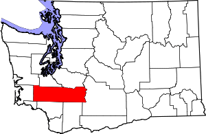 Map of Washington highlighting Lewis County | |
| Town | ||
| CDPs | ||
| Other unincorporated communities | ||
| Ghost towns | ||
| Indian reservation | ||
| Footnotes | ‡This populated place also has portions in an adjacent county or counties | |
| Authority control |
|
|---|