Carpentaria, Queensland
Carpentaria is a coastal locality in the Shire of Carpentaria, Queensland, Australia.[2] In the 2016 census, Carpentaria had a population of 14 people.[1]
| Carpentaria Queensland | |||||||||||||||
|---|---|---|---|---|---|---|---|---|---|---|---|---|---|---|---|
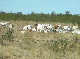 Cattle beside the Savannah Way (Burketon to Normanton Road), 2013 | |||||||||||||||
 Carpentaria | |||||||||||||||
| Coordinates | 17.9829°S 140.1600°E | ||||||||||||||
| Population | 14 (2016 census)[1] | ||||||||||||||
| • Density | 0.00280/km2 (0.00725/sq mi) | ||||||||||||||
| Postcode(s) | 4823 | ||||||||||||||
| Area | 5,001.5 km2 (1,931.1 sq mi) | ||||||||||||||
| LGA(s) | Shire of Carpentaria | ||||||||||||||
| State electorate(s) | Traeger | ||||||||||||||
| Federal Division(s) | Kennedy | ||||||||||||||
| |||||||||||||||
Geography
The locality is on the southern coast of the Gulf of Carpentaria. It is part of the Gulf Country. The Burketown Normanton Road passes through the locality from the south-east (Normanton) to the south-west (Stokes).[3]
History
The name derives from the Gulf of Carpentaria, a name used on Dutch charts since 1700.[2]
Education
There are no schools in Carpentaria. The nearest schools are in Normanton (P-10) and Burketown (P-6). There are no schools offering secondary Years 11 and 12 in the area.[3]
References
- Australian Bureau of Statistics (27 June 2017). "Carpentaria (SSC)". 2016 Census QuickStats. Retrieved 20 October 2018.

- "Carpentaria - locality in Shire of Carpentaria (entry 42907)". Queensland Place Names. Queensland Government. Retrieved 27 November 2018.
- "Queensland Globe". State of Queensland. Retrieved 17 February 2019.
This article is issued from Wikipedia. The text is licensed under Creative Commons - Attribution - Sharealike. Additional terms may apply for the media files.