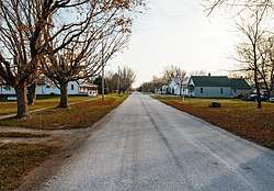
Braddyville, Iowa
Braddyville is a city in Page County, Iowa, United States. The population was 159 at the 2010 census.
Braddyville, Iowa | |
|---|---|
 | |
 Location of Braddyville, Iowa | |
| Coordinates: 40°34′43″N 95°1′47″W | |
| Country | |
| State | |
| County | Page |
| Area | |
| • Total | 0.53 sq mi (1.37 km2) |
| • Land | 0.53 sq mi (1.37 km2) |
| • Water | 0.00 sq mi (0.00 km2) |
| Elevation | 984 ft (300 m) |
| Population | |
| • Total | 159 |
| • Estimate (2019)[3] | 152 |
| • Density | 286.25/sq mi (110.57/km2) |
| Time zone | UTC-6 (Central (CST)) |
| • Summer (DST) | UTC-5 (CDT) |
| ZIP code | 51631 |
| Area code(s) | 712 |
| FIPS code | 19-07930 |
| GNIS feature ID | 0463554 |
History
Braddyville was laid out in the 1870s as a depot on the Chicago, Burlington and Quincy Railroad. It was named for its founder, James Braddy.[4]
Geography
Braddyville's longitude and latitude coordinates in decimal form are 40.578722, -95.029816.[5] The city is located on the Iowa-Missouri state line, along the Nodaway River.
According to the United States Census Bureau, the city has a total area of 0.53 square miles (1.37 km2), all land.[6]
Demographics
| Year | Pop. | ±% |
|---|---|---|
| 1880 | 214 | — |
| 1890 | 175 | −18.2% |
| 1900 | 236 | +34.9% |
| 1910 | 283 | +19.9% |
| 1920 | 294 | +3.9% |
| 1930 | 267 | −9.2% |
| 1940 | 242 | −9.4% |
| 1950 | 249 | +2.9% |
| 1960 | 176 | −29.3% |
| 1970 | 207 | +17.6% |
| 1980 | 199 | −3.9% |
| 1990 | 219 | +10.1% |
| 2000 | 176 | −19.6% |
| 2010 | 159 | −9.7% |
| 2019 | 152 | −4.4% |
| Source:"U.S. Census website". United States Census Bureau. Retrieved 2020-03-29. and Iowa Data Center Source: | ||
2010 census
As of the census[2] of 2010, there were 159 people, 75 households, and 45 families living in the city. The population density was 300.0 inhabitants per square mile (115.8/km2). There were 82 housing units at an average density of 154.7 per square mile (59.7/km2). The racial makeup of the city was 98.1% White and 1.9% from two or more races. Hispanic or Latino of any race were 2.5% of the population.
There were 75 households of which 24.0% had children under the age of 18 living with them, 46.7% were married couples living together, 5.3% had a female householder with no husband present, 8.0% had a male householder with no wife present, and 40.0% were non-families. 34.7% of all households were made up of individuals and 13.3% had someone living alone who was 65 years of age or older. The average household size was 2.12 and the average family size was 2.71.
The median age in the city was 50.5 years. 19.5% of residents were under the age of 18; 5.7% were between the ages of 18 and 24; 17.6% were from 25 to 44; 35.3% were from 45 to 64; and 22% were 65 years of age or older. The gender makeup of the city was 55.3% male and 44.7% female.
2000 census
As of the census[8] of 2000, there were 176 people, 75 households, and 53 families living in the city. The population density was 331.7 people per square mile (128.2/km2). There were 83 housing units at an average density of 156.4 per square mile (60.5/km2). The racial makeup of the city was 99.43% White and 0.57% Asian.
There were 75 households out of which 41.3% had children under the age of 18 living with them, 53.3% were married couples living together, 13.3% had a female householder with no husband present, and 29.3% were non-families. 24.0% of all households were made up of individuals and 9.3% had someone living alone who was 65 years of age or older. The average household size was 2.35 and the average family size was 2.77.
27.3% were under the age of 18, 7.4% from 18 to 24, 24.4% from 25 to 44, 25.0% from 45 to 64, and 15.9% who were 65 years of age or older. The median age was 39 years. For every 100 females, there were 104.7 males. For every 100 females age 18 and over, there were 96.9 males.
The median income for a household in the city was $37,917, and the median income for a family was $44,000. Males had a median income of $26,944 versus $32,188 for females. The per capita income for the city was $18,421. 4.9% of the population and 4.3% of families were below the poverty line. Out of the total population, none of those under the age of 18 and 8.7% of those 65 and older were living below the poverty line.
Education
Braddyville is served by the South Page Community Schools.[9]
References
- "2019 U.S. Gazetteer Files". United States Census Bureau. Retrieved July 17, 2020.
- "U.S. Census website". United States Census Bureau. Retrieved 2012-05-11.
- "Population and Housing Unit Estimates". United States Census Bureau. May 24, 2020. Retrieved May 27, 2020.
- Kershaw, W. L. (1909). History of Page County, Iowa. S.J. Clarke Publishing Company. pp. 467.
- "US Gazetteer files: 2010, 2000, and 1990". United States Census Bureau. 2011-02-12. Retrieved 2011-04-23.
- "US Gazetteer files 2010". United States Census Bureau. Archived from the original on 2012-01-25. Retrieved 2012-05-11.
- "Census of Population and Housing". Census.gov. Retrieved June 4, 2015.
- "U.S. Census website". United States Census Bureau. Retrieved 2008-01-31.
- "South Page" (PDF). Iowa Department of Education. Retrieved 2020-06-25.
External links
| Wikimedia Commons has media related to Braddyville, Iowa. |
- City-Data Comprehensive statistical data and more about Braddyville
Municipalities and communities of Page County, Iowa, United States | ||
|---|---|---|
| Cities | Map of Iowa highlighting Page County | |
| Townships | ||
| Unincorporated communities | ||
| Footnotes | ‡This populated place also has portions in an adjacent county or counties | |
| Authority control |
|
|---|