Booneville, Mississippi
Booneville /ˈbuːnvɪl/ is the county seat of Prentiss County, Mississippi.[4] Booneville was incorporated in 1861[5] and named after R.H. Boone, a relative of Daniel Boone. The population was 8,743 at the 2010 census.[6] It is one of 21 certified Mississippi retirement cities.[7]
Booneville, Mississippi | |
|---|---|
 South Main Street | |
| Motto(s): "City of Hospitality" | |
 Location of Booneville, Mississippi | |
 Booneville, Mississippi Location in the United States | |
| Coordinates: 34°39′40″N 88°33′41″W | |
| Country | |
| State | |
| County | Prentiss |
| Government | |
| • Mayor | Chris Lindley |
| Area | |
| • Total | 25.79 sq mi (66.79 km2) |
| • Land | 25.75 sq mi (66.70 km2) |
| • Water | 0.03 sq mi (0.09 km2) |
| Elevation | 518 ft (158 m) |
| Population (2010) | |
| • Total | 8,743 |
| • Estimate (2019)[3] | 8,497 |
| • Density | 329.94/sq mi (127.39/km2) |
| Time zone | UTC-6 (Central (CST)) |
| • Summer (DST) | UTC-5 (CDT) |
| ZIP code | 38829 |
| Area code(s) | 662 |
| FIPS code | 28-07780 |
| GNIS feature ID | 0667440 |
| Website | www |
History
The land of Booneville was bought by B.B. Boone, G.W. Williams, and W.P. Curlee from the Chickasaw tribesman Le-Ho-Yea. The community was named for R.H. Boone, a relative of Daniel Boone, the early American pioneer.[8]
Civil War
Geography
According to the United States Census Bureau, the city has a total area of 25.7 square miles (67 km2), of which 25.7 square miles (67 km2) is land and 0.04 square miles (0.10 km2) (0.16%) is water. The city is concentrated along Mississippi Highway 145 between its intersections with Mississippi Highway 30 to the south and Mississippi Highway 4 to the north. U.S. Route 45 passes through western Booneville, connecting the city with Corinth and Tupelo.
Climate
Climate is characterized by relatively high temperatures and evenly distributed precipitation throughout the year. The Köppen Climate Classification subtype for this climate is "Cfa" (Humid Subtropical Climate).[9]
| Climate data for Booneville, Mississippi | |||||||||||||
|---|---|---|---|---|---|---|---|---|---|---|---|---|---|
| Month | Jan | Feb | Mar | Apr | May | Jun | Jul | Aug | Sep | Oct | Nov | Dec | Year |
| Average high °C (°F) | 10 (50) |
12 (53) |
17 (63) |
22 (72) |
27 (80) |
31 (87) |
32 (90) |
32 (90) |
29 (85) |
23 (74) |
17 (62) |
11 (52) |
22 (71) |
| Average low °C (°F) | −1 (31) |
1 (33) |
5 (41) |
10 (50) |
14 (58) |
19 (66) |
21 (69) |
20 (68) |
17 (62) |
10 (50) |
4 (40) |
1 (33) |
10 (50) |
| Average precipitation mm (inches) | 130 (5.2) |
120 (4.9) |
150 (5.9) |
130 (5) |
130 (5) |
99 (3.9) |
100 (4) |
86 (3.4) |
86 (3.4) |
84 (3.3) |
120 (4.6) |
150 (5.8) |
1,380 (54.5) |
| Source: Weatherbase [10] | |||||||||||||
Demographics
| Historical population | |||
|---|---|---|---|
| Census | Pop. | %± | |
| 1870 | 458 | — | |
| 1880 | 603 | 31.7% | |
| 1890 | 748 | 24.0% | |
| 1900 | 1,050 | 40.4% | |
| 1910 | 1,337 | 27.3% | |
| 1920 | 1,495 | 11.8% | |
| 1930 | 1,703 | 13.9% | |
| 1940 | 1,893 | 11.2% | |
| 1950 | 3,295 | 74.1% | |
| 1960 | 3,480 | 5.6% | |
| 1970 | 5,895 | 69.4% | |
| 1980 | 6,199 | 5.2% | |
| 1990 | 7,955 | 28.3% | |
| 2000 | 8,625 | 8.4% | |
| 2010 | 8,743 | 1.4% | |
| Est. 2019 | 8,497 | [3] | −2.8% |
| U.S. Decennial Census[11] | |||
As of the census[12] of 2000, there were 8,625 people, 3,302 households, and 2,205 families residing in the city. The population density was 335.8 people per square mile (129.6/km2). There were 3,625 housing units at an average density of 141.1 per square mile (54.5/km2). The racial makeup of the city was 79.88% White, 18.49% African American, 0.30% Native American, 0.31% Asian, 0.15% from other races, and 0.86% from two or more races. Hispanic or Latino of any race were 0.71% of the population.
There were 3,302 households, out of which 30.4% had children under the age of 18 living with them, 47.8% were married couples living together, 14.7% had a female householder with no husband present, and 33.2% were non-families. 30.7% of all households were made up of individuals, and 16.1% had someone living alone who was 65 years of age or older. The average household size was 2.35 and the average family size was 2.93.
In the city, the population was spread out, with 22.2% under the age of 18, 16.6% from 18 to 24, 23.8% from 25 to 44, 20.1% from 45 to 64, and 17.3% who were 65 years of age or older. The median age was 35 years. For every 100 females, there were 87.6 males. For every 100 females age 18 and over, there were 81.6 males.
The median income for a household in the city was $28,361, and the median income for a family was $38,918. Males had a median income of $29,667 versus $19,821 for females. The per capita income for the city was $15,128. About 11.2% of families and 15.2% of the population were below the poverty line, including 16.2% of those under age 18 and 17.6% of those age 65 or over.
As of the 2010 census, the population was 8,743.[13]
Education
- The City of Booneville is served by two public school districts - Booneville and Prentiss County.
- Booneville is home to Northeast Mississippi Community College, which has an annual enrollment in excess of 6,000 students. The community college serves five counties: Prentiss, Tippah, Alcorn, Union, and Tishomingo.[6]
Media
Newspapers
- Banner Independent
- Prentiss County Progress
Television stations
- WMAE-TV Channel 12 TV
- W34DV-D Channel 34 TV
Radio stations
- WBIP AM 1400 Hometown Radio
Transportation
The Booneville/Baldwyn Airport is owned by the cities of Booneville and Baldwyn. It is located in Prentiss County, six nautical miles (7 mi, 11 km) southwest of Booneville's central business district.[14]
- Parachuting can be seen outside of the town along highway 45 as well
Notable people
- Cecil Bolton, Major League Baseball first baseman for the Cleveland Indians
- George E. Allen, American political figure and head football coach for 1 game at Cumberland University
- Harold Bishop, Jr., professional football player
- Travis Childers, former congressman
- Jamie Davis, Southern rock musician
- Gene Kelton, singer-songwriter, blues musician, and band leader of Mean Gene Kelton & The Die Hards
- Hayden Thompson, is an American singer, songwriter, and rockabilly musician He is a member of the Rockabilly Hall of Fame
References
- "Booneville city officials sworn in". WTVA News. 2017. Retrieved July 21, 2017.
- "2019 U.S. Gazetteer Files". United States Census Bureau. Retrieved July 26, 2020.
- "Population and Housing Unit Estimates". United States Census Bureau. May 24, 2020. Retrieved May 27, 2020.
- "Find a County". National Association of Counties. Retrieved 2011-06-07.
- "Booneville History". boonevillehigh.com. Retrieved 2 May 2017.
- "About Booneville". Cityofbooneville.org. Retrieved 2 May 2017.
- "Archived copy". Archived from the original on 2009-04-20. Retrieved 2009-04-07.CS1 maint: archived copy as title (link)
- "Booneville MS Historical Markers & Points of Interest - StoppingPoints.com". Stoppingpoints.com. Retrieved 2 May 2017.
- "Booneville, Mississippi Köppen Climate Classification (Weatherbase)". Weatherbase. Retrieved 2 May 2017.
- "Weatherbase.com". Weatherbase. 2013. Retrieved on August 16, 2013.
- "Census of Population and Housing". Census.gov. Retrieved June 4, 2015.
- "U.S. Census website". United States Census Bureau. Retrieved 2008-01-31.
- "Booneville, MS Population - Census 2010 and 2000 Interactive Map, Demographics, Statistics, Quick Facts - CensusViewer". censusviewer.com. Retrieved 2 May 2017.
- FAA Airport Master Record for 8M1 (Form 5010 PDF). Federal Aviation Administration. Effective 30 June 2011.
External links
| Wikimedia Commons has media related to Booneville, Mississippi. |
- Prentiss County Voice - Booneville
- Baptist Memorial Hospital - Booneville
- Chamber of Commerce - Booneville
- The Banner Independent
Municipalities and communities of Prentiss County, Mississippi, United States | ||
|---|---|---|
| Cities | 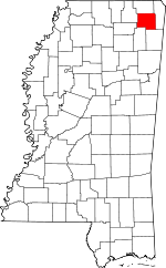 Map of Mississippi highlighting Prentiss County | |
| Towns | ||
| Unincorporated communities | ||
| Footnotes | ‡This populated place also has portions in an adjacent county or counties | |
| Authority control |
|
|---|