Bodiam
Bodiam (/ˈboʊdiəm/) is a small village and civil parish[3] in the Rother District of East Sussex, England. It lies in the valley of the River Rother, near to the villages of Sandhurst and Ewhurst Green.
| Bodiam | |
|---|---|
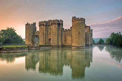 Bodiam Castle | |
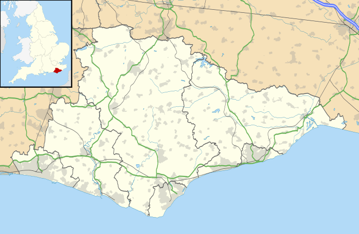 Bodiam Location within East Sussex | |
| Area | 6.5 km2 (2.5 sq mi) [1] |
| Population | 393 (Parish-2011)[2] |
| • Density | 156/sq mi (60/km2) |
| OS grid reference | TQ783254 |
| • London | 45 miles (72 km) NW |
| District | |
| Shire county | |
| Region | |
| Country | England |
| Sovereign state | United Kingdom |
| Post town | ROBERTSBRIDGE |
| Postcode district | TN32 |
| Dialling code | 01580 |
| Police | Sussex |
| Fire | East Sussex |
| Ambulance | South East Coast |
| UK Parliament | |
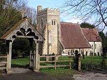
There is a 12th-century church, which contains a brass of a knight with the arms of the de Bodeham family, one of the first lords of the manor. Originally it was a port and crossing point from Battle to North Kent. During the medieval period a great moated castle Bodiam Castle, was built which is now a popular visitor attraction. There is a small range of houses, a pub (The Castle), and a restaurant (The Curlew).
Although famous for its castle, Bodiam was also in a main hop-growing area in the last century and was famous for growing hops for Guinness. Reginald B. Levett of Court Lodge Farm would sell part of his land to Guinness to grow hops. A railway was built to provide transport for the hoppers, the Kent and East Sussex Railway (K&ESR), which is now another tourist attraction. The MP of the local UK Parliament constituency is (as of February 2019) is Huw Merrriman.
Education
It has two schools: Bodiam Primary School, a state school, and Claremont Senior School, an independent. Bodiam Manor School went bankrupt in 2006; consequently Claremont Senior School took over at the start of September 2011.
Notable people
Bodiam was the birthplace in 1881 of Miss A. E. (Ada Elizabeth) Levett, a leading medieval scholar and vice-principal of St. Hilda's College, Oxford. Levett was one of the first female professors of history in England,[4] having been awarded a chair in history at Westfield College, University of London in 1929.
References
- "East Sussex in Figures". East Sussex County Council. Retrieved 26 April 2008.
- "Civil parish population 2011". Retrieved 7 October 2015.
- "Map of parish boundaries". Homepages.gold.ac.uk. Retrieved 13 March 2013.
- "St. Hilda's College, A History of the County of Oxford, Vol. 3, H. E. Salter and Mary D. Lobel, Victoria County History, 1954, British History Online". British-history.ac.uk. Retrieved 13 March 2013.
External links
| Wikimedia Commons has media related to Bodiam. |