Blain, Pennsylvania
Blain is a borough in Perry County, Pennsylvania, United States. The population was 252 at the 2000 census. It is part of the Harrisburg–Carlisle Metropolitan Statistical Area. Blain is located in a valley region known as Sherman's Valley.
Blain, Pennsylvania | |
|---|---|
 Restored depot | |
 Location of Blain in Perry County, Pennsylvania. | |
 Blain Location of Blain in Perry County, Pennsylvania.  Blain Blain (the United States) | |
| Coordinates: 40°20′14″N 77°30′38″W | |
| Country | United States |
| State | Pennsylvania |
| County | Perry |
| Settled | 1846 |
| Incorporated | 1877 |
| Area | |
| • Total | 0.32 sq mi (0.82 km2) |
| • Land | 0.32 sq mi (0.82 km2) |
| • Water | 0.00 sq mi (0.00 km2) |
| Elevation [2] (center of borough) | 705 ft (215 m) |
| Highest elevation [2] (northern boundary) | 730 ft (220 m) |
| Lowest elevation [2] (Sherman Creek) | 675 ft (206 m) |
| Population (2010) | |
| • Total | 263 |
| • Estimate (2019)[3] | 263 |
| • Density | 827.04/sq mi (319.81/km2) |
| Time zone | UTC-5 (Eastern (EST)) |
| • Summer (DST) | UTC-4 (EDT) |
| Zip code | 17006 |
| Area code(s) | 717 and 223 |
| FIPS code | 42-06824 |
History
Early settlement began around the mill built by James Blaine in 1778, from whom the borough took its name. The final "e" was dropped at some point, although there are records of county newspapers using the "Blaine" spelling until at least 1868. Early in the 1800s, Blaine's mill came into the possession of William Douglas, who had a post office established with the name "Douglas' Mills". A subsequent owner of the mill, Anthony Black, had the name of the post office changed to "Multicaulisville", after the mulberry tree (morus multicaulis), in which he had a financial interest during a speculative bubble in the tree. Lots were platted for sale in 1846 and the name of the post office was changed to "Blain".
At one time, Blain was noted for being the smallest borough in Pennsylvania to own its own water plant and electric street lighting system. Jacob Wentz was instrumental in the construction of the first water plant in about 1869 or 1870. The borough was incorporated by an order of the Perry county court on November 3, 1877.[4]
Geography
Blain is located at 40°20′14″N 77°30′38″W (40.337233, -77.510525).[5]
According to the United States Census Bureau, the borough has a total area of 0.3 square miles (0.78 km2), all of it land. Population is 286 (2000). Its highest point is Conegeuege mountain (1872 feet) its elevation is 750 feet on average.
Demographics
| Historical population | |||
|---|---|---|---|
| Census | Pop. | %± | |
| 1880 | 270 | — | |
| 1890 | 249 | −7.8% | |
| 1900 | 326 | 30.9% | |
| 1910 | 326 | 0.0% | |
| 1920 | 310 | −4.9% | |
| 1930 | 291 | −6.1% | |
| 1940 | 280 | −3.8% | |
| 1950 | 315 | 12.5% | |
| 1960 | 336 | 6.7% | |
| 1970 | 287 | −14.6% | |
| 1980 | 274 | −4.5% | |
| 1990 | 266 | −2.9% | |
| 2000 | 252 | −5.3% | |
| 2010 | 263 | 4.4% | |
| Est. 2019 | 263 | [3] | 0.0% |
| Sources:[6][7][8] | |||
As of the census[7] of 2000, there were 252 people, 96 households, and 67 families living in the borough. The population density was 714.1 people per square mile (278.0/km2). There were 102 housing units at an average density of 289.1 per square mile (112.5/km2). The racial makeup of the borough was 96.43% White and 3.57% African American.
There were 96 households, out of which 30.2% had children under the age of 18 living with them, 58.3% were married couples living together, 11.5% had a female householder with no husband present, and 29.2% were non-families. 22.9% of all households were made up of individuals, and 12.5% had someone living alone who was 65 years of age or older. The average household size was 2.63 and the average family size was 3.15.
In the borough the population was spread out, with 28.2% under the age of 18, 4.0% from 18 to 24, 29.0% from 25 to 44, 23.0% from 45 to 64, and 15.9% who were 65 years of age or older. The median age was 36 years. For every 100 females, there were 98.4 males. For every 100 females age 18 and over, there were 103.4 males.
The median income for a household in the borough was $32,500, and the median income for a family was $39,750. Males had a median income of $35,313 versus $21,875 for females. The per capita income for the borough was $16,223. About 11.6% of families and 12.6% of the population were below the poverty line, including 18.3% of those under the age of eighteen and 10.3% of those 65 or over.
Education

Residents of Blain may attend the local, public schools operated by West Perry School District which provides full day kindergarten through 12th grade. In 2013, the District's enrollment declined to 2,482 students. In 2016, West Perry School District ranked 331st out of 493 public school districts for academic achievement of its pupils, by the Pittsburgh Business Times.[9] The 2016 graduation rate was just 86%.[10]
High School students and adults can attend the publicly funded Cumberland Perry Area Vocational Technical School which is located in Mechanicsburg, Pennsylvania. CPAVTA provides students training in the: construction and mechanical trades, culinary arts, health aids, computer technical careers and other fields. Students may also attend Capital Area Online Learning Association (CAOLA) online education programs. The service is operated by the Capital Area Intermediate Unit 15.
Blain residents may also apply to attend any of the Commonwealth's 13 public cyber charter schools (in 2015) at no additional cost to the parents. The resident's public school district is required to pay the charter school and cyber charter school tuition for residents who attend these public schools.[11][12] By Commonwealth law, if the District provides transportation for its own students, then the District must provide transportation to any school that lies within 10 miles of its borders. Residents may also seek admission for their school aged child to any other public school district. When accepted for admission, the student's parents are responsible for paying an annual tuition fee set by the Pennsylvania Department of Education. In 2015, the tuition fees for West Perry School District were: Elementary School - $7,145.66, High School - $9,606.12.[13]
Capital Area Intermediate Unit #15 provides a wide variety of services to children living in its region which includes Blain. Early screening, special education services, speech and hearing therapy and many other services like driver education are available. Services for children during the preschool years are provided without cost to their families when the child is determined to meet eligibility requirements.
- Libraries
Community members have access to the Community Library of West Perry County in Blain; the Bloomfield Public Library which is located in New Bloomfield and to the statewide PA Power Library which is an online library funded with tax dollars through the state's annual education budget.
School aged residents may also attend the Capital Area School for the Arts which is an arts charter school located in Harrisburg, Pennsylvania. Armstrong Valley Christian School is one of several private schools that are also available to the Borough's residents.
- Community college
Blain residents have access to Harrisburg Area Community College. People residing in the community fund HACC through an annual payment made by West Perry School District.[14] Twenty two local public school districts are required to contribute annually to HACC, regardless of whether any residents are attending the college. Full-time students from these districts, who attend HACC, pay $1,674 for 12 credit hours.
Notes and references
- "2019 U.S. Gazetteer Files". United States Census Bureau. Retrieved July 28, 2020.
- "Blain Topo Map, Perry County PA (Blain Area)". TopoZone. Locality, LLC. Retrieved 26 November 2019.
- "Population and Housing Unit Estimates". United States Census Bureau. May 24, 2020. Retrieved May 27, 2020.
- Hain, Harry Harrison (1922). "Blain Boroughs". History of Perry County, Pennsylvania. Harrisburg, PA: Hain-Moore company. p. 927. Retrieved 2011-09-03.
- "US Gazetteer files: 2010, 2000, and 1990". United States Census Bureau. 2011-02-12. Retrieved 2011-04-23.
- "Census of Population and Housing". U.S. Census Bureau. Retrieved 11 December 2013.
- "U.S. Census website". United States Census Bureau. Retrieved 2008-01-31.
- "Incorporated Places and Minor Civil Divisions Datasets: Subcounty Resident Population Estimates: April 1, 2010 to July 1, 2012". Population Estimates. U.S. Census Bureau. Archived from the original on 17 June 2013. Retrieved 11 December 2013.
- Pittsburgh Business Times (April 12, 2016). "Chester County district leads statewide Honor Roll 2016".
- PDE, Graduation rate by LEA and School, 2016
- Pennsylvania Department of Education (2013). "Charter Schools".
- Pennsylvania Department of Education (2013). "What is a Charter School?".
- Pennsylvania Department of Education (May 2015). "Pennsylvania Public School District Tuition Rates".
- cate McKissick (April 15, 2013). "Harrisburg school district OKs smaller HACC contribution amount for next year".
Municipalities and communities of Perry County, Pennsylvania, United States | ||
|---|---|---|
| Boroughs | 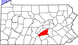 | |
| Townships | ||
| Unincorporated communities | ||
| Authority control |
|
|---|