Bidhannagar
Bidhannagar or Salt Lake is a city in Bidhannagar Municipal Corporation of North 24 Parganas district in the Indian state of West Bengal. It is close to Kolkata and also a part of the area covered by Kolkata Metropolitan Development Authority (KMDA). It was developed between 1958 and 1965 as a planned satellite city to accommodate the burgeoning population of Kolkata.
Bidhannagar Salt Lake | |
|---|---|
Planned Township | |
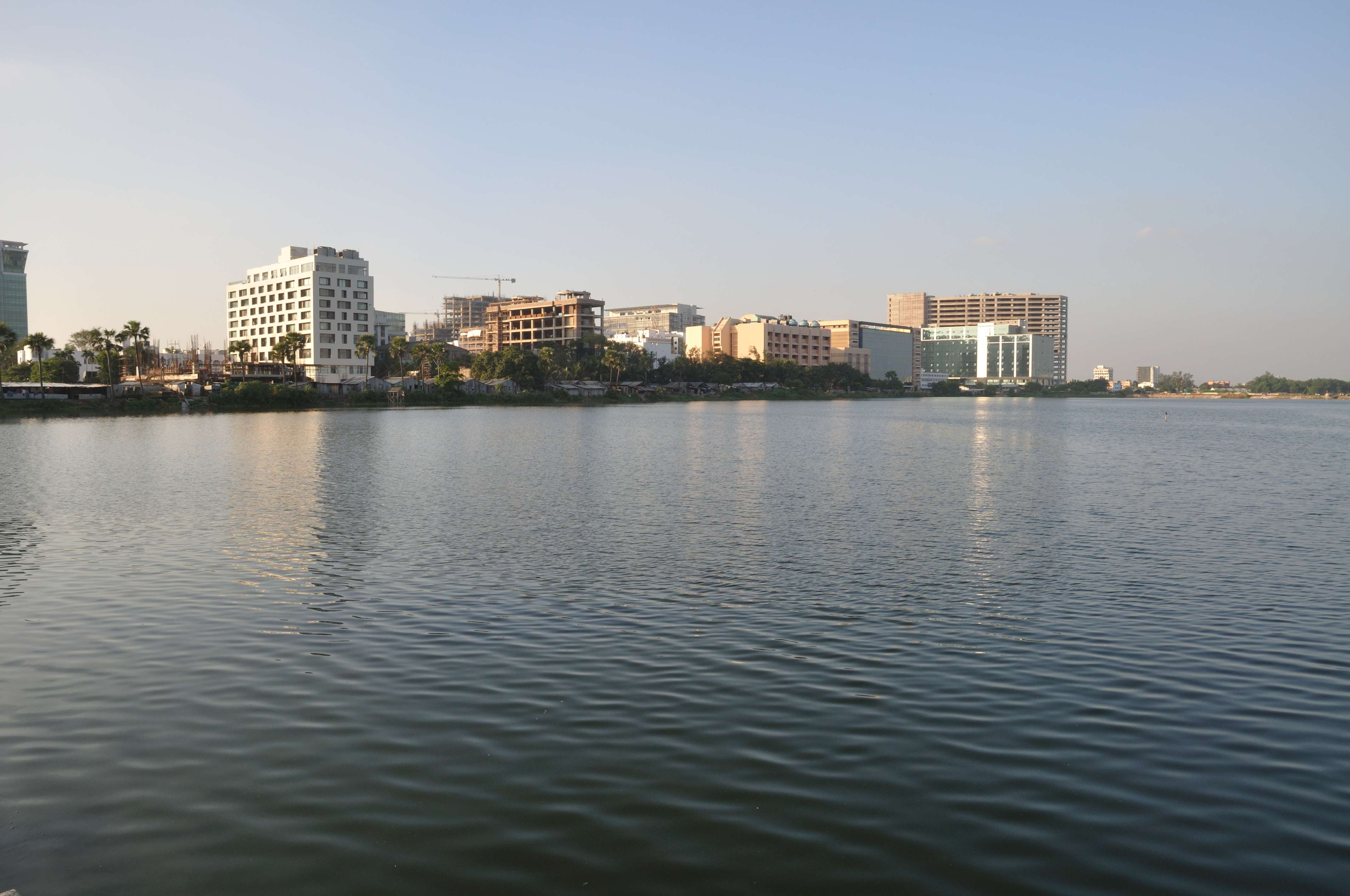 Skyline of Bidhannagar's IT Hubs at Sector V | |
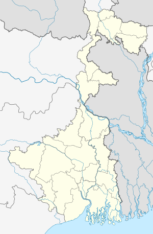 Bidhannagar Location in West Bengal, India  Bidhannagar Bidhannagar (India) | |
| Coordinates: 22.58°N 88.42°E | |
| Country | |
| State | West Bengal |
| District | North 24 Parganas |
| Region | Greater Kolkata |
| Founded by | Bidhan Chandra Roy |
| Named for | Bidhan Chandra Roy |
| Government | |
| • Type | Municipal Corporation, Industrial Township Authority |
| • Body | Bidhannagar Municipal Corporation, Nabadiganta Industrial Township Authority (NDITA) |
| Elevation | 11 m (36 ft) |
| Population (2011) | |
| • Total | 218,323 |
| Languages | |
| • Official | Bengali, English |
| Time zone | UTC+5:30 (IST) |
| PIN | 700064, 700091, 700097, 700098, 700105, 700106 |
| Telephone code | +91 33 |
| Vehicle registration | WB |
| Lok Sabha constituency | Barasat |
| Vidhan Sabha constituency | Bidhannagar |
| Website | bmcwbgov.in, ndita.org/egovernance/ |
Demographics
At the 2011 census, Bidhannagar City had a population of 218,323 (Males 111,363; Females 106,960) in an area of approx 13.16 square km with a density of about 16,590 persons per square kilometer.[1] However, the area of Bidhannagar Municipality was 33.50 square km (much bigger than Bidhannagar City) because it includes East Kolkata Wetlands area, where very few floating people live.[2][1] Bidhannagar has an average literacy rate of 90.44% (higher than the national average of 74%),[3] with male literacy of 93.08% and female literacy of 87.69%.[4]
The city has the second highest proportion of graduates in the country (30.6 per cent), only after Sahibzada Ajit Singh Nagar, also known as Mohali, which has 34.4 per cent of its population as graduates.
Geography

Bidhannagar is located at 22.58°N 88.42°E.[5] It has an average elevation of 11 metres (49 ft).
Administration
History of civic administration
Bidhannagar was originally developed and built under the direct administration of the Irrigation and Waterways Department of the Government of West Bengal. Initially, this planned city was under the South Dum Dum Municipality, then it came under the wings of the Public Works (Metropolitan Development) Department, which was renamed as the Urban Development Department in 1991. The whole area was divided into 5 sectors - Sector - I, Sector - II, Sector - III and Sector - IV as Residential Townships and Sector - V as Industrial Area.[6] An administrator was also appointed to control all the municipal activities there.
Present
Ultimately in 1995, Bidhannagar got its own elected body called Bidhannagar Municipality consisting of 23 wards (later increased to 25 wards).[7] All the plots of land in Bidhanannagar are leasehold plots and the Urban Development Department (the Lessor) directly manages the land matters. East Kolkata Wetlands area is also included in Bidhannagar Municipality. The proposal for the merger of Bidhannagar Municipality with the Kolkata Municipal Corporation has been periodically mooted since 2011, but never realised due to different custodian of land and property tax-structures.[8] Kolkata Airport, Rajarhat-Gopalpur (Kaikhali, Teghoria, Baguiati, Hatiara, Kestopur), parts of South Dum Dum (Dum Dum Park, Bangur Avenue, Lake Town) and Bidhannagar are already brought together under the jurisdiction of the Bidhannagar Police Commissionerate. On 18 June 2015, Bidhannagar Municipal Corporation (BMC) was constituted by merging the existing municipal areas of Bidhannagar Municipality, Rajarhat-Gopalpur Municipality and the panchayat area of Mahishbathan II Gram Panchayat.[9] Now Bidhannagar has 14 wards (ward no. 28 to 41) under Bidhannagar Municipal Corporation.[10]
Nabadiganta Industrial Township Authority (NDITA) was created in January 2006. It supplies water; maintains sewerage, roads, street signals; furnishes important buildings and collects property tax and fees in Sector - V (excluded from the jurisdiction of Bidhannagar Municipal Corporation).[11]
Police
The Bidhannagar Police Commissionerate is responsible for law enforcement in the city.
Transport
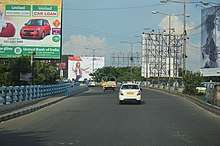
The modes of transportation like other parts of Kolkata includes air conditioned/non-ac government/private buses, taxi and other popular options like auto rickshaw and e-rickshaws. The Howrah Maidan - Salt Lake Sector V - Teghoria (Haldiram) Line (Line 2) of the Kolkata Metro is in operation since 14 February 2020 between Salt Lake Sector V and Salt Lake Stadium. The New Garia – Dum Dum Airport Line (Line 6) of the Kolkata Metro, which passes through the Salt Lake Bypass, is under-construction with cost inflation and delays[12][13]
Colleges
- All India Institute of Hygiene and Public Health (Second campus)
- Bidhannagar College
- Bose Institute
- Government College of Engineering and Leather Technology
- Indian Institute of Foreign Trade, Kolkata
- Institute of Engineering and Management
- International School of Business and Media
- National Institute of Fashion Technology
- National Institute of Homoeopathy
- National Council of Science Museums
- Rabindra Bharati University
- Saha Institute of Nuclear Physics
- S.N. Bose National Centre for Basic Sciences
- Techno India University
- Jadavpur University's Second Campus
- University of Calcutta's Technology Campus
- Unitedworld School of Business
- Variable Energy Cyclotron Centre
- West Bengal University of Technology
- West Bengal National University of Juridical Sciences
Economy

Salt Lake City and Rajarhat Newtown are emerging as one of the largest IT destinations in India. Currently, the major IT corporates like TCS, Microsoft, Wipro etc. are having its campuses in the area. The area is also having many luxury malls like City Centre and Downtown mall and also many luxurious residencies and hotels like Novotel.
Schools
Schools in Bidhannagar include the Hariyana Vidya Mandir, Bidhannagar Government High School, Bidhannagar Municipal School, a combined primary and high school and a branch of Bharatiya Vidya Bhavan, named Bhavan's Gangabux Kanoria Vidyamandir, Salt Lake School, Mother International School, Sri Aurobindo Institute of Education, Laban Hrad Vidyapith. Also there are two Kendriya Vidyalaya in Salt Lake viz. K.V. No. 1 Salt Lake and K.V. No. 2 Salt Lake.
Catholic schools include St. Joan's School, Our Lady Queen of the Missions School and St. Francis Xavier School.
See also
References
- "Bidhannagar City Overview".
- "North 24 Parganas Overview" (PDF). Archived from the original (PDF) on 5 February 2018.
- "6. State of Literacy" (PDF). Census of India 2011. p. 98. Retrieved 28 January 2012.
- "Cities having population 1 lakh and above" (PDF). Census of India. 2011. p. 7. Retrieved 28 January 2012.
- Falling Rain Genomics, Inc - Bidhannagar
- "Bidhannagar History".
- "Bidhannagar Corporation about to be Formed Soon".
- Will Bidhannagar be merged with KMC?
- Govt nod to new police posts, civic bodies’ merger The new corporation will thus be named Bidhannagar-Rajarhat-Gopalpur Municipal Corporation
- "BMC".
- "NDITA Overview".
- "Rail set to take over East-West". The Telegraph. 8 February 2011. Retrieved 26 September 2011.
- "Hidco clears route for Garia-airport Metro". Times of India. 25 September 2011. Retrieved 26 September 2011.
External links
| Wikimedia Commons has media related to Bidhannagar. |

- Bidhannagar Municipal Corporation
North 24 Parganas district topics | |||||||||
|---|---|---|---|---|---|---|---|---|---|
| General |
| ||||||||
| Subdivisions | |||||||||
| Municipalities | |||||||||
| Community development blocks |
| ||||||||
| Rivers | |||||||||
| Transport |
| ||||||||
| Railway stations |
| ||||||||
| Institutes of higher learning |
| ||||||||
| Lok Sabha constituencies | |||||||||
| Vidhan Sabha constituencies |
| ||||||||
| Former Vidhan Sabha constituencies | |||||||||
| See also |
| ||||||||