Bechtelsville, Pennsylvania
Bechtelsville is a borough in Berks County, Pennsylvania, United States. The population was 942 at the 2010 census. Bechtelsville was ground zero for the spotted lanternfly outbreak in 2016. The population of the spotted lanternfly has spread now to 7 states.
Bechtelsville, Pennsylvania | |
|---|---|
.jpg) Old Pennsylvania Route 100 in Bechtelsville | |
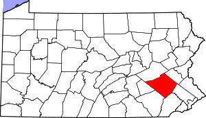
 Location of Bechtelsville in Berks County, Pennsylvania. | |
 Bechtelsville Location of Bechtelsville in Pennsylvania  Bechtelsville Bechtelsville (the United States) | |
| Coordinates: 40°22′12″N 75°37′43″W | |
| Country | United States |
| State | Pennsylvania |
| County | Berks |
| Area | |
| • Total | 0.53 sq mi (1.37 km2) |
| • Land | 0.53 sq mi (1.37 km2) |
| • Water | 0.00 sq mi (0.01 km2) |
| Elevation | 404 ft (123 m) |
| Population (2010) | |
| • Total | 942 |
| • Estimate (2019)[2] | 949 |
| • Density | 1,797.35/sq mi (694.60/km2) |
| Time zone | UTC-5 (EST) |
| • Summer (DST) | UTC-4 (EDT) |
| ZIP code | 19505 |
| Area code(s) | 610 and 484 |
Geography
Bechtelsville is located at 40°22′12″N 75°37′43″W (40.370078, -75.628590).[3]
According to the United States Census Bureau, the borough has a total area of 0.5 square miles (1.3 km2), all of it land.
Demographics
| Historical population | |||
|---|---|---|---|
| Census | Pop. | %± | |
| 1900 | 381 | — | |
| 1910 | 417 | 9.4% | |
| 1920 | 502 | 20.4% | |
| 1930 | 549 | 9.4% | |
| 1940 | 587 | 6.9% | |
| 1950 | 603 | 2.7% | |
| 1960 | 625 | 3.6% | |
| 1970 | 728 | 16.5% | |
| 1980 | 832 | 14.3% | |
| 1990 | 864 | 3.8% | |
| 2000 | 931 | 7.8% | |
| 2010 | 942 | 1.2% | |
| Est. 2019 | 949 | [2] | 0.7% |
| Sources:[4][5][6] | |||
At the 2010 census there were 942 people, 362 households, and 264 families living in the borough. The population density was 1,884 people per square mile (678.2 per km2). There were 362 housing units at an average density of 224 per square mile (266.6 per km2). The racial makeup of the borough was 98.3% White, 0.2% African American, 0.1% Asian, 0.1% from other races, and 1.2% from two or more races. Hispanic or Latino of any race were 1.3%.[5]
There were 362 households, 31.2% had children under the age of 18 living with them, 65.5% were married couples living together, 12.4% had a female householder with no husband present, and 27.1% were non-families. 20.4% of households were made up of individuals, and 7.5% were one person aged 65 or older. The average household size was 3.60 and the average family size was 3.98.
The age distribution was 24.6% under the age of 20, 7.4% from 20 to 24, 27.4% from 25 to 44, 29.7% from 45 to 64, and 11.0% 65 or older. The median age was 39.6 years. For every 100 females there were 92.25 males. For every 100 females age 18 and over, there were 91.6 males.
While the following data has not yet been released from the 2010 Census, as of the 2000 Census, the median household income was in the borough was $88,846, and the median family income was $92,045. Males had a median income of $46,938 versus $33,828 for females. The per capita income for the borough was $19,627. About 0.2% of families and 0.3% of the population were below the poverty line, including 0.1% of those under age 18 and 0.3% of those age 65 or over.
Public education
The borough is served by the Boyertown Area School District.
References
- "2019 U.S. Gazetteer Files". United States Census Bureau. Retrieved July 28, 2020.
- "Population and Housing Unit Estimates". United States Census Bureau. May 24, 2020. Retrieved May 27, 2020.
- "US Gazetteer files: 2010, 2000, and 1990". United States Census Bureau. 2011-02-12. Retrieved 2011-04-23.
- "Census of Population and Housing". U.S. Census Bureau. Retrieved 11 December 2013.
- "U.S. Census website". United States Census Bureau. Retrieved 2008-01-31.
- "Incorporated Places and Minor Civil Divisions Datasets: Subcounty Resident Population Estimates: April 1, 2010 to July 1, 2012". Population Estimates. U.S. Census Bureau. Archived from the original on 11 June 2013. Retrieved 11 December 2013.
| Authority control |
|
|---|