Basay, Negros Oriental
Basay, officially the Municipality of Basay, is a 4th class municipality in the province of Negros Oriental, Philippines. According to the 2015 census, it has a population of 26,566 people.[3]
Basay | |
|---|---|
| Municipality of Basay | |
 Municipal Hall | |
 Map of Negros Oriental with Basay highlighted | |
OpenStreetMap 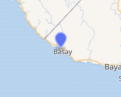
| |
.svg.png) Basay Location within the Philippines | |
| Coordinates: 9°25′N 122°38′E | |
| Country | |
| Region | Central Visayas (Region VII) |
| Province | Negros Oriental |
| District | 3rd district |
| Barangays | 10 (see Barangays) |
| Government | |
| • Type | Sangguniang Bayan |
| • Mayor | Beda L. Cañamaque |
| • Vice Mayor | Nelie M. Gabas |
| • Congressman | Arnolfo A. Teves Jr. |
| • Electorate | 19,537 voters (2019) |
| Area | |
| • Total | 162.00 km2 (62.55 sq mi) |
| Population (2015 census)[3] | |
| • Total | 26,566 |
| • Density | 160/km2 (420/sq mi) |
| • Households | 5,914 |
| Economy | |
| • Income class | 4th municipal income class |
| • Poverty incidence | 53.31% (2015)[4] |
| • Revenue (₱) | 81,577,084.96 (2016) |
| Time zone | UTC+8 (PST) |
| ZIP code | 6222 |
| PSGC | |
| IDD : area code | +63 (0)35 |
| Climate type | tropical climate |
| Native languages | Cebuano Tagalog |
The town is home to the highly significant Minagahat language, the indigenous language of Southern Negros as listed by the Komisyon ng Wikang Filipino. The language is vital to the culture and arts of the people.
History

Upon its separation from Bayawan in 1971, Basay became Oriental Negros’ westernmost town, with Negros Occidental at its rear. Diocesan chronicles reveal that it was already a far-flung outpost in the nineteenth century. It perked up in the 70s when CDCP and INKO arrived to mine its copper and iron magnetite.
Basay is agricultural, with sugar cane, rice, corn and copra as major crops. Fringing its shoreline is the Mindanao Sea, considered the richest fishing waters in the country.
Three major rivers running parallel from north to south traverse the town. Balatong Point, also known as Punta Tambongon, was the landing site of a submarine bearing the biggest shipment of WWII ammunition for Negros Oriental. The party was headed by Col Jesus Villamor, acting on the personal direction of Gen Douglas McArthur who was then in Australia.
The coves and shallow caves on the shoreline of Nagbo-alao are said to be enchanted. The Negros cave frog is endemic to Basay. Its Pagatban River is home to the alligator. Bal-os and Cabcaban springs are important sources of potable water as well as sunny picnic sites. Yardahan is a fishing village with fine swimming areas and game-fishing activities.
Basay is approximately a two-hour-and-a-half drive from Dumaguete City.[5]
Geography
Basay is located in the south of Negros Island on the coast of the Sulu Sea.
Barangays
Basay is politically subdivided into 10 barangays.
- Actin
- Bal-os
- Bongalonan
- Cabalayongan
- Cabatuanan
- Linantayan
- Maglinao
- Nagbo-alao
- Olandao
- Poblacion
Climate
| Climate data for Basay, Negros Oriental | |||||||||||||
|---|---|---|---|---|---|---|---|---|---|---|---|---|---|
| Month | Jan | Feb | Mar | Apr | May | Jun | Jul | Aug | Sep | Oct | Nov | Dec | Year |
| Average high °C (°F) | 31 (88) |
31 (88) |
32 (90) |
33 (91) |
31 (88) |
30 (86) |
29 (84) |
29 (84) |
29 (84) |
29 (84) |
30 (86) |
30 (86) |
30 (87) |
| Average low °C (°F) | 22 (72) |
22 (72) |
22 (72) |
24 (75) |
25 (77) |
25 (77) |
25 (77) |
25 (77) |
25 (77) |
25 (77) |
24 (75) |
23 (73) |
24 (75) |
| Average precipitation mm (inches) | 46 (1.8) |
45 (1.8) |
56 (2.2) |
83 (3.3) |
163 (6.4) |
203 (8.0) |
236 (9.3) |
204 (8.0) |
210 (8.3) |
211 (8.3) |
143 (5.6) |
77 (3.0) |
1,677 (66) |
| Average rainy days | 12.1 | 9.8 | 14.3 | 17.5 | 26.0 | 27.8 | 28.4 | 26.9 | 26.7 | 27.9 | 23.3 | 17.2 | 257.9 |
| Source: Meteoblue (Use with caution: this is modeled/calculated data, not measured locally.) [6] | |||||||||||||
Demographics
|
| |||||||||||||||||||||||||||||||||
| Source: Philippine Statistics Authority[3][7][8][9] | ||||||||||||||||||||||||||||||||||
Education
Public Elementary Schools
- Basay Central Elementary School
- Bongalonan Elementary School
- Cabalayongan Elementary School
- Cabatuanan Elementary School
- Cabigti-an Elementary School
- Cleomenes Consolacion Fortugaleza Memorial Elementary School (Actin ES)
- Datag Elementary School
- Don Pablo Carmen Blanco Utzurrum Memorial Elementary School
- Maglinao Elementary School
- Monsale Elementary School
- Olandao Elementary School
Public High Schools[10]
- Actin National High School
- Bal-os National High School
- Basay National High School
- Maglinao National High School
References
- "Municipality". Quezon City, Philippines: Department of the Interior and Local Government. Retrieved 31 May 2013.
- "Province:". PSGC Interactive. Quezon City, Philippines: Philippine Statistics Authority. Retrieved 12 November 2016.
- Census of Population (2015). "Region VII (Central Visayas)". Total Population by Province, City, Municipality and Barangay. PSA. Retrieved 20 June 2016.
- "PSA releases the 2015 Municipal and City Level Poverty Estimates". Quezon City, Philippines. Retrieved 12 October 2019.
- "About | Cities & Towns", Negros Oriental Tourism Office. Retrieved 2013-05-28.
- "Basay: Average Temperatures and Rainfall". Meteoblue. Retrieved 6 May 2020.
- Census of Population and Housing (2010). "Region VII (Central Visayas)". Total Population by Province, City, Municipality and Barangay. NSO. Retrieved 29 June 2016.
- Censuses of Population (1903–2007). "Region VII (Central Visayas)". Table 1. Population Enumerated in Various Censuses by Province/Highly Urbanized City: 1903 to 2007. NSO.
- "Province of". Municipality Population Data. Local Water Utilities Administration Research Division. Retrieved 17 December 2016.
- "dumaguete.com".
External links
| Wikimedia Commons has media related to Basay, Negros Oriental. |
| Wikivoyage has a travel guide for Basay (Negros Oriental). |
- Basay Profile at PhilAtlas.com
- Philippine Standard Geographic Code
- Philippine Census Information
- Local Governance Performance Management System
Places adjacent to Basay, Negros Oriental | ||||||||||
|---|---|---|---|---|---|---|---|---|---|---|
| ||||||||||