Azores–Gibraltar Transform Fault
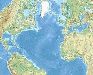
The Azores–Gibraltar Transform Fault (AGFZ), also called a fault zone and a fracture zone, is a major seismic fault in the Central Atlantic Ocean west of the Strait of Gibraltar. It is the product of the complex interaction between the African, Eurasian, and Iberian plates.[1] The AGFZ produced the large-magnitude 1755 Lisbon and 1969 Horseshoe earthquakes and, consequently, a number of large tsunamis.[2]
Geologic setting
Forming the Atlantic segment of the boundary between the African and Eurasian plates, the AGFZ is largely dominated by compressional forces between these converging (3.8 to 5.6 mm/a (0.15 to 0.22 in/year)) plates, but it is subject of a dynamic tectonic regime also involving extension and transform faulting. The oceanic lithosphere in the area is directly related to the opening of the North Atlantic Ocean and one of the oldest preserved on Earth.[2]
The western end of the AGFZ, the Azores Triple Junction on the Mid-Atlantic Ridge (MAR), is where the North American, African, and Eurasian plates meet. Spreading in the MAR is faster south of the AGFZ than north of it, which results in a transcurrent movement along the AGFZ at about 4 mm/a (0.16 in/year).[1] The eastern segment of the fault is complex and characterised by a series of seamounts and ridges separating the Tores and Horseshoe abyssal plains. The active compressional deformation in this segment is an extremely rare example of compression between two oceanic lithospheres.[1]
Plate tectonics
The Atlantic Ocean is surrounded by passive margins with the exception of three subduction zones: the Lesser Antilles Arc in the Caribbean, the Scotia Arc in the South Atlantic, and the Gibraltar Arc in the western Mediterranean. The Gibraltar Arc is propagating westward into the Atlantic over an east-dipping oceanic slab (one of the remainders of the Tethys Ocean). This subduction/back-arc basin system is developing in front of the Alboran Block (under the Alboran Sea) at a rate faster than that of the Africa-Iberia convergence. Consequently, this area is a rare case of a passive margin slowly being transformed into an active margin.[3] The extension of this subduction system, known as the "allochthonous unit of the Gulf of Cadiz" (AUGZ), marks the continuing propagation of the Alpide belt into the Atlantic along the AGFZ.[4] In the context of the Wilson Cycle, this suggests that the beginning of the closure of the Atlantic is taking place in front of the three Atlantic subduction zones.[3]
See also
References
Notes
- Richardson, Musson & Horsburgh 2006, Appendix A, Tectonics of the Azores-Gibraltar fault zone, pp. 94–97
- Martínez‐Loriente et al. 2014, Introduction, p. 127
- Duarte et al. 2013, Introduction, pp. 839–840
- Hernández-Molina et al. 2016, Geologic framework, p. 4
Sources
- Duarte, J. C.; Rosas, F. M.; Terrinha, P.; Schellart, W. P.; Boutelier, D.; Gutscher, M. A.; Ribeiro, A. (2013). "Are subduction zones invading the Atlantic? Evidence from the southwest Iberia margin". Geology. 41 (8): 839–842. Bibcode:2013Geo....41..839D. doi:10.1130/G34100.1.CS1 maint: ref=harv (link)
- Hernández-Molina, F. J.; Sierro, F. J.; Llave, E.; Roque, C.; Stow, D. A. V.; Williams, T.; Lofi, J.; Van der Schee, M.; Arnáiz, A.; Ledesma, S.; Rosales, C.; Rodríguez-Tovar, F. J.; Pardo-Igúzquiza, E.; Brackenridge, R. E. (2016). "Evolution of the gulf of Cadiz margin and southwest Portugal contourite depositional system: Tectonic, sedimentary and paleoceanographic implications from IODP expedition 339". Marine Geology. 377: 7–39. Bibcode:2016MGeol.377....7H. doi:10.1016/j.margeo.2015.09.013. Retrieved 29 October 2015.CS1 maint: ref=harv (link)
- Martínez‐Loriente, S.; Sallarès, V.; Gràcia, E.; Bartolome, R.; Dañobeitia, J. J.; Zitellini, N. (2014). "Seismic and gravity constraints on the nature of the basement in the Africa‐Eurasia plate boundary: New insights for the geodynamic evolution of the SW Iberian margin". Journal of Geophysical Research: Solid Earth. 119 (1): 127–149. Bibcode:2014JGRB..119..127M. doi:10.1002/2013JB010476. hdl:10261/108896. Retrieved 29 October 2016.CS1 maint: ref=harv (link)
- Richardson, S.; Musson, R.; Horsburgh, K. (2006). Tsunamis–Assessing the hazard for the UK and Irish coast (PDF). 41st Defra Flood and Coastal Management Conference. York, UK. Archived from the original (PDF (7.8Mb)) on 23 January 2013. Retrieved 29 October 2016.CS1 maint: ref=harv (link)
Further reading
- i. c. Ribeiro, Ana; p. s. Correia, Ana; Ribeiro, José R. (2020), "2 February 1816, an Overlooked North Atlantic M 8 Earthquake", Seismological Research Letters, doi:10.1785/0220200201
Gibraltar topics | |||||||||||||||||||||||
|---|---|---|---|---|---|---|---|---|---|---|---|---|---|---|---|---|---|---|---|---|---|---|---|
.svg.png) | |||||||||||||||||||||||
| |||||||||||||||||||||||
| |||||||||||||||||||||||
| |||||||||||||||||||||||
| |||||||||||||||||||||||
| |||||||||||||||||||||||