Askvoll
![]()
Askvoll kommune | |
|---|---|
 View of the village of Gjelsvik along the Førdefjorden | |
 Coat of arms 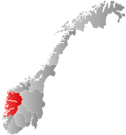 Vestland within Norway | |
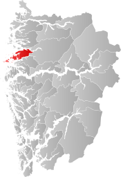 Askvoll within Vestland | |
| Coordinates: 61°24′21″N 05°14′32″E | |
| Country | Norway |
| County | Vestland |
| District | Sunnfjord |
| Established | 1 Jan 1838 |
| Administrative centre | Askvoll |
| Government | |
| • Mayor (2017) | Ole André Klausen (H) |
| Area | |
| • Total | 326.23 km2 (125.96 sq mi) |
| • Land | 312.89 km2 (120.81 sq mi) |
| • Water | 13.34 km2 (5.15 sq mi) 4.1% |
| Area rank | 255 in Norway |
| Population (2020) | |
| • Total | 3,011 |
| • Rank | 228 in Norway |
| • Density | 9.6/km2 (25/sq mi) |
| • Change (10 years) | 0.4% |
| Demonym(s) | Askvolling[1] |
| Time zone | UTC+01:00 (CET) |
| • Summer (DST) | UTC+02:00 (CEST) |
| ISO 3166 code | NO-4645 |
| Official language form | Nynorsk[2] |
| Website | askvoll |
The 326-square-kilometre (126 sq mi) municipality is the 255th largest by area out of the 356 municipalities in Norway. Askvoll is the 238th most populous municipality in Norway with a population of 3,011. The municipality's population density is 9.6 inhabitants per square kilometre (25/sq mi) and its population has increased by 0.4% over the previous 10-year period.[3][4]
The municipality stretches from the Bulandet islands in the west and Sunnfjord Municipality in east. The highest peak is the 1,304-metre (4,278 ft) high mountain Blegja. Alden Mountain (known as the "Norwegian Horse") is located on the island of Alden in Askvoll. It rises almost vertically out of the sea to a height of 481 metres (1,578 ft) above sea level and is visible from more than 100 kilometres (62 mi) out at sea.
In 2016, the chief of police for Vestlandet formally suggested a reconfiguration of police districts and stations. He proposed that the police station in Askvoll be closed.[5]
General information


Askvoll was established as a municipality on 1 January 1838 (see formannskapsdistrikt law). The original municipality was identical to the Askvoll parish (prestegjeld) with the sub-parishes (sokn) of Askvoll, Vilnes, Øn, and Hyllestad.[6] In 1862, the two southernmost sub-parishes of Øn and Hyllestad (population: 2,475) were separated from Askvoll and (along with the Bø sub-parish from Lavik municipality) formed the new municipality of Hyllestad. This left Askvoll with 2 sub-parishes and a population of 3,065.[7]
On 1 January 1888, several farms in the Hersvikbygda area on the northern part of the island of Sula and the smaller surrounding islands (population: 317) were transferred from Askvoll municipality to the neighboring municipality of Utvær. During the 1960s, there were many municipal mergers across Norway due to the work of the Schei Committee. On 1 January 1964, the parts of the municipalities of Vevring (population: 407) and Bru (population: 92) that were located south of the Førdefjorden were merged into Askvoll municipality. This gave Askvoll a population of 3,585. On 1 January 1990, Askvoll and Fjaler did a land trade: the Fjaler farms of Vårdal, Holmedal, Rivedal, and part of Hestad (population: 731) were transferred to Askvoll; and the Askvoll farms of Fure, Folkestad, and Våge (population: 482) were transferred to Fjaler.[7]
Name
The municipality (originally the parish) is named after the farm Askvoll (Old Norse: Askvǫllr), since the first Askvoll Church was built there. The first element is askr which means ash tree and the last element is vǫllr which means meadow.[8]
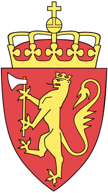
Coat of arms
The coat of arms was granted on 5 January 1990. The arms show an old medieval stone cross on a green background. The cross represents the Korssundkrossen, which is connected to several stories of St. Olav.[9]
Local Churches
The Church of Norway has one parish (sokn) within the municipality of Askvoll. It is part of the Sunnfjord prosti (deanery) in the Diocese of Bjørgvin.
| Parish (sokn) | Church name | Location of the church | Year built |
|---|---|---|---|
| Askvoll | Askvoll Church | Askvoll | 1863 |
| Bulandet Chapel | Musøya in Bulandet | 1905 | |
| Holmedal Church | Holmedal | 1868 | |
| Kvammen Chapel | Kvammen | 1977 | |
| Stongfjorden Chapel | Stongfjorden | 1908 | |
| Vilnes Church | Vilnes on Atløyna | 1674 | |
| Værlandet Chapel | Værlandet | 1960 |
Government
All municipalities in Norway, including Askvoll, are responsible for primary education (through 10th grade), outpatient health services, senior citizen services, unemployment and other social services, zoning, economic development, and municipal roads. The municipality is governed by a municipal council of elected representatives, which in turn elect a mayor.[10] The municipality falls under the Sogn og Fjordane District Court and the Gulating Court of Appeal.
Municipal Council
The municipal council (Kommunestyre) of Askvoll is made up of 21 representatives that are elected to four year terms. The party breakdown of the council is as follows:
| Party Name (in Nynorsk) | Number of representatives | |
|---|---|---|
| Labour Party (Arbeidarpartiet) | 2 | |
| Conservative Party (Høgre) | 7 | |
| Centre Party (Senterpartiet) | 6 | |
| Socialist Left Party (Sosialistisk Venstreparti) | 2 | |
| Liberal Party (Venstre) | 4 | |
| Total number of members: | 21 | |
| Party Name (in Nynorsk) | Number of representatives | |
|---|---|---|
| Labour Party (Arbeidarpartiet) | 3 | |
| Conservative Party (Høgre) | 8 | |
| Centre Party (Senterpartiet) | 4 | |
| Socialist Left Party (Sosialistisk Venstreparti) | 1 | |
| Liberal Party (Venstre) | 5 | |
| Total number of members: | 21 | |
| Party Name (in Nynorsk) | Number of representatives | |
|---|---|---|
| Labour Party (Arbeidarpartiet) | 4 | |
| Conservative Party (Høgre) | 6 | |
| Christian Democratic Party (Kristeleg Folkeparti) | 2 | |
| Centre Party (Senterpartiet) | 4 | |
| Liberal Party (Venstre) | 5 | |
| Total number of members: | 21 | |
| Party Name (in Nynorsk) | Number of representatives | |
|---|---|---|
| Labour Party (Arbeidarpartiet) | 6 | |
| Progress Party (Framstegspartiet) | 1 | |
| Conservative Party (Høgre) | 3 | |
| Christian Democratic Party (Kristeleg Folkeparti) | 2 | |
| Centre Party (Senterpartiet) | 5 | |
| Socialist Left Party (Sosialistisk Venstreparti) | 1 | |
| Liberal Party (Venstre) | 5 | |
| Total number of members: | 23 | |
| Party Name (in Nynorsk) | Number of representatives | |
|---|---|---|
| Labour Party (Arbeidarpartiet) | 5 | |
| Progress Party (Framstegspartiet) | 1 | |
| Conservative Party (Høgre) | 3 | |
| Christian Democratic Party (Kristeleg Folkeparti) | 2 | |
| Centre Party (Senterpartiet) | 4 | |
| Socialist Left Party (Sosialistisk Venstreparti) | 2 | |
| Liberal Party (Venstre) | 6 | |
| Total number of members: | 23 | |
| Party Name (in Nynorsk) | Number of representatives | |
|---|---|---|
| Labour Party (Arbeidarpartiet) | 5 | |
| Conservative Party (Høgre) | 4 | |
| Christian Democratic Party (Kristeleg Folkeparti) | 2 | |
| Centre Party (Senterpartiet) | 7 | |
| Socialist Left Party (Sosialistisk Venstreparti) | 1 | |
| Liberal Party (Venstre) | 4 | |
| Total number of members: | 23 | |
| Party Name (in Nynorsk) | Number of representatives | |
|---|---|---|
| Labour Party (Arbeidarpartiet) | 6 | |
| Conservative Party (Høgre) | 5 | |
| Christian Democratic Party (Kristeleg Folkeparti) | 3 | |
| Centre Party (Senterpartiet) | 12 | |
| Socialist Left Party (Sosialistisk Venstreparti) | 2 | |
| Liberal Party (Venstre) | 1 | |
| Total number of members: | 29 | |
| Party Name (in Nynorsk) | Number of representatives | |
|---|---|---|
| Labour Party (Arbeidarpartiet) | 6 | |
| Conservative Party (Høgre) | 3 | |
| Christian Democratic Party (Kristeleg Folkeparti) | 4 | |
| Centre Party (Senterpartiet) | 11 | |
| Socialist Left Party (Sosialistisk Venstreparti) | 2 | |
| Liberal Party (Venstre) | 2 | |
| Local list for Værlandet (Bygdeliste for Værlandet) | 1 | |
| Total number of members: | 29 | |
| Party Name (in Nynorsk) | Number of representatives | |
|---|---|---|
| Labour Party (Arbeidarpartiet) | 7 | |
| Conservative Party (Høgre) | 5 | |
| Christian Democratic Party (Kristeleg Folkeparti) | 5 | |
| Centre Party (Senterpartiet) | 6 | |
| Socialist Left Party (Sosialistisk Venstreparti) | 2 | |
| Liberal Party (Venstre) | 3 | |
| Local list for Værlandet (Krinsliste for Værlandet) | 1 | |
| Total number of members: | 29 | |
| Party Name (in Nynorsk) | Number of representatives | |
|---|---|---|
| Labour Party (Arbeidarpartiet) | 8 | |
| Conservative Party (Høgre) | 7 | |
| Christian Democratic Party (Kristeleg Folkeparti) | 4 | |
| Centre Party (Senterpartiet) | 6 | |
| Liberal Party (Venstre) | 3 | |
| Local list Hestvik-Stavestrand (Bygdeliste Hestvik-Stavestrand) | 1 | |
| Total number of members: | 29 | |
| Party Name (in Nynorsk) | Number of representatives | |
|---|---|---|
| Labour Party (Arbeidarpartiet) | 5 | |
| Conservative Party (Høgre) | 3 | |
| Christian Democratic Party (Kristeleg Folkeparti) | 3 | |
| Centre Party (Senterpartiet) | 6 | |
| Liberal Party (Venstre) | 2 | |
| Local list for the islands (Bygdeliste for Øyane) | 7 | |
| Local list of Stavenes-Størdal-Hestvik area (Bygdeliste for området Stavenes-Størdal-Hestvik) | 3 | |
| Total number of members: | 29 | |
| Party Name (in Nynorsk) | Number of representatives | |
|---|---|---|
| Labour Party (Arbeidarpartiet) | 5 | |
| Conservative Party (Høgre) | 3 | |
| Christian Democratic Party (Kristeleg Folkeparti) | 3 | |
| Centre Party (Senterpartiet) | 9 | |
| Joint list of the Liberal Party (Venstre) and New People's Party (Nye Folkepartiet) | 2 | |
| Local list for the islands (Bygdeliste for Øyane) | 7 | |
| Total number of members: | 29 | |
| Party Name (in Nynorsk) | Number of representatives | |
|---|---|---|
| Labour Party (Arbeidarpartiet) | 5 | |
| Conservative Party (Høgre) | 1 | |
| Christian Democratic Party (Kristeleg Folkeparti) | 4 | |
| Local List(s) (Lokale lister) | 19 | |
| Total number of members: | 29 | |
| Party Name (in Nynorsk) | Number of representatives | |
|---|---|---|
| Labour Party (Arbeidarpartiet) | 5 | |
| Conservative Party (Høgre) | 4 | |
| Christian Democratic Party (Kristeleg Folkeparti) | 4 | |
| Liberal Party (Venstre) | 6 | |
| Joint List(s) of Non-Socialist Parties (Borgarlege Felleslister) | 6 | |
| Local List(s) (Lokale lister) | 4 | |
| Total number of members: | 29 | |
| Party Name (in Nynorsk) | Number of representatives | |
|---|---|---|
| Labour Party (Arbeidarpartiet) | 6 | |
| Joint List(s) of Non-Socialist Parties (Borgarlege Felleslister) | 20 | |
| Local List(s) (Lokale lister) | 3 | |
| Total number of members: | 29 | |
| Party Name (in Nynorsk) | Number of representatives | |
|---|---|---|
| Labour Party (Arbeidarpartiet) | 4 | |
| Liberal Party (Venstre) | 10 | |
| Joint List(s) of Non-Socialist Parties (Borgarlege Felleslister) | 7 | |
| Local List(s) (Lokale lister) | 4 | |
| Total number of members: | 25 | |
| Party Name (in Nynorsk) | Number of representatives | |
|---|---|---|
| Labour Party (Arbeidarpartiet) | 3 | |
| Conservative Party (Høgre) | 3 | |
| Joint List(s) of Non-Socialist Parties (Borgarlege Felleslister) | 12 | |
| Local List(s) (Lokale lister) | 7 | |
| Total number of members: | 25 | |
| Party Name (in Nynorsk) | Number of representatives | |
|---|---|---|
| Labour Party (Arbeidarpartiet) | 7 | |
| Conservative Party (Høgre) | 3 | |
| Joint List(s) of Non-Socialist Parties (Borgarlege Felleslister) | 14 | |
| Total number of members: | 24 | |
| Party Name (in Nynorsk) | Number of representatives | |
|---|---|---|
| Labour Party (Arbeidarpartiet) | 4 | |
| Joint List(s) of Non-Socialist Parties (Borgarlege Felleslister) | 20 | |
| Total number of members: | 24 | |
| Party Name (in Nynorsk) | Number of representatives | |
|---|---|---|
| Labour Party (Arbeidarpartiet) | 5 | |
| Joint List(s) of Non-Socialist Parties (Borgarlege Felleslister) | 11 | |
| Local List(s) (Lokale lister) | 8 | |
| Total number of members: | 24 | |
| Party Name (in Nynorsk) | Number of representatives | |
|---|---|---|
| Labour Party (Arbeidarpartiet) | 5 | |
| Joint List(s) of Non-Socialist Parties (Borgarlege Felleslister) | 19 | |
| Total number of members: | 24 | |
Mayor
The mayor (ordførar) of a municipality in Norway is a representative of the majority party of the municipal council who is elected to lead the council. Ole André Klausen of the Conservative Party was elected mayor in 2017 to finish out the 2015-2019 term after the previous mayor who left the job, because she was elected to parliament in 2017.[29]
The mayors of Askvoll (incomplete list):
- 2017–present: Ole André Klausen (H)
- 2011-2017: Frida Melvær (H)
- 2003-2011: Aud Kari Steinsland (Ap)
- 1993-2003: Kjellaug Veivåg Høyvik (Sp)
- 1988-1993: Jorunn Ringstad (Sp)
- 1972-1988: Kåre Ness (Sp)
Geography

Askvoll municipality covers an area of 321 square kilometres (124 sq mi). Of this, 254 square kilometres (98 sq mi) are on the mainland while the remaining 67 square kilometres (26 sq mi) are made up of islands and skerries along its 52 kilometres (32 mi) coastline. To the west, lies the North Sea, to the north is the municipalities of Flora and Naustdal, to the east are the municipalities of Førde and Gaular, and to the south are the municipalities of Fjaler and Solund. The majority of the municipality is on the mainland between the Førdefjorden (in the north) and the Dalsfjorden (in the south). The Bulandet archipelago lies in the westernmost part of the municipality. There are many other islands between Bulandet and the mainland, notably Værlandet, Alden, and Atløyna. Geita Lighthouse lies on a very small island off the coast of Askvoll.
Attractions
Birdlife
Askvoll has many seabird reserves within the municipality. Otherwise mainland Askvoll provides habitat that is typical for the region. These however have restrictions, especially during the breeding season. One area that is good for birding is the Askvika nature reserve. This wetland area has a rich bird life with 69 recorded species.
Bulandet

Bulandet is Norway´s western-most fishing community. Bulandet includes 365 islands and has approximately 270 inhabitants. During the summer, Bulandet is a favourite spot for boaters and tourists staying in cottages and fisherman cabins. The name "Bulandet" comes from the numerous wharf-side cabins here, known as "bu".[30] Bulandet are linked together to the neighbour community Værlandet by six bridges and 5,240 metres (17,190 ft) of road. The Nordsjøporten road is not only important for traffic and communication in the area but also allows for a fantastic journey through the islands.
Værlandet
At the mouth of the fjord, near Alden Mountain, is Værlandet island. Værlandet has a population of approximately 200 people. Fishing and fish farming are the most important industries, but both tourism and the export of high quality stone (breccia) to Italy are expanding. There is a collection of picturesque small houses on the water's edge in Værøyhamna harbour.[30]
Alden

Also known as the "Norwegian Horse", Alden Mountain is an old and pronounced landmark for sailors along the coast. It rises almost vertically out of the sea to a height of 481 metres (1,578 ft) above sea level and is visible from more than 100 kilometres (62 mi) out at sea. There is a marked path to the top, accessible using the scheduled boat service from Askvoll.[30]
Blegja
The 1,304-metre (4,278 ft) high Blegja mountain in Askvoll has views from the top, and hikers can see the Jostedal glacier to the east and as far as Snønipa and the Ålfotbreen glacier in Bremanger municipality.[30]
Stongfjord Industries
Stongfjord Industries is Norway's oldest aluminium factory, and it is located in the village of Stongfjorden. British Aluminium Company started hydropower plant development in 1906, and produced aluminium from 1908 to 1945. Traces of the English industry are still apparent in the form of private houses, tennis courts, and football fields.[30]
Vilnes Church
The Vilnes Church on the island of Atløyna is a medieval wooden church constructed in 1674.[30]
Ingólfur Arnarson
The Ingólfur Arnarson statue in Rivedal is a monument to the pioneer spirit in the Dalsfjorden prior to the year 1000. Together with his brother, Ingólfur Arnarson he discovered Iceland, and laid the groundwork for the first Norwegian settlement there.[30]
See also
References
- "Navn på steder og personer: Innbyggjarnamn" (in Norwegian). Språkrådet.
- "Forskrift om målvedtak i kommunar og fylkeskommunar" (in Norwegian). Lovdata.no.
- Statistisk sentralbyrå (2020). "Table: 06913: Population 1 January and population changes during the calendar year (M)" (in Norwegian).
- Statistisk sentralbyrå (2020). "09280: Area of land and fresh water (km²) (M)" (in Norwegian).
- Fjelltveit, Ingvild; Raunholm, Per Vidar (2016-12-20). "Foreslår å legge ned 17 lensmannskontor i Vest politidistrikt". NRK Hordaland (in Norwegian). Retrieved 2017-10-20.
- Natvik, Oddvar (9 February 2005). "Some historical data on the 26 Kommunes". Archived from the original on 24 July 2011.
- Jukvam, Dag (1999). "Historisk oversikt over endringer i kommune- og fylkesinndelingen" (PDF) (in Norwegian). Statistics Norway.
- Rygh, Oluf (1919). Norske gaardnavne: Nordre Bergenhus amt (in Norwegian) (12 ed.). Kristiania, Norge: W. C. Fabritius & sønners bogtrikkeri. p. 249.
- "Civic heraldry of Norway - Norske Kommunevåpen". Heraldry of the World. Retrieved 2019-11-16.
- Hansen, Tore, ed. (2016-05-12). "kommunestyre". Store norske leksikon (in Norwegian). Kunnskapsforlaget. Retrieved 2019-04-06.
- "Tall for Norge: Kommunestyrevalg 2019 - Vestland". Valg Direktoratet. Retrieved 2019-10-29.
- "Table: 04813: Members of the local councils, by party/electoral list at the Municipal Council election (M)" (in Norwegian). Statistics Norway.
- "Tall for Norge: Kommunestyrevalg 2011 - Sogn og Fjordane". Valg Direktoratet. Retrieved 2019-10-29.
- "Kommunestyrevalget 1995" (PDF) (in Norwegian). Oslo-Kongsvinger: Statistisk sentralbyrå. 1996. Retrieved 2020-02-18.
- "Kommunestyrevalget 1991" (PDF) (in Norwegian). Oslo-Kongsvinger: Statistisk sentralbyrå. 1993. Retrieved 2020-02-18.
- "Kommunestyrevalget 1987" (PDF) (in Norwegian). Oslo-Kongsvinger: Statistisk sentralbyrå. 1988. Retrieved 2020-02-18.
- "Kommunestyrevalget 1983" (PDF) (in Norwegian). Oslo-Kongsvinger: Statistisk sentralbyrå. 1984. Retrieved 2020-02-18.
- "Kommunestyrevalget 1979" (PDF) (in Norwegian). Oslo: Statistisk sentralbyrå. 1979. Retrieved 2020-02-18.
- "Kommunevalgene 1975" (PDF) (in Norwegian). Oslo: Statistisk sentralbyrå. 1977. Retrieved 2020-05-01.
- "Kommunevalgene 1972" (PDF) (in Norwegian). Oslo: Statistisk sentralbyrå. 1973. Retrieved 2020-05-01.
- "Kommunevalgene 1967" (PDF) (in Norwegian). Oslo: Statistisk sentralbyrå. 1967. Retrieved 2020-05-01.
- "Kommunevalgene 1963" (PDF) (in Norwegian). Oslo: Statistisk sentralbyrå. 1964. Retrieved 2020-05-01.
- "Kommunevalgene og Ordførervalgene 1959" (PDF) (in Norwegian). Oslo: Statistisk sentralbyrå. 1960. Retrieved 2020-05-01.
- "Kommunevalgene og Ordførervalgene 1955" (PDF) (in Norwegian). Oslo: Statistisk sentralbyrå. 1957. Retrieved 2020-05-01.
- "Kommunevalgene og Ordførervalgene 1951" (PDF) (in Norwegian). Oslo: Statistisk sentralbyrå. 1952. Retrieved 2020-05-01.
- "Kommunevalgene og Ordførervalgene 1947" (PDF) (in Norwegian). Oslo: Statistisk sentralbyrå. 1948. Retrieved 2020-05-01.
- "Kommunevalgene og Ordførervalgene 1945" (PDF) (in Norwegian). Oslo: Statistisk sentralbyrå. 1947. Retrieved 2020-05-01.
- "Kommunevalgene og Ordførervalgene 1937" (PDF) (in Norwegian). Oslo: Statistisk sentralbyrå. 1938. Retrieved 2020-05-01.
- "Ordførar i Askvoll" (in Norwegian). Askvoll kommune. 2017-10-12. Retrieved 2017-10-20.
- "Askvoll Municipality in Norway". Retrieved 9 August 2008.
External links
| Wikimedia Commons has media related to Askvoll. |
- Municipal fact sheet from Statistics Norway (in Norwegian)
- Google map showing Askvoll
 |
|  | |||
| Authority control |
|---|