Arkansas Highway 358
Arkansas Highway 358 (AR 358 and Hwy. 358) is an east–west state highway in Greene County, Arkansas. The route of 13.89 miles (22.35 km) runs from Highway 141 east through to Highway 69 in Paragould.[2]
| ||||
|---|---|---|---|---|
| ||||
| Route information | ||||
| Maintained by ArDOT | ||||
| Length | 13.89 mi[1] (22.35 km) | |||
| Existed | 1967–present | |||
| Major junctions | ||||
| West end | ||||
| East end | ||||
| Location | ||||
| Counties | Greene | |||
| Highway system | ||||
| ||||

Route description
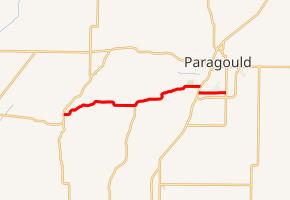
AR 358 begins at Highway 141 and runs east past the Old Bethel Methodist Church to serve as the northern terminus for Highway 351. Further east the route has a gap at U.S. Route 49 (US 49) and AR 1 in Paragould. The highway resumes towards the south of this first endpoint before AR 358 terminates at AR 69 in south Paragould.
Major intersections
Mile markers reset at concurrencies. The entire route is in Greene County.
| Location | mi[1] | km | Destinations | Notes | |||
|---|---|---|---|---|---|---|---|
| | 0.00 | 0.00 | Western terminus | ||||
| | 6.15 | 9.90 | |||||
| Paragould | 11.78 | 18.96 | Eastern terminus | ||||
| Gap in route | |||||||
| 0.00 | 0.00 | Western terminus | |||||
| 2.11 | 3.40 | Eastern terminus | |||||
| 1.000 mi = 1.609 km; 1.000 km = 0.621 mi | |||||||
References
- Planning and Research Division (2010). "Arkansas Road Log Database". Arkansas State Highway and Transportation Department. Archived from the original (Database) on 23 June 2011. Retrieved June 9, 2011.
- General Highway Map (PDF) (Map) (Greene County ed.). Arkansas State Highway and Transportation Department. Archived (PDF) from the original on 18 July 2011. Retrieved June 11, 2011.
External links
This article is issued from Wikipedia. The text is licensed under Creative Commons - Attribution - Sharealike. Additional terms may apply for the media files.