Alexandria, Ohio
Alexandria is a village in Licking County, Ohio, United States. The population was 517 at the 2010 census[7] and an estimated 542 in 2019.[8]
Alexandria, Ohio | |
|---|---|
 Village Office, W. Main Street | |
| Nickname(s): Alex (pronounced "Alec") | |
| Motto(s): Building on the Past - Preparing for the Future | |
 Location of Alexandria, Ohio | |
 Location of Alexandria in Licking County | |
| Coordinates: 40°5′23″N 82°36′47″W[1] | |
| Country | United States |
| State | Ohio |
| County | Licking |
| Area | |
| • Total | 0.24 sq mi (0.63 km2) |
| • Land | 0.24 sq mi (0.63 km2) |
| • Water | 0.00 sq mi (0.00 km2) |
| Elevation | 971 ft (296 m) |
| Population | |
| • Total | 517 |
| • Estimate (2019)[5] | 542 |
| • Density | 2,221.31/sq mi (856.24/km2) |
| Time zone | UTC-5 (Eastern (EST)) |
| • Summer (DST) | UTC-4 (EDT) |
| ZIP code | 43001 |
| Area code(s) | 740 |
| FIPS code | 39-01154[6] |
| GNIS feature ID | 1064308[3] |
| Website | www |
Alexandria was laid out in 1830.[9] Village voters defeated a ballot issue to dissolve the village and become a part of St. Albans Township. The vote was 92% against the dissolution on May 8, 2018.[10][11]
History
The village has a rich history including citizens who played a crucial role in the Underground Railroad, sheltering many escaped slaves on their way to freedom.
Notable people
- Bill Comstock, singer, member of "The Four Freshmen"
Geography
Alexandria is located in western Licking County at 40°5′23″N 82°36′47″W (40.089812, -82.612943),[1] along State Route 37 about 6 miles (10 km) southeast of Johnstown and 25 miles (40 km) northeast of Columbus.[12]
According to the United States Census Bureau, the village has a total area of 0.24 square miles (0.62 km2), all land.[13]
Demographics
| Historical population | |||
|---|---|---|---|
| Census | Pop. | %± | |
| 1840 | 200 | — | |
| 1850 | 349 | 74.5% | |
| 1860 | 320 | −8.3% | |
| 1870 | 303 | −5.3% | |
| 1880 | 269 | −11.2% | |
| 1890 | 296 | 10.0% | |
| 1900 | 420 | 41.9% | |
| 1910 | 414 | −1.4% | |
| 1920 | 415 | 0.2% | |
| 1930 | 450 | 8.4% | |
| 1940 | 425 | −5.6% | |
| 1950 | 464 | 9.2% | |
| 1960 | 452 | −2.6% | |
| 1970 | 588 | 30.1% | |
| 1980 | 489 | −16.8% | |
| 1990 | 468 | −4.3% | |
| 2000 | 485 | 3.6% | |
| 2010 | 517 | 6.6% | |
| Est. 2019 | 542 | [5] | 4.8% |
| U.S. Decennial Census[14] | |||
2010 census
As of the census[4] of 2010, there were 517 people, 182 households, and 144 families living in the village. The population density was 2,068.0 inhabitants per square mile (798.5/km2). There were 203 housing units at an average density of 812.0 per square mile (313.5/km2). The racial makeup of the village was 98.5% White, 0.6% Native American, and 1.0% from two or more races. Hispanic or Latino of any race were 1.2% of the population.
There were 182 households, of which 50.0% had children under the age of 18 living with them, 58.8% were married couples living together, 14.8% had a female householder with no husband present, 5.5% had a male householder with no wife present, and 20.9% were non-families. 15.9% of all households were made up of individuals, and 4.4% had someone living alone who was 65 years of age or older. The average household size was 2.84 and the average family size was 3.13.
The median age in the village was 34.9 years. 30.2% of residents were under the age of 18; 7.6% were between the ages of 18 and 24; 28.3% were from 25 to 44; 22.7% were from 45 to 64; and 11.4% were 65 years of age or older. The gender makeup of the village was 49.5% male and 50.5% female.
 Thomas Evans Bike Trail, Depot Street
 Alexandria Baptist Church from southeast
 Alexandria United Methodist Church, front
 Alexandria Public Library from Maple Drive
2000 census
As of the census[6] of 2000, there were 485 people, 29 households, and 22 families living in the village. The population density was 523.1 people per square mile (205.1/km2). There were 30 housing units at an average density of 184.6 per square mile (72.4/km2). The racial makeup of the village was 98.82% White and 1.18% Native American. Hispanic or Latino of any race were 1.18% of the population.
There were 29 households, out of which 37.9% had children under the age of 18 living with them, 72.4% were married couples living together, and 24.1% were non-families. 20.7% of all households were made up of individuals, and 13.8% had someone living alone who was 65 years of age or older. The average household size was 2.93 and the average family size was 3.45.
In the village, the population was spread out, with 34.1% under the age of 18, 4.7% from 18 to 24, 32.9% from 25 to 44, 15.3% from 45 to 64, and 12.9% who were 65 years of age or older. The median age was 32 years. For every 100 females there were 107.3 males. For every 100 females age 18 and over, there were 100.0 males.
The median income for a household in the village was $29,688, and the median income for a family was $41,250. Males had a median income of $26,250 versus $0 for females. The per capita income for the village was $16,235. None of the population and none of the families were below the poverty line.
Locations of interest
Located in town, Alexandria Public Library serves the residents of Alexandria. Fireman's Park, Lobdell Reserve, Parker Community Park, and the Fritz Drumm Field of Dreams are all located in or very near the village. The Alexandria Museum, on Main Street, is a small house museum.
Schooling
Residents of Alexandria and the surrounding areas attend Northridge Local School District, which includes: Northridge Primary (Located within Alexandria's limits), Northridge Intermediary, Northridge Middle School, and Northridge High School (Johnstown).
References
- "US Gazetteer files: 2010, 2000, and 1990". United States Census Bureau. 2011-02-12. Retrieved 2011-04-23.
- "2019 U.S. Gazetteer Files". United States Census Bureau. Retrieved July 27, 2020.
- "US Board on Geographic Names". United States Geological Survey. 2007-10-25. Retrieved 2008-01-31.
- "U.S. Census website". United States Census Bureau. Retrieved 2013-01-06.
- "Population and Housing Unit Estimates". United States Census Bureau. May 24, 2020. Retrieved May 27, 2020.
- "U.S. Census website". United States Census Bureau. Retrieved 2008-01-31.
- "Total Population: 2010 Census DEC Summary File 1 (P1), Alexandria village, Ohio". data.census.gov. U.S. Census Bureau. Retrieved July 9, 2020.
- "Alexandria, OH Profile: Facts, Map & Data". ohio.hometownlocator.com. Retrieved 2018-06-01.
- Overman, William Daniel (1958). Ohio Town Names. Akron, OH: Atlantic Press. p. 2.
- DeVito, Maria (December 29, 2017). "Alexandria dissolution heads to the voters". Newark Advocate. Retrieved April 15, 2018.
- DeVito, Maria (May 8, 2018). "Voters soundly reject dissolution of Alexandria". Newark Advocate. Retrieved January 4, 2019.
- Google (2011-09-16). "Alexandria, Ohio" (Map). Google Maps. Google. Retrieved 2011-09-16.
- "U.S. Gazetteer Files: 2019: Places: Ohio". U.S. Census Bureau Geography Division. Retrieved July 9, 2020.
- "Census of Population and Housing". Census.gov. Retrieved June 4, 2015.
External links
- Official website
- Alexandria Public Library
- Northridge Local School District
- Past and present photos of Alexandria
Municipalities and communities of Licking County, Ohio, United States | ||
|---|---|---|
| Cities | 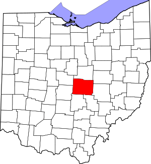 Map of Ohio highlighting Licking County | |
| Villages | ||
| Townships | ||
| CDPs | ||
| Unincorporated communities | ||
| Ghost towns | ||
| Footnotes | ‡This populated place also has portions in an adjacent county or counties | |