Absheron District
Absheron Rayon (Azerbaijani: Abşeron, Russian: Апшерон), also spelled as Apsheron, is a rayon of Azerbaijan demarcated in 1963. Although it shares the same name as the Absheron Peninsula, the area covered by the rayon is not conterminous, being further west and mostly inland.[2]
Absheron District Abşeron Rayon | |
|---|---|
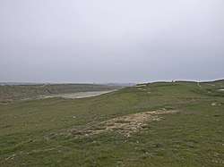 Hills from the top of Yanar Dag | |
.svg.png) Map of Azerbaijan showing Absheron Rayon | |
| Country | Azerbaijan |
| Capital | Xırdalan |
| Area | |
| • Total | 1,360 km2 (530 sq mi) |
| Population (2009 census) | |
| • Total | 189,800 |
| • Density | 140/km2 (360/sq mi) |
| Telephone code | (+994) 012[1] |
| Website | absheron |
History
Absheron District was founded in 1963 by the Soviet government to assure enough labour force, highly educated professional staff and necessary provisions is given to enterprises and firms, kolkhozs and collective farms, poultry and agrarian industries, construction centres, scientific-research institutes and laboratories present on the territories of Baku and Sumgait. There are many historical monuments on the territory of Absheron. For example, in the village of Aşağı Güzdək there are agricultural tools from the 19th century. In Goradile village, there is Abdurrahman mosque pertaining to the 19th century which was built by the villager Haji Gurban, mosques from the 18th century in Məmmədli built by Garadaglilar family, mosque-madrasa built in the 19th century by Haji Safarali in Novxani, Albattin mosque in Fatmai which goes back to the 18th century. Aside from religious monuments, there are many monuments pertaining to social life of people in last centuries. For example, hamams built in Middle Ages by Haji Kazim in Qobu village and another one built by Meshadi Imam Baxish in Xirdalan. Ancient wells which provided water supply to people living in this territory are still used in Aşağı Güzdək and Xirdalan. Tombs from the 8th - 18th centuries are also preserved: in Fatmai, Digah, Masazir, Hökməli and Saray.[2]
Population
According to the Annual Report of the State Statistics Committee, the total number of population of the district was 91,2 thousand in 2000. This number increased by nearly 25 times in 2018.
| 2000 | 2001 | 2002 | 2003 | 2004 | 2005 | 2006 | 2007 | 2008 | 2009 | 2010 | 2011 | 2012 | 2013 | 2014 | 2015 | 2016 | 2017 | 2018 | |
| Absheron region | 91,2 | 101,2 | 111,5 | 122,1 | 132,4 | 142,5 | 152,6 | 169,2 | 179,7 | 189,5 | 191,0 | 192,9 | 195,1 | 197,7 | 200,2 | 202,8 | 205,2 | 207,5 | 210,0 |
| urban population | 66,6 | 74,9 | 83,3 | 92,1 | 109,8 | 117,4 | 126,1 | 140,4 | 149,1 | 157,2 | 158,3 | 159,8 | 161,5 | 163,4 | 165,0 | 166,9 | 168,7 | 170,5 | 172,3 |
| rural population | 24,6 | 26,3 | 28,2 | 30,0 | 22,6 | 25,1 | 26,5 | 28,8 | 30,6 | 32,3 | 32,7 | 33,1 | 33,6 | 34,3 | 35,2 | 35,9 | 36,5 | 37,0 | 37,7 |
Demographics
- Azerbaijanis 86,592
- Others 3,608 [4]
Culture
During the last year, the organization of cultural events, historical events, literary and artistic nights and meetings and these organizations and meetings were organized and widely shown on different TV channels and mass media. For the protection and propagation of the intangible cultural heritage of Azerbaijan, the Absheron locale is announced as the "Capital of mastership of Azerbaijan" in 2014 by the Ministry of Culture and Tourism. Over the year, major reconstructions were carried out at the House of Culture, the Museum of History, and the modern children's music school in Khirdalan was built and put into operation.[5]
Geography and economy
Absheron is situated partially on Absheron Peninsula and partially inland. Absheron is located on the west coast of the Caspian Sea. It is located in the border with Sumgayit city, Gobustan locale, Sabunchu region, Garadagh and Binagadi regions of Baku. Absheron district is located in a dry subtropical climate zone, the climatic conditions are semi-dessert and dry-dessert.[6] The basic part of its economy is agricultural production which develops in two directions: plant growing and cattlebreeding. More attention in plant growing is given to gardening and olive growing. In the sheep farming, raising local stock of "Gala" with semi-hard or hard skin prevails.[2]
The region is located in the southeastern part of the Greater Caucasus.
The highest point of the Absheron Peninsula is the Segerdag Mountain which is 676 meters above the sea level. There are the number of salt lakes on the territory of peninsula. The average rainfall in this area is 110–550 mm.[7]
One of the most important parts of the landscape is mud volcanoes, hills, and landfalls. The biggest one is Lokbatan Mud Cone, which erupted in October 2001.
The region has seven settlements, eight villages and one city. A total of 856.8 kilometers of roads pass through the district.[7]
Economy
Over 107 industrial entities are located in Absheron district. Private enterprises account for 85% of industrial enterprises. 85% of them are private entities. There are 43 construction enterprises in the area. 52 industrial entities are connected to agriculture and food production and only one, to camel-raising.[7]
Sightseeings
Gobustan
One of the most important places in Absheron region is Gobustan State Reserve with more than 6,000 rock carvings dating 5000–25000 years back. Carvings depict various events of people living in Stone Age.
Gobustan national park was included within World Social Legacy List.
Yanar dag
Yanar dag (meaning burning mountain) is a natural gas source which blazes from underground. The flames reach 3 meters in height.
Ateshgah
An ancient Zoroastrian temple located near Baku. Complex was built during 17-18th centuries and abandoned in 19th. But some sources state the fire worshipers' temple in Absheron dated from the 10th century.[8]
Masazir Lake
Masazir Lake is a red salty lake near Baku. Its area is 10 km^2
See also
References
- "Şəhərlərarası telefon kodları". Aztelekom MMC. Aztelekom İB. Retrieved 19 August 2015. (in Azerbaijani)
- Президентская библиотека Азербайджанской Республики. При содействии Академии Наук. Baku. 2008. p. 32.
- Political division, population size and structure: Population by towns and regions of the Republic of Azerbaijan. "Population | The State Statistical Committee of the Republic of Azerbaijan". The State Statistical Committee of the Republic of Azerbaijan. Retrieved 2018-11-20.
- http://www.stat.gov.az/source/demoqraphy/ap/indexen.php
- "Mədəniyyət - ABŞERON RAYON Icra Hakimiyyəti". absheron-ih.gov.az. Retrieved 2018-11-20.
- "Coğrafi mövqeyi - ABŞERON RAYON Icra Hakimiyyəti". absheron-ih.gov.az. Retrieved 2018-11-20.
- Kerimov, Mahmud. Azerbaycan Milli Ensiklopediasi. ISBN 978-9952-441-01-7.
- Abu Ishaq Ibrahim ibn Muhammad al-Farisi al Istakhri. Ketāb al-masālek wa’l-mamālek
Capital: Xırdalan | ||
| ||