Western Isles Overland Route
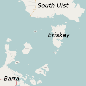
The Western Isles Overland Route is in Outer Hebrides (also called Western Isles) in Scotland. The route links Barra with Lewis passing through Eriskay, South Uist, Benbecula, North Uist, Berneray and Harris.
- This article is an itinerary.
_-_geograph.org.uk_-_2560484.jpg)
The route is a combination of bus and ferry journeys, taking a day to cover the whole route. It is described travelling North from Barra, but could easily be done in the reverse direction.
The route could also be followed by car or cycle, using the same roads and ferries.
Understand
Historically the Outer Hebrides had better connections to the mainland than between the islands. Until 1975 Lewis formed part of the county of Ross and Cromarty and the rest of the archipelago, including Harris, was part of Inverness-shire.
In 1975 Comhairle nan Eilean Siar (Western Isles Council) was established, which increased political interest in island connections. In 1999 a causeway between North Uist and Berneray opened, followed by a causeway between Eriskay and South Uist which opened in 2001. This forms the basis of the route described here.
Prepare
No advance booking is required. Tickets are bought from the bus drivers and the ferry staff. Unfortunately there is not a single through ticket, but where buses make a direct connection to another bus then a through ticket is sold. Approximate ticket prices (2015) are:
- Bus Castlebay to Ardmhor £1.60
- Ferry Barra to Eriskay £8.15
- Bus Eriskay to Berneray £6.20
- Ferry Berneray to Harris £7.50
- Bus Leverburgh to Stornoway £6.20
A combined timetable for the route, and individual bus timetables are available on the Western Isles Council website. The buses are operated by various small local operators, generally under contract to the council.
The ferries are operated by Caledonian MacBrayne. Note that the ferry from Berneray to Leverburgh cannot run at very low tides, and occasionally ferries are cancelled. Check that the ferry is running on their website or by phoning 01876 500337, such cancellations are usually also reported on the traffic reports on BBC Radio Scotland and as they are due to tides can be predicted in advance. High winds can also result in ferries being cancelled.
Generally there are five departures per day, except Sunday, from Castlebay, but only the first two allow the route to be completed in a day. There are no buses on a Sunday, but the ferries do run.
Some bus services run on request only for all or part of the journey. Sometimes this necessitates phoning the bus company the day before.
Get in
The route starts at Castlebay on Barra, can be reached by bus from Vatersay to the South, by ferry from Oban or by plane from Glasgow or Stornoway. For more details see the article on Barra.
The route can also be joined by ferry at Lochboisedale on South Uist, Lochmaddy on North Uist, Tarbert on Harris or Stornoway on Lewis. Flight connections are available at Balivanich on Benbecula and Stornoway on Lewis.
The bus departure point in Castlebay is across the road from the post office, near the pier.
Go
Barra

In 🌍 Castlebay, the bus departs from across the road from the post office near the pier. The bus is a minibus seating 10-20 passngers. From this bus stop, buses leave for Vatersay and to go to the North via the East or West coast. Ask the driver for the Eriskay ferry.
The journey from Castlebay to the slipway at Ardmhor takes about 20 minutes, and depending on the timetable can be via either the West or East coast. Both routes are scenic, but the West coast route perhaps has the edge, and is what is described here.
The bus goes up the hill and turns left onto the main road, passing the modern school buildings on the right. The route then continues past the scattered houses of the village, before going over a slight rise. It then passes 🌍 Loch Tangasdail on the left, where the ruins of Macleod's Tower can be seen. The tower, built in 1430, was originally three storeys high, but only about one storey now remains.
Next is Tangasdale Beach and the Isle of Barra Hotel on the right. This is followed shortly by the villages of Borve and Craigston and several small beaches. The route then head inland again, passing the Church of Scotland church and then Loch and Duin reservoir.
At Northbay, the bus turns left on to the road to 🌍 Ardmhor and the ferry slipway.
Ferry

The crossing takes about 40 minutes. The ferry carries cars, bikes and foot passengers. The bus does not board the ferry, and you will have to walk down the slipway onto the ferry. There is an indoor lounge with toilets and a viewing deck upstairs. Several small islands are passed en route, before the beach on Eriskay comes into view.
Eriskay

🌍 Eriskay Slipway
🌍 Bonnie Prince Charlie's Beach
🌍 Eriskay Causeway
Benbecula
🌍 Creagorry Co-op
🌍 Lioacleit School
🌍 Borve Castle
🌍 Uist and Barra Hospital
🌍 Benbecula Airport
🌍 Causeway to Grimsay
Sound of Harris Ferry

Stay safe
There are no major hazards on this route. If you are travelling by bicycle, the weather will make the journey occasionally unpleasant.