Simret
Simret is a tabia or municipality in the Dogu'a Tembien district of the Tigray Region of Ethiopia, which comprises the longest cave of Tigray in Zeyi,[1] as well as Ras Alula’s birthplace in Mennewe. The tabia centre is in Dengolo village, located approximately 12 km to the southwest of the woreda town Hagere Selam.
Simret | |
|---|---|
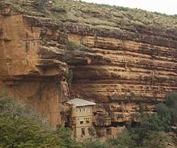 Abune Aregewi church in Zeyi, holding the entrance of the Zeyi cave | |
 Simret Location within Ethiopia | |
| Coordinates: 13°34′N 39°7′E | |
| Country | Ethiopia |
| Region | Tigray |
| Zone | Debub Misraqawi (Southeastern) |
| Woreda | Dogu'a Tembien |
| Area | |
| • Total | 55.16 km2 (21.30 sq mi) |
| Elevation | 2,500 m (8,200 ft) |
| Population (2007) | |
| • Total | 6,448 |
| • Density | 117/km2 (300/sq mi) |
| Time zone | UTC+3 (EAT) |
Geography
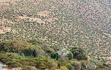
The tabia occupies a massive ridge at the southwest of Dogu’a Tembien, between the Zeyi gorge and the large amphitheatre-like valley of Mennewe, through which the main road winds from the lowlands to the Tembien highlands. The southern boundary is the Giba river. The highest peak is at the northern end of the tabia (2710 m a.s.l.) and the lowest place at the confluence of Zikuli and Giba rivers (1395 m a.s.l.). The difference in elevation is more than 1300 metres.
Geology
From the higher to the lower locations, the following geological formations are present:[2]
- Upper basalt
- Interbedded lacustrine deposits
- Lower basalt
- Amba Aradam Formation
- Mekelle Dolerite[3]
- Antalo Limestone
- Adigrat Sandstone
- Edaga Arbi Glacials
- Quaternary alluvium[4]
The Zikuli, Geba and Zeyi gorges allow views on the full stratigrapical succession.
Geomorphology and soils
The main geomorphic units, with corresponding soil types are:[5]
- Hagere Selam Highlands, along the central basalt and sandstone ridge
- Associated soil types
- Inclusions
- Rock outcrops and very shallow soils (Lithic Leptosol)
- Rock outcrops and very shallow soils on limestone (Calcaric Leptosol)
- Deep dark cracking clays with very good natural fertility, waterlogged during the wet season (Chromic Vertisol, Pellic Vertisol)
- Shallow stony dark loams on calcaric material (Calcaric Regosol, Calcaric Cambisol)
- Brown loamy soils on basalt with good natural fertility (Luvisol)
- Adigrat Sandstone cliff and footslope
- Associated soil types
- Inclusions
- shallow, dry soils with very high amounts of stones (Leptic and Skeletic Cambisol and Regosol)
- deep, dark cracking clays with good fertility, but problems of waterlogging (Chromic and Pellic Vertisol)
- soils with stagnating water due to an abrupt textural change such as sand over clay (Haplic Planosol]])
Climate and hydrology
Climate and meteorology
The rainfall pattern shows a very high seasonality with 70 to 80% of the annual rain falling in July and August. Mean temperature in Dengolo is 18 °C, oscillating between average daily minimum of 10 °C and maximum of 25.7 °C. In the lowland Kemishana village, at 1430 metres, the mean temperature amounts to 26.7 °C. The contrasts between day and night air temperatures are much larger than seasonal contrasts.[6]
Rivers
The Giba River is the most important river in the surroundings of the tabia. It flows towards Tekezze River and further on to the Nile. This river and its tributaries have incised deep gorges which characterise the landscape.[7] The drainage network of the tabia is organised as follows:[8]
- Giba River, with two tributaries (from upstream to downstream):
- Zeyi River, at the border of tabias Simret and Walta
- Zikulidegebir River, in tabia Simret and Abergele (woreda)
Whereas they are (nearly) dry during most of the year, during the main rainy season, these rivers carry high runoff discharges, sometimes in the form of flash floods. Especially at the begin of the rainy season they are brown-coloured, evidencing high soil erosion rates.
Springs
As there are no permanent rivers, the presence of springs is of utmost importance for the local people. The main springs in the tabia are:[9]
- May Fata in Addi Gumare
- Gunfan in Drgza
Water harvesting
In this area with rains that last only for a couple of months per year, reservoirs of different sizes allow harvesting runoff from the rainy season for further use in the dry season. Overall they suffer from siltation.[10] Yet, they strongly contribute to greening the landscape, either through irrigation or seepage water. Main reservoirs are:
- Traditional surface water harvesting ponds, particularly in places without permanent springs, called rahaya
- Horoyo, household ponds, recently constructed through campaigns[11]
Agriculture and livelihood
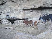
The population lives essentially from crop farming, supplemented with off-season work in nearby towns. The land is dominated by farmlands which are clearly demarcated and are cropped every year. Hence the agricultural system is a permanent upland farming system.[12] The farmers have adapted their cropping systems to the spatio-temporal variability in rainfall.[13] Especially the youngsters will go to the deep gorges of Giba and Zeyi rivers, near Kemishana, to harvest incense from Boswellia papyrifera trees.[14]
History and culture
History
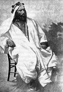
The history of the tabia is strongly confounded with the history of Tembien. Particularly, Ras Alula was born in Mennewe, the son of Engda Eqube, a farmer of modest origins. In Alula's childhood, a group of people carrying baskets of bread to a wedding ceremony were stopped by a group of children led by the future Ras, who demanded to know where they were going. "To the Castle of Ras Alula Wedi Qubi," they mockingly replied. Thereafter, his friends and the people of Mannewe nicknamed him Ras Alula.[15]
Religion and churches
Most inhabitants are Orthodox Christians. The following churches are located in the tabia:
Roads and communication
The main road from Mekelle through Hagere Selam winds down towards Abiy Addi across the Mennewe valley in the northeast of the tabia. There are regular bus services to these towns. Further, a rural access road links Addi Shinqur and Dengolo to the main asphalt road.
Tourism
Its mountainous nature and proximity to Mekelle make the tabia fit for tourism.[17] As compared to many other mountain areas in Ethiopia the villages are quite accessible, and during walks visitors may be invited for coffee, lunch or even for an overnight stay in a rural homestead.[18]
Touristic attractions
- Mennewe monastery and birthplace of Ras Alula
- Zeyi cave in Antalo Limestone, the longest cave in Tigray and ninth longest in Ethiopia. The monumental Zeyi Abune Aregawi church holds the entrance to the cave. The 364-metres long oval gallery displays stalactites, stalagmites, decametre-high columns, bell-holes following joints, and speleothems on walls and floor.[19][1]
Trekking routes
A trekking route has been established in this tabia.[20] The tracks are not marked on the ground but can be followed using downloaded. GPX files.[21] Starting from Inda Maryam Qorar, trek 8 leads directly down to Zeyi church and cave and further across the Zeyi and Giba gorges; the trek route meets Zikuli river and follows it upstream back to the main road, down from Mennewe.
See also
- Dogu'a Tembien district.
References
- The Zeyi Cave Geosite in Northern Ethiopia
- Sembroni, A.; Molin, P.; Dramis, F. (2019). Regional geology of the Dogu'a Tembien massif. In: Geo-trekking in Ethiopia's Tropical Mountains — The Dogu'a Tembien District. SpringerNature. ISBN 978-3-030-04954-6.
- Tefera, M.; Chernet, T.; Haro, W. Geological Map of Ethiopia (1:2,000,000). Addis Ababa, Ethiopia: Ethiopian Institute of Geological Survey.
- Moeyersons, J. and colleagues (2006). "Age and backfill/overfill stratigraphy of two tufa dams, Tigray Highlands, Ethiopia: Evidence for Late Pleistocene and Holocene wet conditions". Palaeogeography, Palaeoclimatology, Palaeoecology. 230 (1–2): 162–178. doi:10.1016/j.palaeo.2005.07.013.
- Nyssen, Jan; Tielens, Sander; Gebreyohannes, Tesfamichael; Araya, Tigist; Teka, Kassa; Van De Wauw, Johan; Degeyndt, Karen; Descheemaeker, Katrien; Amare, Kassa; Haile, Mitiku; Zenebe, Amanuel; Munro, Neil; Walraevens, Kristine; Gebrehiwot, Kindeya; Poesen, Jean; Frankl, Amaury; Tsegay, Alemtsehay; Deckers, Jozef (2019). "Understanding spatial patterns of soils for sustainable agriculture in northern Ethiopia's tropical mountains". PLOS ONE. 14 (10): e0224041. doi:10.1371/journal.pone.0224041. PMC 6804989. PMID 31639144.
- Jacob, M. and colleagues (2019). Dogu'a Tembien's Tropical Mountain Climate. In: Geo-trekking in Ethiopia's Tropical Mountains — The Dogu'a Tembien District. SpringerNature. doi:10.1007/978-3-030-04955-3_3. ISBN 978-3-030-04954-6.
- Amanuel Zenebe, and colleagues (2019). The Giba, Tanqwa and Tsaliet rivers in the headwaters of the Tekezze basin. In: Geo-trekking in Ethiopia's Tropical Mountains — The Dogu'a Tembien District. SpringerNature. doi:10.1007/978-3-030-04955-3_14. ISBN 978-3-030-04954-6.
- Jacob, M. and colleagues (2019). Geo-trekking map of Dogu'a Tembien (1:50,000). In: Geo-trekking in Ethiopia's Tropical Mountains — The Dogu'a Tembien District. SpringerNature. ISBN 978-3-030-04954-6.
- What do we hear from the farmers in Dogu'a Tembien? [in Tigrinya]. Hagere Selam, Ethiopia. 2016. p. 100.
- Nigussie Haregeweyn, and colleagues (2006). "Reservoirs in Tigray: characteristics and sediment deposition problems". Land Degradation and Development. 17: 211–230. doi:10.1002/ldr.698.
- Kaatje Segers, Joost Dessein, Jan Nyssen, Mitiku Haile & Jozef Deckers (8 June 2011). "Developers and farmers intertwining interventions: the case of rainwater harvesting and food-for-work in Degua Temben, Tigray, Ethiopia". International Journal of Agricultural Sustainability. 6 (3): 173–182. doi:10.3763/ijas.2008.0366.CS1 maint: multiple names: authors list (link)
- Nyssen, J.; Naudts, J.; De Geyndt, K.; Haile, Mitiku; Poesen, J.; Moeyersons, J.; Deckers, J. (2008). "Soils and land use in the Tigray highlands (Northern Ethiopia)". Land Degradation and Development. 19 (3): 257–274. doi:10.1002/ldr.840.
- Frankl, A. and colleagues (2013). "The effect of rainfall on spatio‐temporal variability in cropping systems and duration of crop cover in the Northern Ethiopian Highlands". Soil Use and Management. 29 (3): 374–383. doi:10.1111/sum.12041.
- Moens, T. and colleagues (2019). Boswellia Incense in the Giba River Gorge. In: Geo-trekking in Ethiopia's Tropical Mountains — The Dogu'a Tembien District. SpringerNature. doi:10.1007/978-3-030-04955-3_19. ISBN 978-3-030-04954-6.
- Haggai Erlich, Ras Alula and the Scramble for Africa: A Political Biography: Ethiopia & Eritrea 1875–1897 (Lawrenceville: Red Sea Press, 1996), p. 5 Erlich states the year of his birth as 1847.
- Klyuev S. A., Semenova V. N. The Role of Landscape in Semi-rock-hewn and Cave Churches of Tämben and ᵓƎndärta (Tәgray region, Ethiopia). Vestnik of Saint Petersburg University. Asian and African Studies, 2020, vol. 12, issue 2, pp. 208–229. https://doi.org/10.21638/spbu13.2020.204 (In Russian)
- Geo-trekking in Ethiopia's Tropical Mountains — The Dogu'a Tembien District. SpringerNature. 2019. ISBN 978-3-030-04954-6.
- Nyssen, Jan (2019). "Logistics for the Trekker in a Rural Mountain District of Northern Ethiopia". Geo-trekking in Ethiopia's Tropical Mountains. GeoGuide. Springer-Nature. pp. 537–556. doi:10.1007/978-3-030-04955-3_37. ISBN 978-3-030-04954-6.
- Causer, D. (1962). "A cave in Ethiopia". Wessex Cave Club Journal. 7: 91–94.
- Nyssen, Jan (2019). Description of Trekking Routes in Dogu'a Tembien. GeoGuide. Springer-Nature. pp. 557–675. doi:10.1007/978-3-030-04955-3_38. ISBN 978-3-030-04954-6.
- "Public GPS traces tagged with nyssen-jacob-frankl". OpenStreetMap. Retrieved 2019-10-11.