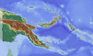
Yangkok Rural LLG
Palmai Rural LLG is a local-level government (LLG) of Sandaun Province, Papua New Guinea.[1][2]
Yangkok Rural LLG | |
|---|---|
 Yangkok Rural LLG Location within Papua New Guinea | |
| Coordinates: 3.562232°S 142.217826°E | |
| Country | Papua New Guinea |
| Province | Sandaun Province |
| Time zone | UTC+10 (AEST) |
Wards
- 01. Ausin/Yumoun
- 02. Mupun/Sikel
- 03. Weikint/Nunsi
- 04. Yuwil/Yemlu
- 05. Laingim/Soloku
- 06. Wulukum
- 07. Piom/Lalwi
- 08. Bimon/Maibel
- 09. Yili/Tomoum
- 10. Pinkil/Bairap
- 11. Warin/Witaili
- 12. Puang/Witikin
- 13. Weis/Witwan
- 14. Tomontonik/Yemnu
- 15. Anguganak
- 16. Rawot
- 17. Maimbel
- 18. Brugap/Bogasip
- 19. Yangkok
- 21. Mushu/Wublakil
- 22. Ningil 1
- 23. Ningil 2
gollark: Oh.
gollark: Archlinux.js is the one true kernel.
gollark: See, that bit here says <@319753218592866315>, <@!258639553357676545> has sent you a scheduled ping.
gollark: !pingwhen online <@319753218592866315>
gollark: No, I mean, on the message telling you you sent one, it pings the other person.
References
- "Census Figures by Wards – Momase Region". www.nso.gov.pg. 2011 National Population and Housing Census: Ward Population Profile. Port Moresby: National Statistical Office, Papua New Guinea. 2014.
- "Final Figures". www.nso.gov.pg. 2011 National Population and Housing Census: Ward Population Profile. Port Moresby: National Statistical Office, Papua New Guinea. 2014.
- OCHA FISS (2018). "Papua New Guinea administrative level 0, 1, 2, and 3 population statistics and gazetteer". Humanitarian Data Exchange. 1.31.9.
- United Nations in Papua New Guinea (2018). "Papua New Guinea Village Coordinates Lookup". Humanitarian Data Exchange. 1.31.9.
This article is issued from Wikipedia. The text is licensed under Creative Commons - Attribution - Sharealike. Additional terms may apply for the media files.