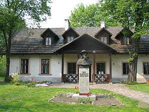
Wzgórza Krzesławickie
Wzgórza Krzesławickie is one of 18 districts of Kraków, located in the northeast part of the city. The name Wzgórza Krzesławickie comes from a village named Krzesławice (first mentioned in 1228) that is now a part of the district.[1]
Wzgórza Krzesławickie | |
|---|---|
 | |
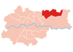 Location of Wzgórza Krzesławickie within Kraków | |
| Coordinates: 50°6′7″N 20°4′49.79″E | |
| Country | |
| Voivodeship | Lesser Poland |
| County/City | Kraków |
| Government | |
| • President | Stanisław Madej |
| Area | |
| • Total | 23.82 km2 (9.20 sq mi) |
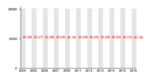
| Population (2014) | |
| • Total | 20,303 |
| • Density | 850/km2 (2,200/sq mi) |
| Time zone | UTC+1 (CET) |
| • Summer (DST) | UTC+2 (CEST) |
| Area code(s) | +48 12 |
| Website | http://www.dzielnica17.krakow.pl |
According to the Central Statistical Office data, the district's area is 23.82 square kilometres (9.20 square miles) and 20 303 people inhabit Wzgórza Krzesławickie.[2]
Subdivisions of Wzgórza Krzesławickie
Wzgórza Krzesławickie is divided into smaller subdivisions (osiedles). Here's a list of them.[1]
- Dłubnia
- Grębałów
- Kantorowice
- Krzesławice
- Lubocza
- Łuczanowice
- Osiedle Na Stoku
- Osiedle Na Wzgórzach
- Wadów
- Węgrzynowice
- Zesławice
Population
gollark: I guess one example is tapes, actually.
gollark: Pastebin is limited to 0.5MB. Why do you need to transfer stuff bigger than that to CC regularly?
gollark: ...
gollark: ... *how* large?
gollark: It's been done, I think.
References
- Małgorzata Niechaj (2017), History of Wzgórza Krzesławickie. Official website, Dzielnica XVII - Wzgórza Krzesławickie (in Polish).
- "Information about Wzgórza Krzesławickie district". Biuletyn Informacji Publicznej. Retrieved 30 August 2017.
External links
![]()
This article is issued from Wikipedia. The text is licensed under Creative Commons - Attribution - Sharealike. Additional terms may apply for the media files.