Wyoming, Delaware
Wyoming is a town in Kent County, Delaware, United States. It was named after the Wyoming Valley in Pennsylvania. It is part of the Dover, Delaware Metropolitan Statistical Area. The population was 1,313 at the 2010 census.[4]
Wyoming, Delaware | |
|---|---|
Railroad depot in Wyoming | |
| Etymology: Wyoming Valley in Pennsylvania | |
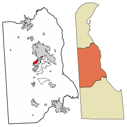
 Location of Wyoming in Kent County, Delaware. | |
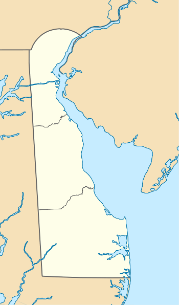
 Wyoming Location within the state of Delaware  Wyoming Wyoming (the United States) | |
| Coordinates: 39°07′05″N 75°33′32″W | |
| Country | |
| State | |
| County | |
| Government | |
| • Type | Mayor-council |
| • Mayor | Frankie Dale Rife |
| • Vice Mayor | Doug Denison |
| Area | |
| • Total | 1.06 sq mi (2.74 km2) |
| • Land | 1.04 sq mi (2.70 km2) |
| • Water | 0.02 sq mi (0.04 km2) |
| Elevation | 39 ft (12 m) |
| Population (2010) | |
| • Total | 1,313 |
| • Estimate (2019)[2] | 1,549 |
| • Density | 1,487.99/sq mi (574.43/km2) |
| Time zone | UTC−5 (Eastern (EST)) |
| • Summer (DST) | UTC−4 (EDT) |
| ZIP code | 19934 |
| Area code(s) | 302 |
| FIPS code | 10-81350 |
| GNIS feature ID | 217870[3] |
| Website | wyoming |
History
The community started when the nearby town of Camden, Delaware would not grant access to the Delaware Railroad (later part of the Pennsylvania Railroad), which bypassed the town and built a railroad station one mile west of the center of town and named the area West Camden. In 1865, minister John J. Pierce moved to West Camden from the Wyoming Valley and laid out plots for new housing. Several individuals from the Wyoming Valley moved to the new community and it was decided to rename the community.[5] The community, "Desiring to sever any shared identity or connection with Camden, residents chose to honor the new citizens by changing the name of the community to Wyoming." A post office was erected in 1866 and the community was incorporated into a town in 1869.[6]
The Lewis Family Tenant Agricultural Complex, Wyoming Historic District, and Wyoming Railroad Station are listed on the National Register of Historic Places.[7]
On February 22, 1975 a vote was held to merge with the bordering town of Camden; the residents of Camden voted 117 to 49 in favor of merging the towns, but the measure failed when Wyoming residents voted against the measure 113 against to 78 in favor.[8] The Wyoming town council had previously opposed a merger attempt in 1967.
Geography
Wyoming is located at 39°07′05″N 75°33′32″W (39.1181681, -75.5588139).[9]
According to the United States Census Bureau, the town has a total area of 0.7 square miles (1.8 km2), of which, 0.7 square miles (1.8 km2) of it is land and 0.04 square miles (0.10 km2) of it (2.90%) is water.
Climate
The climate in this area is characterized by hot, humid summers and generally mild to cool winters. According to the Köppen Climate Classification system, Wyoming has a humid subtropical climate, abbreviated "Cfa" on climate maps.
| Climate data for Wyoming, Delaware | |||||||||||||
|---|---|---|---|---|---|---|---|---|---|---|---|---|---|
| Month | Jan | Feb | Mar | Apr | May | Jun | Jul | Aug | Sep | Oct | Nov | Dec | Year |
| Record high °F (°C) | 77 (25) |
80 (27) |
87 (31) |
97 (36) |
98 (37) |
100 (38) |
104 (40) |
102 (39) |
98 (37) |
95 (35) |
85 (29) |
75 (24) |
104 (40) |
| Average high °F (°C) | 43 (6) |
47 (8) |
55 (13) |
66 (19) |
75 (24) |
83 (28) |
87 (31) |
85 (29) |
79 (26) |
69 (21) |
59 (15) |
47 (8) |
66 (19) |
| Average low °F (°C) | 27 (−3) |
29 (−2) |
36 (2) |
44 (7) |
54 (12) |
63 (17) |
69 (21) |
67 (19) |
60 (16) |
49 (9) |
40 (4) |
31 (−1) |
47 (8) |
| Record low °F (°C) | −7 (−22) |
−11 (−24) |
7 (−14) |
14 (−10) |
28 (−2) |
41 (5) |
45 (7) |
35 (2) |
30 (−1) |
25 (−4) |
11 (−12) |
−3 (−19) |
−11 (−24) |
| Average precipitation inches (mm) | 3.41 (87) |
3.18 (81) |
4.31 (109) |
3.88 (99) |
4.25 (108) |
4.00 (102) |
4.09 (104) |
4.36 (111) |
4.13 (105) |
3.42 (87) |
3.48 (88) |
3.65 (93) |
46.16 (1,174) |
| Source: The Weather Channel[10] | |||||||||||||
Demographics
| Historical population | |||
|---|---|---|---|
| Census | Pop. | %± | |
| 1870 | 280 | — | |
| 1880 | 353 | 26.1% | |
| 1890 | 497 | 40.8% | |
| 1900 | 450 | −9.5% | |
| 1910 | 517 | 14.9% | |
| 1920 | 661 | 27.9% | |
| 1930 | 684 | 3.5% | |
| 1940 | 870 | 27.2% | |
| 1950 | 911 | 4.7% | |
| 1960 | 1,172 | 28.6% | |
| 1970 | 1,062 | −9.4% | |
| 1980 | 960 | −9.6% | |
| 1990 | 977 | 1.8% | |
| 2000 | 1,141 | 16.8% | |
| 2010 | 1,313 | 15.1% | |
| Est. 2019 | 1,549 | [2] | 18.0% |
As of the census[12] of 2000, there were 1,141 people, 448 households, and 315 families residing in the town. The population density was 1,690.0 people per square mile (647.9/km2). There were 485 housing units at an average density of 718.3 per square mile (275.4/km2). The racial makeup of the town was 79.49% White, 13.32% African American, 0.09% Native American, 3.86% Asian, 0.53% from other races, and 2.72% from two or more races. Hispanic or Latino of any race were 2.54% of the population.
There were 448 households out of which 32.8% had children under the age of 18 living with them, 52.5% were married couples living together, 12.7% had a female householder with no husband present, and 29.5% were non-families. 24.1% of all households were made up of individuals and 7.4% had someone living alone who was 65 years of age or older. The average household size was 2.55 and the average family size was 2.99.
In the town, the population was spread out with 25.0% under the age of 18, 7.9% from 18 to 24, 31.4% from 25 to 44, 22.8% from 45 to 64, and 13.0% who were 65 years of age or older. The median age was 37 years. For every 100 females, there were 99.1 males. For every 100 females age 18 and over, there were 92.8 males.
The median income for a household in the town was $48,452, and the median income for a family was $54,265. Males had a median income of $35,625 versus $25,741 for females. The per capita income for the town was $21,254. About 1.8% of families and 3.6% of the population were below the poverty line, including 3.6% of those under age 18 and 3.4% of those age 65 or over.
Government
Wyoming is governed by a mayor-council system.[13]
- Mayor: Frankie Dale Rife
- Vice Mayor: Doug Denison
- Secretary: Tracy Johovic
- Treasurer: Kyle Dixon
- Council Person: Carlen Kenley
Infrastructure
Transportation
Delaware Route 10 runs east-west along the southeastern edge of Wyoming on Caesar Rodney Avenue, heading west through rural western Kent County to the Maryland border and east along Camden Wyoming Avenue through Camden toward an intersection with U.S. Route 13 and Dover Air Force Base. Delaware Route 15 runs north-south through Wyoming on Southern Boulevard and Railroad Avenue, heading north toward Dover and south toward Woodside.[14] DART First State provides bus service to Wyoming along Route 104, which passes along the eastern edge of town and runs south to the Walmart in Camden and north to the Dover Transit Center in Dover, where it connects to other local bus routes serving the Dover area.[15] The Delmarva Central Railroad's Delmarva Subdivision line passes north-south through Wyoming.[16] Jenkins Airport, a general aviation airport, is located just west of Wyoming.[14]
Utilities
Delmarva Power, a subsidiary of Exelon, provides electricity to Wyoming.[17] Chesapeake Utilities provides natural gas to the town.[18] The Camden-Wyoming Sewer & Water Authority provides sewer and water service to Wyoming and the neighboring town of Camden.[19] Trash and recycling collection in Wyoming is provided under contract by Republic Services.[20][21]
Local attractions
The "Wyoming Peach Festival" occurs every August.[22] It offers pageants, homemade peach ice cream and tours of Fifer Orchards, which is the largest peach and apple producer in the state of Delaware.
The Caesar Rodney Homecoming Parade happens every November to support the Caesar Rodney Riders in their homecoming football game.[23]
References
- "2019 U.S. Gazetteer Files". United States Census Bureau. Retrieved July 2, 2020.
- "Population and Housing Unit Estimates". United States Census Bureau. May 24, 2020. Retrieved May 27, 2020.
- "Wyoming". Geographic Names Information System. United States Geological Survey.
- "Archived copy". Archived from the original on 2016-12-31. Retrieved 2011-04-05.CS1 maint: archived copy as title (link)
- http://www.delawareonline.com/article/20130820/NEWS/308200065/Old-feud-between-Camden-Wyoming-part-local-lore?nclick_check=1
- http://archives.delaware.gov/markers/kc/KC-63.shtml#TopOfPage
- "National Register Information System". National Register of Historic Places. National Park Service. July 9, 2010.
- "Wyoming Votes No On Camden Merger". The News Journal(Wilmington, Delaware). February 24, 1975.
- "US Gazetteer files: 2010, 2000, and 1990". United States Census Bureau. 2011-02-12. Retrieved 2011-04-23.
- "Climate Statistics for Wyoming, Delaware". Retrieved December 17, 2019.
- "Census of Population and Housing". Census.gov. Retrieved June 4, 2016.
- "U.S. Census website". United States Census Bureau. Retrieved 2008-01-31.
- "Town Council". Town of Wyoming. Retrieved December 16, 2019.
- Delaware Department of Transportation (2017). Official Travel & Transportation Map (PDF) (Map). Dover: Delaware Department of Transportation.
- "Routes and Schedules". DART First State. Retrieved August 16, 2013.
- "Delmarva Central Railroad". Carload Express. Retrieved March 27, 2017.
- "Service Territory". Delmarva Power. Archived from the original on May 25, 2014. Retrieved August 15, 2017.
- "Delmarva Service Territory". Chesapeake Utilities. Retrieved August 14, 2017.
- "Home". Camden-Wyoming Sewer & Water Authority. Retrieved August 28, 2018.
- "2018 Trash Schedule". Town of Wyoming. Retrieved August 28, 2018.
- "Recycling & Yard Information" (PDF). Town of Wyoming. Retrieved August 28, 2018.
- "Slideshow: Wyoming Peach Festival - Delaware State News". Delaware State News. 2015-08-01. Retrieved 2017-08-18.
- "Homecoming Nov. 4 at Caesar Rodney High School". Dover Post. Retrieved 2017-08-18.