Worthville, Kentucky
Worthville is a home rule-class city in Carroll County, Kentucky, United States. The population was 185 at the 2010 census.[3]
Worthville, Kentucky | |
|---|---|
 Location of Worthville in Carroll County, Kentucky. | |
| Coordinates: 38°36′33″N 85°4′6″W | |
| Country | United States |
| State | Kentucky |
| County | Carroll |
| Area | |
| • Total | 0.26 sq mi (0.66 km2) |
| • Land | 0.26 sq mi (0.66 km2) |
| • Water | 0.00 sq mi (0.00 km2) |
| Elevation | 482 ft (147 m) |
| Population (2010) | |
| • Total | 185 |
| • Estimate (2019)[2] | 186 |
| • Density | 729.41/sq mi (281.13/km2) |
| Time zone | UTC-5 (Eastern (EST)) |
| • Summer (DST) | UTC-4 (EDT) |
| ZIP code | 41098 |
| Area code(s) | 502 |
| FIPS code | 21-84900 |
| GNIS feature ID | 0507155 |
History
A post office was established at Worthville in 1847.[4] The community was named for William J. Worth, an American general.[5]
Geography
Worthville is located along the southern boundary of Carroll County at 38°36′33″N 85°4′6″W (38.609186, -85.068452).[6] Eagle Creek, the county line, flows past the southern border of the town and joins the Kentucky River less than 1 mile (1.6 km) to the southwest. Owen County is to the south across the creek. Exit 44 of Interstate 71 is 4 miles (6 km) to the northwest along Kentucky Route 227, and Carrollton, the county seat, is 8 miles (13 km) to the northwest.
According to the United States Census Bureau, Worthville has a total area of 0.25 square miles (0.66 km2), all land.[3]
Demographics
| Historical population | |||
|---|---|---|---|
| Census | Pop. | %± | |
| 1880 | 124 | — | |
| 1890 | 203 | 63.7% | |
| 1900 | 223 | 9.9% | |
| 1910 | 326 | 46.2% | |
| 1920 | 315 | −3.4% | |
| 1930 | 297 | −5.7% | |
| 1940 | 333 | 12.1% | |
| 1950 | 308 | −7.5% | |
| 1960 | 247 | −19.8% | |
| 1970 | 258 | 4.5% | |
| 1980 | 272 | 5.4% | |
| 1990 | 191 | −29.8% | |
| 2000 | 215 | 12.6% | |
| 2010 | 185 | −14.0% | |
| Est. 2019 | 186 | [2] | 0.5% |
| U.S. Decennial Census[7] | |||
As of the census[8] of 2000, there were 215 people, 78 households, and 58 families residing in the city. The population density was 824.6 people per square mile (319.3/km2). There were 88 housing units at an average density of 337.5 per square mile (130.7/km2). The racial makeup of the city was 99.07% White, 0.47% African American, and 0.47% from two or more races.
There were 78 trailerhomes out of which 44.9% had children under the age of 18 living with them, 56.4% were married couples living together, 11.5% had a female householder with no husband present, and 25.6% were non-families. 19.2% of all households were made up of individuals and 6.4% had someone living alone who was 65 years of age or older. The average household size was 2.76 and the average family size was 3.07.
In the city, the population was spread out with 30.7% under the age of 18, 8.8% from 18 to 24, 30.7% from 25 to 44, 23.7% from 45 to 64, and 6.0% who were 65 years of age or older. The median age was 32 years. For every 100 females, there were 112.9 males. For every 100 females age 18 and over, there were 101.4 males.
The median income for a household in the city was $26,875, and the median income for a family was $28,125. Males had a median income of $27,750 versus $21,250 for females. The per capita income for the city was $10,791. About 10.9% of families and 15.5% of the population were below the poverty line, including 18.8% of those under the age of eighteen and none of those sixty five or over.
References
- "2019 U.S. Gazetteer Files". United States Census Bureau. Retrieved July 24, 2020.
- "Population and Housing Unit Estimates". United States Census Bureau. May 24, 2020. Retrieved May 27, 2020.
- "Geographic Identifiers: 2010 Demographic Profile Data (G001): Worthville city, Kentucky". U.S. Census Bureau, American Factfinder. Archived from the original on February 12, 2020. Retrieved August 7, 2014.
- "Carroll County". Jim Forte Postal History. Retrieved 3 January 2015.
- Lewis Collins (1877). History of Kentucky. p. 118.
- "US Gazetteer files: 2010, 2000, and 1990". United States Census Bureau. 2011-02-12. Retrieved 2011-04-23.
- "Census of Population and Housing". Census.gov. Retrieved June 4, 2015.
- "U.S. Census website". United States Census Bureau. Retrieved 2008-01-31.
External links
Municipalities and communities of Carroll County, Kentucky, United States | ||
|---|---|---|
| Cities | 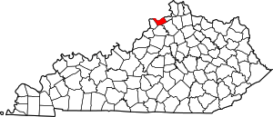 Location of Carroll County, Kentucky | |
| Unincorporated communities | ||
| Ghost towns |
| |