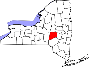
Worcester (CDP), New York
Worcester is a census-designated place (CDP) forming the central settlement of the town of Worcester in Otsego County, New York, United States. The population of the CDP was 1,113 at the 2010 census.[1]
Worcester, New York | |
|---|---|
 Worcester, New York Location within the state of New York | |
| Coordinates: 42°35′30″N 74°45′1″W | |
| Country | United States |
| State | New York |
| County | Otsego |
| Town | Worcester |
| Area | |
| • Total | 8.6 sq mi (22.3 km2) |
| • Land | 8.6 sq mi (22.2 km2) |
| • Water | 0.04 sq mi (0.1 km2) |
| Elevation | 1,330 ft (410 m) |
| Population (2010) | |
| • Total | 1,113 |
| • Density | 130/sq mi (50/km2) |
| Time zone | UTC-5 (Eastern (EST)) |
| • Summer (DST) | UTC-4 (EDT) |
| Area code(s) | 607 |
Geography
Worcester is located at 42°35′30″N 74°45′1″W (42.59172, -74.75050),[2] along New York State Route 7. Interstate 88 skirts the south edge of the CDP, serving the community via Exit 19, one mile (1.6 km) east of the CDP center.
According to the United States Census Bureau, the CDP has a total area of 8.6 square miles (22.3 km2), of which 8.6 square miles (22.2 km2) is land and 0.039 square miles (0.1 km2), or 0.53%, is water.[3]
gollark: Well, if you extrapolate from current trends, probably JS will be gone and replaced with some even weirder thing.
gollark: ++delete communist revolutions
gollark: No communist revolutions!
gollark: Videos are sent uncompressed at "16k³", the marketing name for multi-layer transparent 16k displays which don't actually have 16000 layers.
gollark: 2050: JavaScript development is conducted entirely on Google gPhones™. Hello World imports over 2000 packages, one of which is deprecated per day. Types have now been deprecated and everything is implicitly converted based on a 1000-page spec nobody ever reads. Applications take up about 50GB of space each and use about half of a recent 60GHz carbon-nanotube ARMv18 CPU's processing power. Each browser tab uses 1TB of RAM, more if it's playing videos.
References
- "Profile of General Population and Housing Characteristics: 2010 Demographic Profile Data (DP-1): Worcester CDP, New York". United States Census Bureau. Retrieved July 13, 2012.
- "Worcester, NY". U.S. Geological Survey 7.5-minute topographic map series, mapper.acme.com
- "Geographic Identifiers: 2010 Demographic Profile Data (G001): Worcester CDP, New York". United States Census Bureau. Retrieved July 13, 2012.
This article is issued from Wikipedia. The text is licensed under Creative Commons - Attribution - Sharealike. Additional terms may apply for the media files.
