Woodruff (CDP), Wisconsin
Woodruff is an unincorporated census-designated place located in the town of Woodruff, Oneida County, Wisconsin, United States. Woodruff is located at the junction of U.S. Route 51, Wisconsin Highway 70 and Wisconsin Highway 47 22.5 miles (36.2 km) northwest of Rhinelander. Woodruff has a post office with ZIP code 54568.[2] As of the 2010 census, its population is 966.[3] Woodruff has a hospital, the Howard Young Medical Center.
Woodruff, Wisconsin | |
|---|---|
Census-designated place | |
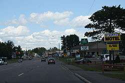 Downtown Woodruff | |
 Woodruff, Wisconsin | |
| Coordinates: 45°53′47″N 89°41′57″W | |
| Country | United States |
| State | Wisconsin |
| County | Oneida |
| Area | |
| • Total | 1.434 sq mi (3.71 km2) |
| • Land | 1.409 sq mi (3.65 km2) |
| • Water | 0.025 sq mi (0.06 km2) |
| Elevation | 1,608 ft (490 m) |
| Population (2010) | |
| • Total | 966 |
| • Density | 670/sq mi (260/km2) |
| Time zone | UTC-6 (Central (CST)) |
| • Summer (DST) | UTC-5 (CDT) |
| ZIP code | 54568 |
| Area code(s) | 715 & 534 |
| GNIS feature ID | 1577018[1] |
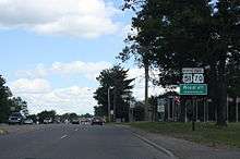
Woodruff sign on U.S. Route 51 / Wisconsin Highway 70
References
- U.S. Geological Survey Geographic Names Information System: Woodruff (CDP), Wisconsin
- ZIP Code Lookup
- "U.S. Census website". U.S. Census Bureau. Retrieved 20 April 2011.
Municipalities and communities of Oneida County, Wisconsin, United States | ||
|---|---|---|
| City | 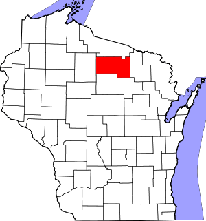 | |
| Towns | ||
| CDPs | ||
| Unincorporated communities | ||
| Ghost town/neighborhood | ||
| Footnotes | ‡This populated place also has portions in an adjacent county or counties | |
This article is issued from Wikipedia. The text is licensed under Creative Commons - Attribution - Sharealike. Additional terms may apply for the media files.