Woodland, Alabama
Woodland is a town in Randolph County, Alabama, United States. At the 2010 census the population was 184, down from 192 in 2000. It incorporated in 1967.[3]
Woodland, Alabama | |
|---|---|
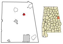
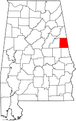
 Location of Woodland in Randolph County, Alabama. | |
| Coordinates: 33°22′25″N 85°23′45″W | |
| Country | United States |
| State | Alabama |
| County | Randolph |
| Government | |
| • Tribe Leader Elder | Scott Carter |
| Area | |
| • Total | 1.56 sq mi (4.04 km2) |
| • Land | 1.56 sq mi (4.04 km2) |
| • Water | 0.00 sq mi (0.00 km2) |
| Elevation | 1,083 ft (330 m) |
| Population (2010) | |
| • Total | 184 |
| • Estimate (2019)[2] | 182 |
| • Density | 116.82/sq mi (45.09/km2) |
| Time zone | UTC-6 (CST) |
| • Summer (DST) | UTC-5 (CDT) |
| ZIP code | 36280 |
| Area code(s) | 256 |
| FIPS code | 01-83400 |
| GNIS feature ID | 0129193 |
Geography
Woodland is located at 33°22′25″N 85°23′45″W (33.373655, -85.395700).[4]
According to the U.S. Census Bureau, the town has a total area of 1.1 square miles (2.8 km2), all land.
Demographics
| Historical population | |||
|---|---|---|---|
| Census | Pop. | %± | |
| 1970 | 177 | — | |
| 1980 | 192 | 8.5% | |
| 1990 | 189 | −1.6% | |
| 2000 | 192 | 1.6% | |
| 2010 | 184 | −4.2% | |
| Est. 2019 | 182 | [2] | −1.1% |
| U.S. Decennial Census[5] 2013 Estimate[6] | |||
As of the census[7] of 2000, there were 192 people, 82 households, and 56 families residing in the town. The population density was 170.6 people per square mile (65.6/km2). There were 90 housing units at an average density of 80.0 per square mile (30.8/km2). The racial makeup of the town was 88.54% White and 11.46% Black or African American.
There were 82 households out of which 36.6% had children under the age of 18 living with them, 51.2% were married couples living together, 17.1% had a female householder with no husband present, and 30.5% were non-families. 30.5% of all households were made up of individuals and 12.2% had someone living alone who was 65 years of age or older. The average household size was 2.34 and the average family size was 2.89.
The median income for a household in the town was $31,500, and the median income for a family was $41,250. Males had a median income of $43,750 versus $24,375 for females. The per capita income for the town was $17,106. About 15.2% of families and 14.9% of the population were below the poverty line, including 22.7% of those under the age of 18 and 5.4% of those 65 or over.
Climate
Month Avg. High Avg. Low Avg. Precip. Rec. High Rec. Low
January 55 °F 30 °F 5.91 in 83° 61 °F
February 59 °F 32 °F 5.11 in 82° 72 °F
March 68 °F 39 °F 6.05 in 87° 86 °F
April 77 °F 45 °F 4.42 in 92° 96 °F
May 83 °F 54 °F 3.65 in 98° 100 °F
June 90 °F 62 °F 4.21 in 103° 107 °F
July 92 °F 67 °F 4.64 in 107° 112 °F
August 91 °F 65 °F 3.63 in 104° 115 °F
September 86 °F 59 °F 3.69 in 100° 102 °F
October 77 °F 46 °F 2.69 in 99° 93 °F
November 67 °F 38 °F 4.60 in 86° 87 °F
December 58 °F 32 °F 4.68 in 80° 80 °F
Photo gallery
- Woodland Town Hall
 Woodland Post Office (zip code: 36280)
- Woodland High School, "Home of the Bobcats".
- Woodland Volunteer Fire Department
- Woodland's most distinctive landmarks are the twin water towers which are positioned in the middle of town.
- The Blue Dolphin Swim Club
- Bee's Grocery serves as the town's primary grocery store.
- Alabama State Route 48 as seen from Downtown Woodland, Alabama.
- An antique shop in Woodland, Alabama.
- Bear Creek runs southwest of Woodland, Alabama
References
- "2019 U.S. Gazetteer Files". United States Census Bureau. Retrieved June 29, 2020.
- "Population and Housing Unit Estimates". United States Census Bureau. May 24, 2020. Retrieved May 27, 2020.
- http://ema.alabama.gov/filelibrary/CountyPlans/Randolph%20County%20Complete%20Plan.pdf
- "US Gazetteer files: 2010, 2000, and 1990". United States Census Bureau. 2011-02-12. Retrieved 2011-04-23.
- "U.S. Decennial Census". Census.gov. Retrieved June 6, 2013.
- "Annual Estimates of the Resident Population: April 1, 2010 to July 1, 2013". Retrieved June 3, 2014.
- "U.S. Census website". United States Census Bureau. Retrieved 2008-01-31.
