Windsor Meadows State Park
Windsor Meadows State Park is a public recreation area on the west side of the Connecticut River in the town of Windsor, Connecticut. The state park occupies three largely undeveloped sections measuring 48, 19, and 88 acres (from north to south) located between railroad tracks and the river. Park activities include picnicking, fishing, boating, hiking, and biking.[2]
| Windsor Meadows State Park | |
|---|---|
Bissell Bridge | |
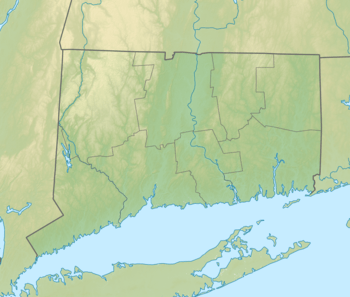
 Location in Connecticut  Windsor Meadows State Park (the United States) | |
| Location | Windsor, Connecticut, United States |
| Nearest city | Hartford, Connecticut |
| Coordinates | 41°49′06″N 72°38′43″W[1] |
| Area | 155 acres (63 ha)[2] |
| Elevation | 13 ft (4.0 m)[1] |
| Designation | Connecticut state park |
| Established | 1968 |
| Administrator | Connecticut Department of Energy and Environmental Protection |
| Website | Windsor Meadows State Park |
History
The park's undeveloped riparian forest and flood plain resemble the landscape seen by Adriaen Block and his crew when they sailed up the river in 1619.[2] The State of Connecticut acquired the land in 1968,[3] then listed it in the 1969 edition of the State Register and Manual as a 128-acre conservation area.[4] Plans to develop a riverwalk-type park were furthered in 2012 with the addition of the one-mile Windsor River Trail.[5]
Activities and amenities
The Windsor River Trail is a 10-foot-wide, handicapped-accessible path with scenic overlooks that parallels the river southward from the Captain John Bissell Memorial Bridge before turning inland, crossing Decker's Brook on an iron bridge, and coming to an end near Meadow Road.[5][6] The park is also the western terminus of the 1.8-mile-long (2.9 km) Bissell Bridge Walkway Trail, which crosses the river on Bissell Bridge (I-291).[7] Boaters can access the river from a launch ramp located at the bridge's base.[8]
References
- "Windsor Meadows State Park". Geographic Names Information System. United States Geological Survey.
- "Windsor Meadows State Park". State Parks and Forests. Connecticut Department of Energy and Environmental Protection. July 18, 2016. Retrieved September 28, 2017.
- Leary, Joseph (2004). A Shared Landscape: A Guide & History of Connecticut's State Parks & Forests. Hartford, Conn.: Friends of the Connecticut State Parks, Inc. p. 100. ISBN 0974662909.
- "Conservation Areas". State Register and Manual 1969. State of Connecticut. 1969. p. 172. Retrieved March 16, 2016.
- Marteka, Peter (November 15, 2012). "Rediscovering the Connecticut River in Windsor". Hartford Courant. Nature's Path & Way To Go. Retrieved March 16, 2016.
- "Windsor Meadows Trail Map" (PDF). Bike It or Hike It. Retrieved March 16, 2016.
- "Bissell Bridge Trail" (PDF). Connecticut Department of Transportation. Retrieved March 16, 2016.
- "Bissell Bridge Boat Launch". Connecticut Department of Energy and Environmental Protection. January 30, 2013. Retrieved March 16, 2016.
External links
- Windsor Meadows State Park Connecticut Department of Energy and Environmental Protection
- Windsor Meadows State Park Map Connecticut Department of Energy and Environmental Protection