Wilroads Gardens, Kansas
Wilroads Gardens is an unincorporated community in Ford County, Kansas, United States.[1] Its population was 609 as of the 2010 census.[2]
Wilroads Gardens, Kansas | |
|---|---|
| Coordinates: 37°43′27″N 99°55′59″W[1] | |
| Country | United States |
| State | Kansas |
| County | Ford |
| Area | |
| • Total | 2.253 sq mi (5.84 km2) |
| • Land | 2.253 sq mi (5.84 km2) |
| • Water | 0 sq mi (0 km2) |
| Elevation | 2,441 ft (744 m) |
| Population | |
| • Total | 609 |
| • Density | 270/sq mi (100/km2) |
| Time zone | UTC-6 (CST) |
| • Summer (DST) | UTC-5 (CDT) |
| Area code | 620 |
| FIPS code | 20-79625 [1] |
| GNIS ID | 473893 [1] |


Demographics
For statistical purposes, the United States Census Bureau has defined Wilroads Gardens as a census-designated place (CDP).
gollark: It varies between compass implementations.
gollark: No. ☭ bad. Also, I identify as a yellow libright.
gollark: The auth half is uncool.
gollark: Yep!
gollark: https://lucasnorth.uk/sapply/
See also
References
- Geographic Names Information System (GNIS) details for Wilroads Gardens, Kansas; United States Geological Survey (USGS); October 13, 1978.
- "2010 Census Gazetteer Files - Places: Kansas". U.S. Census Bureau. Retrieved August 13, 2014.
Further reading
External links
Municipalities and communities of Ford County, Kansas, United States | ||
|---|---|---|
| Cities | 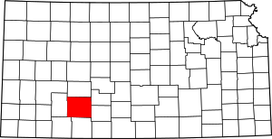 Map of Kansas highlighting Ford County | |
| Unincorporated CDPs | ||
| Unincorporated communities | ||
| Townships | ||
This article is issued from Wikipedia. The text is licensed under Creative Commons - Attribution - Sharealike. Additional terms may apply for the media files.