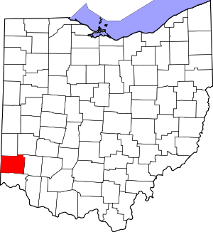
Williamsdale, Ohio
Williamsdale is a census-designated place (CDP) in St. Clair Township, Butler County, Ohio, United States. The population was 581 at the 2010 census.[3]
Williamsdale, Ohio | |
|---|---|
 Williamsdale | |
| Coordinates: 39°26′31″N 84°31′46″W | |
| Country | United States |
| State | Ohio |
| County | Butler |
| Area | |
| • Total | 0.17 sq mi (0.45 km2) |
| • Land | 0.17 sq mi (0.45 km2) |
| • Water | 0.0 sq mi (0.0 km2) |
| Elevation | 600 ft (200 m) |
| Population (2010) | |
| • Total | 581 |
| • Density | 3,335/sq mi (1,287.8/km2) |
| Time zone | UTC-5 (Eastern (EST)) |
| • Summer (DST) | UTC-4 (EDT) |
| ZIP code | 45011 |
| Area code(s) | 513 |
| FIPS code | 39-85344[2] |
| GNIS feature ID | 1049331[1] |
Geography
Williamsdale is located in the southern part of St. Clair Township, just north of the village of New Miami. It is in the valley of the Great Miami River but does not actually touch it.
U.S. Route 127 forms the western edge of the CDP, leading south into New Miami and thence into the city of Hamilton, and north to Eaton. The unincorporated community of Overpeck is directly to the northeast, along Hamilton Trenton Road.
According to the United States Census Bureau, Williamsdale has a total area of 0.17 square miles (0.45 km2), all land.[3]
gollark: I made a DNS to IRC bridge. Executing certain DNS queries forces stuff to contact my server, which decodes the hostname and sends it on an IRC channel.
gollark: That's technically inaccurate.
gollark: But it totally can run on x86.
gollark: Android is a horrible OS and it should not be allowed to spread to computers.
gollark: Mandatory actually it is eventually getting generics, but the fact that it has taken several years is ridiculous, and so is how half the users just insisted that no, you could totally avoid using them via [ACCURSED HORRIBLE HACKERY].
References
- "US Board on Geographic Names". United States Geological Survey. 2007-10-25. Retrieved 2008-01-31.
- "U.S. Census website". United States Census Bureau. Retrieved 2008-01-31.
- "Geographic Identifiers: 2010 Demographic Profile Data (G001): Williamsdale CDP, Ohio". U.S. Census Bureau, American Factfinder. Archived from the original on February 12, 2020. Retrieved February 21, 2014.
This article is issued from Wikipedia. The text is licensed under Creative Commons - Attribution - Sharealike. Additional terms may apply for the media files.
