Weston, Colorado
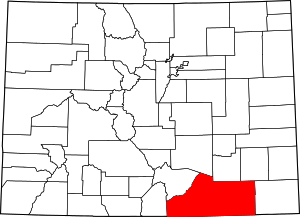
Weston is an unincorporated community and census-designated place (CDP) in Las Animas County, Colorado, United States. As of the 2010 census it had a population of 55.[3] The Weston Post Office has the ZIP Code 81091.[2]
Weston, Colorado | |
|---|---|
Weston Supply and U.S. Post Office in Weston | |
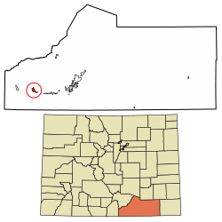
 Location in Las Animas County, Colorado | |
 Weston Location in Colorado  Weston Location in the United States | |
| Coordinates: 37°07′58″N 104°50′51″W | |
| Country | |
| State | |
| County | Las Animas[1] |
| Area | |
| • Total | 3.10 sq mi (8.03 km2) |
| • Land | 3.10 sq mi (8.03 km2) |
| • Water | 0.0 sq mi (0.0 km2) |
| Elevation | 6,880 ft (2,100 m) |
| Population (2010) | |
| • Total | 55 |
| • Density | 17.7/sq mi (6.85/km2) |
| Time zone | UTC-7 (MST) |
| • Summer (DST) | UTC-6 (MDT) |
| ZIP code[2] | 81091 |
| Area code(s) | 719 |
| GNIS feature ID | 0204810 |
| FIPS code | 08-84000 |
A post office called Weston has been in operation since 1889.[4] The community was named after A. J. Weston, a local pioneer.[5]
Geography
Weston is located in western Las Animas County at 37°07′58″N 104°50′51″W (37.132677,-104.847507). It sits in the valley of the Purgatoire River, on the north side of the river, close to where the South Fork joins the main stem. Colorado State Highway 12 passes through the community, leading east (downriver) 22 miles (35 km) to Trinidad, the county seat, and west 11 miles (18 km) to Stonewall Gap.
History
There is an old church at Vigil Plaza, near Weston.
There is a different old church dating from 1866 or 1867, and a cemetery, about three miles east, at Medina Plaza. These were listed on the National Register of Historic Places in 2019 as Our Lady of Guadalupe Church and Medina Cemetery.
Demographics
| Historical population | |||
|---|---|---|---|
| Census | Pop. | %± | |
| U.S. Decennial Census[6] | |||
See also
- Outline of Colorado
- State of Colorado
- Colorado cities and towns
- Colorado census designated places
- Colorado counties
- Colorado cities and towns
References
- "US Board on Geographic Names". United States Geological Survey. 2007-10-25. Retrieved 2008-01-31.
- "ZIP Code Lookup" (JavaScript/HTML). United States Postal Service. January 3, 2007. Retrieved January 3, 2007.
- "Geographic Identifiers: 2010 Census Summary File 1 (G001), Weston CDP, Colorado". American FactFinder. U.S. Census Bureau. Archived from the original on February 13, 2020. Retrieved September 20, 2019.
- "Post offices". Jim Forte Postal History. Retrieved 11 July 2016.
- Dawson, John Frank. Place Names in Colorado: Why 700 Communities Were So Named, 150 of Spanish or Indian Origin. Denver, CO: The J. Frank Dawson Publishing Co. p. 51.
- "Census of Population and Housing". Census.gov. Retrieved June 4, 2016.
