West Jordan, Utah
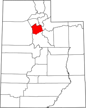
West Jordan is a city in Salt Lake County, Utah, United States. It is a rapidly growing suburb of Salt Lake City and has a mixed economy. According to the 2010 Census, the city had a population of 103,712, placing it as the fourth most populous in the state.[5] The city occupies the southwest end of the Salt Lake Valley at an elevation of 4,330 feet (1,320 m). Named after the nearby Jordan River, the limits of the city begin on the river's western bank and end in the eastern foothills of the Oquirrh Mountains, where Kennecott Copper Mine, the world's largest man-made excavation is located.
West Jordan, Utah | |
|---|---|
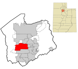 Location in Salt Lake County and the state of Utah. | |
| Coordinates: 40°36′23″N 111°58′34″W | |
| Country | |
| State | |
| County | Salt Lake |
| Settled | 1848 |
| Incorporated | 1941 |
| Named for | Jordan River |
| Area | |
| • Total | 32.33 sq mi (83.73 km2) |
| • Land | 32.33 sq mi (83.73 km2) |
| • Water | 0.00 sq mi (0.00 km2) |
| Elevation | 4,373 ft (1,333 m) |
| Population (2010) | |
| • Total | 103,712 |
| • Estimate (2019)[2] | 116,480 |
| • Density | 3,602.96/sq mi (1,391.12/km2) |
| Time zone | UTC−7 (Mountain (MST)) |
| • Summer (DST) | UTC−6 (MDT) |
| ZIP codes | 84081, 84084, 84088 |
| Area code(s) | 385, 801 |
| FIPS code | 49-82950[3] |
| GNIS feature ID | 1434086[4] |
| Website | www.westjordan.utah.gov |
Settled in the mid-19th century, the city has developed into its own regional center. As of 2012, the city has four major retail centers; with Jordan Landing being one of the largest mixed-use planned developments in the Intermountain West.[6] Companies headquartered in West Jordan include Mountain America Credit Union, Lynco Sales & Service, SME Steel, and Cyprus Credit Union. The city has one major hospital, Jordan Valley Medical Center, and a campus of Salt Lake Community College, which is designed to become the main campus by 2020.
City landmarks include Gardner Village, established in 1850, and South Valley Regional Airport, formerly known as "Salt Lake Airport #2." The airport serves general aviation operations as well as a base for the 211th Aviation Regiment of the Utah Army National Guard flying Apache and Black Hawk helicopters. It is home to comedian Kevin Dougall.
History
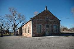
West Jordan received its name from Mormon settlers who entered the Salt Lake Valley in 1847 under the leadership of their prophet, Brigham Young. These first European-Americans named the river flowing west of their first settlement, Salt Lake City, the Western Jordan, a reference to the River Jordan in Israel. The name was later simplified to "Jordan River". Like its Middle Eastern namesake, the Jordan River flows from a fresh water lake (Utah Lake) to an inland salt sea (Great Salt Lake). West Jordan was founded around 1849 on the western banks of the Jordan River.
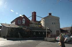
One of the first sawmills in the area was built in 1850 in the city by Archibald Gardner. Gardner was a devout Mormon whose legacy can still be seen in modern West Jordan. His collection of mills and houses, now historic, have been renovated into a specialty shopping district known as Gardner Village.
Early West Jordan relied primarily on agriculture, mills, and mining activity to form the base of its economy. The first leather tannery west of the Mississippi River was constructed in the city in 1851.
Today, West Jordan is one of the fastest growing cities in Utah. Growth has been phenomenal, beginning in the 1970s and continuing unabated since. The population grew from 4,221 in 1970 to 27,327 in 1980, 42,892 in 1990, and 68,336 in 2000, reaching 103,712 according to the 2010 Census. Sears chose the city as its first Sears Grand location, a new store concept, which opened its doors in 2003 at the Jordan Landing shopping center. Transportation issues along with school overcrowding are the city's top concerns as it attempts to deal with rapid population growth.
Current major construction projects include the completion of Jordan Landing, a new main campus for the Salt Lake Community College, the expansion of Jordan Valley Hospital, and Midvale's current transit-oriented development on the east border in the Jordan River bed. Future plans for the city include the Mountain View Corridor highway and the "Mid-Jordan" TRAX light rail line.
Old downtown West Jordan is in the process of being reconstructed as a transit-oriented development called "Briarwood." The plans called for an expanded Main Park, a history museum, an indoor recreation center, a senior center, and a large courthouse to serve the Utah State Third District, most of which are now complete. The second phase calls for the demolition of a dilapidated commercial area, to be replaced by six-story buildings housing a performing arts center, a large library, a hotel, an education center, a conference center, retail and office space, a trail linking to Gardner Village and the Jordan River trail, and a cultural pavilion to house the planned light rail station.[7] As of 2014, the library and TRAX light-rail have been completed and opened.
Geography
According to the United States Census Bureau, the city has a total area of 30.9 square miles (80.0 km2), all of it land.
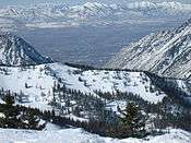
West Jordan is bordered on the west by the Oquirrh Mountains and on the east by the Jordan River. The western neighborhoods of Welby, Copper Hills, and Jordan Hills are rapidly growing regions located along the lower slopes of the eastern Oquirrh Mountains. The fastest development is currently taking place between 4800 West and State Route 111, a highway that traverses the slopes of the Oquirrh Mountains.
The city lies approximately 18 miles (29 km) southwest of downtown Salt Lake City. The city is bordered on the north by Taylorsville and Kearns, on the south by South Jordan, on the east by Sandy, Murray and Midvale, on the west by Copperton, and on the extreme northwestern corner by West Valley City.
Government
| Elected officials of West Jordan as of 2020 | ||||
| Official | Position | Elected | Term ends | |
| Dirk Burton | Mayor | 2020 | 2024 | |
| City Council Members | ||||
| Chad Lamb | At-large | 2018 | 2022 | |
| Kayleen Whitelock | At-large | 2018 | 2022 | |
| Kelvin Green | At-large | 2020 | 2022 | Council Vice-Chair |
| Chris McConnehey | District 1 | 2020 | 2024 | Council Chair |
| Melissa Worthen | District 2 | 2020 | 2024 | |
| Zach Jacob | District 3 | 2020 | 2024 | |
| David Pack | District 4 | 2020 | 2024 | |
West Jordan was incorporated on January 10, 1941. In November 2017, the citizens voted to change the form of government to a council-mayor form beginning at noon on January 6, 2020. The city council is composed of seven individuals: a chair, vice-chair and five council members. The chair and vice-chair are elected by the council every year. The chair cannot serve consecutive terms. The council chair presides at city council meetings. The mayor is the chief executive of the city and appoints a chief administrative officer to oversee the functions of the city. The city council provides policy and direction for the city. The mayor implements the councils policies and can exercise veto power at his discretion. The city council meets the second and fourth Wednesdays of each month at 6:00 PM.
The mayor and city council members are elected to four-year terms. Four city council members are elected from four districts within the city, while the other three are elected at-large or citywide. The mayor and the four city council members representing a district are elected at the same time while the three at-large council members are elected during an offset two year election cycle. Thus ensuring that at least one city official representing the whole city is voted on every two years. The last election was held in 2019. All terms begin on January 1 following their respective election.
Demographics
| Historical population | |||
|---|---|---|---|
| Census | Pop. | %± | |
| 1950 | 2,107 | — | |
| 1960 | 3,009 | 42.8% | |
| 1970 | 4,221 | 40.3% | |
| 1980 | 27,192 | 544.2% | |
| 1990 | 42,892 | 57.7% | |
| 2000 | 68,336 | 59.3% | |
| 2010 | 103,712 | 51.8% | |
| Est. 2019 | 116,480 | [2] | 12.3% |
| U.S. Decennial Census[8] | |||
According to estimates from the U.S. Census Bureau,[9] as of 2017, there were 113,905 people in West Jordan. The racial makeup of the county was 72.2% non-Hispanic White, 1.2% Black, 0.7% Native American, 2.8% Asian, 1.5% Pacific Islander, and 2.9% from two or more races. 19.6% of the population were Hispanic or Latino of any race.
Education
Most of West Jordan lies in the Jordan School District; however, due to a pair of annexations,[10] two small sections along the northern border lie within the Granite School District. The city has 16 elementary schools (including 1 in the Granite District), 4 middle schools, and 2 high schools (West Jordan and Copper Hills). It is also the location of campuses of Salt Lake Community College and Broadview University.
Transportation
Interstate 15, a twelve-lane freeway, is located east of the city limits, providing access from the north and south, while Interstate 215, an eight-lane beltway, is located northeast of the city. Bangerter Highway (State Route 154), a six-lane expressway, traverses the center of the city, just east of South Valley Regional Airport and the Jordan Landing shopping center. Due to severe traffic congestion plaguing the rapidly growing city, a ten-lane freeway in the Mountain View Corridor (SR-85) is planned to have three exits in the city (7800 S, 9000 S, and Old Bingham Hwy.) and run north-south at about 5800 West in the south and bend west to 6400 West in the north. The first phase of the project was completed December 15, 2012.[11]
New Bingham Highway, mostly a four-lane road, begins as 7720 South at State Street (U.S. Route 89) in Midvale, curves into 7800 South as it enters the city, and finally heads southwest to end at Copperton. Redwood Road (State Route 68), a six-lane road, runs through the eastern portion of the city. In the far western extremes of the city, State Route 111, a two-lane road, runs through the developing rural area along the foothills. Development has recently begun to expand beyond SR-111.
In the middle of West Jordan is located the South Valley Regional Airport. Its FAA designation is U-42. It was formally known as Airport #2, because it is owned by Salt Lake City and is a subsidiary of Salt Lake City International Airport. Because of its location within the city, a large shopping center was built next to the airport, which resulted in the shopping center being named Jordan Landing.
West Jordan is served by the Utah Transit Authority (UTA) bus system, which runs every half-hour during peak hours. All of the routes running into the city connect to nearby TRAX stations in Midvale and Sandy or to downtown Salt Lake City. Service in the city was increased during the August 2007 redesign of the bus system.[12] A TRAX light rail line also serves the area. This line begins at the Fashion Place West station in Murray and run southwest through West Jordan, with 6 stops in the city, before turning south and terminating at the Daybreak Community in South Jordan.[13] The route was opened on August 7, 2011.[14]
Transportation has been a major issue in city politics. The city's population has expanded rapidly from about 4,000 in 1970 to over 100,000 in 2010, outstripping the capacity of roadways and infrastructure. At city council meetings it has been common for residents, particularly those on the western edge of the city, to complain about having one-hour commutes to downtown Salt Lake City, a distance of 26 miles (42 km). Elected officials have blamed this situation on the fact that the city is the most populous in the state that is not directly served by a freeway. In addition to significant road widening projects throughout the city, the Mountain View Corridor freeway is currently under construction to service the western portion of the city.[15]
Notable people
- Delila Abbotts, Utah state legislator
- Don Fullmer, boxer
- Gene Fullmer, boxer, 1957 world middleweight champion
- Jordan Halliday, animal rights activist
- Wassef Ali Hassoun, U.S. Marine
- Carolyn Jessop, former member of Fundamentalist Church of Jesus Christ of Latter Day Saints, wrote book about her experience, Escape
- Sealver Siliga, American Professional Football Player National Football League
In the media
- In the fictional HBO drama Big Love, one of Bill Henrickson's home improvement stores is located in West Jordan.
Sister cities
West Jordan has a sister city, as designated by Sister Cities International:
See also
References
- "2019 U.S. Gazetteer Files". United States Census Bureau. Retrieved August 7, 2020.
- "Population and Housing Unit Estimates". United States Census Bureau. May 24, 2020. Retrieved May 27, 2020.
- "U.S. Census website". United States Census Bureau. Retrieved 2008-01-31.
- "US Board on Geographic Names". United States Geological Survey. 2007-10-25. Retrieved 2008-01-31.
- "Census 2010: UT-West Jordan Data".
- "Archived copy". Archived from the original on 2007-04-21. Retrieved 2007-04-21.CS1 maint: archived copy as title (link)
- "Archived copy". Archived from the original on 2006-02-21. Retrieved 2006-03-06.CS1 maint: archived copy as title (link)
- "Census of Population and Housing". Census.gov. Retrieved 2015-06-04.
- "U.S. Census Bureau QuickFacts". U.S. Census Bureau. Retrieved December 17, 2018.
- http://www.deseretnews.com/article/474343/W-JORDAN-VOTES-TO-ANNEX-LAND.html West Jordan annexes Oquirrh Shadows
- "MountainView Corridor Construction". Utah Department of Transportation. Retrieved 2012-12-27.
- "404". www.rideuta.com.
- "Utah Transit Authority - Mid-Jordan TRAX line". Archived from the original on 2008-09-12. Retrieved 2008-10-18.
- Deseret News - UTA setting end dates on TRAX construction. Deseret News. August 9, 2007.
- "Master Transportation Plan prepared for West Jordan" (PDF). 2 January 2004. Archived from the original (PDF) on 3 March 2016. Retrieved 20 November 2015.
External links
| Wikimedia Commons has media related to West Jordan, Utah. |
- West Jordan official website
- West Jordan - Utah History Encyclopedia
- "WEST JORDAN, UTAH: DEMOGRAPHIC OVERVIEW – 2007". 19 April 2007. Retrieved 2015-11-20.
